Illela, Niger

Last updated
Illela, Niger
CountryFlag of Niger.svg  Niger
Region Tahoua Region
Department Illela Department
Area
   Commune 753 sq mi (1,951 km2)
Elevation
1,020 ft (310 m)
Population
 (2012 census)
   Commune 142,214
  Density190/sq mi (73/km2)
   Urban
22,491
Time zone UTC+1 (WAT)

Illela, Niger is a town and urban commune in Niger. [1]

Contents

Geography

Illéla is located in the Sahel zone on the edge of the Ader Doutchi mountain landscape. [2] The neighboring municipalities of Illéla are Bambeye in the north, Badaguichiri in the northeast, Tajaé in the southeast, Alléla in the south and Bagaroua in the west.

The urban area is divided into 14 urban districts and a rural part with 69 villages and 34 hamlets. The 14 districts are Azna, Azna Zaroumèye, Baïtché, Dabagawa, Dabsaou, Illéla (Kétaré), Illéla Kétaré, Illéla Nassarawa, Illéla Toudou, Kétaré, Nassaraoua, Toudou, Toudou (neighborhood) and Zaroumèye. [3] The city center is at an altitude of 312 m. The larger villages in the rural municipality include Toullou, Dafawa, Dangona and Dandadji.

History

Illéla was founded by Tuareg in the 18th century. [4] At the beginning of the 19th century, the place became the capital of the Ader province of the Sultanate of Agadez instead of Birni Ader. Serki n’Ader served here as governor of the Sultan. When the province broke up into several parts at the end of the 19th century, the serki n'Ader of Illéla only controlled a small area in western Ader. [5]

Illéla fell to France at the beginning of the 20th century. The local market was one of the small markets in the region that were permitted by the French administration at the time. The British travel writer A. Henry Savage Landor visited the villages of Illéla, Agourmi, Dangona and Daouréré in 1906 as part of his twelve-month journey across Africa. He described the large Hausa granaries in Illéla, built in various designs. [6]

In 1960, the year of Niger's independence, Illéla became the capital of the Illéla district, [7] , from which the Arrondissement of Illéla [8] emerged in 1964 and the department of Illéla in 1998. The village of Dagona in the municipality of Illéla was one of the most affected places in the country during the 2005/06 hunger crisis in Niger. Here the population had less than one meal a day.. [9] In the 2010 West African floods, over 2000 residents of Illéla were impacted.

Demographics

At the 2012 census, the municipality had a population of 142,214 living in 22,684 households. The majority of the population is Hausa (80%), followed by Tuareg (8%) and Fulani (2%). [10]

CensusPopulation [11]
200191,312
2012142,214

Sights

The city's sights include the ruler's palace of Illéla and the mosque in the village of Libatan Mallameye.

Related Research Articles

Tahoua is a city in Niger and the administrative centre of the Department of Tahoua and the larger Tahoua Region. It is the fourth largest town in the country, with a population of 117,826.

<span class="mw-page-title-main">Departments of Niger</span>

The regions of Niger are subdivided into 63 departments. Before the devolution program on 1999–2005, these departments were styled arrondissements. Confusingly, the next level up (regions) had, before 2002-2005 been styled departments. Prior to a revision in 2011, there had been 36 departments. A draft law in August 2011 would expand that number to 63. Until 2010, arrondissements remained a proposed subdivision of departments, though none were used. The decentralisation process, begun in the 1995-1999 period replaced appointed Prefects at Departmental or Arrondissement level with elected councils, first elected in 1999. These were the first local elections held in the history of Niger. Officials elected at commune level are then selected as representatives at Departmental, regional, and National level councils and administration. The Ministry of Decentralisation was created to oversee this task, and to create a national consultative council of local officials.

<span class="mw-page-title-main">Tahoua Region</span> Region of Niger

Tahoua is one of eight Regions of Niger. The capital of the region is the commune of Tahoua. The region covers 106,677 km².

<span class="mw-page-title-main">Abalak</span> Place in Tahoua Region, Niger

Abalak is a town located in the Tahoua Region, Abalak Department of northern Niger. It is both a town and Commune: a local administrative division. It is the seat (Chef-lieu) of Abalak Department, one of eight subdivisions of Tahoua Region. The town had a population of less than 74,719 at the 2012 census.

<span class="mw-page-title-main">Dakoro</span> Commune in Maradi, Niger

Dakoro is a town and commune located in the Maradi Region of Niger. As of 2012, it had a population of 71,201. It is the capital of the Dakoro Department.

<span class="mw-page-title-main">Mayahi</span> Commune in Maradi Region, Niger

Mayahi is a town located in the Maradi Region of Niger. It is the seat of Mayahi Department and a Commune about 45 km from Tessaoua. In 2012 it had a population of 14,000 in the urban area. The name "Mayaki" is also a rulers' title among the Sudié and Maouri: local subgroups of the Hausa people.

Téra is a city in the Tillabéri Region, Tera Department of Niger. It is situated 175 km north-west of the capital Niamey, close to the border with Burkina Faso. It is mainly inhabited by Songhai, Fulani, Gourmantche and Buzu ethnic groups. The majority of the population are farmers.

<span class="mw-page-title-main">Communes of Niger</span>

The Departments of Niger are subdivided into communes. As of 2005, in the seven Regions and one Capital Area, there were 36 départements, divided into 265 communes, 122 cantons and 81 groupements. The latter two categories cover all areas not covered by Urban Communes or Rural Communes, and are governed by the Department, whereas Communes have elected councils and mayors. Additional semi-autonomous sub-divisions include Sultanates, Provinces and Tribes (tribus). The Nigerien government estimates there are an additional 17000 Villages administered by Rural Communes, while there are over 100 Quartiers administered by Urban Communes.

<span class="mw-page-title-main">Karma, Niger</span> Commune in Tillabéri Region, Niger

Karma is a town and a rural commune in southwestern Niger, near the city of Niamey. The town had a population of 8,505 as of the 2012 census, and the commune had a population of 88,244.

<span class="mw-page-title-main">Abdou Moumouni University</span>

Abdou Moumouni University, formerly the University of Niamey from 1974 to 1994, is a public university based in Niamey, the capital of Niger. The main campus is situated on the right bank of the Niger River. Historically, its students and faculty have been involved in protest movements in the capital.

Dabaga is a town and rural commune in the Agadez Region of northern Niger. The town is situated around 50 kilometers north of the regional capital, Agadez, on the main road leading north into the Aïr Mountains and the town of Elmeki. Like the nearby communities of Azel, Elmeki and Egandawel, Dabaga is an oasis in the Aïr Massif valleys, populated by both sedentary and semi-nomadic Tuaregs and small numbers of Hausa and other groups. According to UNICEF, Dabaga had a permanent population of 35,000 in early 2007, mostly families of Tuareg pastoralists, where the adult males traveled with their herds.

Akoubounou, or Akabinu in the local Tin Sert language, is a village located in the west to the town of Abalak, in the Tahoua Region of Niger.

Abala, Niger is a village and rural commune in Niger.

Badaguichiri is a village and rural commune in Niger.

Garhanga is a village and rural commune in Niger. It is located in the Keita Department of the Tahoua region. As of 2012, it has a population of 69,712.

Tamaske is a city and rural commune in Niger. It is located in the Keita Department, in the Tahoua Region.

Tarka, Niger is a village and rural commune in Niger. It is located in the Belbédji Departement of the Zinder Region. As of 2012 the commune had a population of 96,452.

Marius-Gabriel Cazemajou was a French officer who died during an expedition in West Africa.

The 2018 Coupe nationale du Niger is the 43rd edition of the Coupe nationale du Niger, the knockout football competition of Niger.

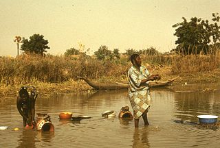
Sikié is a Songhai town near Namaro in Niger. Sikié was the place where the defeated Songhai Empire army led by Askia Muhammed Gao installed their base hoping for a possible passage of the Moroccan army.

References

  1. Loi n° 2002-014 du 11 JUIN 2002 portant création des communes et fixant le nom de leurs chefs-lieux [ permanent dead link ]. Includes list of 213 communes rurales and seats, 52 Communes urbaines and seats
  2. M. Bocquier, M. Gavaud, esdac.jrc.ec.europa.eu République du Niger. Carte Pédologique de la Région de l'Ader Doutchi. Localisation des observations Pédologiques., Paris: ORSTOM, retrieved 2018-09-30{{citation}}: Check |url= value (help)
  3. "Répertoire National des Localités (ReNaLoc)" (in French). Institut National de la Statistique, République du Niger. July 2014. pp. 344–346. Archived from the original (RAR) on 2015-09-24. Retrieved 2022-03-27.
  4. Abdourahmane Idrissa, Samuel Decalo (2012), Historical Dictionary of Niger (4. ed.), Plymouth: Scarecrow, p. 267, ISBN   978-0-8108-6094-0
  5. Edmond Séré de Rivières (1965), Histoire du Niger, Paris: Berger-Levrault, p. 168
  6. A. Henry Savage Landor (1907), [archive.org Across Widest Africa. An Account of the Country and People of Eastern, Central and Western Africa As Seen During a Twelve Months' Journey From Djibuti To Cape Verde], vol. II, London: Hurst and Blackett, pp. 365–366, retrieved 2021-03-13{{citation}}: Check |url= value (help)
  7. Edmond Séré de Rivières (1965), Histoire du Niger, Paris: Berger-Levrault, p. 19
  8. Edmond Séré de Rivières (1965), Histoire du Niger, Paris: Berger-Levrault, p. 275
  9. "Niger Food Crisis 2005: Humanitarian Situation Report No. 1". UN Office for the Coordination of Humanitarian Affairs. 2005-07-26. Retrieved 2021-02-11.
  10. Dubois Touraoua (2011-07-07). "La Commune urbaine d'Illéla dans la région de Tahoua : une solide organisation sociale traditionnelle". Le Sahel (in French). Archived from the original on 2011-10-07. Retrieved 2022-05-12.
  11. "Illéla (Commune, Niger) - Population Statistics, Charts, Map and Location". www.citypopulation.de. Retrieved 2024-02-19.

14°28′N5°14′E / 14.46°N 5.24°E / 14.46; 5.24