Dakoro

Last updated
Dakoro
NE-Dakoro.png
Location of Dakoro in Niger
CountryFlag of Niger.svg  Niger
Region Maradi
Department Dakoro
Area
   Commune 126.5 sq mi (327.6 km2)
Population
 (2012 census)
   Commune 71,201
  Density560/sq mi (220/km2)
   Urban
29,293
Time zone UTC+1 (WAT)

Dakoro is a town and commune located in the Maradi Region of Niger. As of 2012, it had a population of 71,201. [1] It is the capital of the Dakoro Department.

Contents

Geography

Town entrance (2023) Dakoro.jpg
Town entrance (2023)

Dakoro is located in the Sahel. The neighbouring communes are Azagor to the north and Birni Lallé to the east, south and west. To the north of the town centre is the Tarka Valley, which extends into Nigeria. The formerly more diverse flora on the sandy soils of Dakoro is - due to recurring droughts and human settlement - essentially only characterised by acacias and balanites.

The municipality of Dakoro consists of an urban and a rural area. The urban area is divided into several neighbourhoods. These are Albadji, Camp de Gardes, Camp Gendarmerie, Centre de Réinsertion, Déram Balaka, Groupement FNIS, Hachimou Chipkaou, Kourmi, Mago Gari, Maguéma, Prison Civile, Quartier Administratif, Quartier Tsouna, Rouboukawa, Sabon Gari Mahamane, Takalmabua and Zangon Madougou. The settlements in the rural commune include 58 villages, 28 hamlets and three camps. [2]

Climate

Dakoro has an arid desert climate.

History

Town hall Mairie de Dakoro 1.jpg
Town hall

Dakoro was founded in the 1890s by Hausa who came from the areas that are now the regions of Agadez and Tahoua. [2]

In 1947, the then French colonial administration set up a school specifically for the nomadic population in the village of Maï Lafia, which belongs to Dakoro. The school was one of the first of its kind in Niger. The French overseas research institute Office de la Recherche Scientifique et Technique Outre-Mer (ORSTOM) operated a geomagnetic station in Dakoro, which was part of a network of several hundred ORSTOM stations in West Africa at which geomagnetic measurements were carried out in the 1950s. That in Dakoro was the first of its kind in Niger. [3]

Dakoro became the capital of the Dakoro district in 1960, the year of Niger's independence from France, [4] from which the Dakoro arrondissement [5] emerged in 1964 and the Dakoro department in 1998. In the 1960s, the Dakoro market was an important transhipment centre for peanuts, the most important export commodity in Niger at the time. [6] In 2002, the municipal area was expanded to include parts of Birni Lallé as part of a nationwide administrative reform.

Demographics

In the 2012 census, the municipality had 71,201 inhabitants living in 9157 households. Around 30,000 people lived in the urban area. [2] [1] The municipality is a settlement area of the Gobirawa, Tuareg and Fulbe.

CensusPopulation [1]
200142,126
201271,201

Economy

The most important economic sectors are agriculture and trade. The cultivation of millet, sorghum and black-eyed peas is severely jeopardised by the lack of rainfall. Conflicts sometimes arise between farmers and cattle breeders over the few agriculturally usable areas. An important cattle market is held in the town centre. Trade links extend as far as Libya and to Nigeria. There are important weekly markets for the trade of agricultural goods.

Health

In the city centre there is a district hospital and a health centre of the Centre de Santé Intégré (CSI) type with its own laboratory and maternity ward. There is another health centre of this type, but without its own laboratory and maternity ward, in the rural settlement of Intouila I. [7]

Persons

Related Research Articles

<span class="mw-page-title-main">Maradi Region</span> Region of Niger

The Region of Maradi is one of seven regions of Niger. It is located in south-central Niger, east of the Region of Tahoua, west of Zinder, and north of the Nigerian city of Katsina. The administrative centre is at Maradi. The population of the Region is predominantly Hausa.

<span class="mw-page-title-main">Madaoua</span> Commune in Tahoua Region, Niger

Madaoua is a town and urban commune located in the Tahoua Region of Niger. It has a population of 127,254. It is seat of the Madaoua Department, forming the southwest corner of the Region, and is an Urban Commune.

<span class="mw-page-title-main">Gaya, Niger</span> Commune in Dosso, Niger

Gaya is a city in the Gaya Department of the Dosso Region of Niger. The city is situated 254 km southeast of the capital, Niamey, is located on the banks of the Niger River, and is near the borders with Benin and Nigeria. Gaya has a population of 63,815. The wettest area in Niger, Gaya averages 800 mm in rainfall a year.

<span class="mw-page-title-main">Mayahi</span> Commune in Maradi Region, Niger

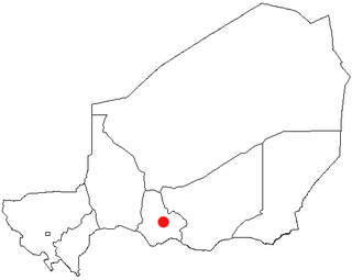
Mayahi is a town located in the Maradi Region of Niger. It is the seat of Mayahi Department and a Commune about 45 km from Tessaoua. In 2012 it had a population of 14,000 in the urban area. The name "Mayaki" is also a rulers' title among the Sudié and Maouri: local subgroups of the Hausa people.

Téra is a city in the Tillabéri Region, Tera Department of Niger. It is situated 175 km north-west of the capital Niamey, close to the border with Burkina Faso. It is mainly inhabited by Songhai, Fulani, Gourmantche and Buzu ethnic groups. The majority of the population are farmers.

The Waki is a river in western French Guiana. It is a right tributary of the Tampok. It is 147 km (91 mi) long. The river has its source as the confluence of the southern Grande Waki which has its source in the Arawa Mountains, and the northern Petite Waki which has its source in the Sommet Tabulaire.

<span class="mw-page-title-main">Communes of Niger</span>

The Departments of Niger are subdivided into communes. As of 2005, in the seven Regions and one Capital Area, there were 36 départements, divided into 265 communes, 122 cantons and 81 groupements. The latter two categories cover all areas not covered by Urban Communes or Rural Communes, and are governed by the Department, whereas Communes have elected councils and mayors. Additional semi-autonomous sub-divisions include Sultanates, Provinces and Tribes (tribus). The Nigerien government estimates there are an additional 17000 Villages administered by Rural Communes, while there are over 100 Quartiers administered by Urban Communes.

<span class="mw-page-title-main">Research Institute for Development</span> French science and technology institute

The French National Research Institute for Sustainable Development, or Institut de Recherche pour le Développement (IRD), is a French science and technology establishment under the joint supervision of the French Ministries of Higher Education and Research and Foreign Affairs. It operates internationally from its headquarters in Marseille, and two metropolitan centres of Montpellier and Bondy.

<span class="mw-page-title-main">Karma, Niger</span> Commune in Tillabéri Region, Niger

Karma is a town and a rural commune in southwestern Niger, near the city of Niamey. The town had a population of 8,505 as of the 2012 census, and the commune had a population of 88,244.

Illela, Niger is a town and urban commune in Niger.

Magaria is a town and urban commune in the Magaria Department of the Zinder Region of Niger.

Mirriah is a town and urban commune in Niger.

Abala, Niger is a village and rural commune in Niger.

Garhanga is a village and rural commune in Niger. It is located in the Keita Department of the Tahoua region. As of 2012, it has a population of 69,712.

Tarka, Niger is a village and rural commune in Niger. It is located in the Belbédji Departement of the Zinder Region. As of 2012 the commune had a population of 96,452.

Tondikandia is a rural commune in Filingué Department, Tillabéri Region, Niger. Its chief place and administrative center is the town of Damana.

Matameye is a town and urban commune, administrative centre of the Matameye Department in Niger, with a total population of 64,988 as of 2012 with 27,615 living in the town. In 2005 a road was completed from Matameye to Takieta. Since 2011 many people have moved to Matameye from Tânout and Gouré because of the food crisis, in search for better harvests, abandoning their homes and schools.

Sikié is a Songhai town near Namaro in Niger. Sikié was the place where the defeated Songhai Empire army led by Askia Muhammed Gao installed their base hoping for a possible passage of the Moroccan army.

Liongo is a village in the Buea Subdivision in the Fako Division of the South West Region of Cameroon.

<span class="mw-page-title-main">Iferouane Department</span> Department in Agadez Region, Niger

Iferouane is a department of the Agadez Region in Niger. Its administrative seat is the city of Iferouane. As of 2012, the department had a total population of 32,731 people.

References

  1. 1 2 3 "Dakoro (Commune, Niger) - Population Statistics, Charts, Map and Location". www.citypopulation.de. Retrieved 2024-02-17.
  2. 1 2 3 "Répertoire National des Localités (ReNaLoc). Institut National de la Statistique, République du Niger 2014". Archived from the original on 2015-09-24. Retrieved 2024-02-18.
  3. J. Rechenmann, R. Remiot (1958), [horizon.documentation.ird.fr Réseau général de bases magnétiques en Afrique Occidentale] (PDF), Paris: Centre de Géophysique de M’bour / Office de la Recherche Scientifique et Technique Outre-Mer, p. 27, retrieved 2023-10-08{{citation}}: Check |url= value (help)
  4. Edmond Séré de Rivières (1965), Histoire du Niger, Paris: Berger-Levrault, p. 19
  5. Edmond Séré de Rivières (1965), Histoire du Niger, Paris: Berger-Levrault, p. 275
  6. Yves Péhaut (1970), L'arachide au Niger, Études d’économie africaine. Série Afrique noire, 1, Paris: Pedone, p. 87
  7. "Niger DSS". snisnet.net. Retrieved 2024-02-18.

14°30′N6°45′E / 14.500°N 6.750°E / 14.500; 6.750