Madaoua

Last updated

Madaoua
Madoua, Madawa
Madaoua 15.jpg
Huts in Madaoua
Niger location map.svg
Red pog.svg
Madaoua
Location in Niger
Coordinates: 14°4′33″N5°57′31″E / 14.07583°N 5.95861°E / 14.07583; 5.95861
CountryFlag of Niger.svg  Niger
Region Tahoua Region
Department Madaoua Department
Urban Commune Madaoua
Government
  TypeSeat of Departmental councils, Urban Commune
Area
   Commune 777.1 km2 (300.0 sq mi)
Elevation
335 m (1,102 ft)
Population
 (2012 census)
   Commune 127,254
  Density160/km2 (420/sq mi)
   Urban
27,972
Time zone UTC+1
Website www.madaoua-niger.com

Madaoua (var. Madoua, Madawa) is a town and urban commune located in the Tahoua Region of Niger. It has a population of 127,254 (2012 census). [1] It is seat of the Madaoua Department, forming the southwest corner of the Region, and is an Urban Commune.

Contents

Geography

Landscape Madaoua 29.jpg
Landscape

The agricultural town is located in the fertile plain of the Tarka Valley in the Sahel region. [2] The city centre lies at an altitude of 322 m. [3] Madaoua's neighbouring municipalities are Bouza and Karofane in the north, Ourno in the east, Bangui in the south, Sabon-Guida in the southwest, Galma Koudawatché in the west and Azarori in the northwest.

Madaoua consists of eleven urban districts and a rural area with 73 villages, 80 hamlets and two camps. The neighbourhoods are Agadestaoua, Alkalaoua, Dar Es Salam, Djamoul, Kara Kara, Madaoua, Malamaoua, Mariétou, Sabon Gari, Tsakaoua and Tsakaoua Gabass. The largest rural villages include Aouloumatt, Gandassamou, Nakoni and Tounfafi.

History

In the last third of the 19th century, before the arrival of the colonial power France, the settlement of Madaoua belonged to the territory of the Tuareg subgroup Kel Gres. [4]

The market in the village of Tounfafi, which belongs to Madaoua, was one of the small markets in the region that were authorised by the French administration at the beginning of the 20th century. [5] Madaoua was elevated to the status of district capital in the French military territory of Niger in 1909. This large district, whose capital had previously been Tahoua, included the towns of Maradi and Tibiri. [6] In the 1920s, the 133-kilometre-long track for riders to Tahoua and the 236-kilometre-long track for riders to Tessaoua were considered the main traffic routes in the former colony. The same was the case for the 1375-kilometre road from Niamey to N'Guigmi, which ran through Madaoua and was passable by cars in the dry season as far as Guidimouni. The town later lost its national importance. Only the market in Madaoua developed into an important transhipment centre for peanuts in the 1960s, the most important export commodity in Niger at the time. [7]

In 1988, Madaoua was given the status of an independent municipality together with nine other Nigerien towns. Until then, there had been twelve municipalities across the country. In July 2008, floods destroyed 24 houses in the town and over 200 people were affected. Large numbers of refugees from Northern Nigeria reached the city in 2023, displaced by conflict. [8]

Economy

Maradi is the major transport trade and agricultural hub of Niger's south central Hausa region. It lies on the major east—west paved highway, which crosses from Niamey in the west to Diffa in the far east. Maradi has long been a merchant city, on the route north from Kano, Nigeria. This explains why one can use either the West African CFA franc (Niger's official currency) or the Nigerian Naira for currency in Maradi. The city lies in a region known for ground nut farming.

Culture

The city's sights include the palace of the traditional ruler of Madaoua. The city is an important centre for lutte traditionnelle, a popular martial art in Niger.

Related Research Articles

<span class="mw-page-title-main">Departments of Niger</span>

The regions of Niger are subdivided into 63 departments. Before the devolution program on 1999–2005, these departments were styled arrondissements. Confusingly, the next level up (regions) had, before 2002-2005 been styled departments. Prior to a revision in 2011, there had been 36 departments. A draft law in August 2011 would expand that number to 63. Until 2010, arrondissements remained a proposed subdivision of departments, though none were used. The decentralisation process, begun in the 1995-1999 period replaced appointed Prefects at Departmental or Arrondissement level with elected councils, first elected in 1999. These were the first local elections held in the history of Niger. Officials elected at commune level are then selected as representatives at Departmental, regional, and National level councils and administration. The Ministry of Decentralisation was created to oversee this task, and to create a national consultative council of local officials.

Birni-N'Konni is a town in the Tahoua Region of Niger, lying immediately north of the border of Nigeria and west of seasonal Maggia River. It is an important market town and transport hub and as of the 2012 census had a population of 63,169. The town is the historic centre of the small pre-colonial Hausa state of Konni. The name comes from the Hausa for "Walled Town of Konni", and many Hausa towns designate the old citadel neighbourhood the "Birni".

<span class="mw-page-title-main">Maradi, Niger</span> Place in Maradi Region, Niger

Maradi is the second largest city in Niger and the administrative centre of Maradi Region. It is also the seat of the Maradi Department and an Urban Commune.

<span class="mw-page-title-main">Tahoua Region</span> Region of Niger

Tahoua is one of eight Regions of Niger. The capital of the region is the commune of Tahoua. The region covers 106,677 km².

<span class="mw-page-title-main">Maradi Region</span> Region of Niger

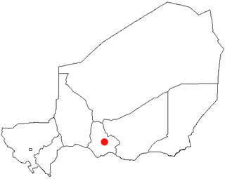
The Region of Maradi is one of seven regions of Niger. It is located in south-central Niger, east of the Region of Tahoua, west of Zinder, and north of the Nigerian city of Katsina. The administrative centre is at Maradi. The population of the Region is predominantly Hausa.

<span class="mw-page-title-main">Dakoro</span> Commune in Maradi, Niger

Dakoro is a town and commune located in the Maradi Region of Niger. As of 2012, it had a population of 71,201. It is the capital of the Dakoro Department.

<span class="mw-page-title-main">Mayahi</span> Commune in Maradi Region, Niger

Mayahi is a town located in the Maradi Region of Niger. It is the seat of Mayahi Department and a Commune about 45 km from Tessaoua. In 2012 it had a population of 14,000 in the urban area. The name "Mayaki" is also a rulers' title among the Sudié and Maouri: local subgroups of the Hausa people.

<span class="mw-page-title-main">Communes of Niger</span>

The Departments of Niger are subdivided into communes. As of 2005, in the seven Regions and one Capital Area, there were 36 départements, divided into 265 communes, 122 cantons and 81 groupements. The latter two categories cover all areas not covered by Urban Communes or Rural Communes, and are governed by the Department, whereas Communes have elected councils and mayors. Additional semi-autonomous sub-divisions include Sultanates, Provinces and Tribes (tribus). The Nigerien government estimates there are an additional 17000 Villages administered by Rural Communes, while there are over 100 Quartiers administered by Urban Communes.

<span class="mw-page-title-main">Karma, Niger</span> Commune in Tillabéri Region, Niger

Karma is a town and a rural commune in southwestern Niger, near the city of Niamey. The town had a population of 8,505 as of the 2012 census, and the commune had a population of 88,244.

<span class="mw-page-title-main">Abdou Moumouni University</span>

Abdou Moumouni University, formerly the University of Niamey from 1974 to 1994, is a public university based in Niamey, the capital of Niger. The main campus is situated on the right bank of the Niger River. Historically, its students and faculty have been involved in protest movements in the capital.

<span class="mw-page-title-main">Outline of Niger</span> Overview of and topical guide to Niger

The following outline is provided as an overview of and topical guide to Niger:

<span class="mw-page-title-main">Regions of Niger</span>

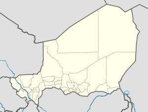
Niger is divided into seven regions, each of which is named after its capital. Additionally, the national capital, Niamey, comprises a capital district.

<span class="mw-page-title-main">Bouza Department</span> Department in Tahoua Region, Niger

Bouza is a department of the Tahoua Region in Niger. Its capital lies at the city of Bouza, and also includes the town of Déoulé. As of 2011, the department had a total population of 386,093 people.

<span class="mw-page-title-main">Administrative divisions of Niger</span>

Niger is governed through a four layer, semi-decentralised series of administrative divisions. Begun 1992, and finally approved with the formation of the Fifth Republic of Niger on 18 July 1999, Niger has been enacting a plan for decentralisation of some state powers to local bodies. Prior to the 1999-2006 project, Niger's subdivisions were administered via direct appointment from the central government in Niamey. Beginning with Niger's first municipal elections of 2 February 1999, the nation started electing local officials for the first time. Citizens now elect local committee representatives in each commune, chosen by subdivisions of the commune: "quarters" in towns and "villages" in rural areas, with additional groupings for traditional polities and nomadic populations. These officials choose mayors, and from them are drawn representatives to the department level. The departmental council, prefect, and representatives to the regional level are chosen here using the same procedure. The system is repeated a regional level, with a regional prefect, council, and representatives to the High Council of Territorial Collectives. The HCCT has only advisory powers, but its members have some financial, planning, educational and environmental powers. The central government oversees this process through the office of the Minister of State for the Interior, Public Safety and Decentralization.

<span class="mw-page-title-main">Harikanassou</span> Commune and village in Dosso, Niger

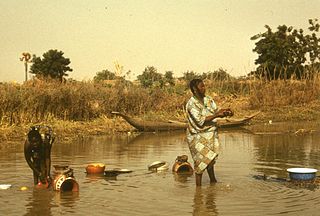
Harikanassou is a large village and rural commune in the Boboye Department of the Dosso Region of southwest Niger, 90.7 kilometres (56.4 mi) by road southeast of the capital of Niamey. At the time of the 2012 census, the rural community had 23,567 residents living in 3,340 households. Onion cultivation is a chief source of income for many, along with the cultivation of lettuce, beans, squashes, and tomatoes.

Tamaske is a city and rural commune in Niger. It is located in the Keita Department, in the Tahoua Region.

The 2018 Coupe nationale du Niger is the 43rd edition of the Coupe nationale du Niger, the knockout football competition of Niger.

References

  1. "Madaoua (Commune, Niger) - Population Statistics, Charts, Map and Location". www.citypopulation.de. Retrieved 19 February 2024.
  2. Jean-Paul Labourdette, Dominique Auzias (2009), Niger 2009, Paris: Nouvelle édition de l’Université, p. 132, ISBN   2-7469-1640-1
  3. Abdel Kader Hassane Saley (2018), [tel.archives-ouvertes.fr Évaluation des ressources en eau de l’aquifère du Continental Intercalaire/Hamadien de la Région de Tahoua (bassin des Iullemeden, Niger). Impacts climatiques et anthropiques] (PDF) (Thèse de doctorat), Saclay/Niamey: Université Paris-Saclay/Université Abdou Moumouni de Niamey, p. 210, retrieved 9 April 2021{{citation}}: Check |url= value (help)
  4. Benedetta Rossi (2002), [etheses.lse.ac.uk The Keita Project: An Anthropological Study of International Development Discourses and Practices In Niger] (PDF) (Dissertation), London: London School of Economics and Political Science, University of London, p. 297, retrieved 15 October 2020{{citation}}: Check |url= value (help)
  5. Hassane Gandah Nabi (2013), Commerçants et entrepreneurs du Niger (1922–2006), Paris: L’Harmattan, p. 39, ISBN   978-2-336-29136-9
  6. Edmond Séré de Rivières (1965), Histoire du Niger, Paris: Berger-Levrault, p. 236
  7. Yves Péhaut (1970), L’arachide au Niger, Études d’économie africaine. Série Afrique noire, 1, Paris: Pedone, p. 87
  8. "Madaoua a silent crisis and the commitment of the UNHCR to support thousands of Nigerian refugees seeking aid and protection". UNHCR Africa. Retrieved 21 February 2024.

Literature

14°04′N5°58′E / 14.07°N 5.96°E / 14.07; 5.96