Commune III (Niamey)

Last updated
Commune III (Niamey)
Commune III (Niamey Map).png
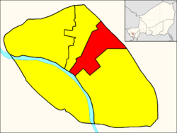
Commune III within Niamey
CountryFlag of Niger.svg  Niger
Region Niamey
Time zone UTC+1 (WAT)

Commune III (Niamey), also known as Niamey III, is an urban commune in Niger. It is a commune of the capital city of Niamey. [1]

Communes of Niger

The Departments of Niger are subdivided into communes. As of 2005, in the seven Regions and one Capital Area, there were 36 départements, divided into 265 communes, 122 cantons and 81 groupements. The latter two categories cover all areas not covered by Urban Communes or Rural Communes, and are governed by the Department, whereas Communes have elected councils and mayors. Additional semi-autonomous sub-divisions include Sultanates, Provinces and Tribes (tribus). The Nigerien government estimates there are an additional 17000 Villages administered by Rural Communes, while there are over 100 Quartiers administered by Urban Communes.

Niger Republic in Western Africa

Niger or the Niger, officially the Republic of the Niger, is a landlocked country in West Africa named after the Niger River. Niger is bordered by Libya to the northeast, Chad to the east, Nigeria to the south, Benin to the southwest, Burkina Faso and Mali to the west, and Algeria to the northwest. Niger covers a land area of almost 1,270,000 km2 (490,000 sq mi), making it the largest country in West Africa. Over 80% of its land area lies in the Sahara Desert. The country's predominantly Islamic population of about 21 million live mostly in clusters in the far south and west of the country. The capital and largest city is Niamey, located in Niger's southwest corner.

Niamey Capital city of Niger

Niamey is the capital and largest city of the West African country of Niger. Niamey lies on the Niger River, primarily situated on the east bank. It is an administrative, cultural and economic centre. Niamey's population was counted as 978,029 as of the 2012 census; the Niamey Capital District, covering 670 km2, had 1,026,848 people. As of 2017, population projections show the capital district growing at a slower rate than the country as a whole, which has the world's highest fertility rate.

Related Research Articles

Dosso, Niger Place in Dosso Region, Niger

Dosso is a city in the south-west corner of Niger. It lies 130–140 kilometres (81–87 mi) south-east of the capital Niamey at the junction of the main routes to Zinder and Benin. The seventh-most populous town in Niger and the largest in Dosso Region, it had an official population during the 2001 census of 43,561. The population grew to 58,671 in the 2012 census. It is the capital of its region—which covers five departments in the southwestern corner of the nation, as well as of its own department: Dosso Department. The city itself lies at the centre of its own Urban Commune.

Ayourou Place in Tillabéri Region, Niger

Ayourou is a town and rural commune in the Tillabéri Region, in western Niger. It is situated 208 km northwest of the capital Niamey near the Malian border. The old town stands on an eponymous island in the River Niger. It is known for its animal market and for wildlife including hippopotamuses and birds.

Kollo is a large town and urban communein southwestern Niger, where NGOs work, as well as, missionaries and Peace Corps volunteers.

Abala, Niger Commune and village in Tillabéri Region, Niger

Abala, Niger is a village and rural commune in Niger.

Dan-Kassari is a village and rural commune in Niger.

Tamou Commune and village in Tillabéri Region, Niger

Tamou is a village and "Rural commune" in Niger. The town is capital of its Rural Commune in the Say Department of Tillabéri Region, in the far southwest of the nation. It is southwest of Niamey, on the right (western) bank of the Niger River, between the departmental capital Say and the border of Burkina Faso. Tamou Commune is home to the Tamou Total Reserve, a wildlife reserve which is part of the larger W National Park and Transborder Reserve. The Tamou Reserve, in which local people also live, is primarily dedicated to the protection of African Elephant populations which migrate through the region.

Tarka, Niger Commune and village in Zinder Region, Niger

Tarka, Niger is a village and rural commune in Niger. It is located in the Belbédji Departement of the Zinder Region. As of 2010 the commune had a population of 86,695.

Tenhya Commune and village in Zinder, Niger

Tenhya is a village and rural commune in Niger. As of 2010 it had a total population of 20,533 people. Tenhya located in the northern Sahel. The neighboring municipalities are Aderbissinat in the northwest, the northeast Tabelot, Tesker to the east and south and Tarka in the west. The rural community of Tenhya was founded in 2002 as an administrative unit. The main ethnic groups are the Fulani subgroup Wodaabe and the Tuareg subgroups Ichiriffen, Imdan, Inesseliman, Kel Ates, Kel Iferwane and Ifoghas, mainly engaged in pastoral farming.

Tondikandia Commune in Tillabéri Region, Niger

Tondikandia is a rural commune in Filingué Department, Tillabéri Region, Niger. Its chief place and administrative center is the town of Damana

Torodi Commune and village in Tillaberi Region, Niger

Torodi is a small town and a rural commune in Niger. As a rural center, Torodi hosts a large weekly market and the seat of local tribal authority (canton). Torodi is in the Say Department of the Tillaberi Region, which surrounds the national capital, Niamey. Say Department, with its capital at the large Niger River town of Say, abuts Niamey to the southwest and across the river to the west. The town of Torodi lies about 60 km due west of the city of Say and 50 km east of the border with Burkina Faso. Torodi itself lies on a tributary of the Niger, the Gourbi river.

Commune I (Niamey) Commune in Niamey, Niger

Commune I (Niamey), also known as Niamey I, is an urban commune in Niger. It is a commune of the capital city of Niamey.

Commune II (Niamey) Commune in Niamey, Niger

Commune II (Niamey), also known as Niamey II, is an urban commune in Niger. It is a commune of the capital city of Niamey.

Commune IV (Niamey) Commune in Niamey, Niger

Commune IV (Niamey), also known as Niamey IV, is an urban commune in Niger. It is a commune of the capital city of Niamey.

Commune V (Niamey) Commune in Niamey, Niger

Commune V (Niamey), also known as Niamey V, is an urban commune in Niger. It is a commune of the capital city of Niamey. It is located in the south-western shore of the Niger River.

Béni Mered Commune and town in Blida Province, Algeria

Béni Mered or Beni Marad is a town and commune in Blida Province, Algeria. As of the 1998 census it had a population of 21,457.

Tadjemout is a town and commune in Laghouat Province, Algeria. According to the 1998 census it has a population of 20,321.

Sidi Abdeldjebar is a town and commune in Mascara Province, Algeria. According to the 2008 census it has a population of 4,190.

The following is a timeline of the history of the city of Niamey, Niger.

References

  1. Loi n° 2002-014 du 11 JUIN 2002 portant création des communes et fixant le nom de leurs chefs-lieux [ permanent dead link ]. Includes list of 213 communes rurales and seats, 52 Communes urbaines and seats

Commons-logo.svg Media related to Niamey III at Wikimedia Commons

Coordinates: 13°31′24″N2°07′46″E / 13.52333°N 2.12944°E / 13.52333; 2.12944

Geographic coordinate system Coordinate system

A geographic coordinate system is a coordinate system that enables every location on Earth to be specified by a set of numbers, letters or symbols. The coordinates are often chosen such that one of the numbers represents a vertical position and two or three of the numbers represent a horizontal position; alternatively, a geographic position may be expressed in a combined three-dimensional Cartesian vector. A common choice of coordinates is latitude, longitude and elevation. To specify a location on a plane requires a map projection.