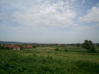
Azeye | |
|---|---|
Commune and village | |
| Country | |
| Elevation | 1,447 ft (441 m) |
| Population (2001) | |
| • Total | 24,129 |
| Time zone | UTC+1 (WAT) |
Azeye | |
|---|---|
Commune and village | |
| Country | |
| Elevation | 1,447 ft (441 m) |
| Population (2001) | |
| • Total | 24,129 |
| Time zone | UTC+1 (WAT) |

Horseshoe Bay is a community of about 1,000 permanent residents in West Vancouver, in the Canadian province of British Columbia. Situated on the western tip of West Vancouver at the entrance to Howe Sound, the village marks the western end of Highway 1 on mainland British Columbia. It also serves as the southern end of the Sea-to-Sky Highway, with Lions Bay just 15 minutes north.

The Wildcat Hills are an escarpment between the North Platte River and Pumpkin Creek in the western Panhandle, in the state of Nebraska in the Great Plains region of the United States. Located in Banner, Morrill, and Scotts Bluff counties, the high tableland between the streams has been eroded by wind and water into a region of forested buttes, ridges and canyons that rise 150 to 300 m above the surrounding landscape.
Castle Comfort is a community in Saint George Parish, Dominica. 789 inhabitants live there and in neighbouring Wall House.

Tamridjet is a town in northern Algeria. It is in the Souk El Tenine District of Béjaïa Province.
Affala is a village and rural commune in Niger. It is in the Department of Tahoua.
Cantagalo is a municipality in the state of Paraná in the Southern Region of Brazil.
Donji Adrovac is a village in the municipality of Aleksinac, Serbia. According to the 2002 census, the village has a population of 761 people.
Manjinac is a village in the municipality of Knjaževac, Serbia. According to the 2002 census, the village has a population of 122 people.
Trubarevac is a village in the municipality of Sokobanja, Serbia. According to the 2002 census, the village has a population of 617 people.
Oloibiri is a small community in Ogbia LGA located in Bayelsa State, in the eastern Niger Delta region of Nigeria. The inhabitants of Oloibiri community are mainly fishermen and farmers. It is the first place that oil was discovered in Nigeria.
Five Corners is an unincorporated community in Outagamie County, Wisconsin, United States. It is located in the towns of Black Creek, Center, Freedom, and Osborn.
Zimić is a village in Croatia.

Marché Medina is a market in Conakry, Guinea and one of the largest markets in West Africa. The market was the scene of the Guinean Market Women's Revolt in 1977 that marketed a turning point in the country's economic history and was celebrated as a national holiday following the end of President Ahmed Sékou Touré's regime.
Kusovac is a village situated in Knić municipality in Serbia.
Beliševo is a village in the municipality of Vladičin Han, Serbia. According to the 2002 census, the village has a population of 136 people.

Gustav V Land is a land area comprising the peninsula on the northwestern part of Nordaustlandet, Svalbard in Arctic Norway. It constitutes roughly one quarter of the island's area, approximately 4000 km2, being some 80 km wide east–west and 85 km north–south, connected to the rest of the island by a 22-km-wide isthmus in the southeast. The peninsula is bordered to the south by Wahlenbergfjorden, to the west by Hinlopen Strait and Hinlopenrenna, to the north by Nordkappsundet, and to the east by Nordenskiöldbukta and Rijpfjorden. Gustav Adolf Land is to the south and Prins Oscars Land is to the east. The boundary of Gustav V Land passes through Rijpdalen and Flaumdalen to Winsnesbreen in the east, continues further southwest to Brånevatnet, and thence follows the river from Brånevatnet to the sea at Bodleybukta. The highest elevation is 630 metres (2,070 ft) on the glacier Vestfonna, which covers large parts of the land.

Hutchinson Air Force Station is a closed United States Air Force station. It is located 2 miles (3.2 km) west-southwest of Yoder, Kansas. It was closed for all military use in 1968. It was operated alongside Hutchinson Air National Guard Base when it was operational.
VVA/Spartaan is a Dutch amateur football club from the Amsterdam borough of Amsterdam-West in the neighborhood Bos en Lommer, founded in 1901. The club hold both a Saturday and a Sunday team, with both competing in the Derde Klasse.

San Diego is an administrative neighborhood (barrio) of Madrid belonging to the district of Puente de Vallecas.

Nadowli-Kaleo District is one of the eleven districts in Upper West Region, Ghana. Originally it was formerly part of the then-larger Nadowli District in 1988; until the eastern part of the district were later split off to create Daffiama-Bussie-Issa District on 28 June 2012; thus the remaining part has been renamed as Nadowli-Kaleo District. The district assembly is located in the northeast part of Upper West Region and has Nadowli as its capital town.
| | This Niger location article is a stub. You can help Wikipedia by expanding it. |