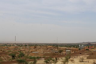
Baoudetta | |
|---|---|
Commune and village | |
 | |
| Country | |
| Region | Maradi |
| Department | Tessaoua |
| Elevation | 1,322 ft (403 m) |
| Population (2010) | |
• Total | 11,375 |
| Time zone | UTC+1 (WAT) |
Baoudetta | |
|---|---|
Commune and village | |
| | |
| Country | |
| Region | Maradi |
| Department | Tessaoua |
| Elevation | 1,322 ft (403 m) |
| Population (2010) | |
• Total | 11,375 |
| Time zone | UTC+1 (WAT) |

Tchirozerine is a department of the Agadez Region in Niger. Its capital lies at the city of Tchirozerine. As of 2012, the department had a total population of 244,706 people.
Bambeye is a village and rural commune in Niger.
Daouche is a village and rural commune in Niger. As of 2012, it had a population of 37,754.
Dingazi is a village and rural commune in Niger. As of 2012, it had a population of 44,486.
Dogonkiria is a village and rural commune in Niger. As of 2012, it had a population of 65,990.
El Allassane Maireyrey is a village and rural commune in Niger. As of 2012, it had a population of 64,183.
Falenko is a village and rural commune in the Tanout Department of the Zinder Region of Niger. As of 2012, it had a population of 13,993.
Gababedji is a village and rural commune in Niger.
Gamou is a village and rural commune in the Goure Department of the Zinder Region of Niger.
Gangara, Tanout is a village and rural commune in Niger. As of 2012, it had a population of 112,967.
Ibrohamane is a village and rural commune in Niger. As of 2012, it had a population of 88,724.
Kourfeye is a village and rural commune in Niger.
Moa, Niger is a village and rural commune in Niger. As of 2012, it had a population of 26,632.
Ollelewa is a village and rural commune in the Tanout Department of the Zinder Region of Niger. As of 2012, it had a population of 116,895.
Ourno is a village and rural commune in Niger. As of 2012, it had a population of 98,769.
Sakoira is a village and rural commune in Niger. As of 2012, it had a population of 26,776.
Tabotaki is a village and rural commune in Niger. As of 2012, it had a population of 46,266.
Tchake is a village and rural commune in Niger. As of 2012, it had a population of 40,502.
Tirmini is a village and rural commune in Niger.
Wame is a village and rural commune in Niger. As of 2012, it had a population of 43,568.
14°37′20″N8°06′43″E / 14.62222°N 8.11194°E
| | This Niger location article is a stub. You can help Wikipedia by expanding it. |