Beaverdam Lake–Salisbury Mills, New York

Last updated

Beaverdam Lake-Salisbury Mills
Moodna Viaduct 2.jpg
The Moodna Viaduct, a major local landmark
Orange County New York incorporated and unincorporated areas Beaver Dam Lake highlighted.svg
Location of Beaverdam Lake in Orange County and the state of New York.
Coordinates: 41°25′50″N74°07′09″W / 41.43056°N 74.11917°W / 41.43056; -74.11917
CountryUnited States
State New York
Region Hudson Valley
County Orange
Area
  Total2.6 sq mi (7 km2)
  Land2.4 sq mi (6 km2)
  Water0.3 sq mi (0.8 km2)
Elevation
300 ft (90 m)
Population
 (2000)
  Total2,779
  Density1,100/sq mi (410/km2)
Time zone UTC-5 (Eastern (EST))
  Summer (DST) UTC-4 (EDT)
ZIP Code
12577
Area code 845

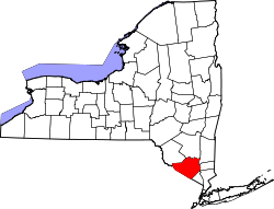
Beaverdam Lake-Salisbury Mills was a census-designated place (CDP) in Orange County, New York, United States. It encompassed a region in the corner of the towns of Blooming Grove, Cornwall, and New Windsor. As of the 2000 census, its population was 2,779. [1] After the 2000 census, the area was counted as two separate CDPs: Beaver Dam Lake in the towns of Blooming Grove and New Windsor and Salisbury Mills in the towns of Blooming Grove and Cornwall. [2] Beaverdam Lake is also the name of a lake next to the community.

Contents

The area is part of the Poughkeepsie Newburgh Middletown, NY Metropolitan Statistical Area as well as the larger New York Newark Bridgeport, NY-NJ-CT-PA Combined Statistical Area.

Geography

Beaverdam Lake-Salisbury Mills was located at 41°26′11″N74°6′41″W / 41.43639°N 74.11139°W / 41.43639; -74.11139 (41.436438, -74.111310). [3]

According to the United States Census Bureau, the CDP had a total area of 2.6 square miles (6.7 km2), of which 2.4 square miles (6.2 km2) was land and 0.3 square miles (0.8 km2) (9.92%) was water.

Demographics

Beaverdam Lake Beaverdam Lake, Salisbury Mills NY.jpg
Beaverdam Lake
Downtown Salisbury Mills Downtown Salisbury Mills, NY.jpg
Downtown Salisbury Mills

As of the census [1] of 2000, there were 2,779 people, 910 households, and 735 families residing in the CDP. The population density was 1,177.6 inhabitants per square mile (454.7/km2). There were 957 housing units at an average density of 405.5 per square mile (156.6/km2). The racial makeup of the CDP was 93.67% White, 2.30% African American, 0.29% Native American, 1.04% Asian, 0.04% Pacific Islander, 1.51% from other races, and 1.15% from two or more races. Hispanic or Latino of any race were 5.36% of the population.

There were 910 households, out of which 47.4% had children under the age of 18 living with them, 67.8% were married couples living together, 9.5% had a female householder with no husband present, and 19.2% were non-families. 15.3% of all households were made up of individuals, and 5.9% had someone living alone who was 65 years of age or older. The average household size was 3.03 and the average family size was 3.39.

In the CDP, the population was spread out, with 31.2% under the age of 18, 6.2% from 18 to 24, 32.5% from 25 to 44, 21.3% from 45 to 64, and 8.9% who were 65 years of age or older. The median age was 36 years. For every 100 females there were 98.1 males. For every 100 females age 18 and over, there were 95.2 males.

The median income for a household in the CDP was $63,250, and the median income for a family was $71,771. Males had a median income of $55,288 versus $36,603 for females. The per capita income for the CDP was $26,948. About 0.9% of families and 1.4% of the population were below the poverty line, including 1.7% of those under age 18 and none of those age 65 or over.

Related Research Articles

<span class="mw-page-title-main">Dade City North, Florida</span> CDP in Florida, United States

Dade City North is a census-designated place (CDP) in eastern Pasco County, Florida, United States. The population was 3,319 at the 2000 census.

Long Lake is an unincorporated community and census-designated place (CDP) in Lake County, Illinois, United States. Per the 2020 census, the population was 3,663.

Goodings Grove was a census-designated place in northern Will County, Illinois, United States. The population was 17,084 at the 2000 census. It is now a neighborhood of the village of Homer Glen, Illinois, which was incorporated in 2001.

<span class="mw-page-title-main">Lutherville-Timonium, Maryland</span> Former census-designated place in Maryland, United States

Lutherville-Timonium was a census-designated place (CDP) in Baltimore County, Maryland, United States, for the 2000 census. At that time the population was 15,814. For the 2010 census the area was split into two CDPs, the unincorporated communities of Lutherville and Timonium. Within its borders lies the Lutherville Historic District. The Maryland State Fair is held in Timonium each year near Labor Day.

<span class="mw-page-title-main">Harvey, Michigan</span> Census-designated place & unincorporated community in Michigan, United States

Harvey is a census-designated place (CDP) in Marquette County in the U.S. state of Michigan. The population was 3,244 as of the 2020 census, up from 1,393 in 2010, before the CDP was enlarged by the Census Bureau. The CDP is located within Chocolay and Sands townships.

<span class="mw-page-title-main">Hillside Lake, New York</span> Census-designated place in New York, United States

Hillside Lake is a hamlet and census-designated place (CDP) in Dutchess County, New York, United States. The population was 1,084 at the 2010 census. It is part of the Poughkeepsie–Newburgh–Middletown, NY Metropolitan Statistical Area as well as the larger New York–Newark–Bridgeport, NY-NJ-CT-PA Combined Statistical Area.

<span class="mw-page-title-main">Blooming Grove, New York</span> Town in New York, United States

Blooming Grove is a town in Orange County, New York, United States. The population was 18,811 at the 2020 census. It is located in the central part of the county, southwest of Newburgh.

<span class="mw-page-title-main">Firthcliffe, New York</span> CDP in New York, United States

Firthcliffe is a hamlet in Orange County, New York United States. The population was 5,022 at the 2020 Census. It is part of the Poughkeepsie–Newburgh–Middletown, NY Metropolitan Statistical Area as well as the larger New York–Newark–Bridgeport, NY-NJ-CT-PA Combined Statistical Area.

<span class="mw-page-title-main">Vails Gate, New York</span> CDP in New York, United States

Vails Gate is a hamlet in Orange County, New York, United States. The population was 3,368 at the 2020 census. It is part of the Poughkeepsie–Newburgh–Middletown, NY Metropolitan Statistical Area as well as the larger New York–Newark–Bridgeport, NY-NJ-CT-PA Combined Statistical Area.

<span class="mw-page-title-main">Walton Park, New York</span> CDP in New York, United States

Walton Park is a census-designated place (CDP) in Orange County, New York, United States. As of the 2020 census, the CDP had a total population of 3,907. Walton Park is on the town line separating the towns of Chester and Monroe. Street addresses within Walton Park are usually assigned to Monroe, not Chester.

<span class="mw-page-title-main">Rock Hill, New York</span> CDP in New York, United States

Rock Hill is a hamlet in Sullivan County, New York, United States. At the 2020 census the population was 2,369.

<span class="mw-page-title-main">Smallwood, New York</span> Census-designated place in New York, US

Smallwood is a hamlet in Sullivan County, New York, United States. The population was 839 at the 2020 census.

<span class="mw-page-title-main">Fairview Lanes, Ohio</span> Unincorporated community and Census-designated place in Ohio, United States

Fairview Lanes is an unincorporated community in Perkins Township, Erie County, Ohio, United States. The area was delineated as a census-designated place (CDP) for the 2000 census, at which time its population was 1,015. The area was not a CDP for the 2010 census. It is part of the Sandusky, Ohio Metropolitan Statistical Area.

Shady Grove is a census-designated place (CDP) in McIntosh County, Oklahoma, United States. The population was 199 at the 2010 census, a decrease of 14.4 percent from 229 in 2000. This is not to be confused with the similarly-named Shady Grove in Cherokee County, or the Shady Grove in Pawnee County.

<span class="mw-page-title-main">Guys Mills, Pennsylvania</span> Census-designated place in Pennsylvania, United States

Guys Mills is a census-designated place in Crawford County, Pennsylvania, United States. The population was 124 at the 2010 census.

<span class="mw-page-title-main">Pymatuning South, Pennsylvania</span> Census-designated place in Pennsylvania, United States

Pymatuning South is a census-designated place (CDP) in Crawford County, Pennsylvania, United States. The population was 479 at the 2010 census.

Middletown is a census-designated place (CDP) in Bethlehem Township in Northampton County, Pennsylvania. The population of Middletown was 7,441 at the 2010 census. Middletown is part of the Lehigh Valley, which had a population of 861,899 and was the 68th-most populous metropolitan area in the U.S. as of the 2020 census.

Wildwood Lake is a census-designated place (CDP) in Bradley County, Tennessee, United States. The population was 3,286 at the 2020 Census. It is included in the Cleveland, Tennessee Metropolitan Statistical Area.

<span class="mw-page-title-main">Spring Valley Lake, California</span> Census-designated place in California, United States

Spring Valley Lake is a census-designated place in the Victor Valley of the Mojave Desert, within San Bernardino County, California. It is located along the Mojave River.

<span class="mw-page-title-main">Beaver Dam Lake, New York</span> Census-designated place in New York, United States

Beaver Dam Lake is a census-designated place (CDP) in the towns of New Windsor, Blooming Grove, and Cornwall in Orange County, New York, United States. As of the 2020 census, it had a population of 2,609.

References

  1. 1 2 "U.S. Census website". United States Census Bureau . Retrieved January 31, 2008.
  2. "Places: New York". 2010 Census Gazetteer Files. United States Census Bureau. Archived from the original on February 17, 2013. Retrieved January 12, 2013.
  3. "US Gazetteer files: 2010, 2000, and 1990". United States Census Bureau. February 12, 2011. Retrieved April 23, 2011.