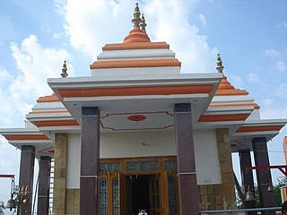
Mainpuri is a city in Mainpuri district in the Indian state of Uttar Pradesh. It is the administrative headquarters of Mainpuri district and is situated to the north-east of Agra and is 270 km from New Delhi. Mainpuri is located in the Braj region, which holds special religious significance to Hindus as the homeland of Krishna.

Mainpuri district is one of the districts in the Agra division of Uttar Pradesh, India. Mainpuri town is the district headquarters. It consists of six tehsils, namely Mainpuri, Bhongaon, Karhal, Kishni, Kurawali and Ghiror.

Ambedkar Nagar is a district in the Indian state of Uttar Pradesh. This district is a part of Ayodhya division in the Awadh region of the state. This district was established on 29 September 1995 by carving out parts of the erstwhile Faizabad district. It was created by the then Chief Minister Mayawati and named in memory of Bhimrao Ambedkar, who worked for the advancement of the depressed classes. The total area of Ambedkar Nagar district is 2350 Sq. Km.
Ghiror, also spelled Ghiraur, is a town and a nagar panchayat in Mainpuri district in the state of Uttar Pradesh, India. It is also the headquarters of a community development block comprising 74 villages. As of 2011, Ghiror has a population of 15,911, in 2,687 households.
Karhal is a town and Nagar Panchayat in Mainpuri district in the Indian state of Uttar Pradesh. It is also a Tehsil, that is subdivided into two blocks, Karhal and Barnahal. It is one of the Vidhan Sabha constituency of Uttar Pradesh.
Kishni is a town in Bhongaon tehsil of Mainpuri district in the Indian state of Uttar Pradesh. It is also the seat of a community development block. As of 2011, the town of Kishni has a population of 11,098, in 5,832 households.
Kuraoli is a town and a nagar panchayat in Mainpuri district in the Indian state of Uttar Pradesh. Kuraoli was known for Rathore thakur state in 18th century, now it is known for its largest garlic and onion mandi in Uttar Pradesh.

Panhan, also called Panhan Khas, is a small village in Purwa block of Unnao district, Uttar Pradesh, India. Located due south of Purwa and a bit to the west of the Loni River, it historically was the seat of a pargana. As of 2011, the village's population is 545 people, in 104 households.
Barnahal is a village and corresponding community development block in Karhal tehsil of Mainpuri district, Uttar Pradesh. Historically the seat of a pargana, Barnahal hosts a market twice per week. As of 2011, it has a population of 10,203, in 1,732 households.
Sultanganj is a village and corresponding community development block in Bhongaon tehsil of Mainpuri district, Uttar Pradesh. As of 2011, it had a population of 4,484, in 751 households.
Nabiganj is a village in Bewar block of Mainpuri district, Uttar Pradesh. Located on a historically important trade route, Nabiganj used to serve as a way station for travelling merchants; it was also historically the seat of a pargana. As of 2011, Nabiganj has a population of 4,883, in 792 households.
Sagamai is a village in Bhongaon tehsil of Mainpuri district, Uttar Pradesh. It is the headquarters of the community development block of Jagir, which comprises Sagamai plus 56 other villages. As of 2011, Sagamai had a population of 3,369, in 587 households.
Allau, also spelled Ailau, is a village in Jagir block of Mainpuri district, Uttar Pradesh. Located south of Bhongaon and east of Mainpuri, Allau is a former community development block headquarters. It contains about a dozen subsidiary hamlets. As of 2011, Allau had a total population of 5,087, in 1,810 households.
Manchhana is a village in Jagir block of Mainpuri district, Uttar Pradesh. It was once a taluqa headquarters. As of 2011, it had a total population of 6,201, in 1,082 households.
Paraunkha is a village in Bewar block of Mainpuri district, Uttar Pradesh. As of 2011, it has a population of 8,198, in 1,390 households.
Nagla Penth is a village in Bewar block of Mainpuri district, Uttar Pradesh. There is a prominent jhil on village lands. As of 2011, it had a population of 1,505, in 239 households.
Nagla Sudama is a village in Bewar block of Mainpuri district, Uttar Pradesh. As of 2011, it has a population of 1,936, in 291 households.
Manpur Hari is a village in Bewar block of Mainpuri district, Uttar Pradesh. As of 2011, it has a population of 1,693, in 296 households.
Manpur Biku is a village in Bewar block of Mainpuri district, Uttar Pradesh. As of 2011, it has a population of 674, in 108 households.


