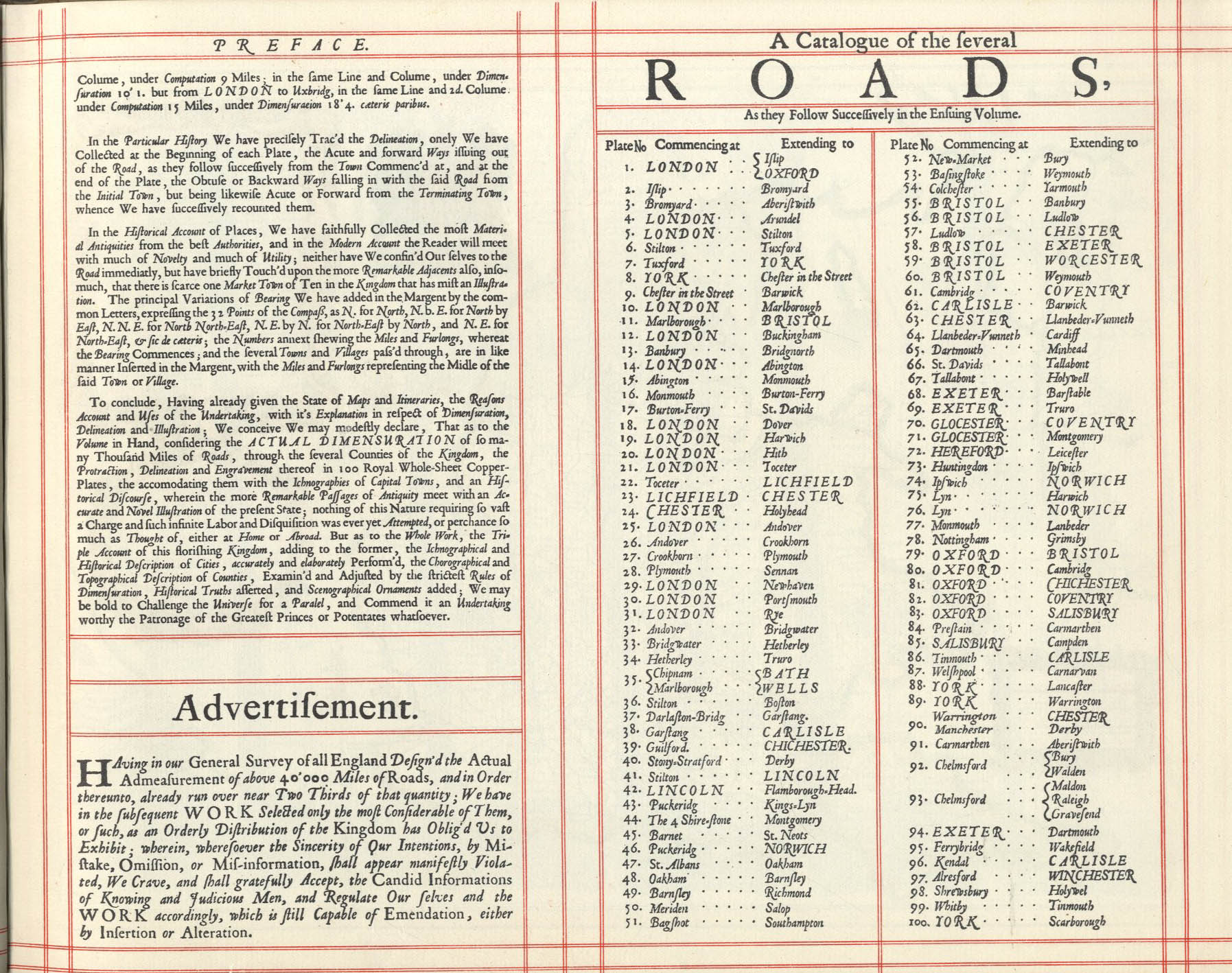
1675 atlas of most major routes in England and Wales
Ogilby's Britannia, frontispiece. A surveyor and assistants are shown at the lower right. This illustration, like the others in the book, was etched by Wenceslaus Hollar.
Britannia is the title of each of three atlases created in England between the late 16th and mid 18th centuries, describing some or all of the British Isles. These are the books published by William Camden (in 1586, reprinted in 1693) and Richard Blome (in 1673) and John Ogilby (in 1675). Of the three, Ogilby's is probably the best known as it was the first to use measured distances.
In 1577, William Camden (1551–1623) began his great work Britannia, a topographical and historical survey of all of Great Britain and Ireland. His stated intention was to "restore antiquity to Britaine, and Britain to his antiquity".[1] The first edition, written in Latin, was published in 1586. It proved very popular, and ran through five further Latin editions, of 1587, 1590, 1594, 1600 and 1607, each greatly enlarged from its predecessor in both textual content and illustrations.[2][3] The 1607 edition included for the first time a full set of English county maps, based on the surveys of Christopher Saxton and John Norden, and engraved by William Kip and William Hole (who also engraved the fine frontispiece). The first English-language edition, translated by Philemon Holland, appeared in 1610, again with some additional content supplied by Camden.[4]
Britannia is a county-by-county description of Great Britain and Ireland. It is a work of chorography: a study that relates landscape, geography, antiquarianism, and history. Rather than write a history, Camden wanted to describe in detail the Great Britain of his time, and to show how the traces of the past could be discerned in the existing landscape. By this method, he produced the first coherent picture of Roman Britain.
Blome's Britannia
This section needs expansion. You can help by adding to it. (August 2023)
Richard Blome (1635-1705) published his Britannia, or a Geographical Description of the Kingdom of England, Scotland and Ireland in 1673.
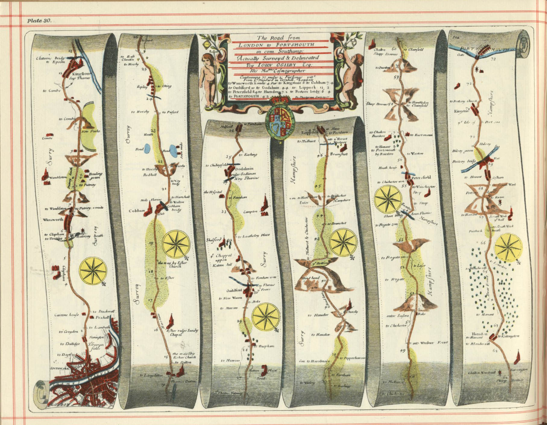
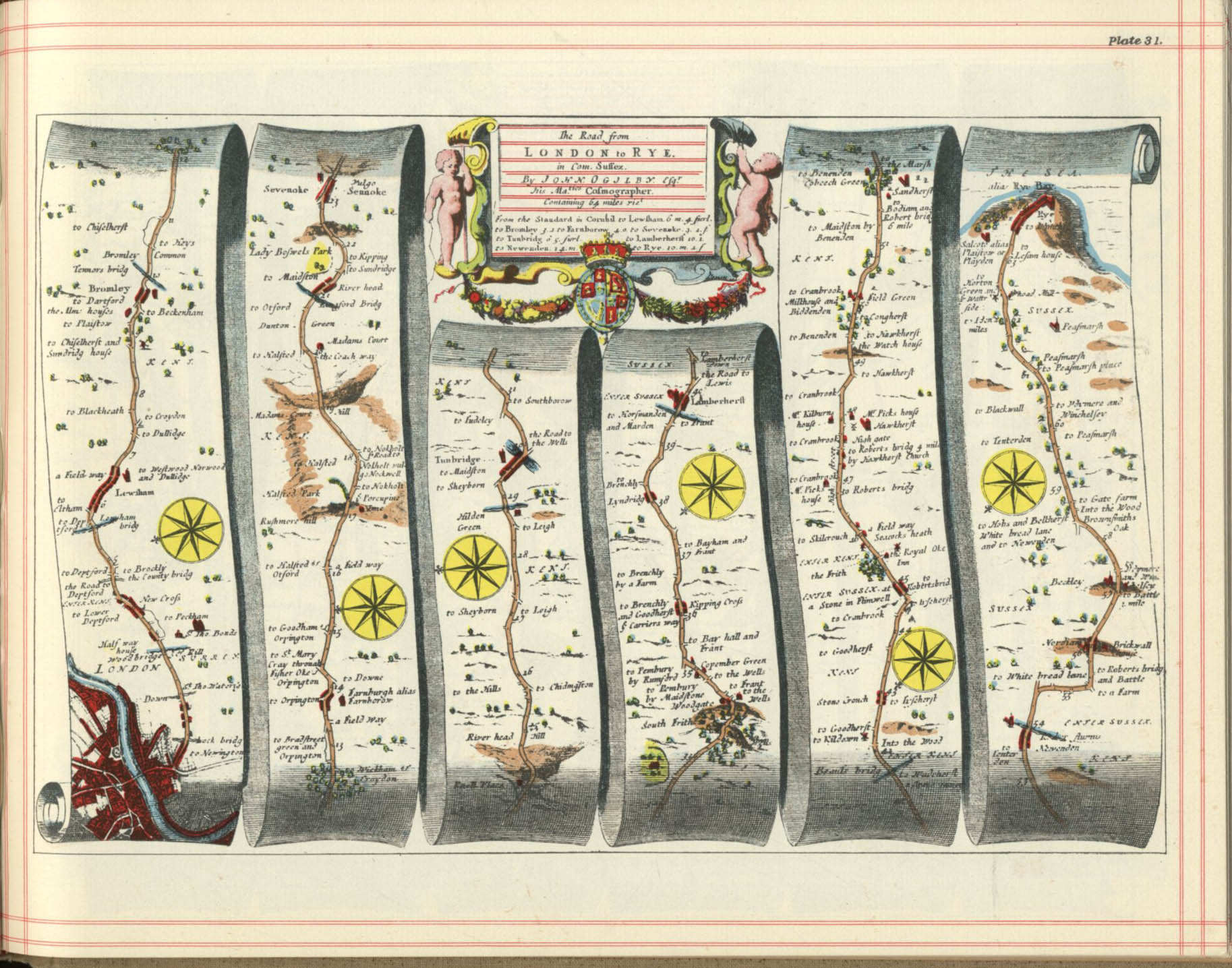
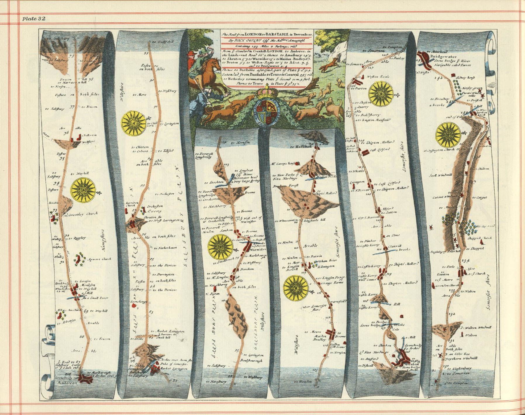
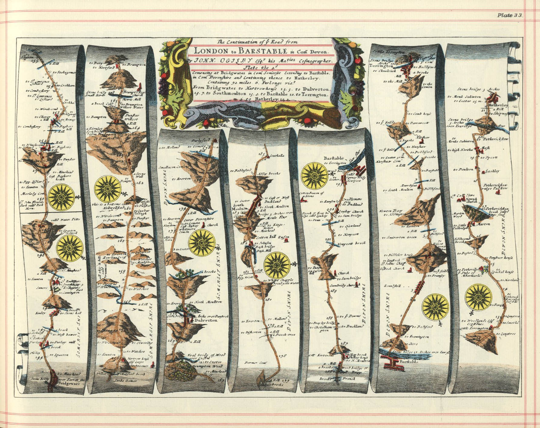
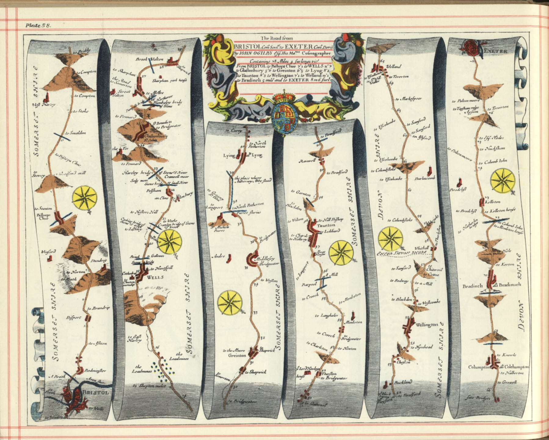
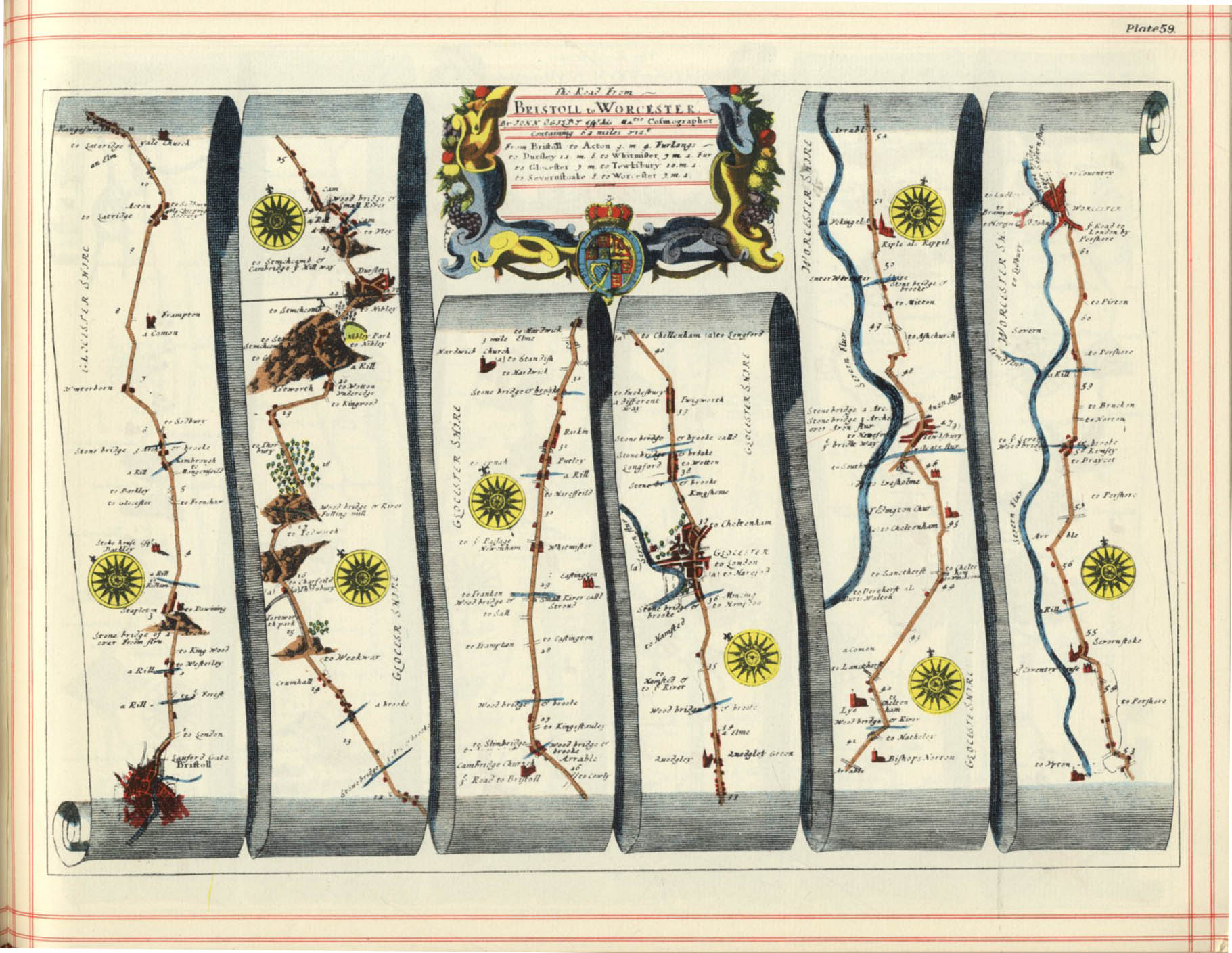
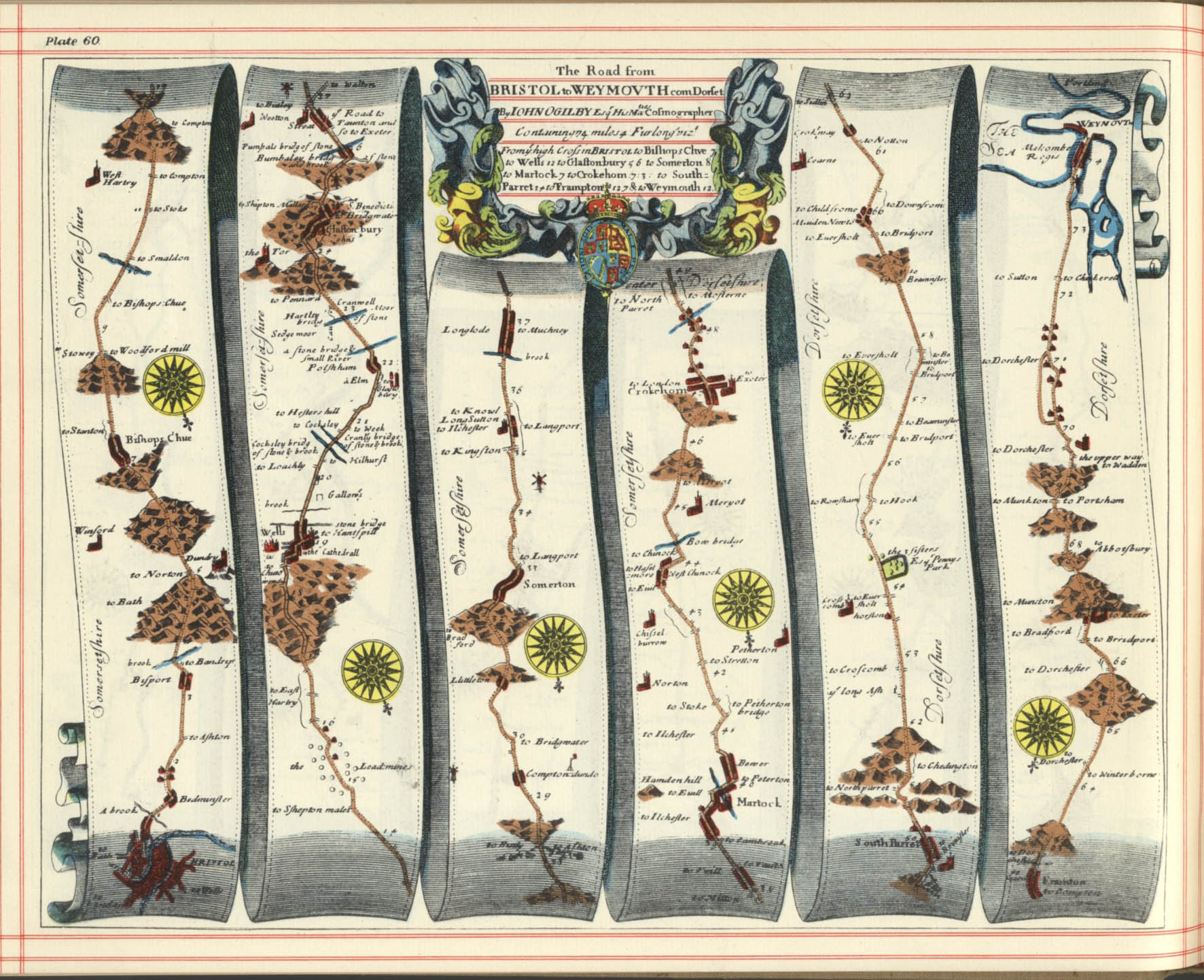
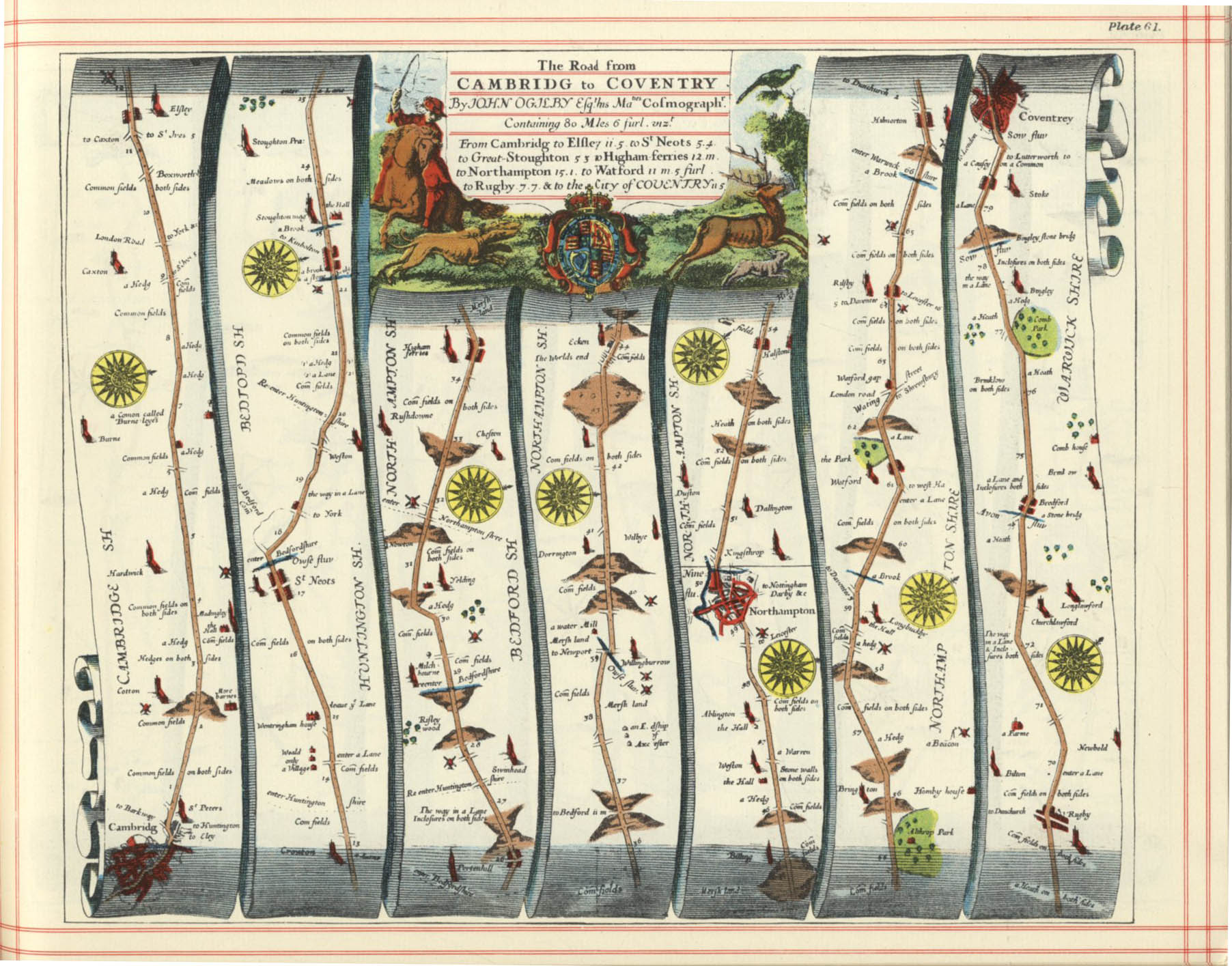
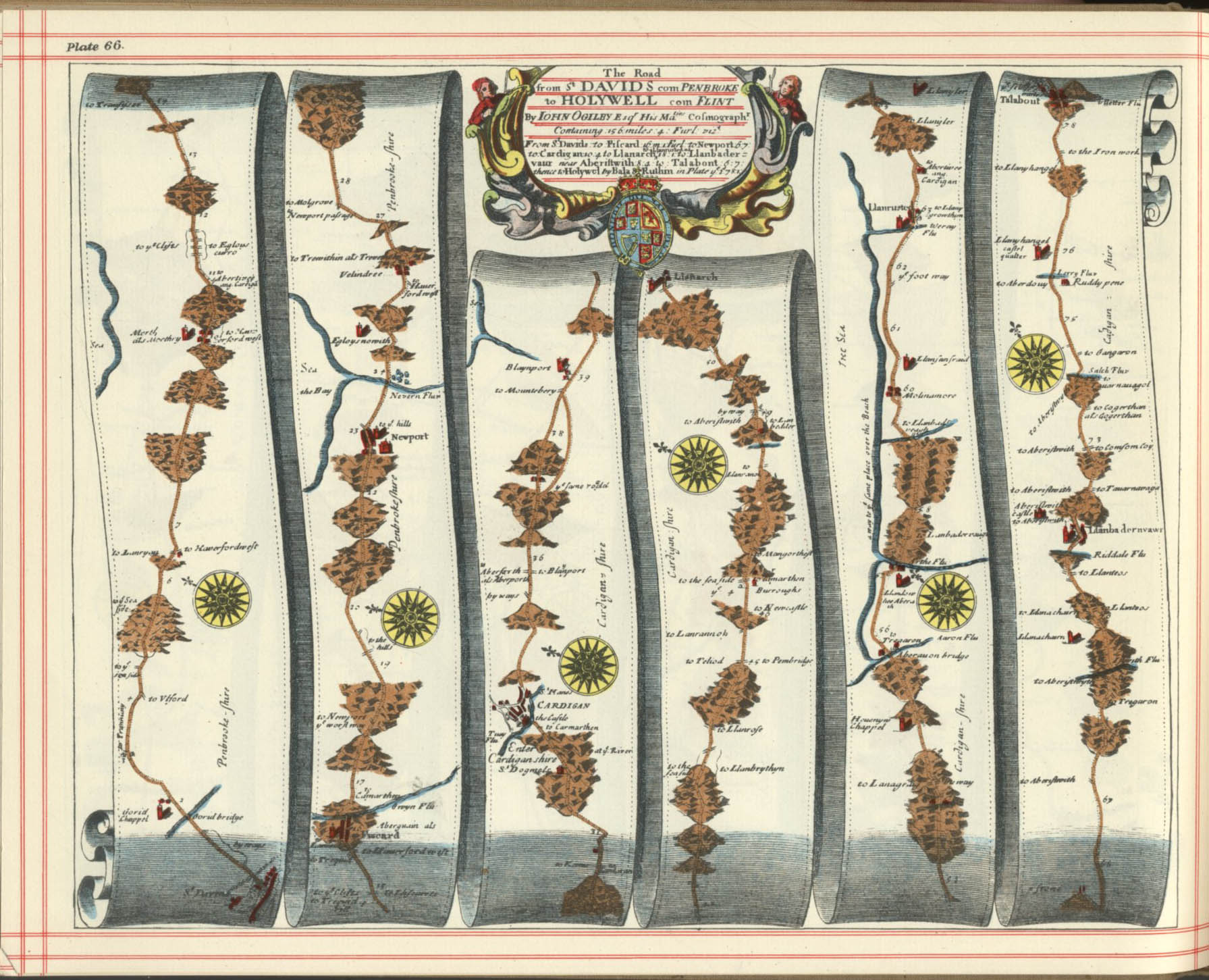
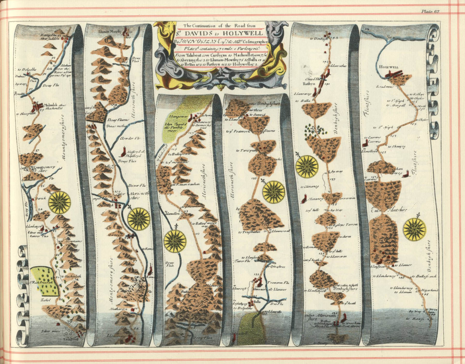
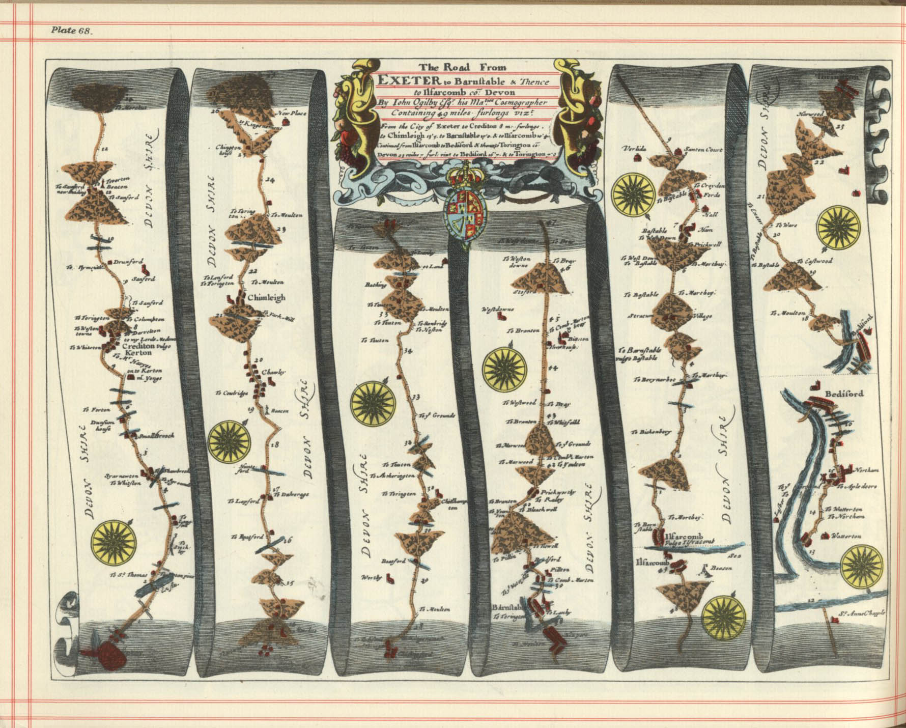
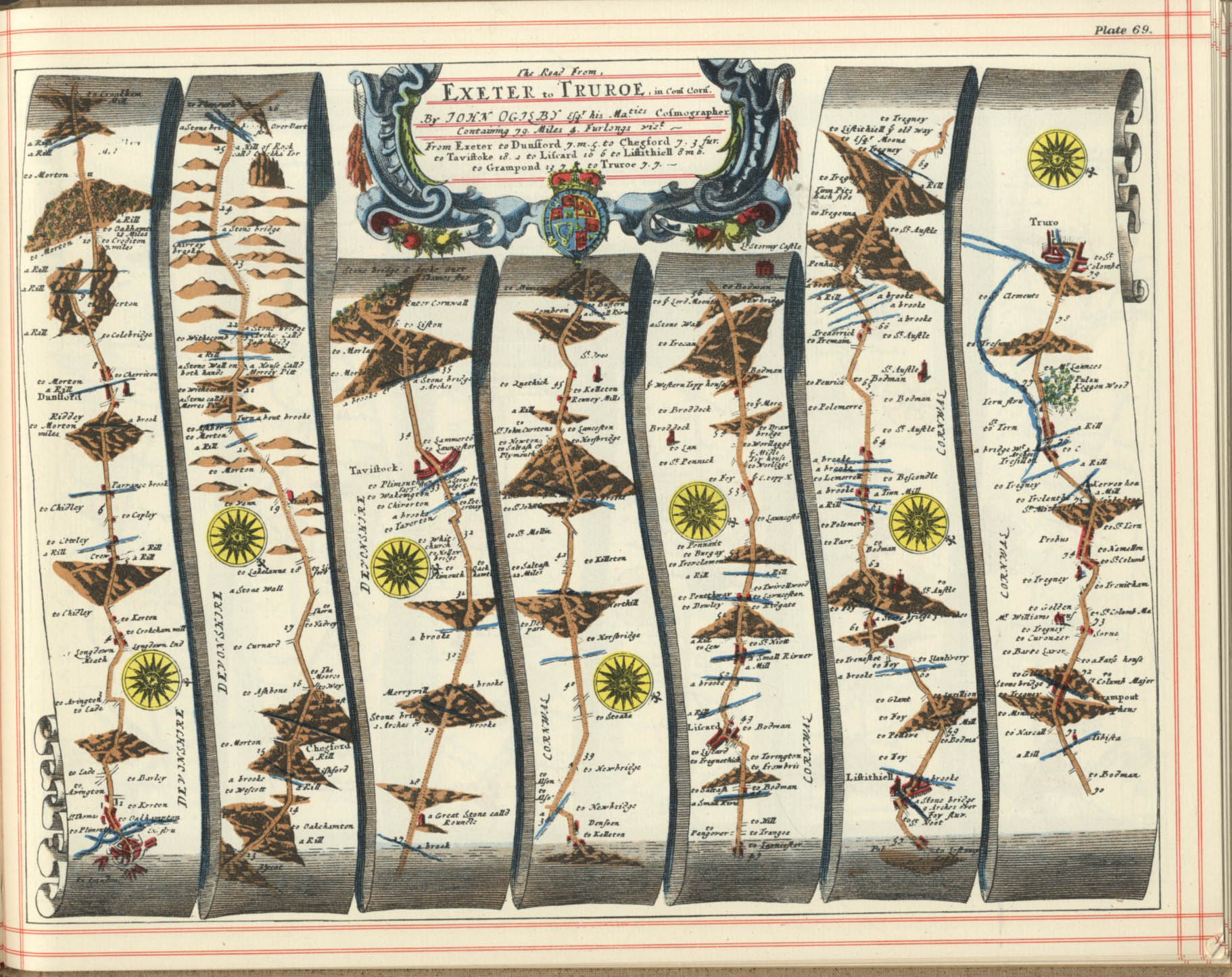
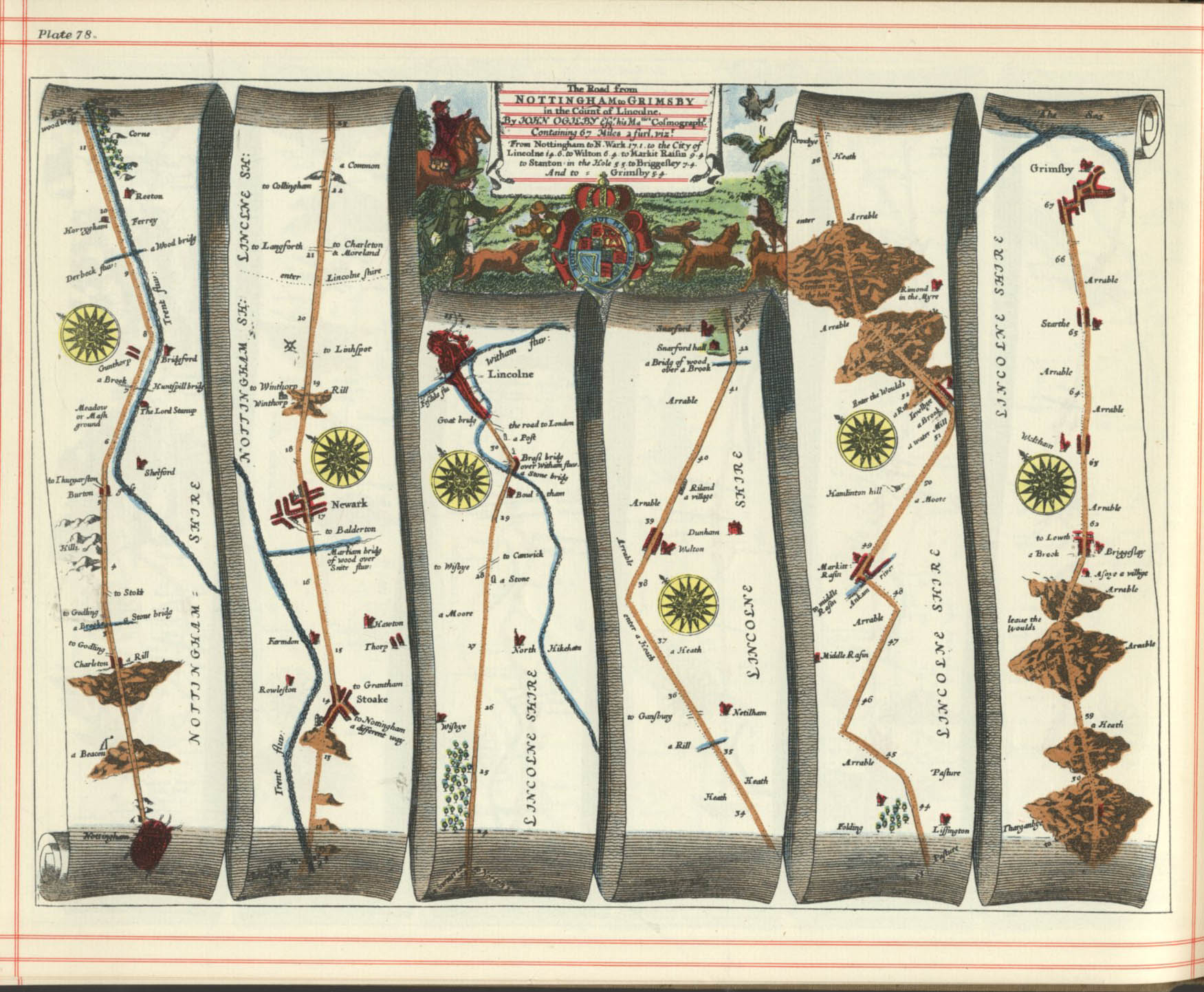
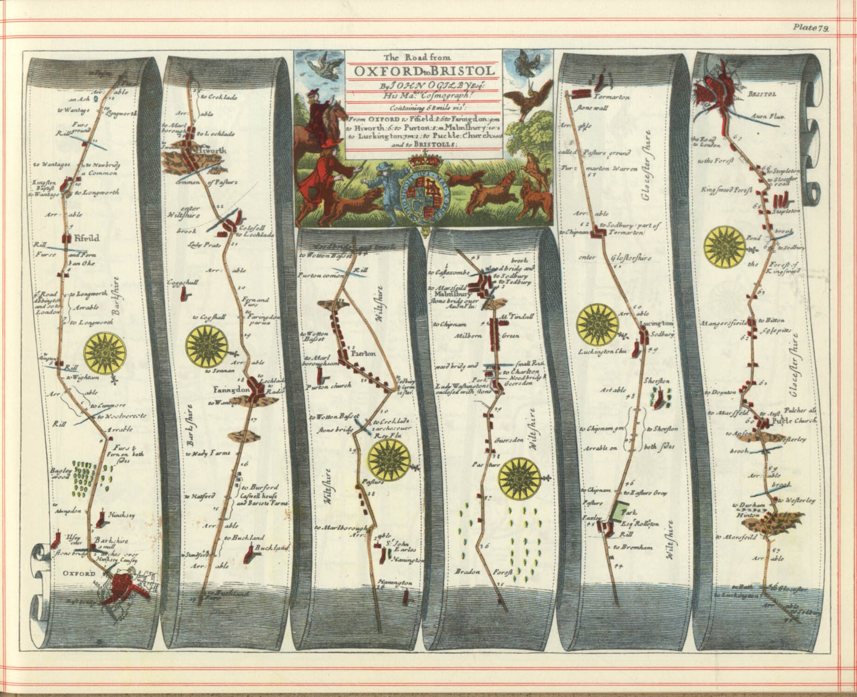
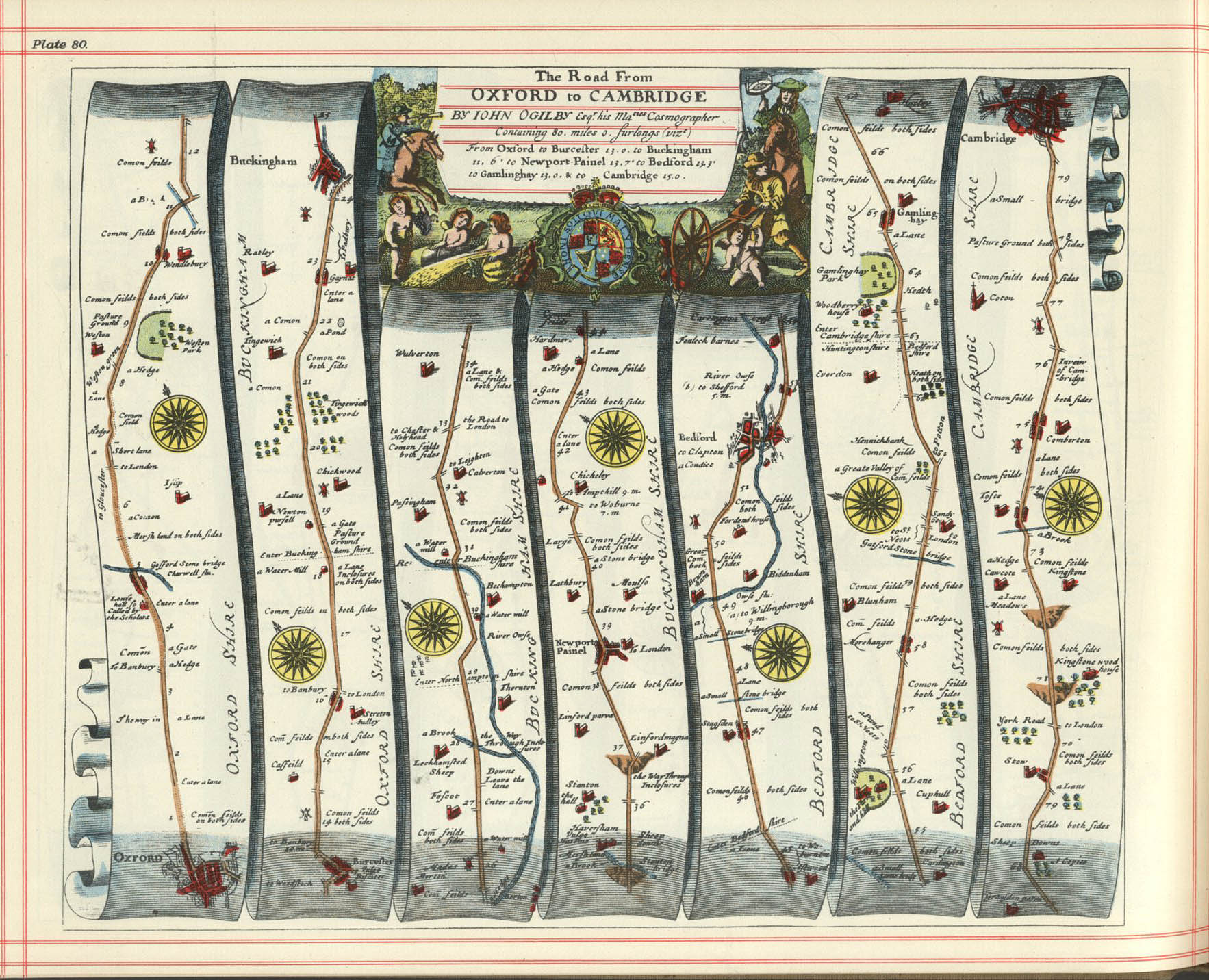
Ogilby's Britannia
A trundle wheel in use (detail from the frontispiece of Ogilby's Britannia (1675)).
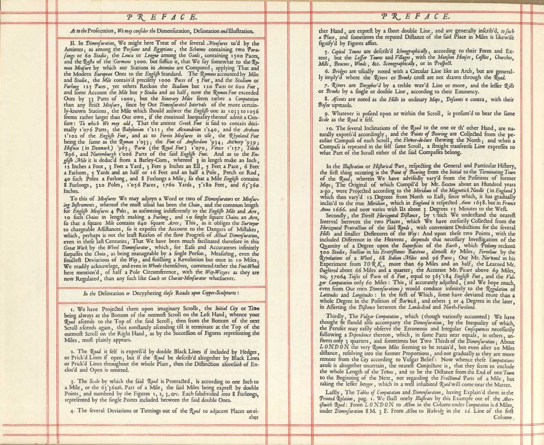
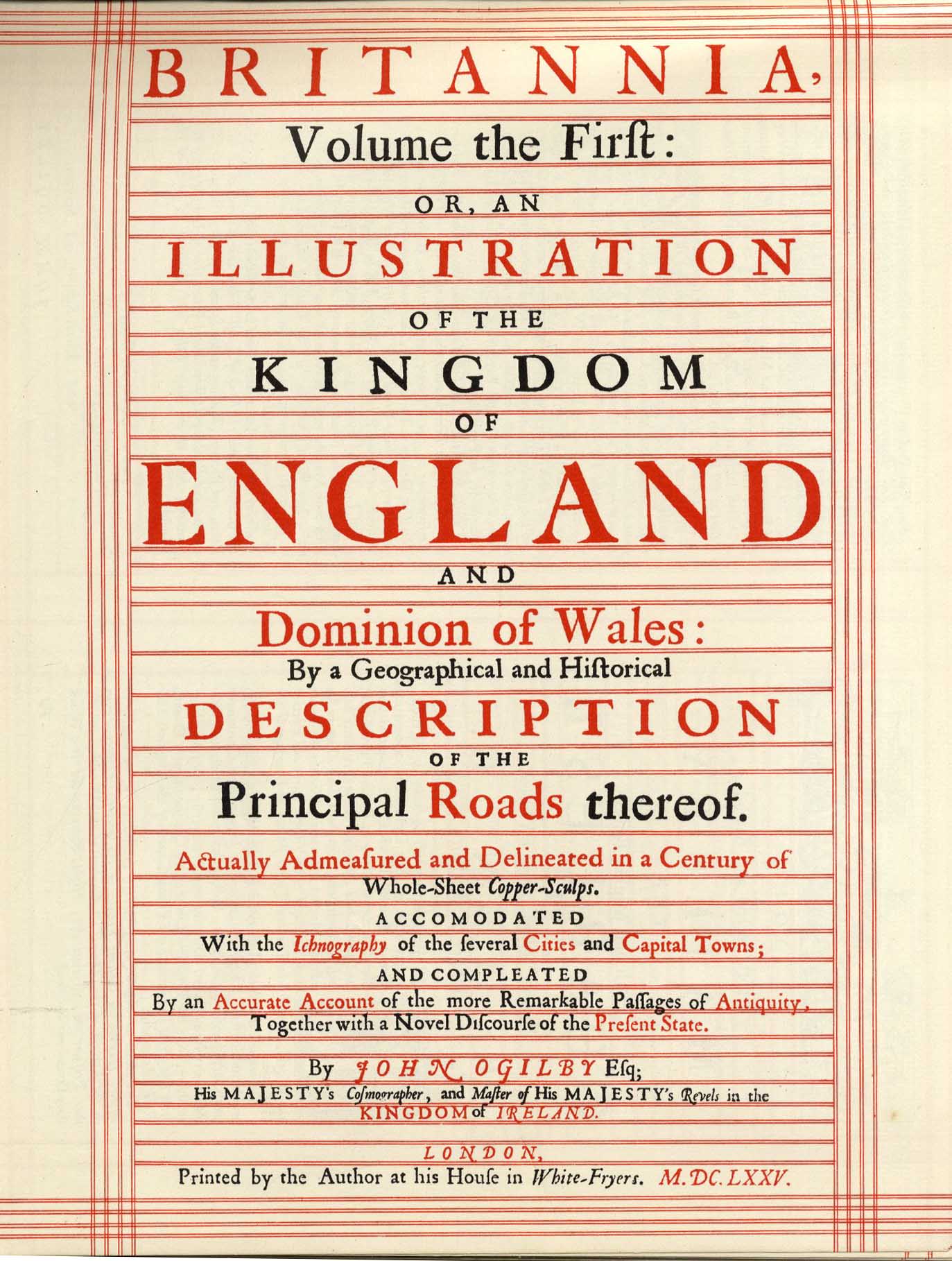
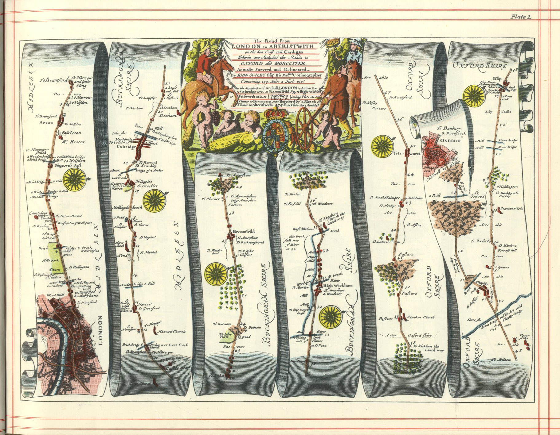
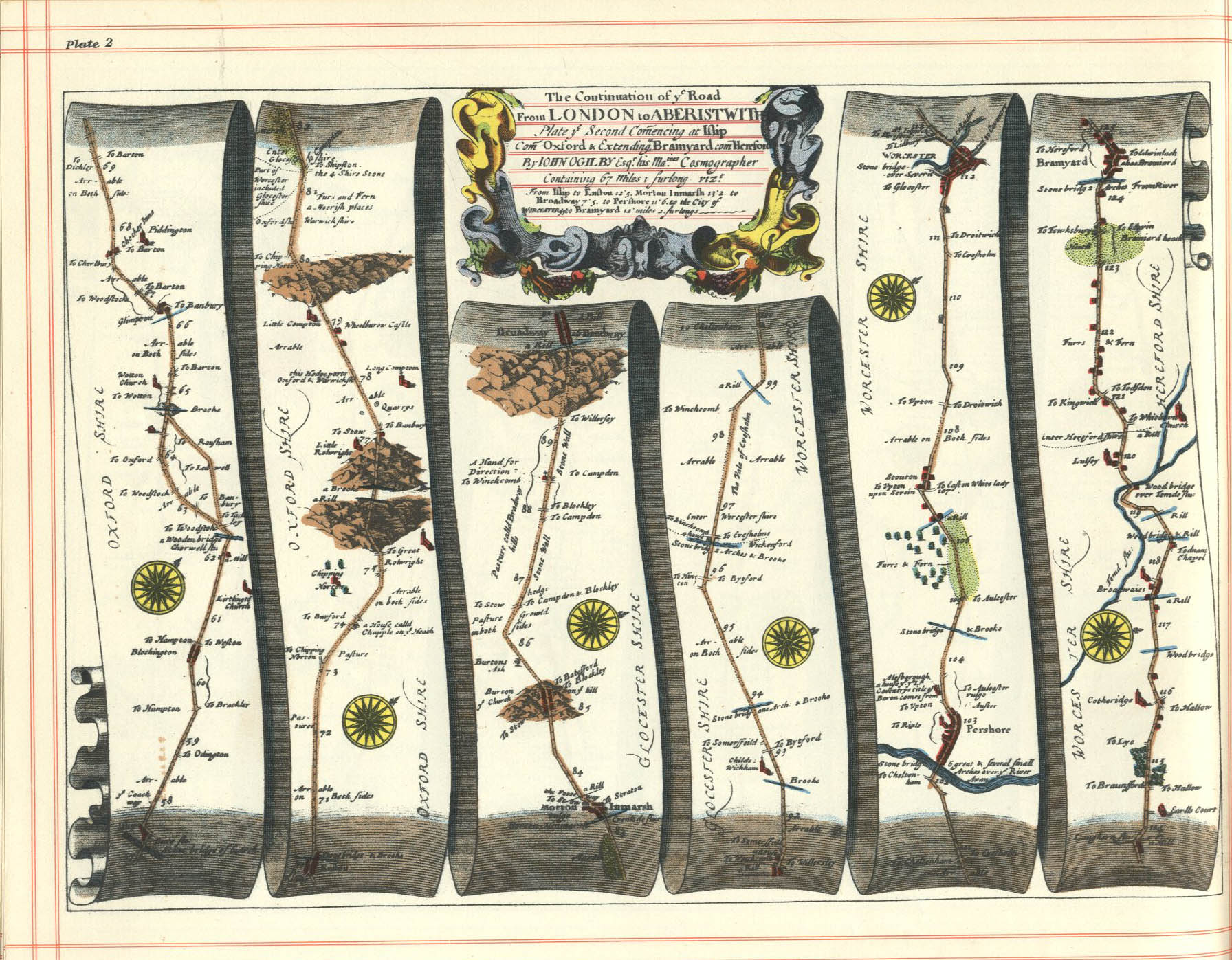
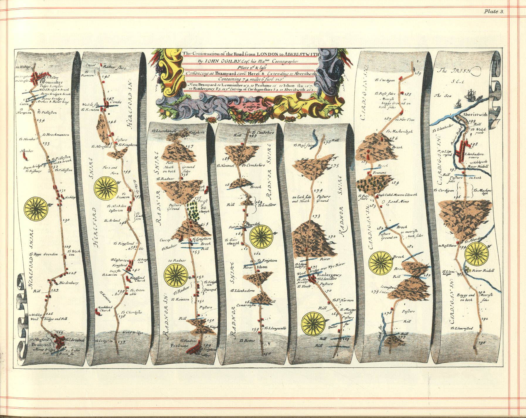
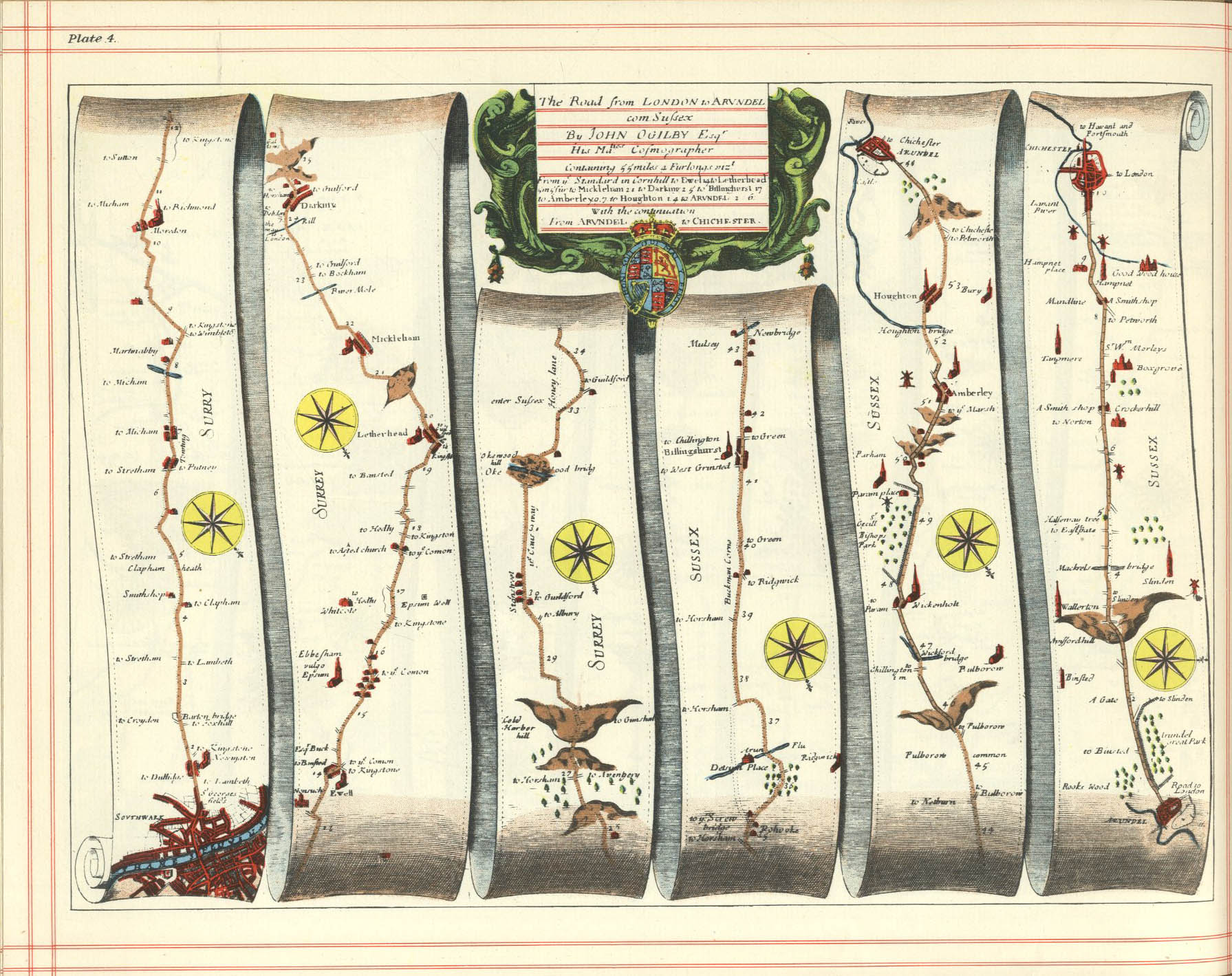
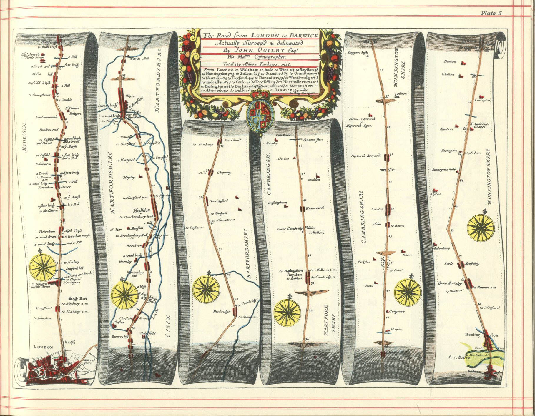
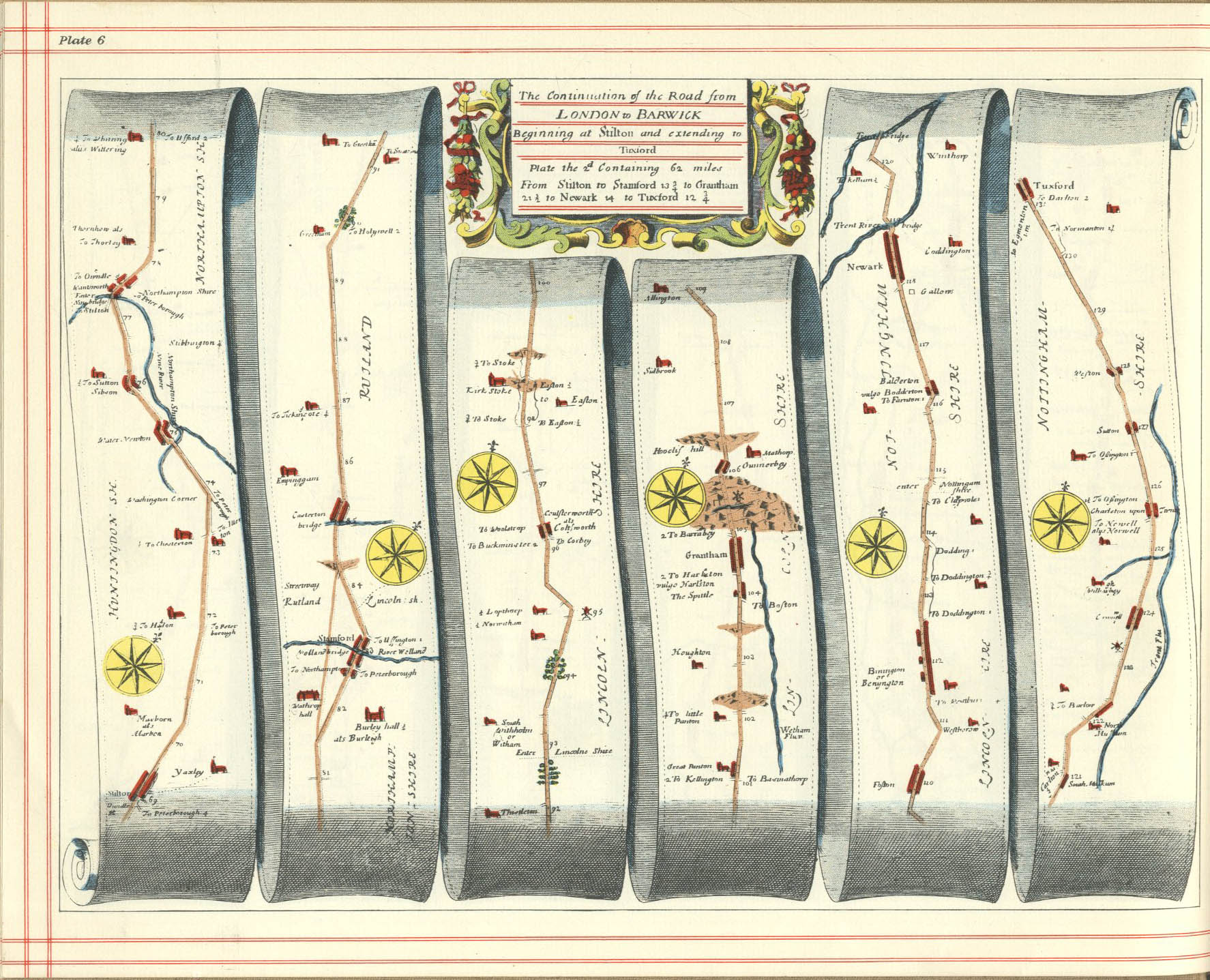
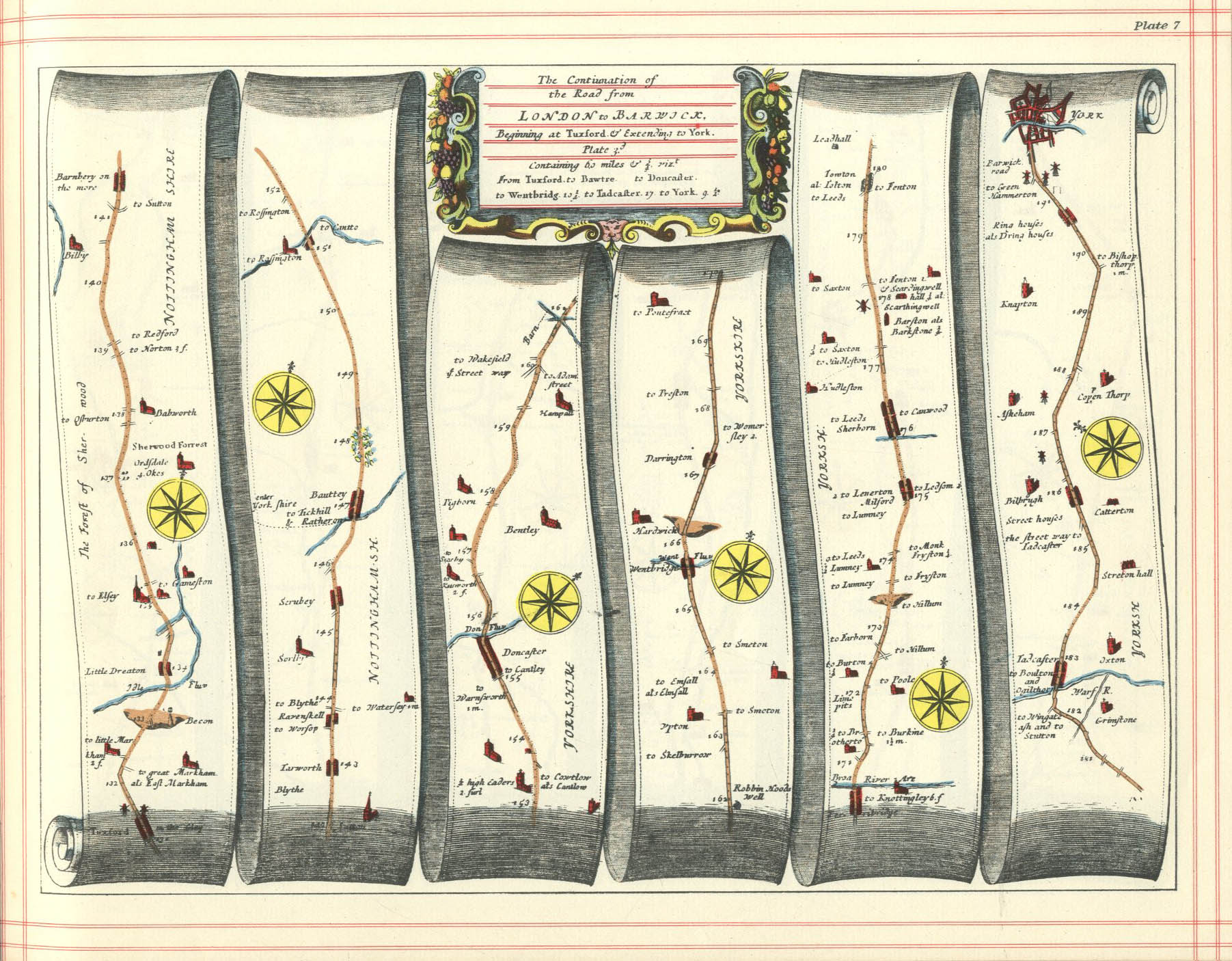
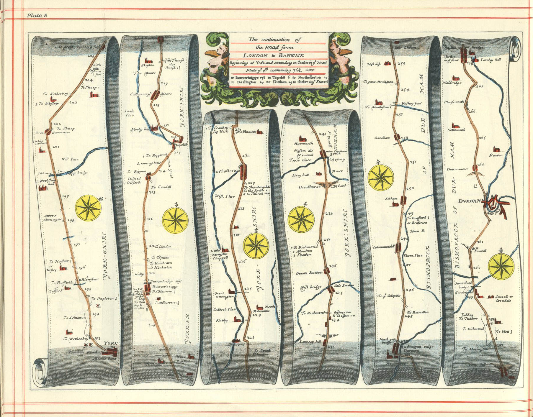
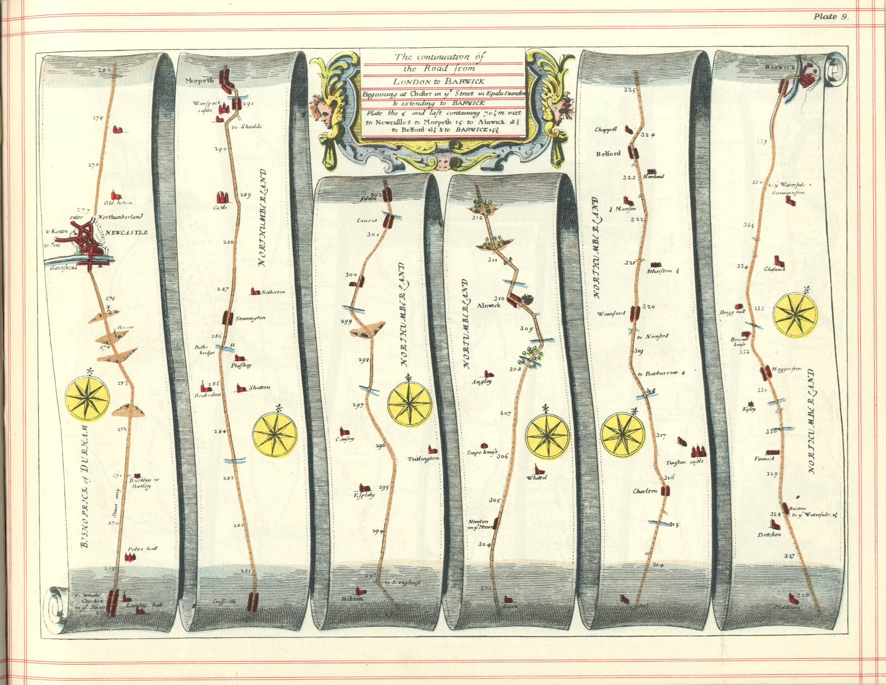
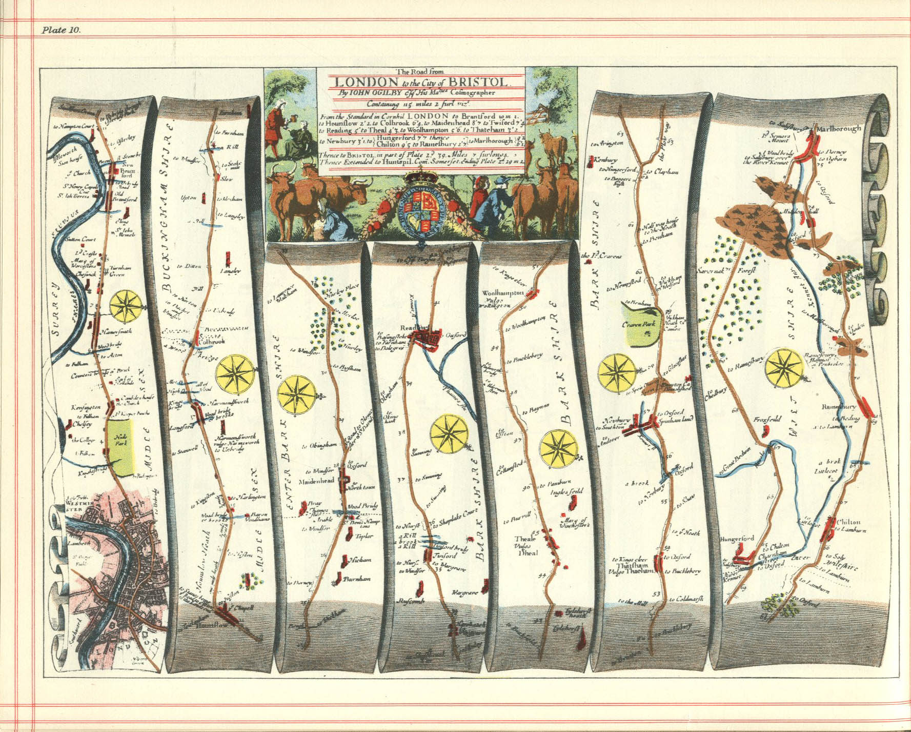
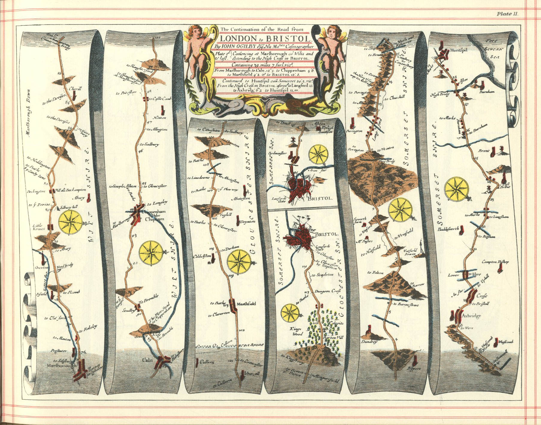
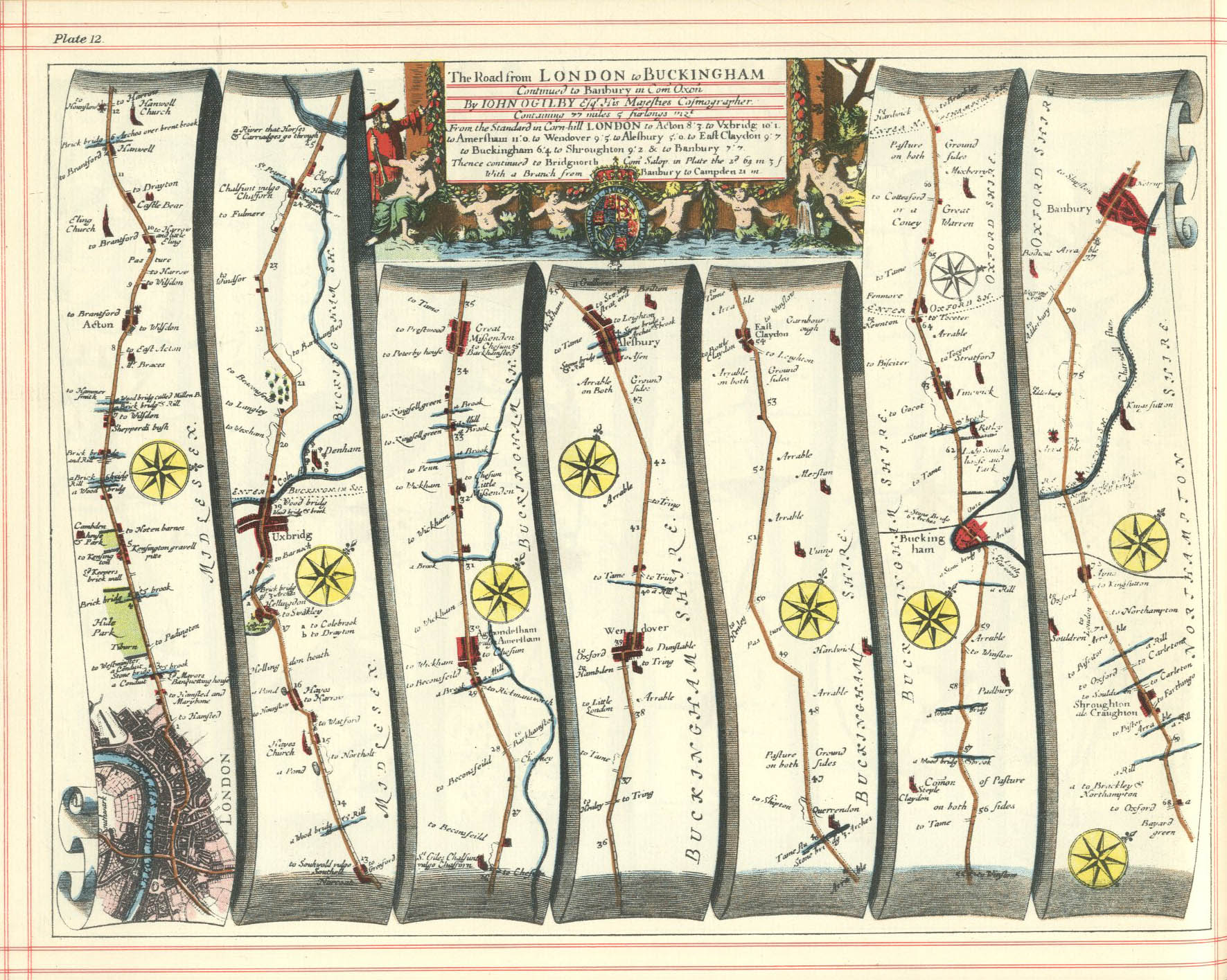
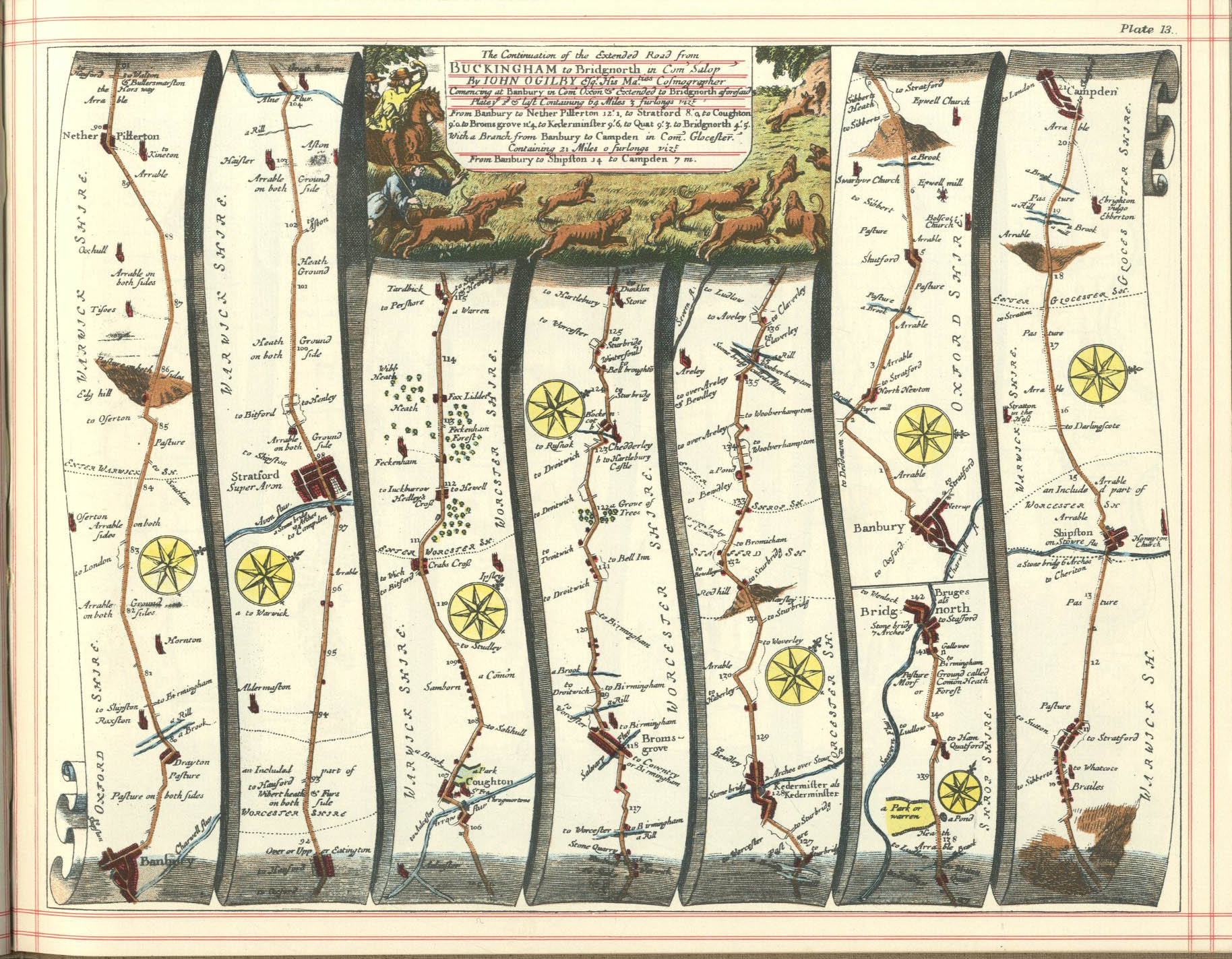
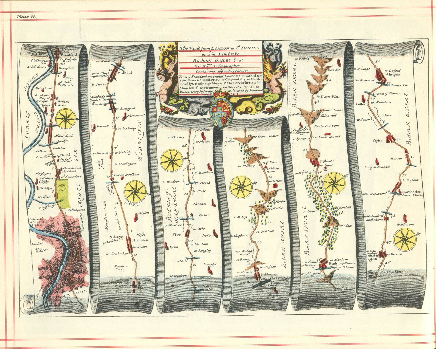
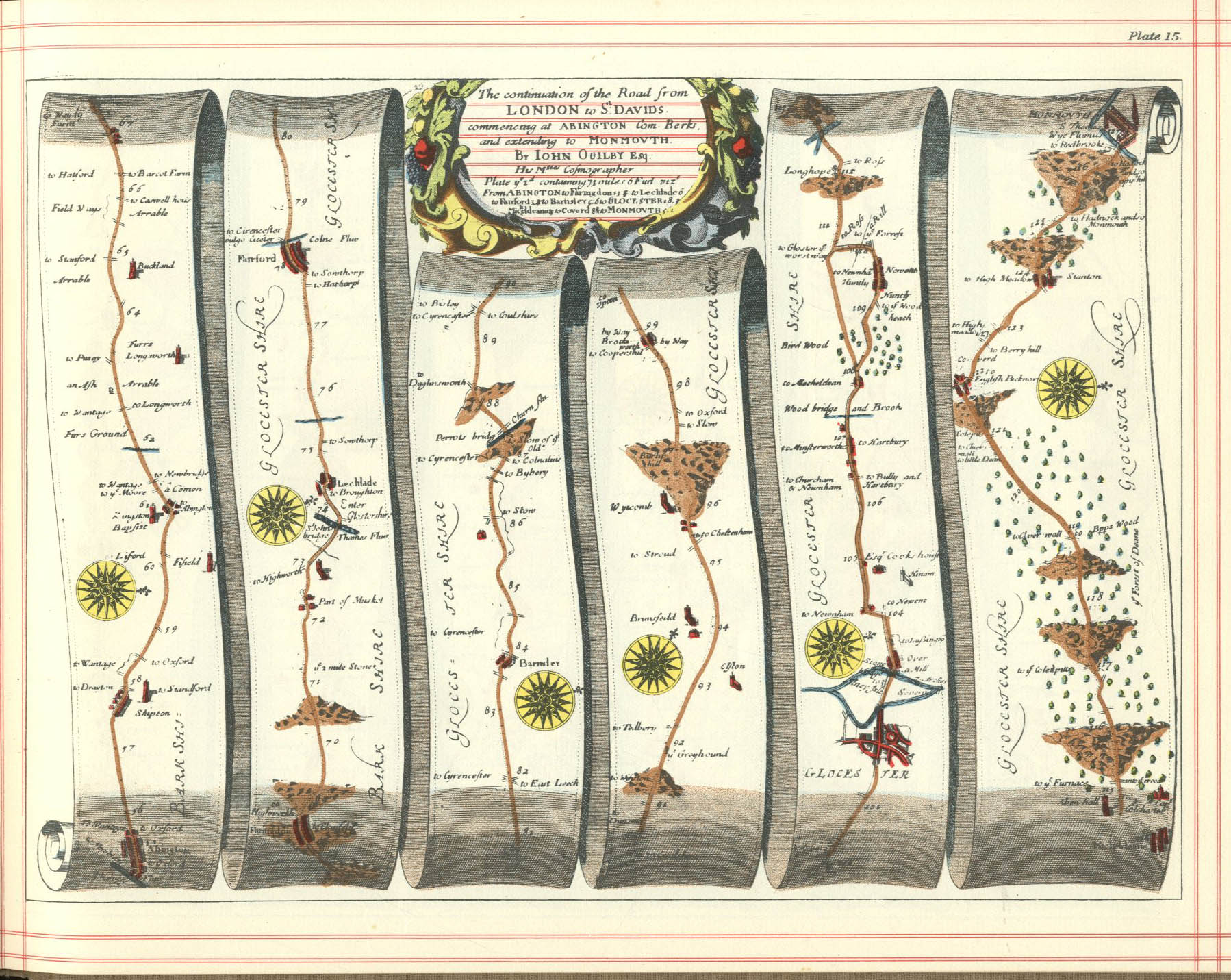
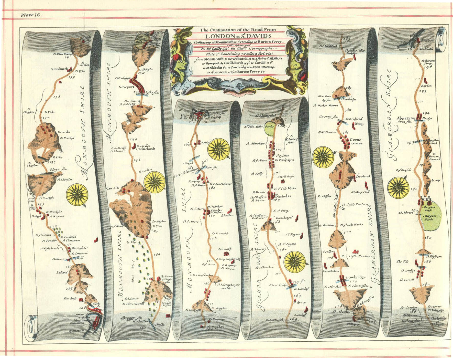
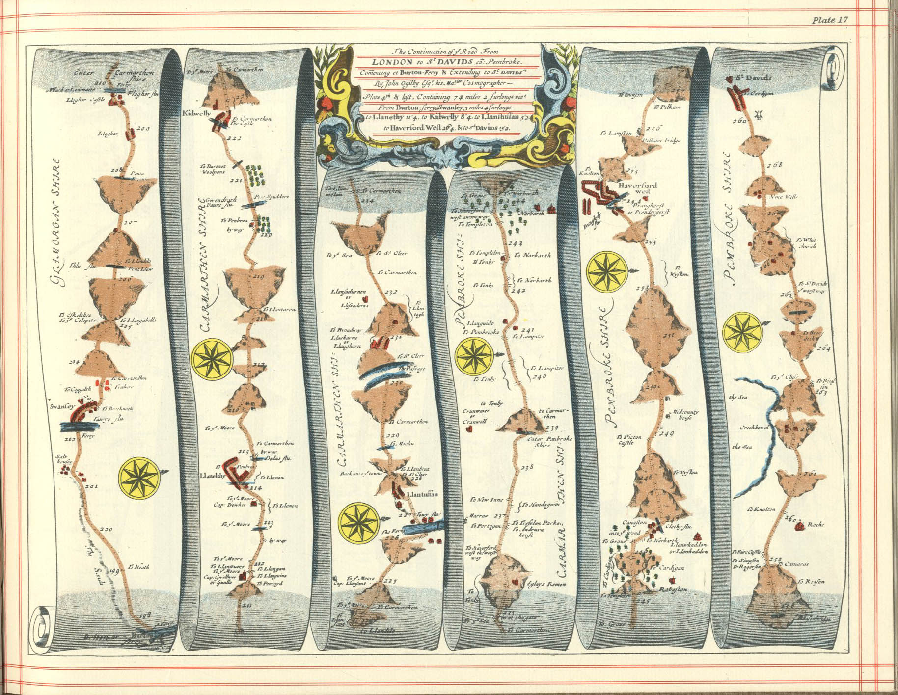
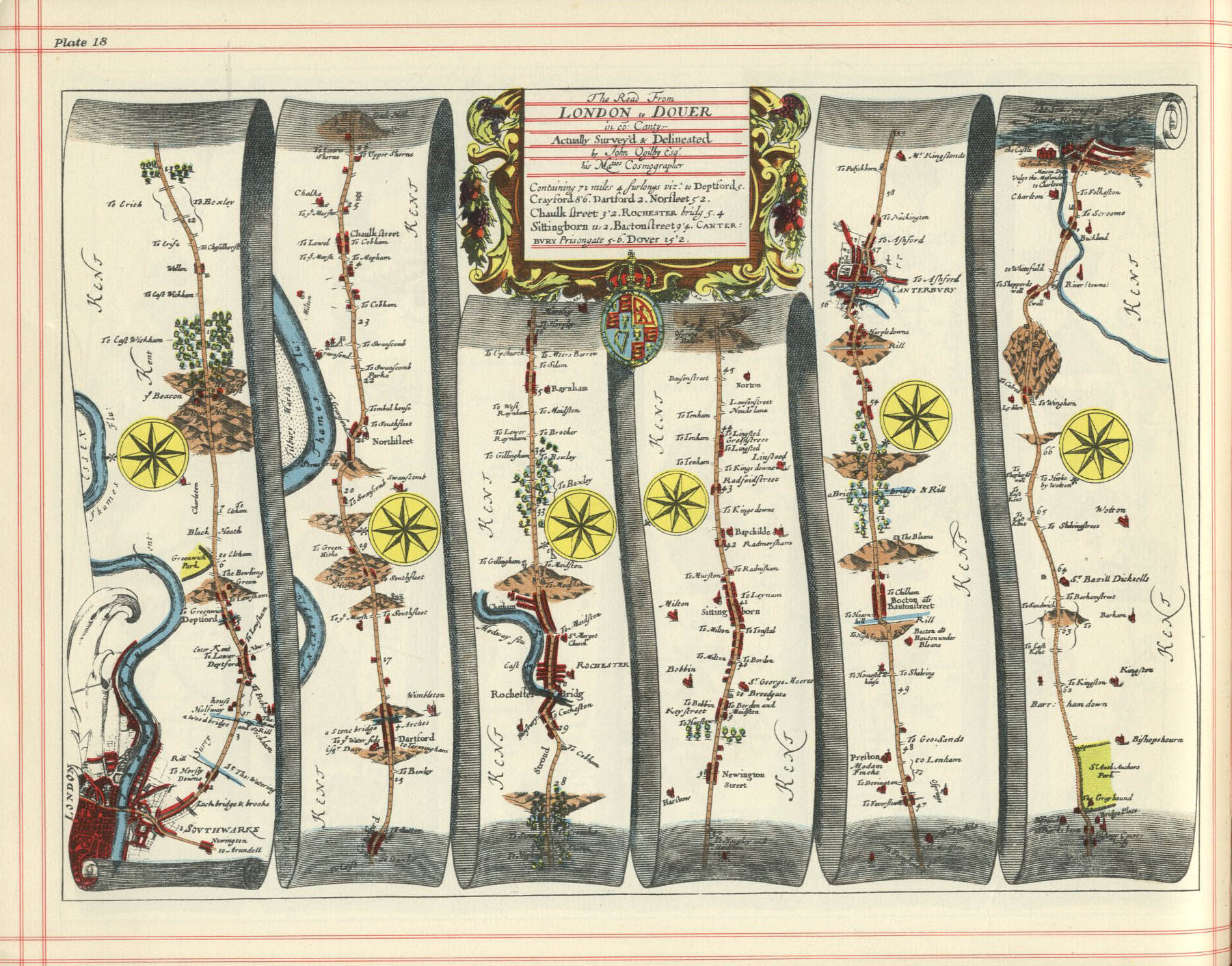
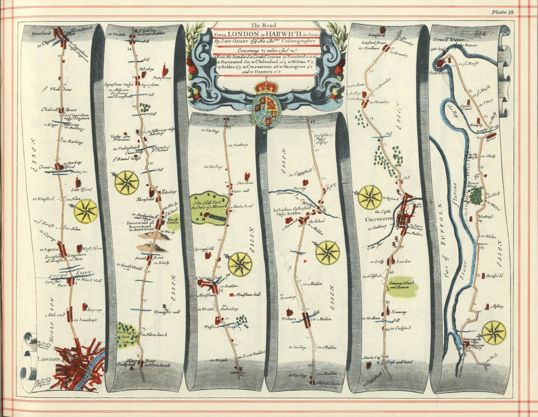
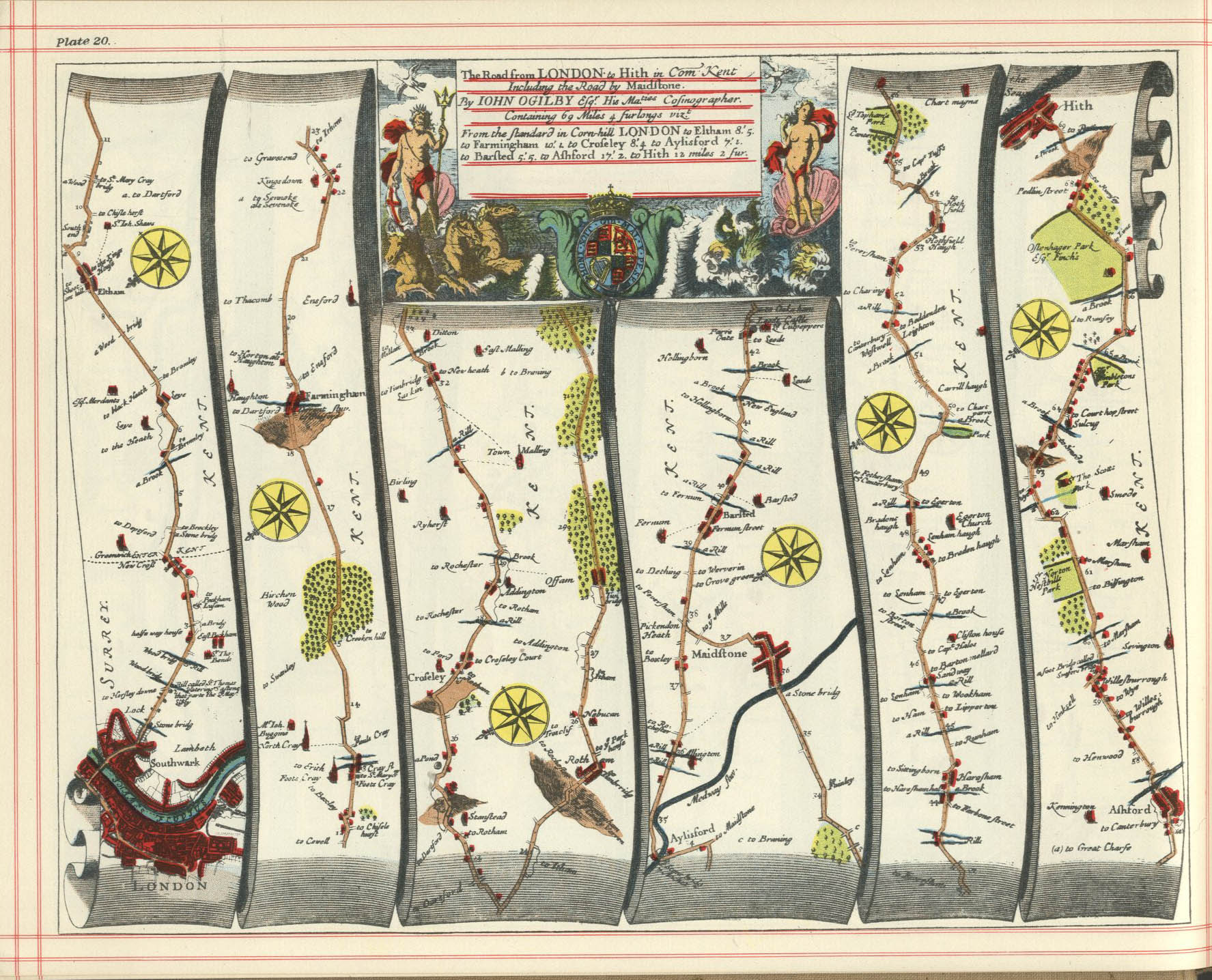
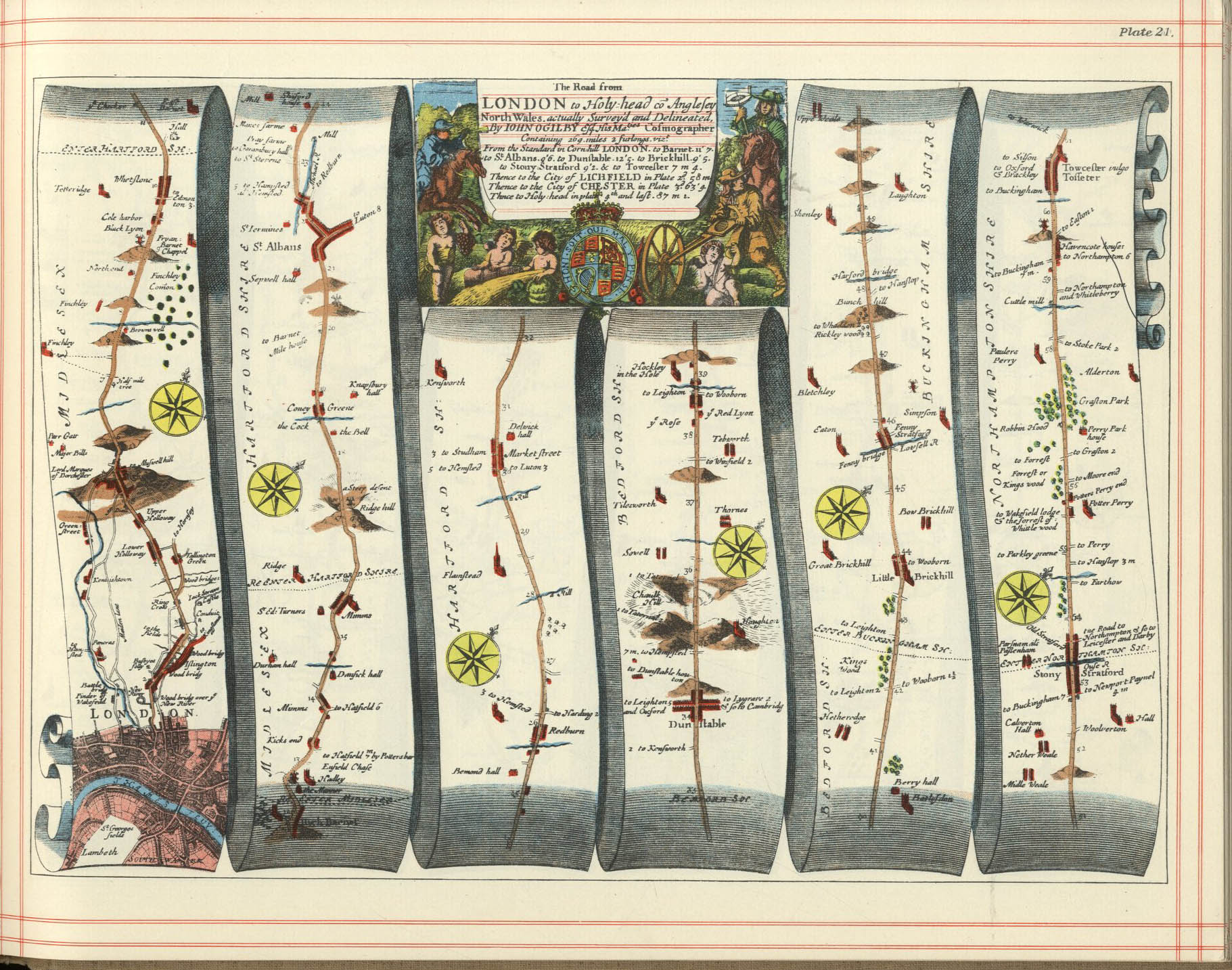
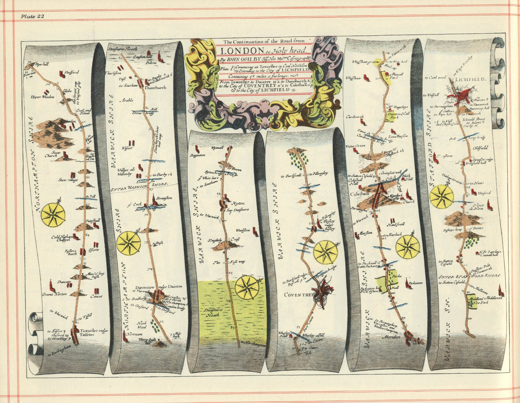
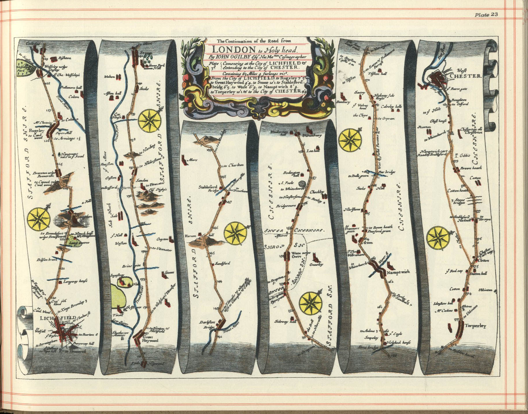
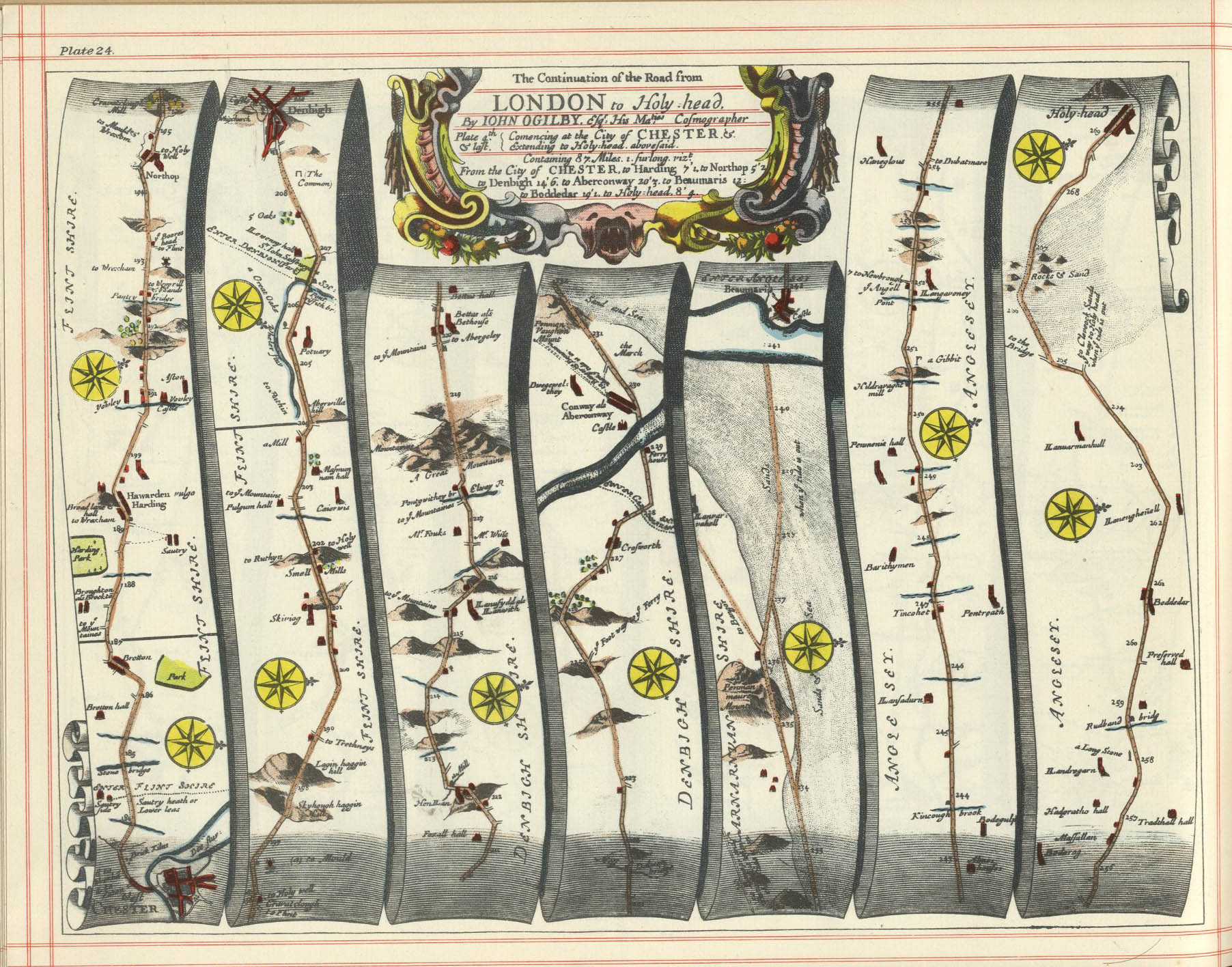
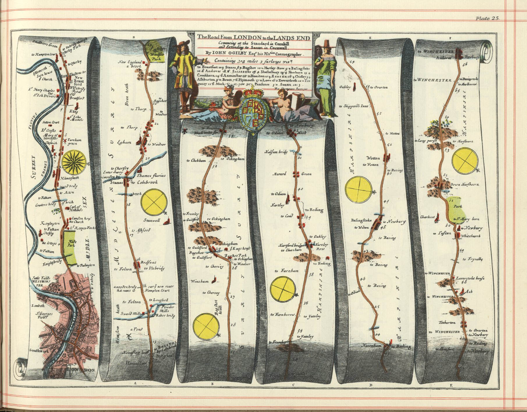
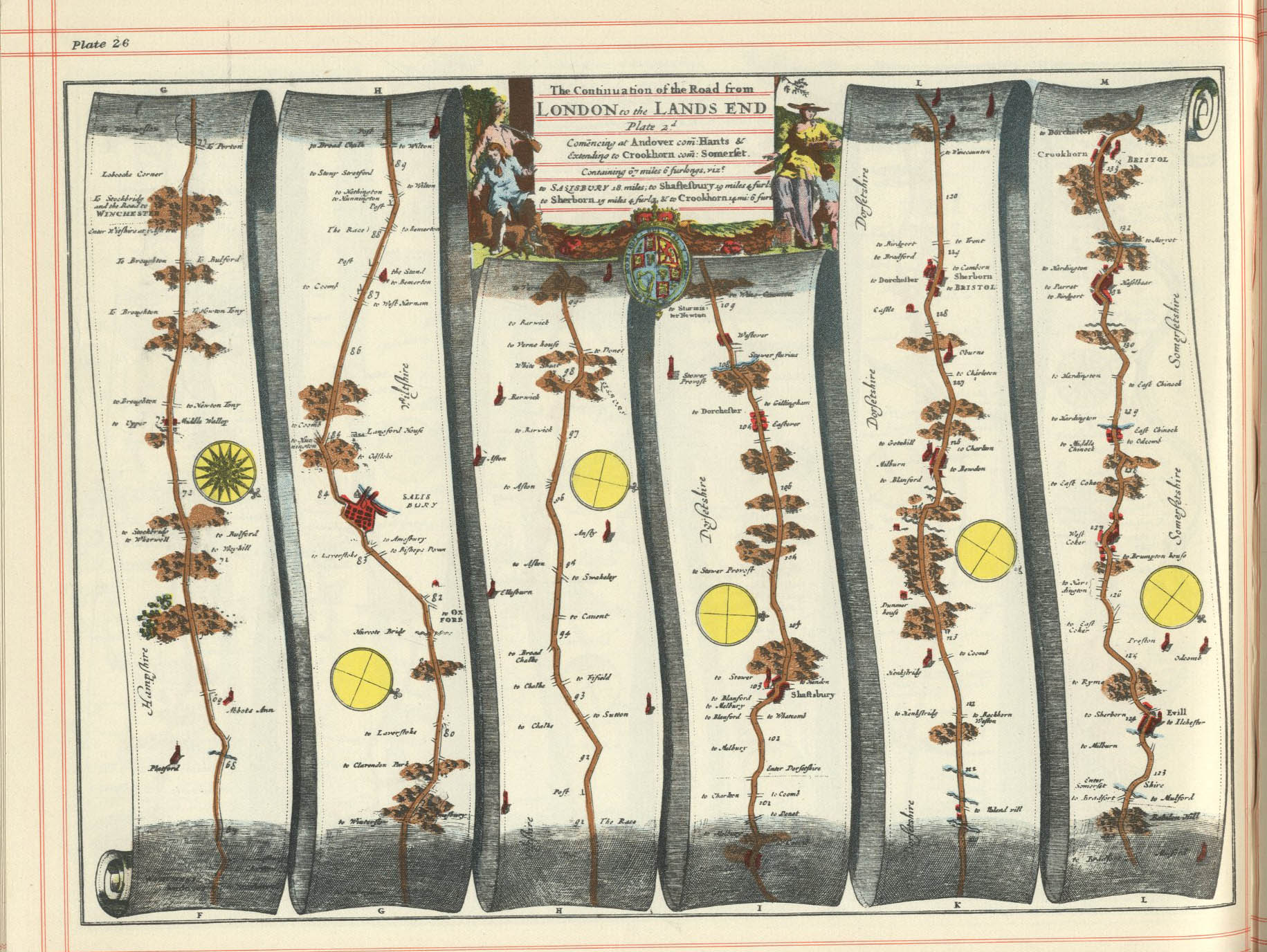
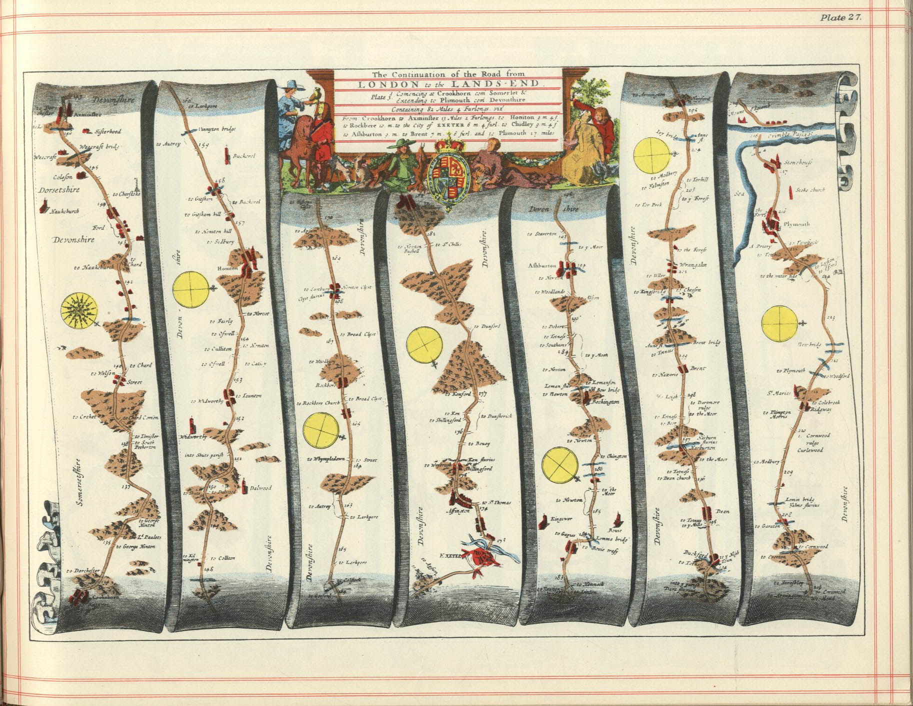
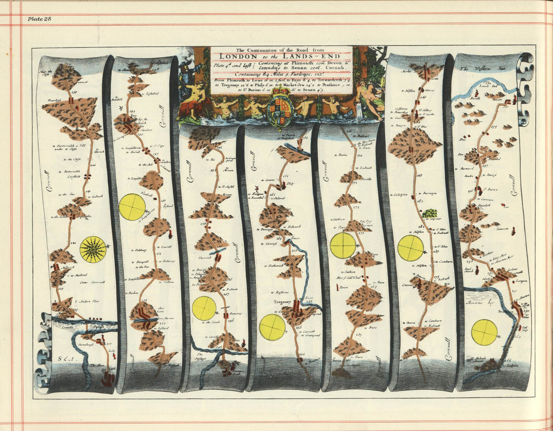
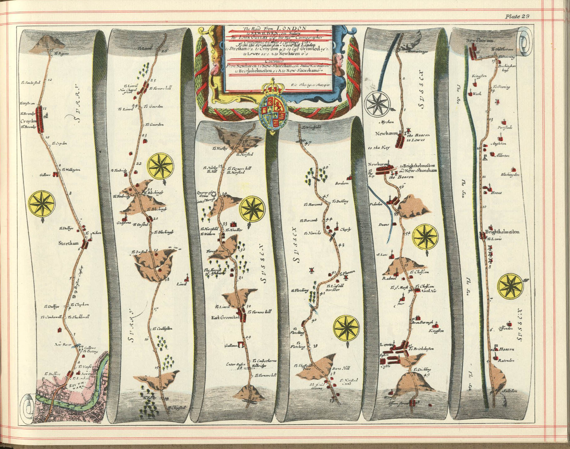
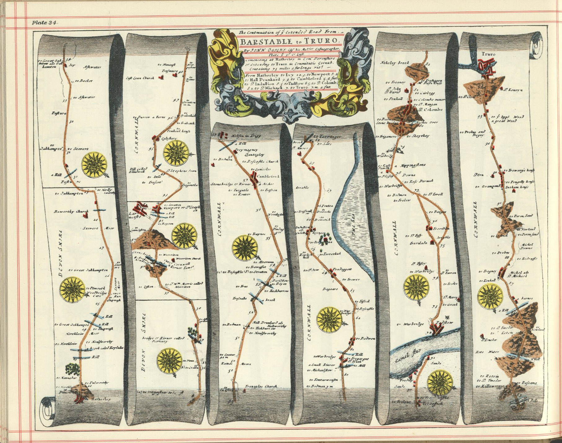
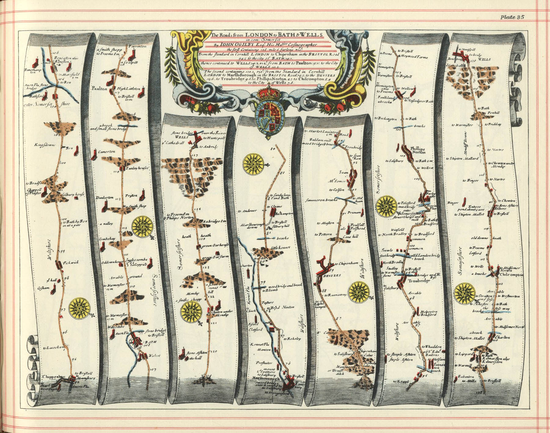
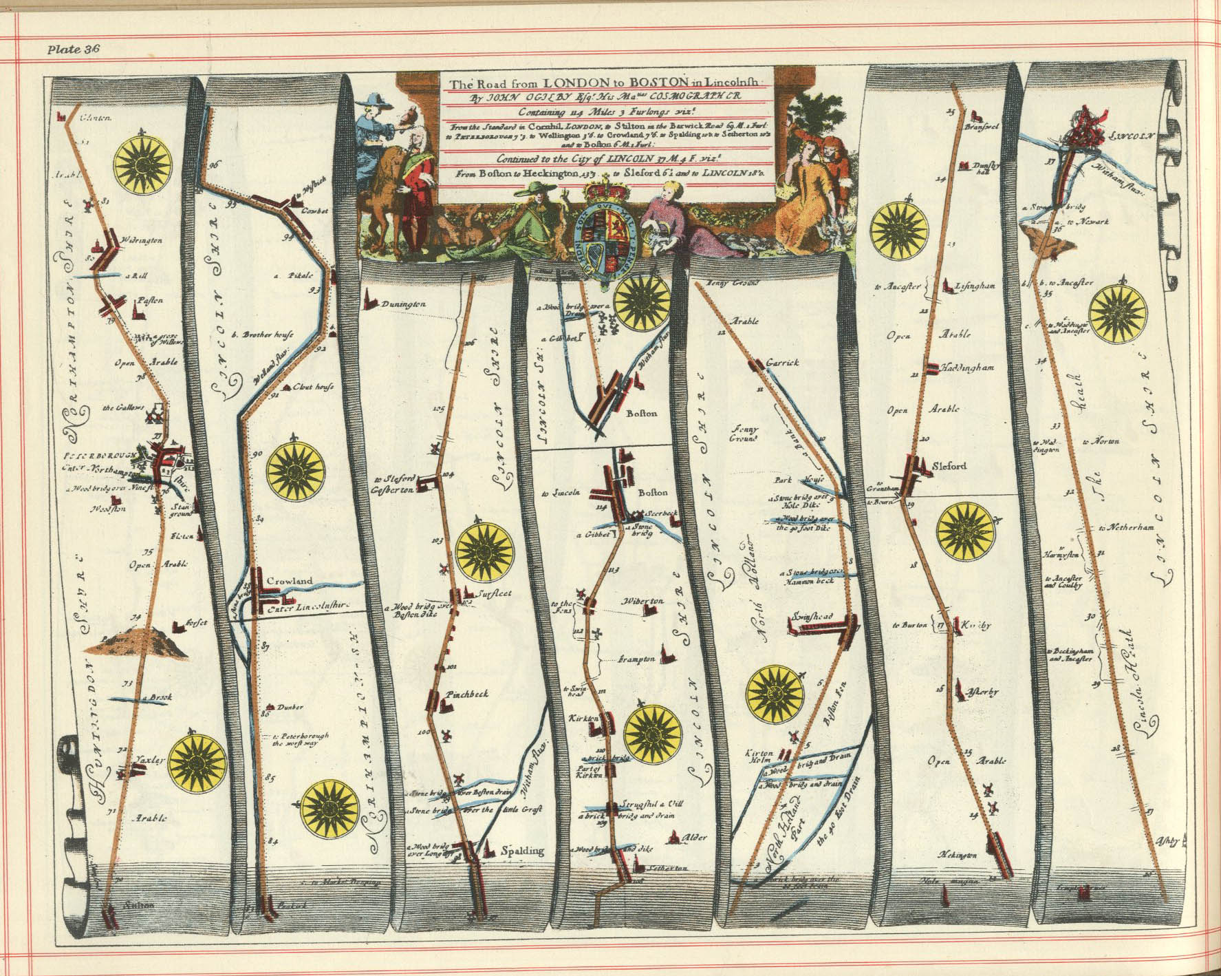
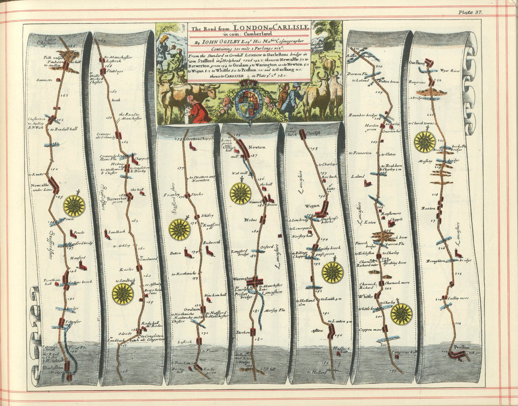
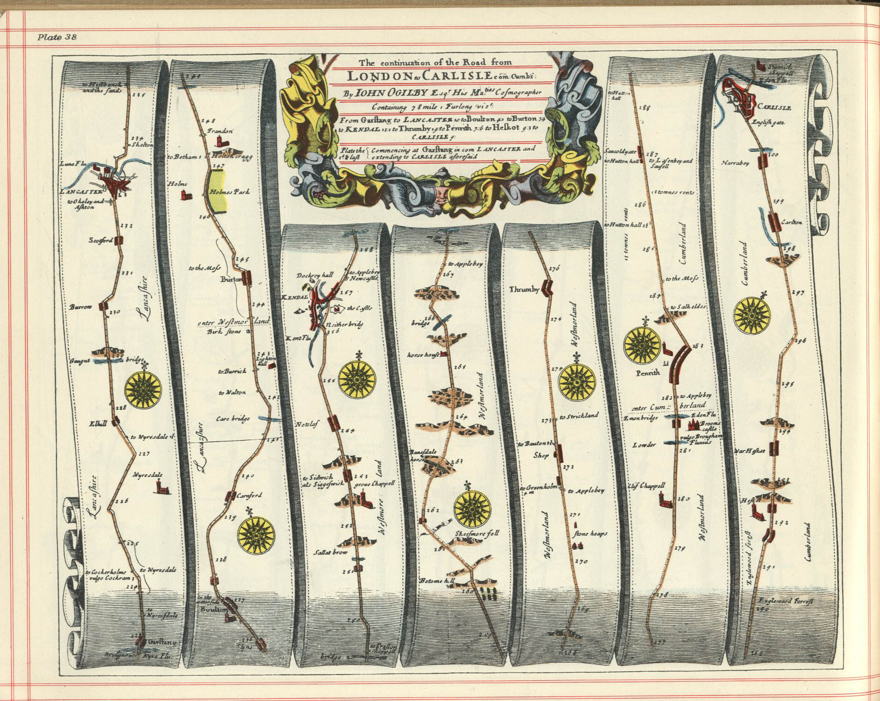
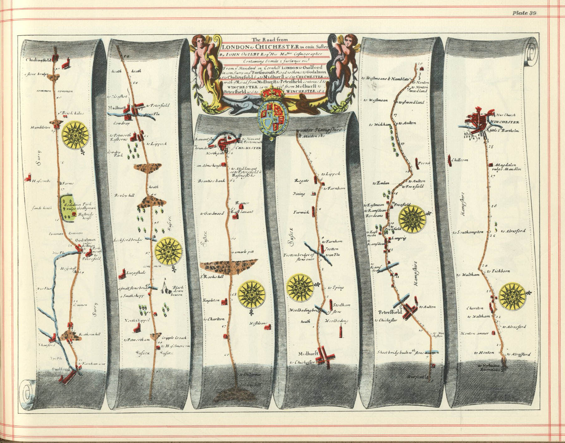
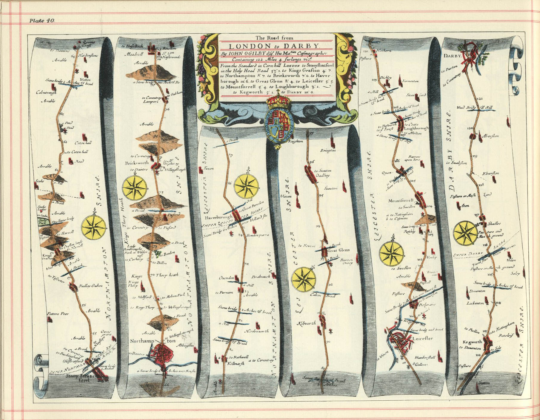
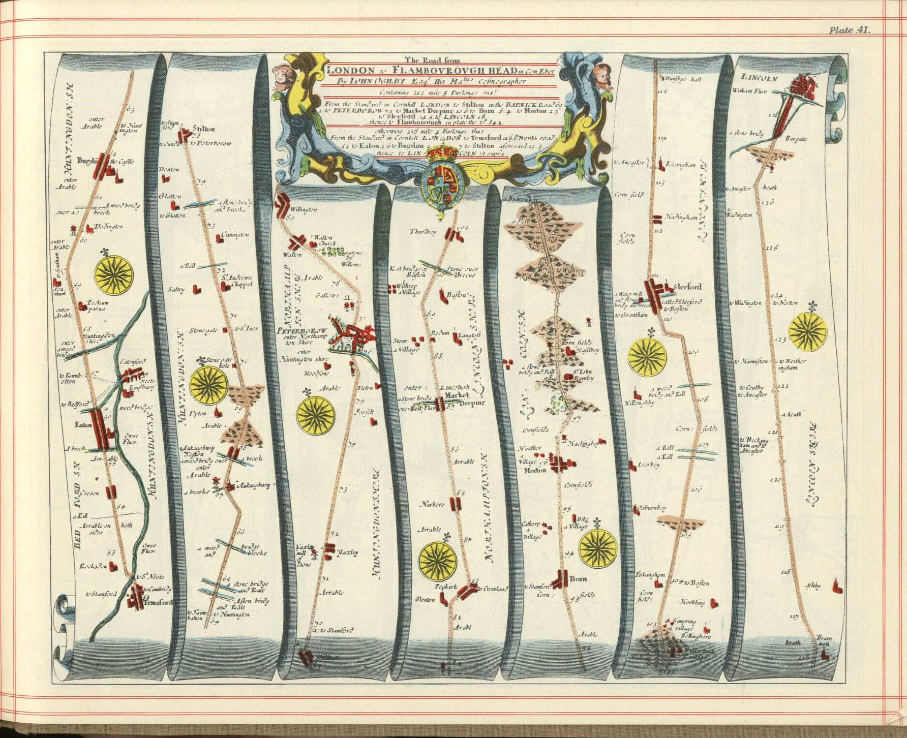
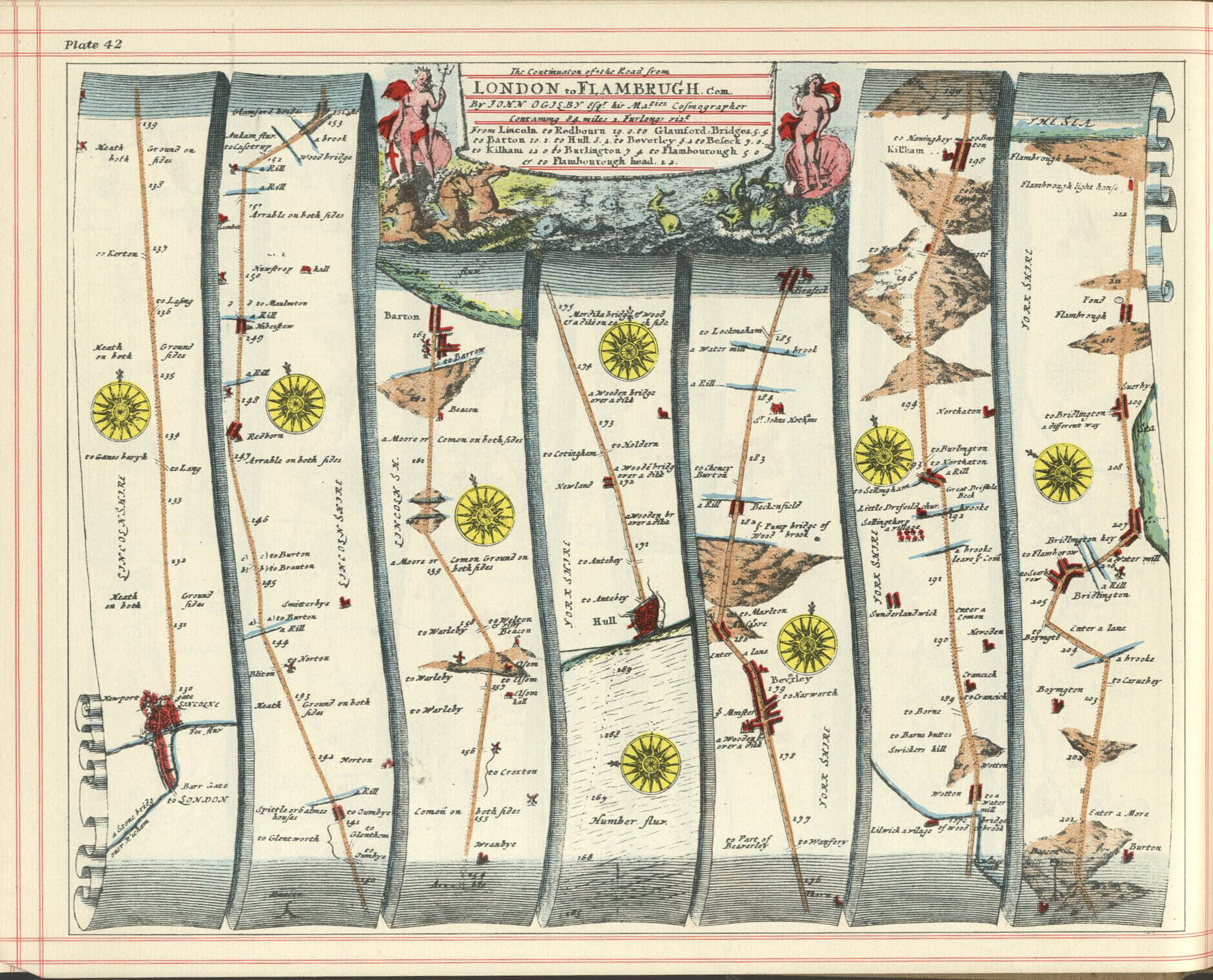
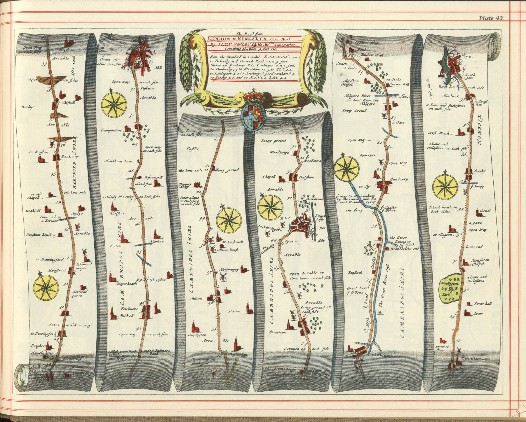
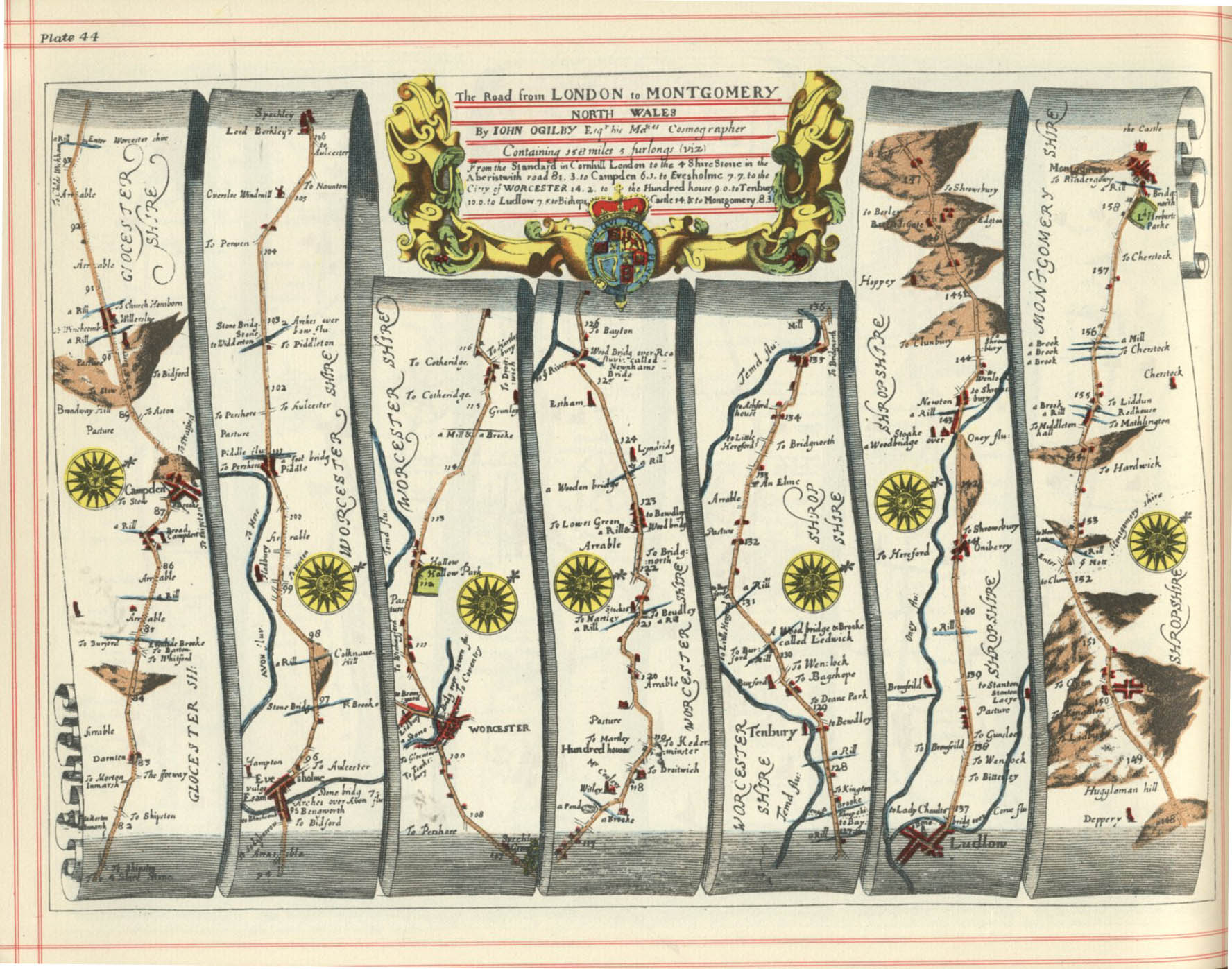
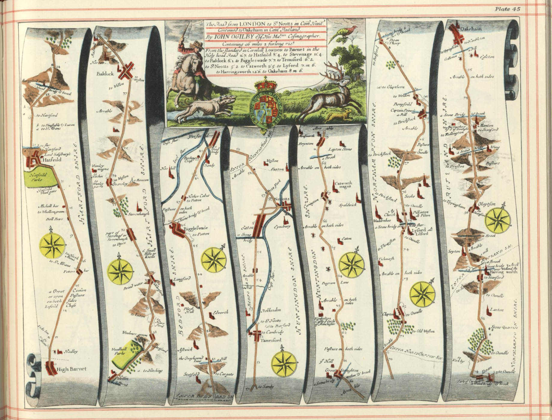
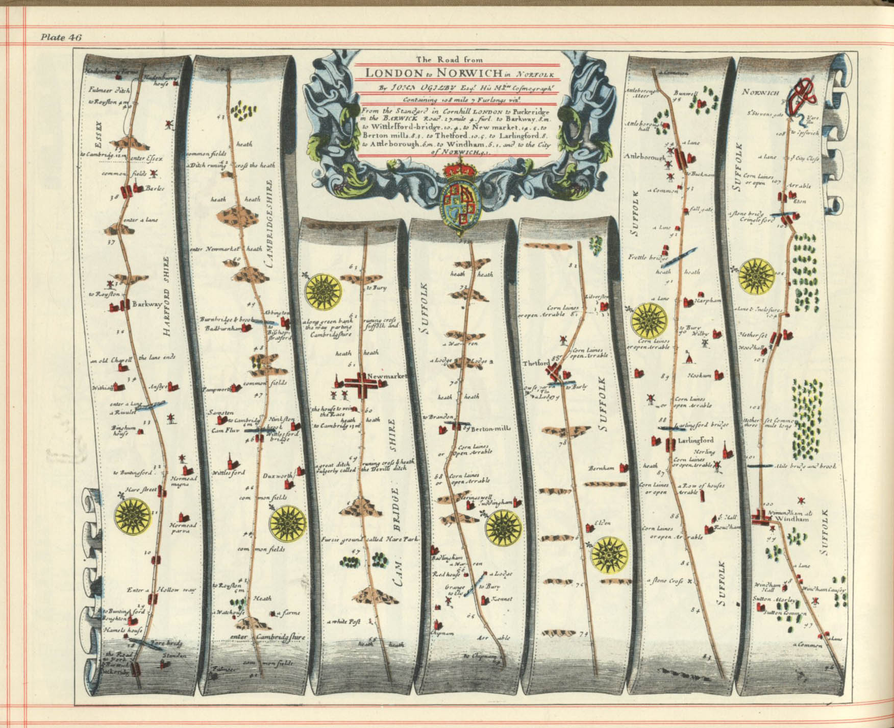
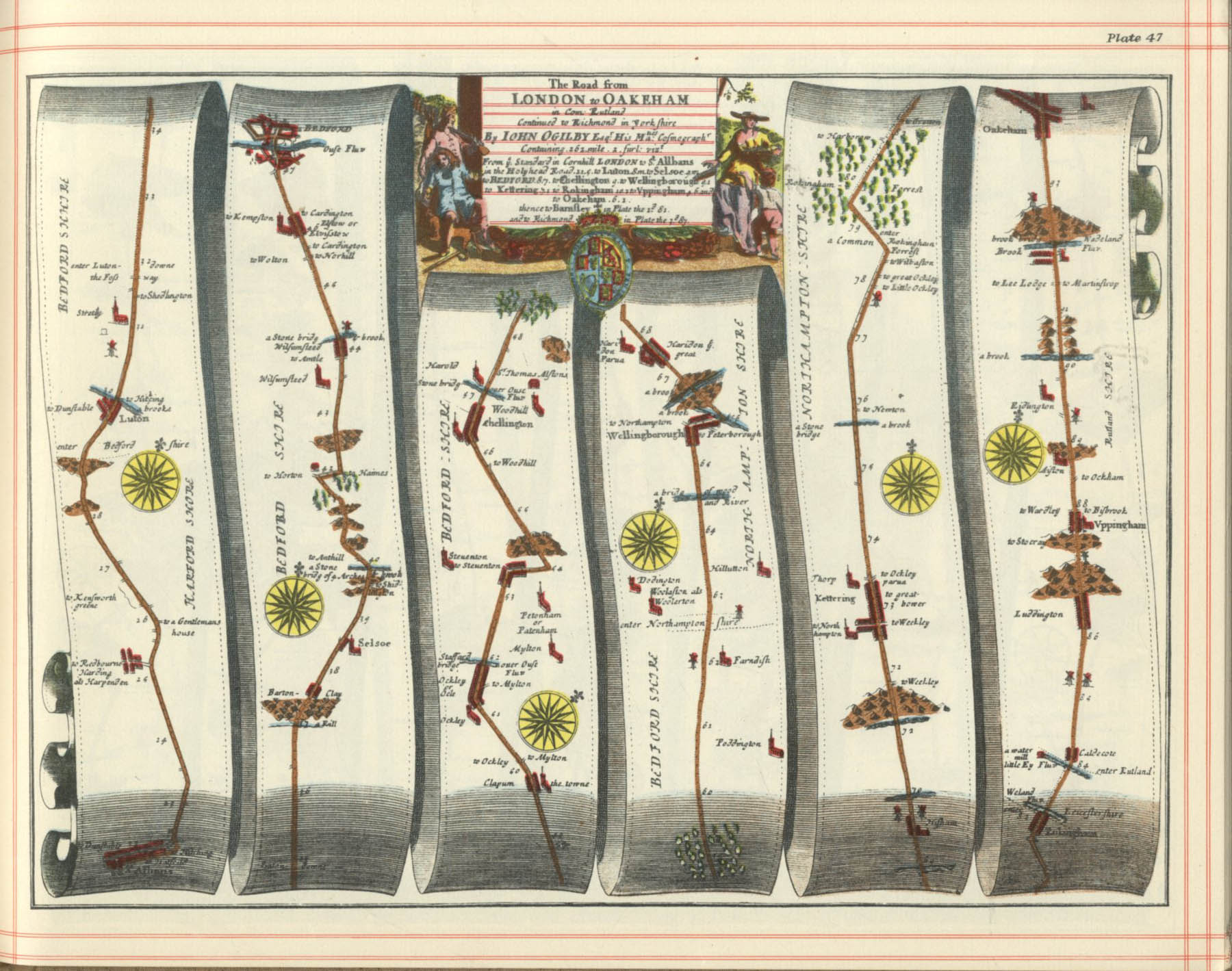
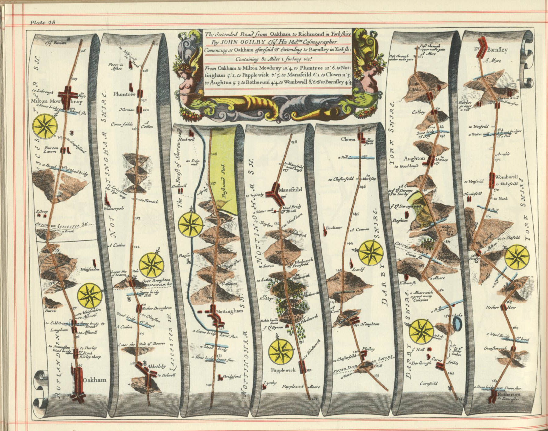
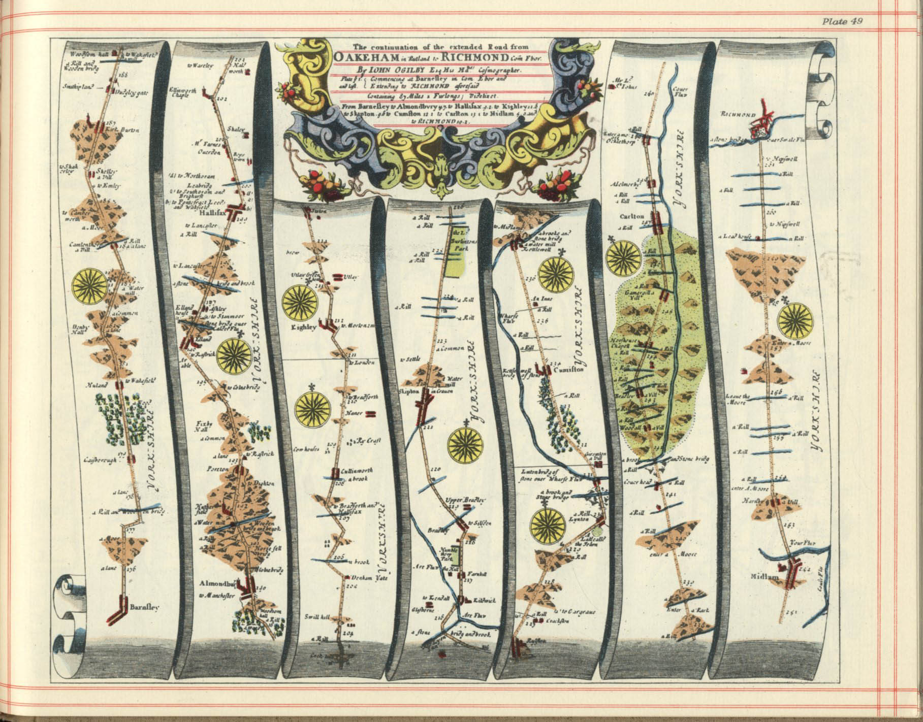
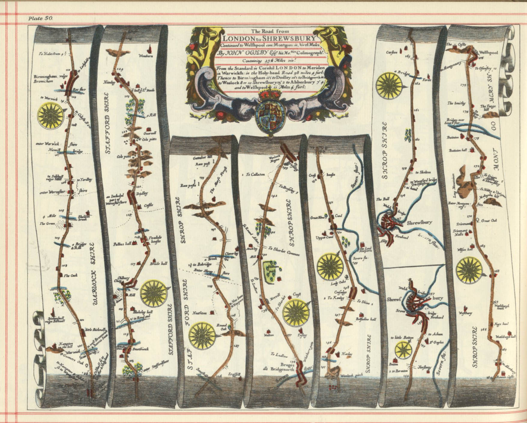
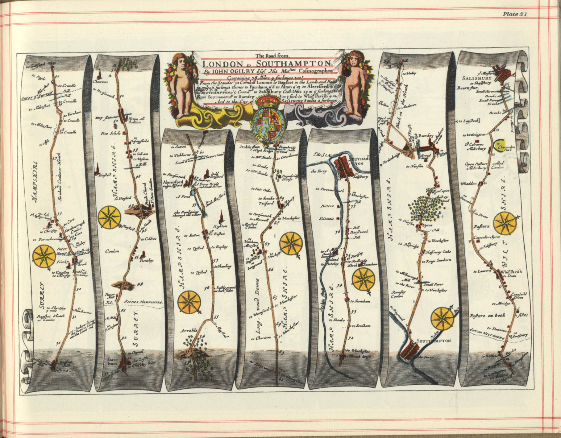
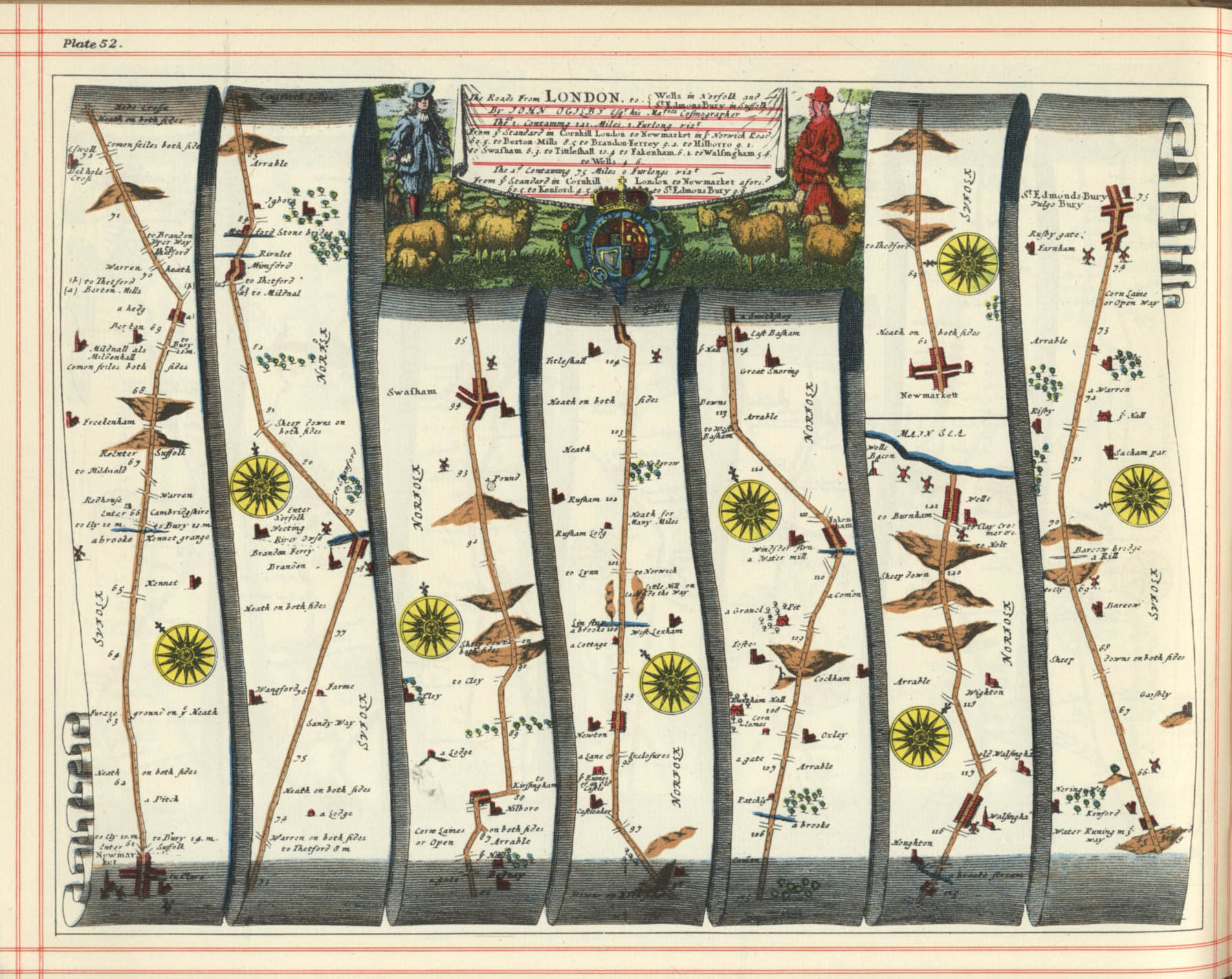
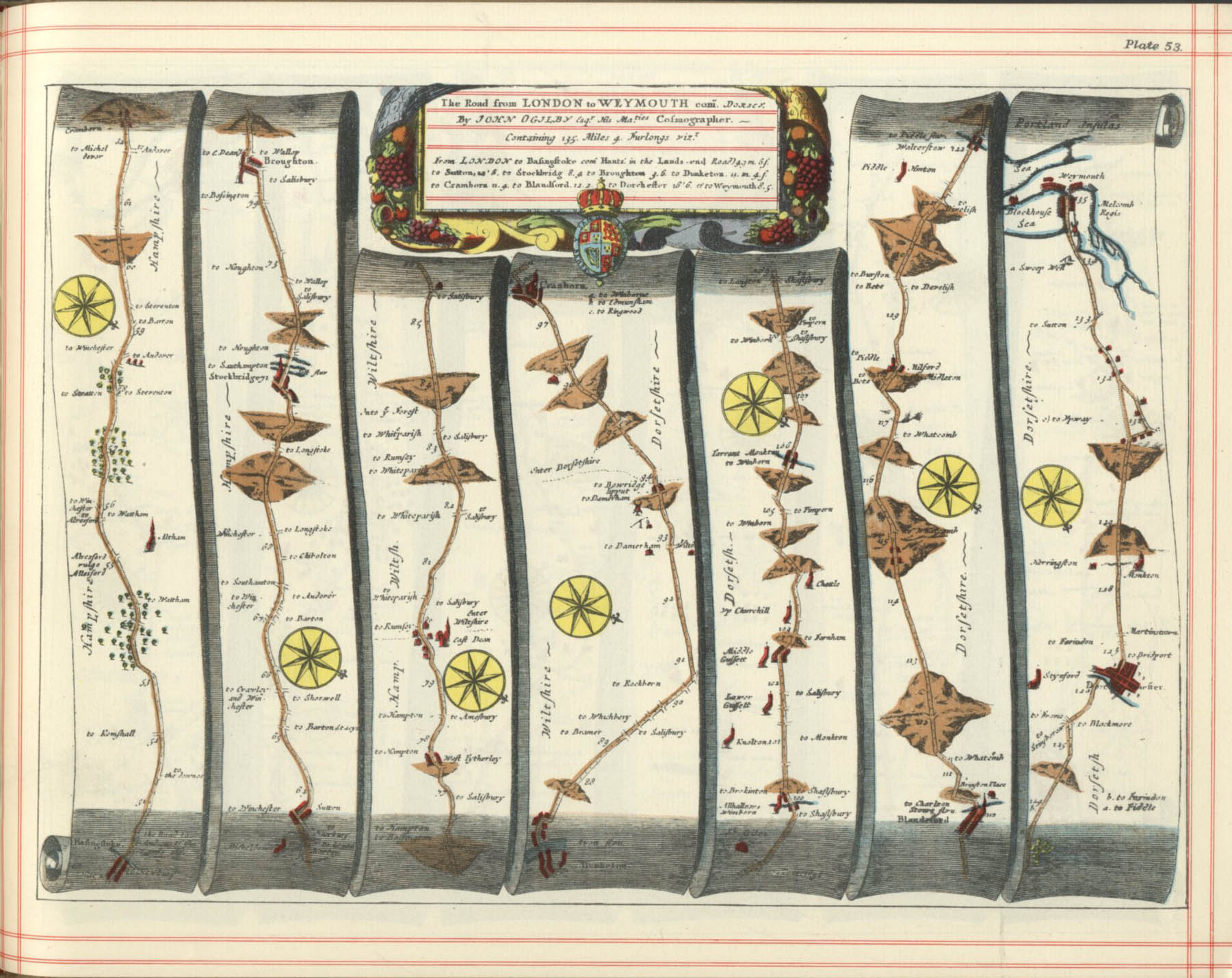
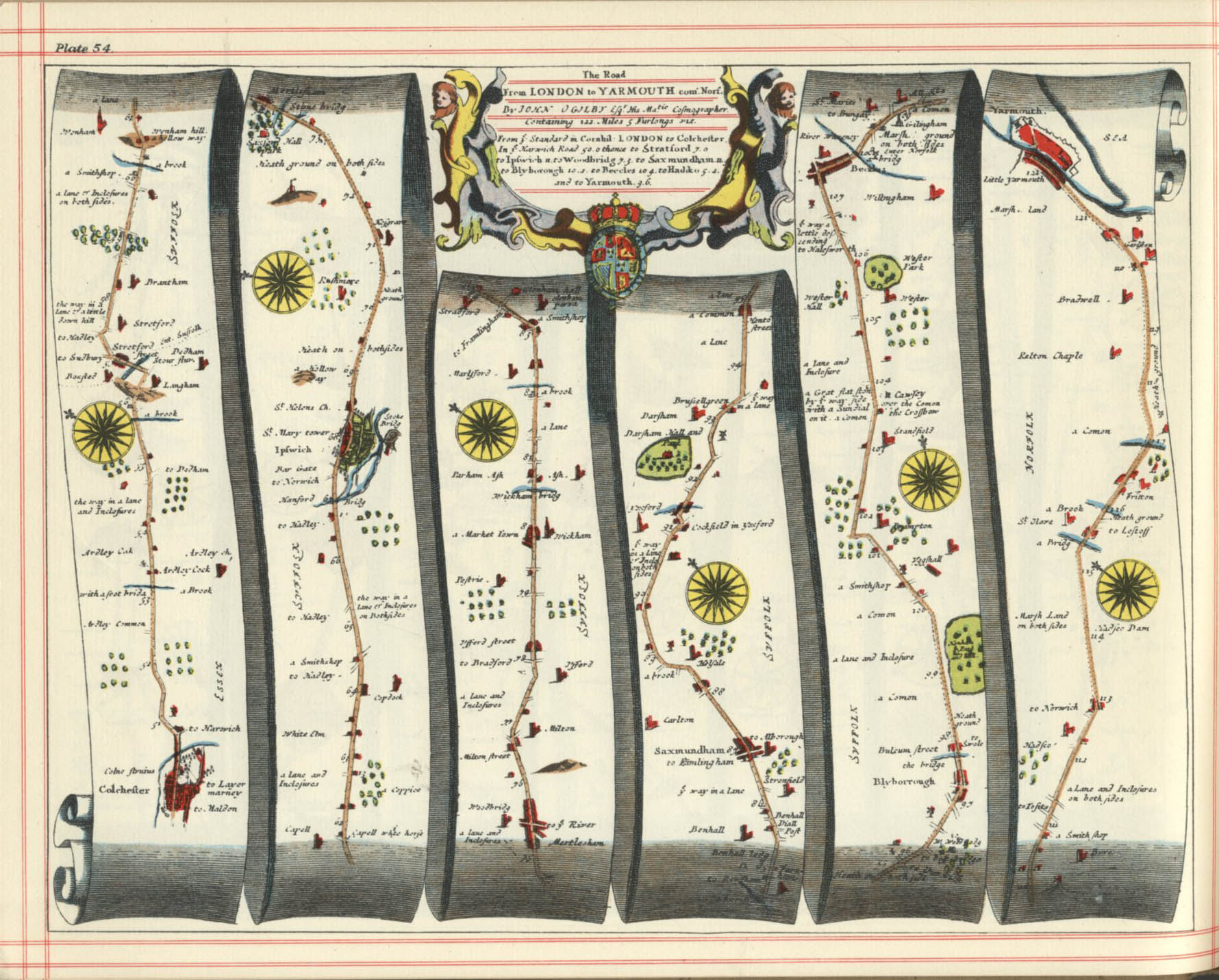
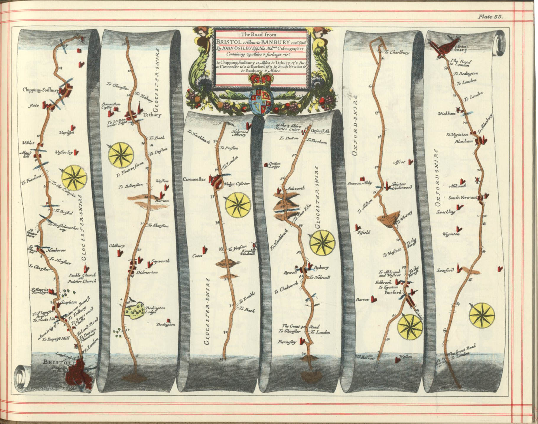
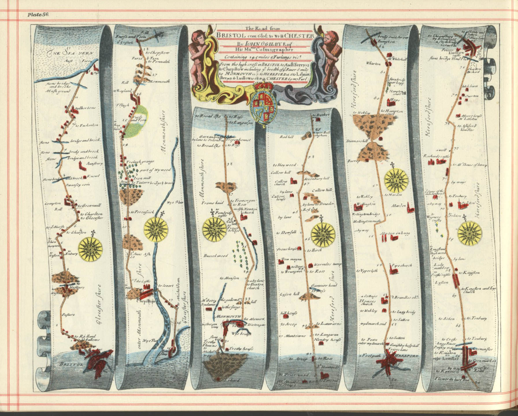
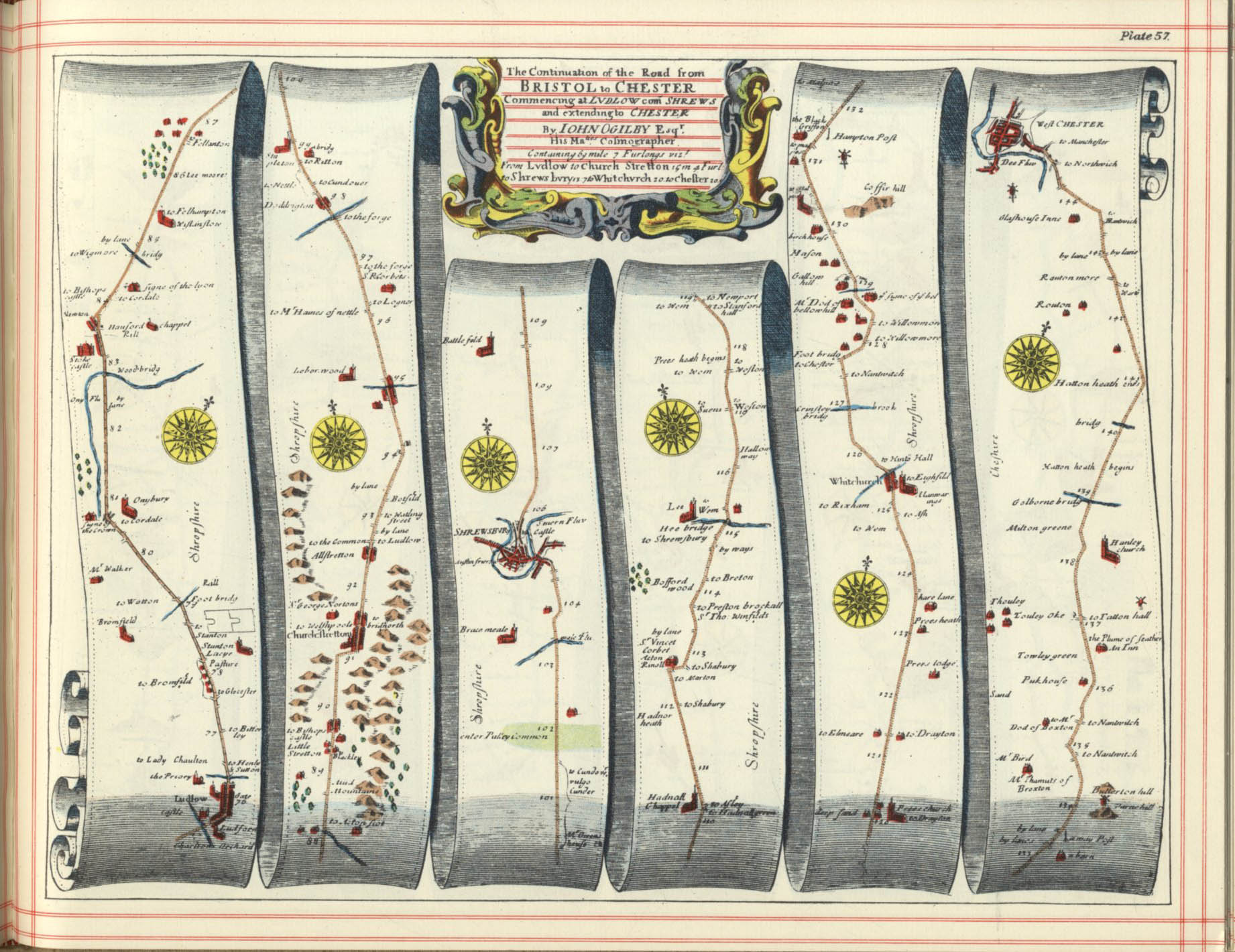
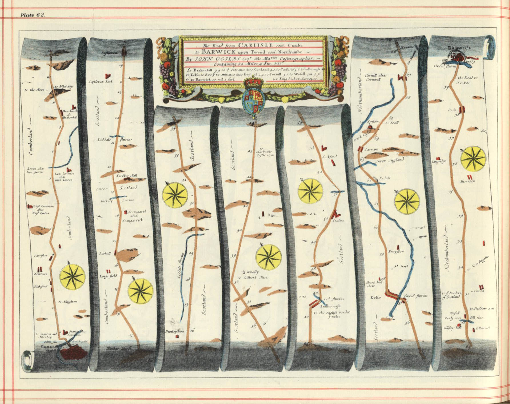
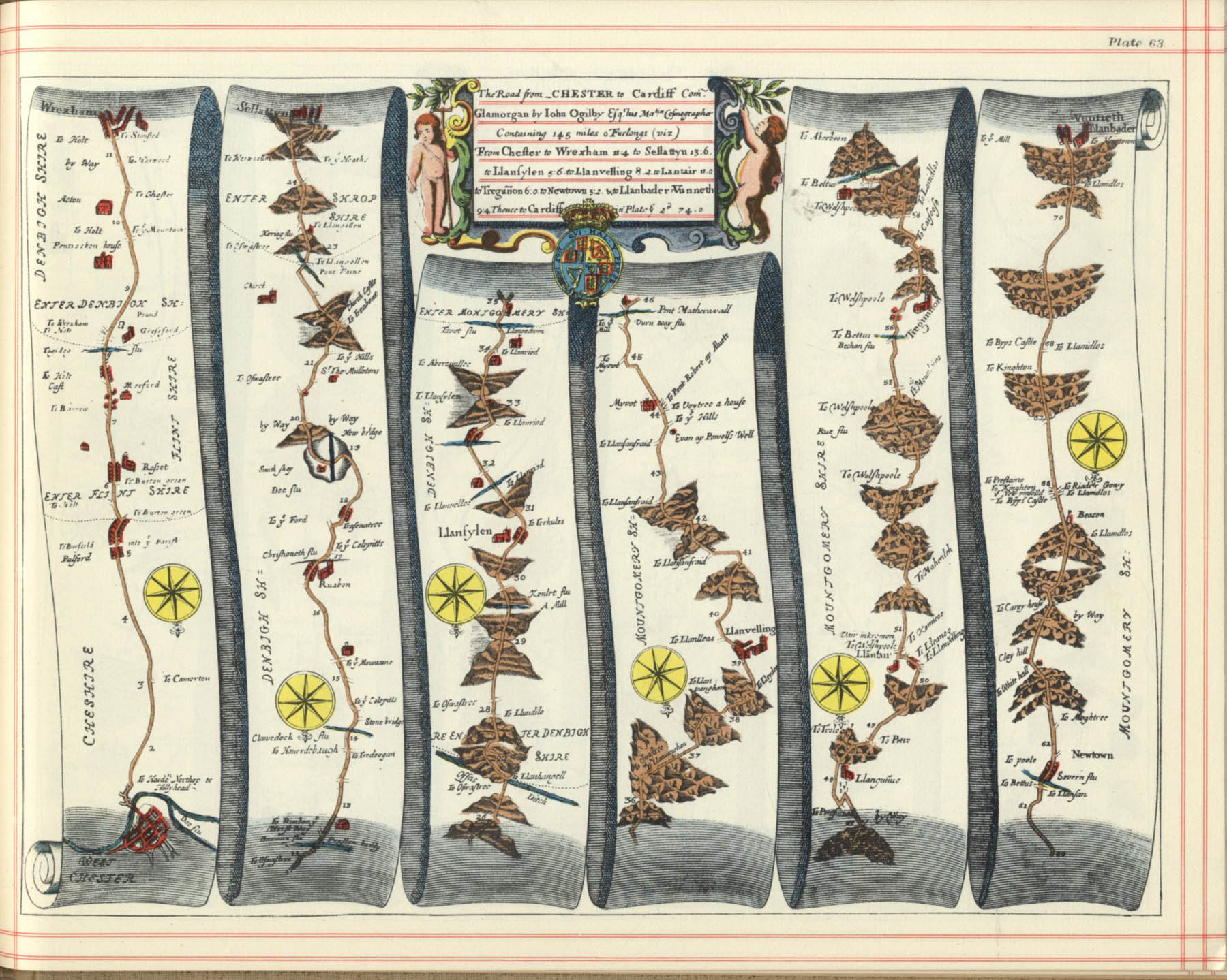
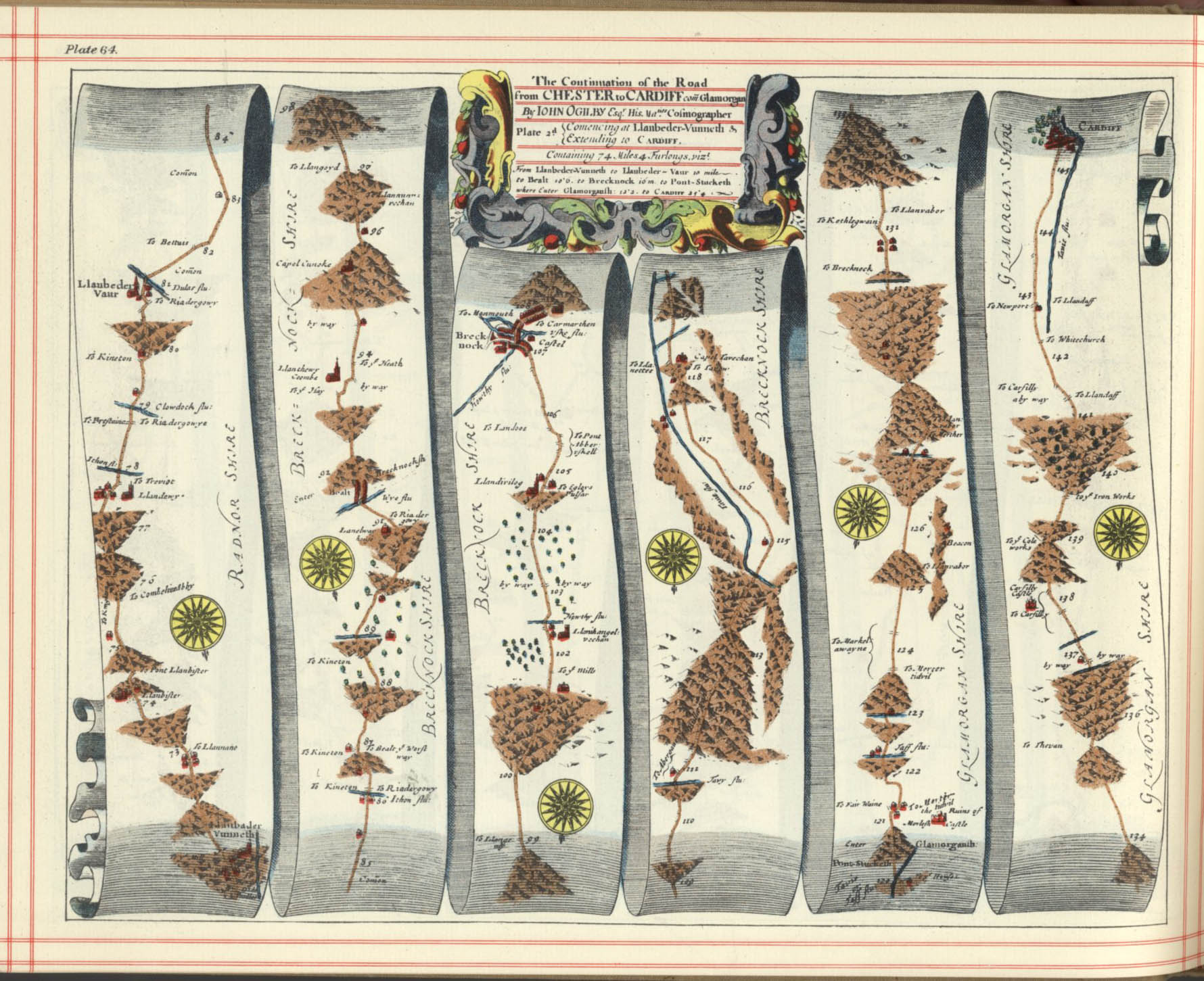
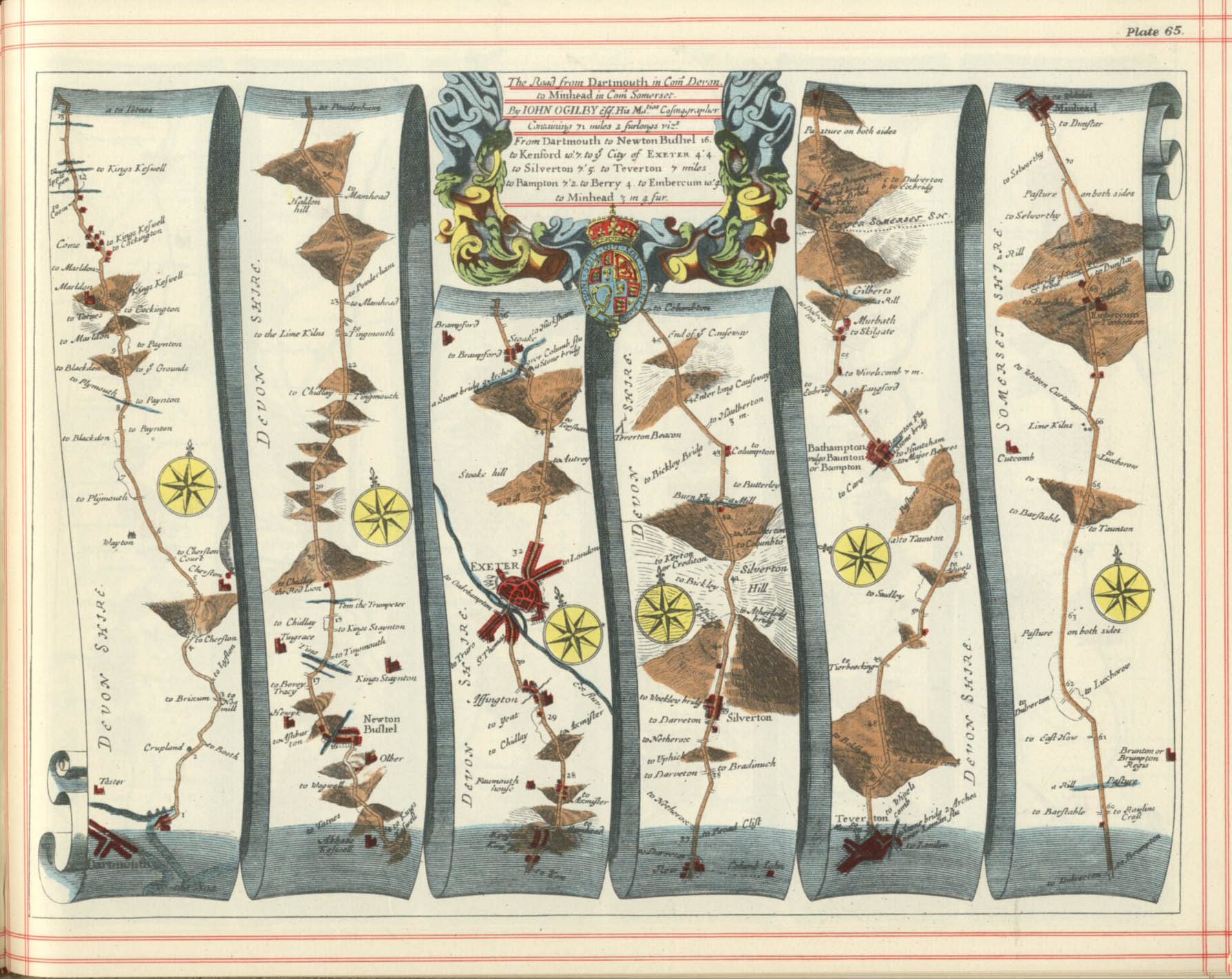
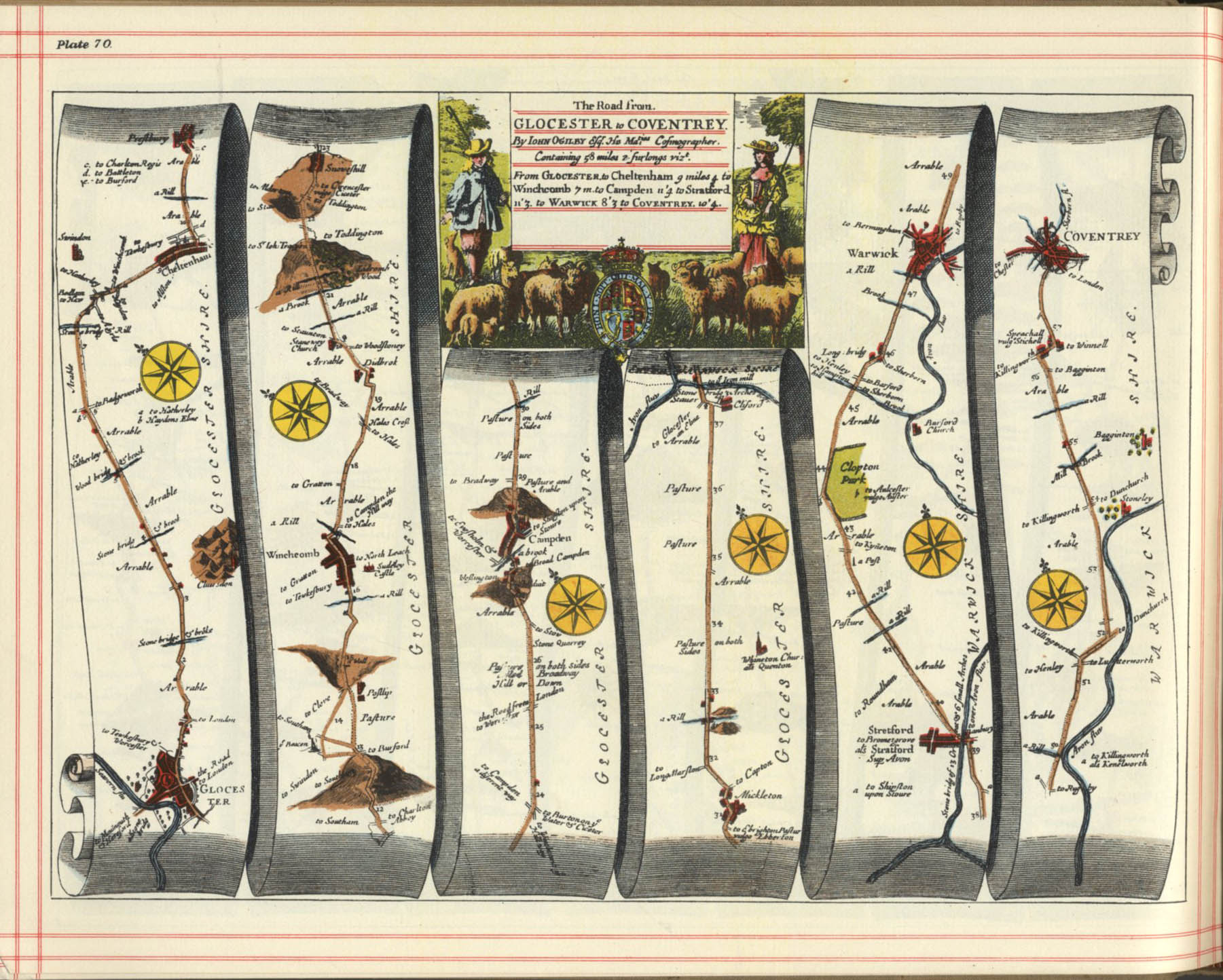
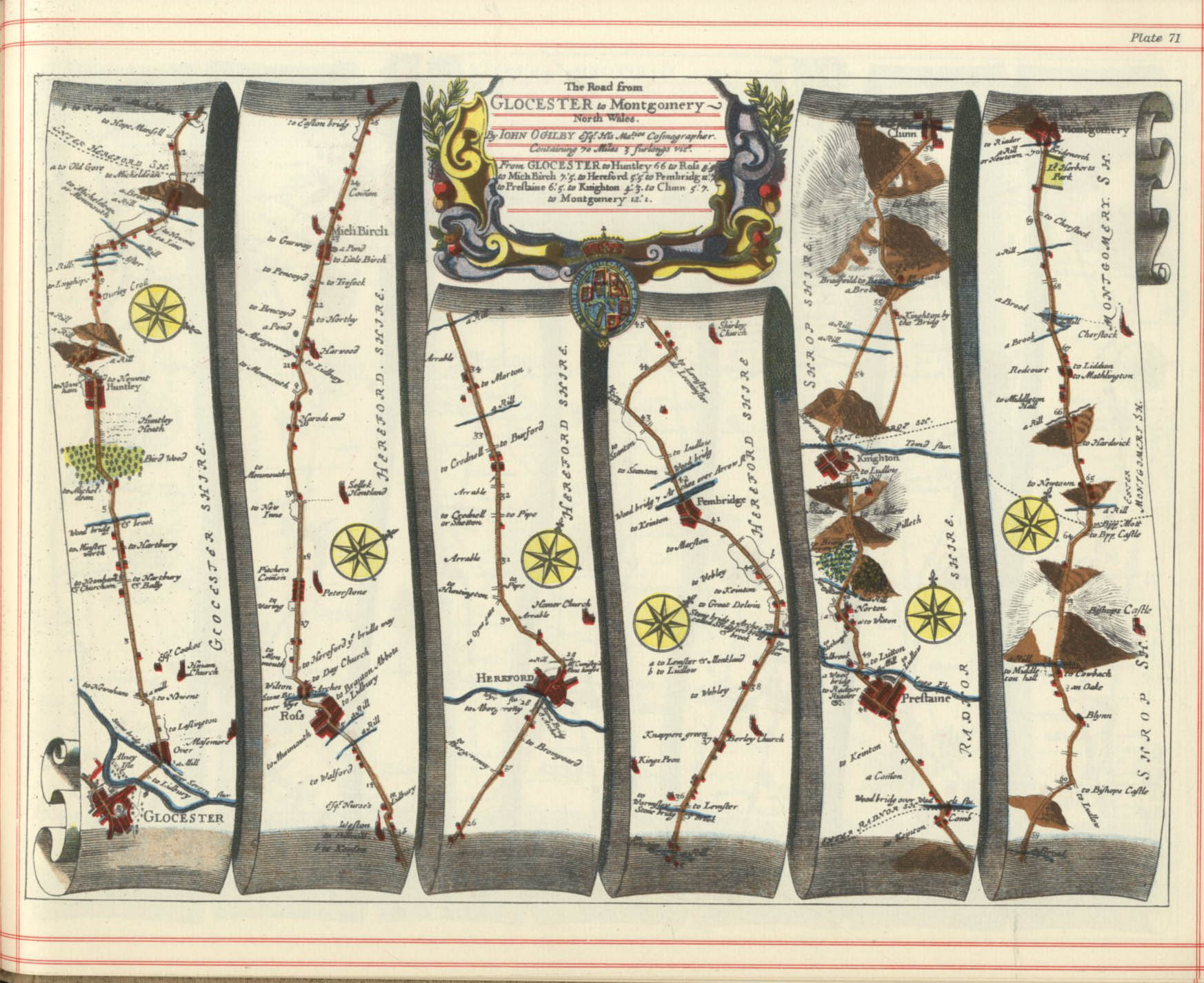
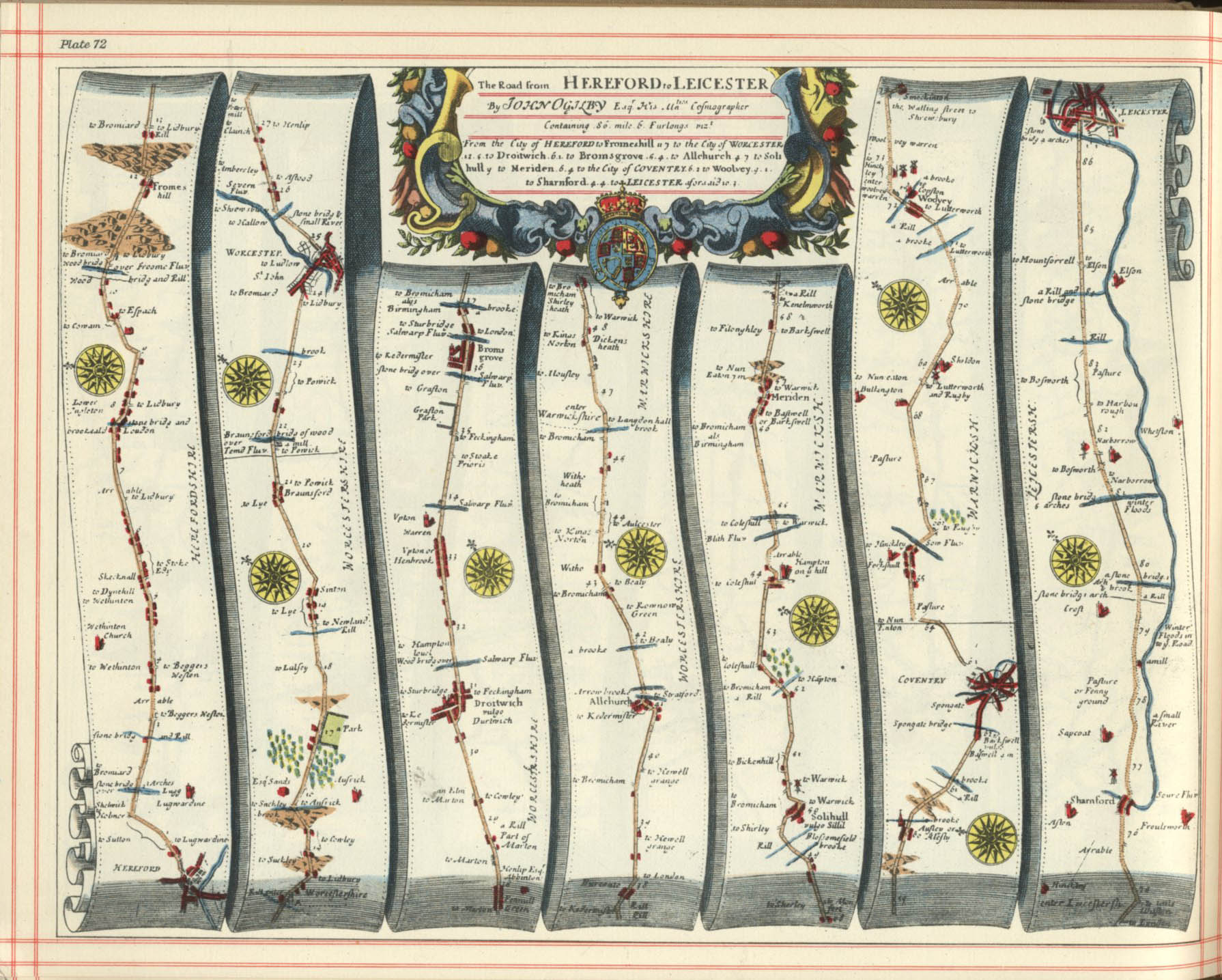
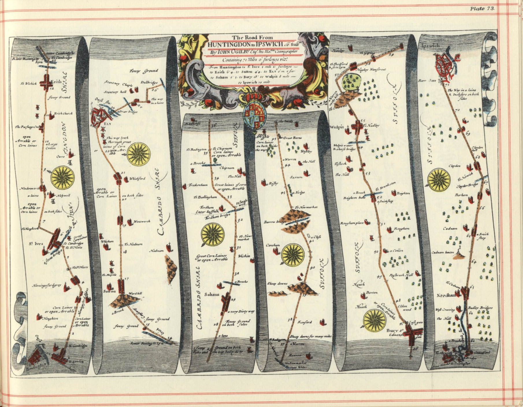
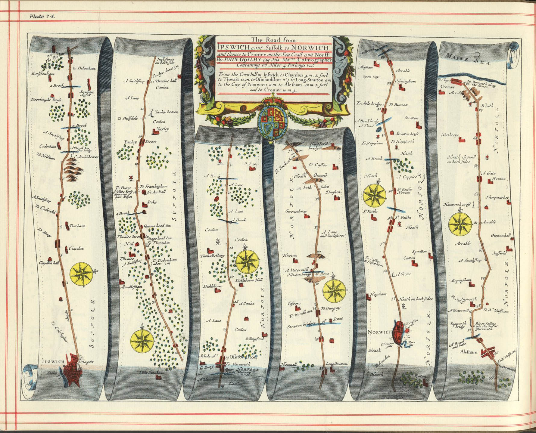
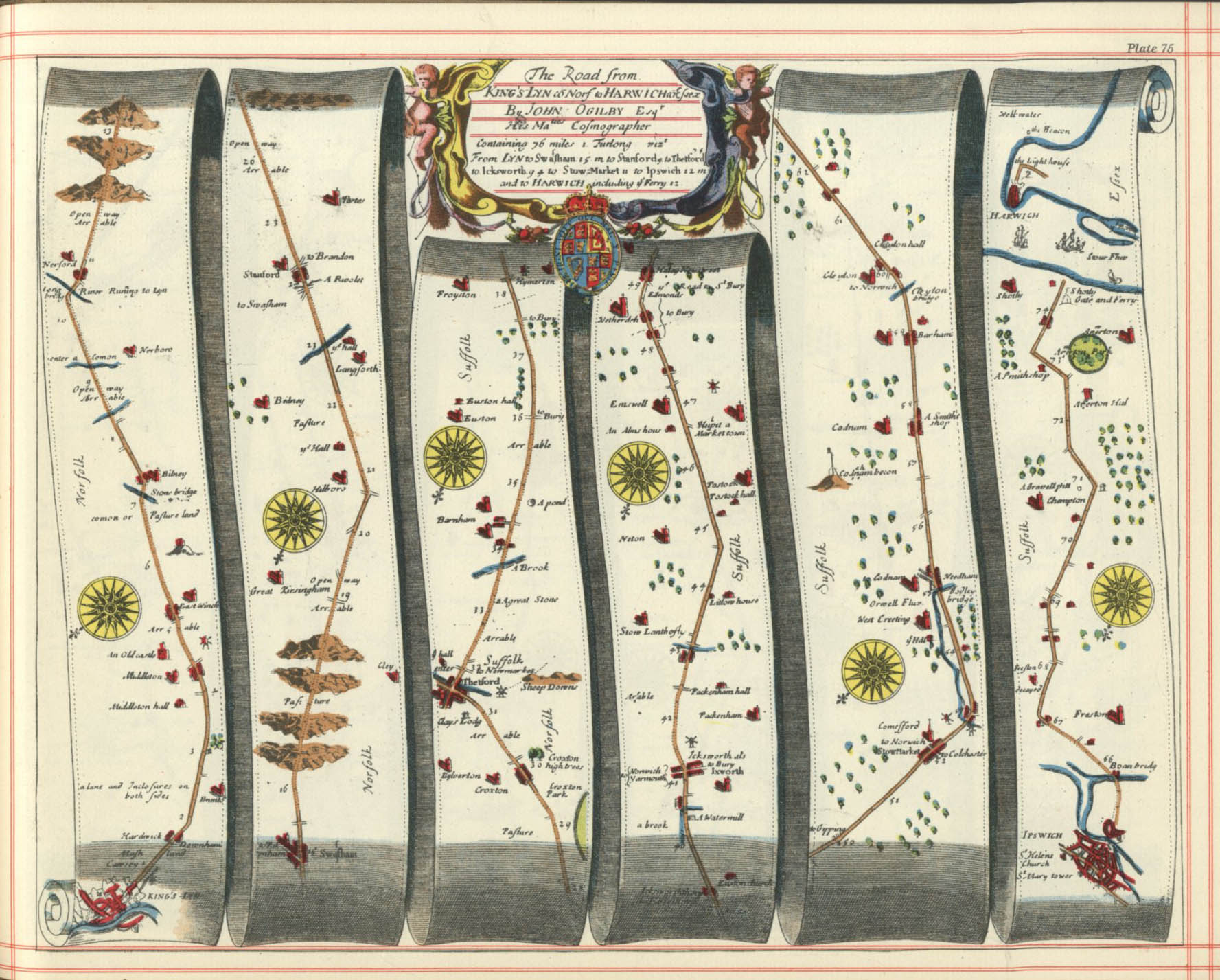
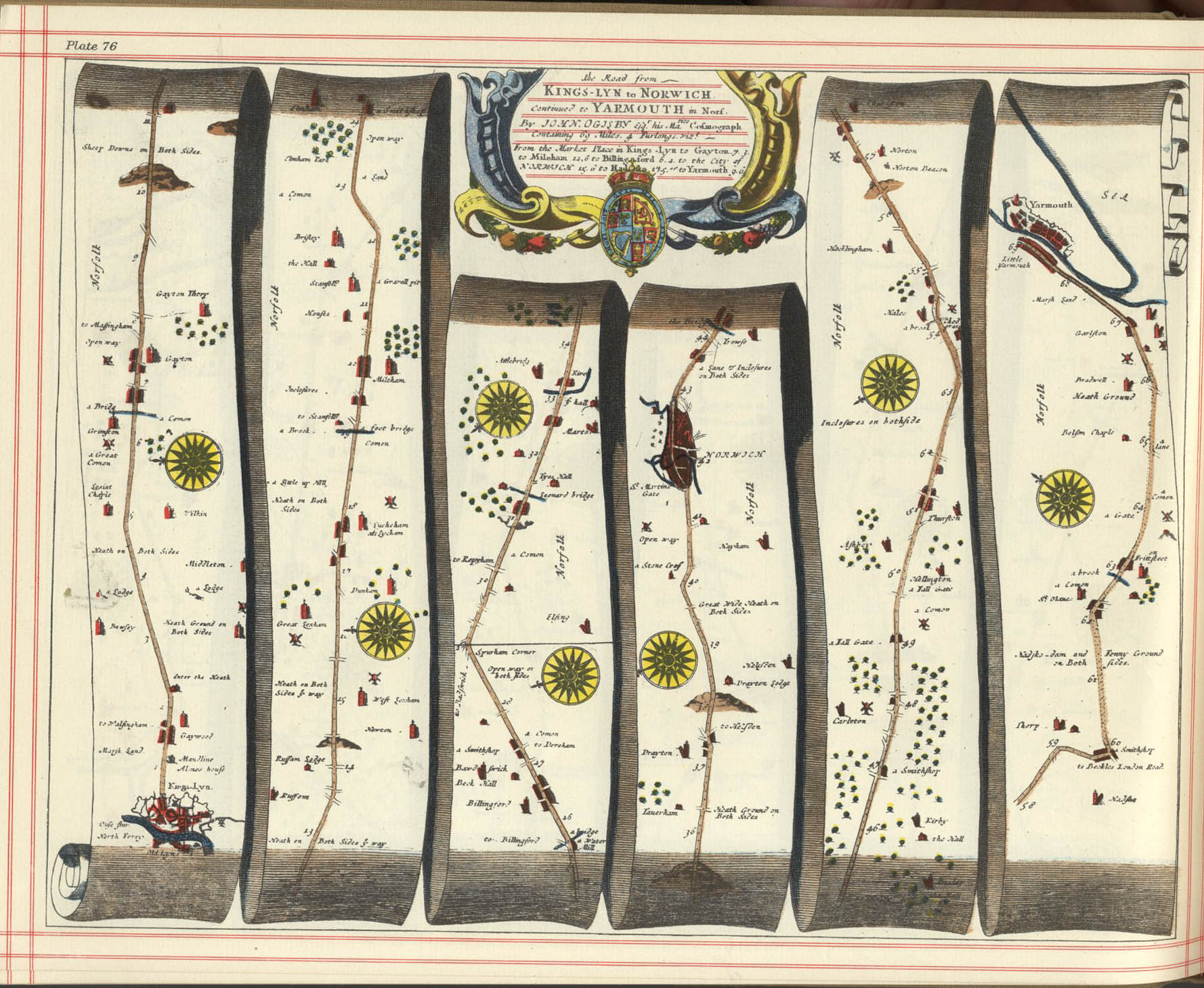
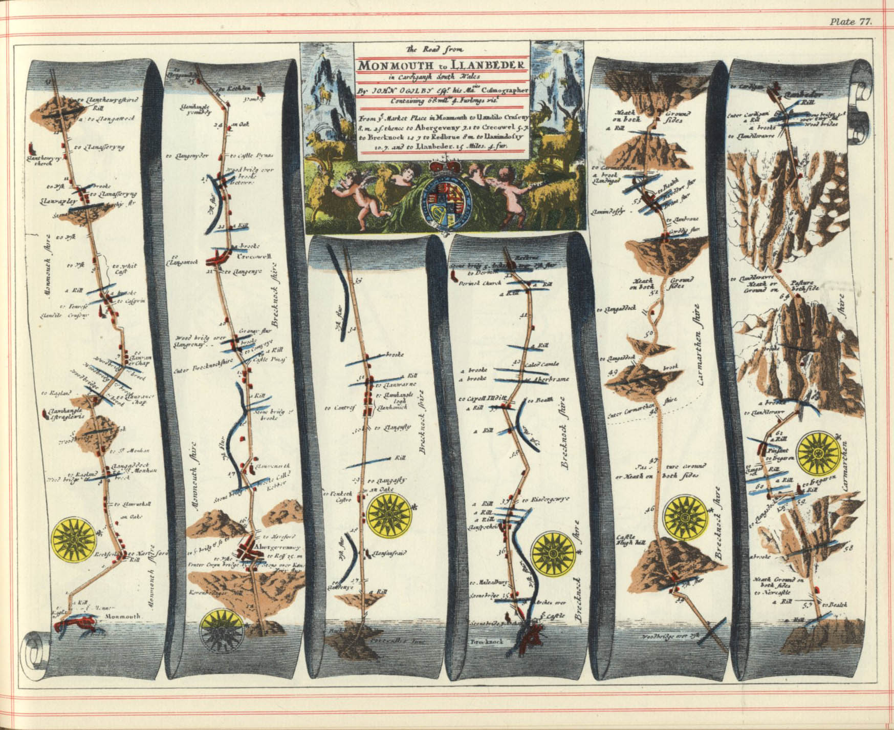
In 1675, John Ogilby (1600–1676) issued his Britannia (also Itinerarium Angliæ), a road atlas depicting in strip form of most of the major routes in England and Wales.[5] The atlas included such details as the configurations of hills, bridges, ferries and the relative size of towns. One hundred strip road maps are shown, accompanied by a double-sided page of text giving additional advice for the map's use, notes on the towns shown and the alternative pronunciations of their name.[6] Another innovation was Ogilby's scale of one inch to the mile (1:63360).[7] These are marked and numbered on each map, the miles further being divided into furlongs.[8] At that period, the measurement of many minor roads had used a locally defined mile rather than the standard mile of 1760 standard yards which Ogilby adopted in his atlas, thus setting the standard for road maps in future.[9]
The most obvious omission from Ogilby's atlas is the route to Liverpool.[10]
The volume includes a panoramic frontispiece plate that includes a surveyor's wheel being used to measure distances.
Editions
It appears that two editions were released, one tinted and one monochrome, under different titles. The tinted edition was called
BRITANNIA Volume the First OR, AN ILLUSTRATION OF THE KINGDOM OF ENGLAND AND Dominion of Wales: By a Geographical and Historical DESCRIPTION OF THE Principal Roads thereof. Actually Admeasured and Delineated in a Century of Whole-Sheet Copper-Sculpt.
Itinerarium Angliæ or, a Book of ROADS Wherein are Contain'd The Principal Road-Ways of His Majesty's Kingdom of ENGLAND and Dominion of Wales: Actually Admeasured and Delineated in a Century of Whole Sheet Copper-Sculps
The book was sold at £5 (the equivalent of about £757 in 2019), was in a large format,[a] and weighed about 8kg (18lb).[13]
Successors
A version of the book, "The traveller's guide or, a most exact description of the roads of England", in a smaller format and without any maps, was published in 1699 by Abel Swall.[14]
Ogilby's Britannia inspired and provided the model for Britannia Depicta or Ogilby improv'd published by Emanuel Bowen and John Owen in 1720.[15]
↑ Meredith Donaldson Clark (2013). "'Now Through You Made Public for Everyone', John Ogilby's Britannia". In Vanhaelen, Angela; Ward, Joseph P. (eds.). Making Space Public in Early Modern Europe: Performance, Geography, Privacy. Taylor & Francis. pp.129-30. ISBN9781135104672.
This page is based on this Wikipedia article Text is available under the CC BY-SA 4.0 license; additional terms may apply. Images, videos and audio are available under their respective licenses.


