
Place Fell is a hill in the English Lake District. It stands at the corner of the upper and middle reaches of Ullswater, with steep western flanks overlooking the villages of Glenridding and Patterdale.
The Nab is a fell in the English Lake District. It has a moderate height of 576 metres (1,888 feet), and lies in the quieter eastern high ground between Ullswater and Haweswater Reservoir. The Nab is included in Alfred Wainwright's list of Lakeland fells and many walkers feel compelled to climb it to complete their list of 'Wainwrights' even though it is not a significant fell and is awkward to reach.
Red Screes is a fell in the English Lake District, situated between the villages of Patterdale and Ambleside. It may be considered an outlier of the Fairfield group in the Eastern Fells, but is separated from its neighbours by low cols. This gives Red Screes an independence which is reflected in its prominence.

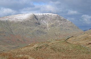
Stony Cove Pike is a fell in the Far Eastern part of the English Lake District. It stands on the other side of the Kirkstone Pass from Red Screes, and is on the end of a ridge coming down from High Street. It is separated from its neighbours by the deep col of Threshthwaite Mouth, so is a Marilyn – the sixteenth highest in the Lake District.

Rest Dodd is a fell in the English Lake District. It is situated in the quieter far eastern region of the national park and reaches a height of 696 metres (2,283 feet). Rest Dodd is a fell that is often by-passed by walkers as they travel the busy footpath between Ullswater and Haweswater either to climb the more significant fell of High Street or strive to complete Alfred Wainwright’s Coast to Coast Walk. Indeed Wainwright describes Rest Dodd as “A fell of little interest although the east flank falls spectacularly in fans of colourful scree”. The fell is usually climbed in conjunction with other nearby "Wainwright" fells such as The Nab, Brock Crags and Angletarn Pikes.

Carl Side is a fell in the English Lake District, forming a part of the Skiddaw "family" near the town of Keswick and prominently visible from its streets. It is listed in Alfred Wainwright's Pictorial Guides to the Lakeland Fells as one of the Northern Fells.

Angletarn Pikes is a fell in the English Lake District near the village of Patterdale. Its most notable feature is Angle Tarn from which it derives its name.

Gray Crag is a fell in the Lake District in Cumbria, England.

Red Pike is a fell in the High Stile range in the western English Lake District, which separates Ennerdale from the valley of Buttermere and Crummock Water. It is 2,476 ft (755 m) high. The direct ascent of Red Pike from Buttermere is very popular and the ridge walk from Red Pike to Haystacks is regarded as one of the finest in the area, with excellent views of the Scafells, Great Gable and Pillar.

High Raise is a fell in the English Lake District, standing to the west of Haweswater Reservoir in the Far Eastern Fells. Note that another High Raise is the highpoint of the Central Fells.

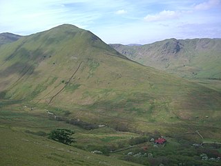
Beda Fell is a fell in the English Lake District, situated to the south of Ullswater. It divides the valleys of Boredale and Bannerdale within the Martindale system.

Hartsop Dodd is a fell in the English Lake District, standing to the south east of Brothers Water. It is a subsidiary top on the north ridge of Caudale Moor, but was given separate fell status by Wainwright in his Pictorial Guide to the Lakeland Fells. That convention is followed here.

Hart Crag is a fell in the English Lake District, being one of the Fairfield group of hills in the Eastern Fells.

Middle Dodd is a fell in the English Lake District, an outlier of the Helvellyn range in the Eastern Fells. It stands above Kirkstone Pass on the road from Ullswater to Ambleside.
High Hartsop Dodd is a fell in the English Lake District, an outlier of the Fairfield group in the Eastern Fells. It stands above Kirkstone Pass on the road from Ullswater to Ambleside.

Arnison Crag is a fell in the English Lake District, an outlier of the Fairfield group in the Eastern Fells. It looks down on Patterdale village and the upper reach of Ullswater.

Rossett Pike is a fell in the English Lake District. It is located at the head of Mickleden, one of two tributary valleys of Great Langdale.

Bannerdale Crags is a fell in the English Lake District. It stands between Blencathra and Bowscale Fell in the Northern Fells.

Bowscale Fell is a hill in the English Lake District. It rises above the village of Mungrisdale in the Northern Fells. Bowscale Fell stands at the extreme north east the Blencathra group, connected to this higher fell by the intervening Bannerdale Crags. In common with many fells the western slopes are smooth and convex while the eastern side exhibits crags.

