Kentmere Pike

Last updated

Kentmere Pike
Kentmere Pike 1234.JPG
Kentmere Pike, seen from the south above Browfoot in Kentmere
Highest point
Elevation 730 m (2,400 ft)
Prominence c. 35 m (115 ft)
Parent peak Harter Fell
Listing Wainwright, Hewitt, Nuttall
Coordinates 54°27′46″N2°49′37″W / 54.46274°N 2.82685°W / 54.46274; -2.82685
Geography
Lake District National Park UK relief location map.png
Red triangle with thick white border.svg
Kentmere Pike
Location relief map United Kingdom South Lakeland.svg
Red triangle with thick white border.svg
Kentmere Pike
Location in South Lakeland, Cumbria
Location Cumbria, England
Parent range Lake District, Far Eastern Fells
OS grid NY465078
Topo map OS Explorer OL7

Kentmere Pike is a fell in the English Lake District, rising between the valleys of Kentmere and Longsleddale. It is the highpoint on the ridge between Harter Fell and Shipman Knotts.

Contents

Topography

The western Kentmere slopes fall over the rough ground of Hallow Bank Quarter to Ullstone Gill, a tributary of the River Kent. Beyond here Smallthwaite Knott, an outlier of Harter Fell, separates Kentmere Pike from the main valley. There is extensive evidence of former quarrying on this flank.

By contrast the Longsleddale side wears a rim of crag above the narrow upper course of the River Sprint. Goat Scar, Raven Crag and Brown Crags are the main faces, while Steel Pike appears from the valley bridleway as an independent rocky peak. The remains of the large Wrengill Quarry are just north of here, together with a mine entrance a little higher up the slope.

The ridge northwards to Harter Fell drops to a wet depression and then climbs up the grassy ridge, following first the wall and then a broken fence. South-eastwards the ridge continues to the cairned top of Goat Scar, which provides a good viewpoint for the craggy throat of Longsleddale. From here the high ground turns due south to Shipman Knotts.

Summit

The top of the fell is a grassy dome with a stone wall running along the ridge. An Ordnance Survey column stands just to the east of the wall whilst a small summit cairn has been built to the west. Both are of equivalent height. The view of Lakeland is intermittent between the tops on the Ill Bell ridge, the Coniston fells and a portion of the Scafell group being visible. An open vista to the south encompasses Windermere and Morecambe Bay. [1]

Ascents

Kentmere Pike is most commonly climbed as part of the Kentmere Horseshoe. This circuit takes in the ridges on either side of the valley, together with the higher fells at its head. Direct ascents can also be made from either flank. An ancient grooved path rises up the fellside from the end of High Lane in Kentmere, meeting the ridgetop wall to the south of the summit. From Longsleddale the walled track that leads to Gatesgarth Pass can be left just north of Steel Pike. The line of an old fence is then followed to the ridge.

Related Research Articles

<span class="mw-page-title-main">Longsleddale</span> Valley and civil parish in Cumbria, England

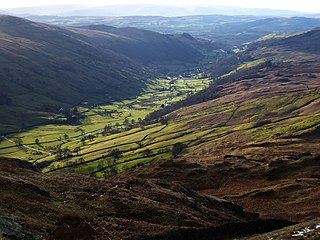
Longsleddale is a valley and civil parish in the South Lakeland district of Cumbria, England. It includes the hamlet of Sadgill. The parish has a population of 73. As the population taken at the 2011 Census was less than 100, details are maintained in the civil parish of Whitwell and Selside.

<span class="mw-page-title-main">Place Fell</span> Fell in the Lake District, Cumbria, England

Place Fell is a hill in the English Lake District. It stands at the corner of the upper and middle reaches of Ullswater, with steep western flanks overlooking the villages of Glenridding and Patterdale.

<span class="mw-page-title-main">Clough Head</span> Mountain in the English Lake District, Cumbria, England

Clough Head is a fell, or hill, in the English Lake District. It marks the northern end of the main ridge of the Helvellyn range and is often walked as part of the ridge walk. The fell stands south of the village of Threlkeld and the A66 road, and it forms the steep eastern side of the tranquil valley of St John's in the Vale.

<span class="mw-page-title-main">Stony Cove Pike</span> Mountain in the English Lake District, Cumbria, England

Stony Cove Pike is a fell in the Far Eastern part of the English Lake District. It stands on the other side of the Kirkstone Pass from Red Screes, and is on the end of a ridge coming down from High Street. It is separated from its neighbours by the deep col of Threshthwaite Mouth, so is a Marilyn – the sixteenth highest in the Lake District.

<span class="mw-page-title-main">Harter Fell (Mardale)</span> Mountain in United Kingdom

Harter Fell is a fell in the far eastern part of the English Lake District. The summit at lies the meeting point of three ridges, and Harter Fell forms the head of three valleys: Mardale, Longsleddale and the valley of the River Kent.

<span class="mw-page-title-main">Branstree</span> Fell in the Lake District, Cumbria, England

Branstree is a fell in the Far Eastern part of the English Lake District. It overlooks the valley of Mardale and Haweswater Reservoir.

<span class="mw-page-title-main">Dow Crag</span> Fell in the Lake District, Cumbria, England

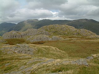
Dow Crag is a fell in the English Lake District near Coniston, Cumbria. The eastern face is one of the many rock faces in the Lake District used for rock climbing.

<span class="mw-page-title-main">Yoke (Lake District)</span> Fell in the Lake District, Cumbria, England

Yoke is a fell in the Lake District in Cumbria, England. It has a height of 706 metres (2,316 ft) and is situated in the far eastern sector of the national park, 6+12 kilometres ENE of the town of Ambleside. Yoke is the southern extremity of the long ridge that runs southwards from the fell of High Street. Yoke’s name is believed to be derived from the Old English language word geoc which is similar to the German word joch meaning mountain ridge.

<span class="mw-page-title-main">Shipman Knotts</span> Fell in Lake District, England

Shipman Knotts is a fell in the English Lake District in Cumbria, England. It reaches a height of 587 metres (1,926 ft) and is situated in one of the quieter areas of the national park, 2 kilometres north-east of Kentmere village. Although not one of the best-known Lake District fells, it earned a separate chapter in Alfred Wainwright’s Pictorial Guide to the Lakeland Fells due to “Its characteristic roughness. .. rocky outcrops are everywhere on its steep slopes”.

<span class="mw-page-title-main">Wandope</span> Fell in the Lake District, Cumbria, England

Wandope is a fell in the north-western area of the English Lake District. It lies to the east of Crummock Water and south of Crag Hill. From the summit there are excellent panoramas of the Sca Fell and High Stile ranges.

<span class="mw-page-title-main">Heron Pike</span>

Heron Pike is a fell in the English Lake District, two kilometres east of Grasmere. It is part of the Fairfield group in the Eastern Fells. It should not be confused with the Heron Pike that forms part of Sheffield Pike, although it appears that, by coincidence, both Heron Pikes are exactly the same height.

<span class="mw-page-title-main">Beda Fell</span> Fell in the Lake District, Cumbria, England

Beda Fell is a fell in the English Lake District, situated to the south of Ullswater. It divides the valleys of Boredale and Bannerdale within the Martindale system.

<span class="mw-page-title-main">Froswick</span> Fell in the Lake District, Cumbria, England

Froswick is a fell in the English Lake District, standing on the fine narrow ridge between the valleys of Kentmere and Troutbeck.

<span class="mw-page-title-main">Sallows</span> Fell in the Lake District, Cumbria, England

Sallows is a fell in the English Lake District, rising between the valleys of Kentmere and Troutbeck. It is the highest point in the upland area to the south of Garburn Pass, variously termed Kentmere Park and Applethwaite Common on Ordnance Survey maps.

<span class="mw-page-title-main">Tarn Crag (Far Eastern Fells)</span> Fell in the Lake District, Cumbria, England

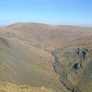
Tarn Crag is a fell in the English Lake District. It stands to the east of Longsleddale in the Far Eastern Fells.

<span class="mw-page-title-main">Grey Crag</span> Fell in the Lake District, Cumbria, England

Grey Crag is a fell in the English Lake District. It stands to the east of Longsleddale in the Far Eastern Fells.

<span class="mw-page-title-main">Nab Scar</span> Mountain in the English Lake District, Cumbria, England

Nab Scar is a fell in the English Lake District, an outlier of the Fairfield group in the Eastern Fells. It stands above Rydal Water.

<span class="mw-page-title-main">Starling Dodd</span>

Starling Dodd is a fell in the western part of the English Lake District, located between the valleys of Ennerdale and Buttermere, on the ridge between Great Borne to its west and Red Pike to its east. Not visible from Buttermere and rounded in profile, Starling Dodd is a relatively unfrequented top.

<span class="mw-page-title-main">Brandreth</span> Fell in the Lake District, Cumbria, England

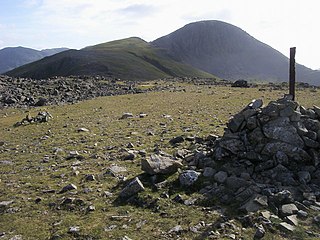
Brandreth is a fell in the English Lake District. It stands between Great Gable and Haystacks in the Western Fells.

<span class="mw-page-title-main">Far Eastern Fells</span> Mountain range in Cumbria, England

The Far Eastern Fells are a part of the Cumbrian Mountains in the Lake District of England. Reaching their highest point at High Street, they occupy a broad area to the east of Ullswater and Kirkstone Pass. Much quieter than the central areas of Lakeland they offer in general easier walking as the fells merge mainly into the surrounding moorlands.

References

  1. Alfred Wainwright: A Pictorial Guide to the Lakeland Fells , Book 2: ISBN   0-7112-2455-2