
High Street is a fell in the English Lake District. At 828 metres (2,718 ft), its summit is the highest point in the far eastern part of the national park. The fell is named after the possible Roman road which ran over the summit.

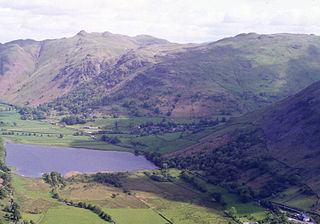
Place Fell is a hill in the English Lake District. It stands at the corner of the upper and middle reaches of Ullswater, with steep western flanks overlooking the villages of Glenridding and Patterdale.

Hallin Fell is a hill in the English Lake District surrounded on three sides by Ullswater.
The Nab is a fell in the English Lake District. It has a moderate height of 576 metres (1,888 feet), and lies in the quieter eastern high ground between Ullswater and Haweswater Reservoir. The Nab is included in Alfred Wainwright's list of Lakeland fells and many walkers feel compelled to climb it to complete their list of 'Wainwrights' even though it is not a significant fell and is awkward to reach.

Dollywaggon Pike is a fell in the English Lake District. It stands on the main spine of the Helvellyn range in the Eastern Fells, between Thirlmere and the Ullswater catchment.
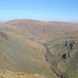
Branstree is a fell in the Far Eastern part of the English Lake District. It overlooks the valley of Mardale and Haweswater Reservoir.

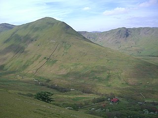
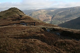
Rest Dodd is a fell in the English Lake District. It is situated in the quieter far eastern region of the national park and reaches a height of 696 metres (2,283 feet). Rest Dodd is a fell that is often by-passed by walkers as they travel the busy footpath between Ullswater and Haweswater either to climb the more significant fell of High Street or strive to complete Alfred Wainwright’s Coast to Coast Walk. Indeed Wainwright describes Rest Dodd as “A fell of little interest although the east flank falls spectacularly in fans of colourful scree”. The fell is usually climbed in conjunction with other nearby "Wainwright" fells such as The Nab, Brock Crags and Angletarn Pikes.

Angletarn Pikes is a fell in the English Lake District near the village of Patterdale. Its most notable feature is Angle Tarn from which it derives its name.

Arthur's Pike is a fell in the English Lake District, near Ullswater. It is a subsidiary top on the ridge falling north from Loadpot Hill in the Far Eastern Fells. An extensive craggy face stands above the lower reach of Ullswater.
Loadpot Hill is a fell in the English Lake District, between Haweswater and Ullswater.

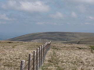
Wether Hill is a fell in the English Lake District, between Martindale and Haweswater. It lies on the main north-south ridge of the Far Eastern Fells between Loadpot Hill and High Raise. Lesser ridges also radiate out to the east and north-west.

High Raise is a fell in the English Lake District, standing to the west of Haweswater Reservoir in the Far Eastern Fells. Note that another High Raise is the highpoint of the Central Fells.

The Knott is a fell in the English Lake District, standing above Hayeswater in the Far Eastern Fells. It is an outlier of Rampsgill Head, being the high point of the ridge from there to Rest Dodd.
Brock Crags is a fell in the English Lake District, standing above Hartsop in the Far Eastern Fells. It forms part of the perimeter of Martindale, lying on the long ridge from Rampsgill Head to Place Fell.

Beda Fell is a fell in the English Lake District, situated to the south of Ullswater. It divides the valleys of Boredale and Bannerdale within the Martindale system.

Kidsty Pike is a fell in the English Lake District, standing to the west of Haweswater Reservoir. It is a subsidiary top of Rampsgill Head, but has long achieved the status of a separate fell, thanks to its classic peaked profile. Wainwright followed this convention in his Pictorial Guide to the Lakeland Fells.
Selside Pike is a fell in the English Lake District. It stands between the valleys of Mardale and Swindale in the Far Eastern Fells.
Hartsop above How is a fell in the English Lake District, an outlier of the Helvellyn range in the Eastern Fells. It stands above Brothers Water and the Ullswater–Ambleside road.
The Far Eastern Fells are a group of hills in the English Lake District. Reaching their highest point at High Street, they occupy a broad area to the east of Ullswater and Kirkstone Pass. Much quieter than the central areas of Lakeland they offer in general easier walking as the fells merge mainly into the surrounding moorlands.

Martindale is a valley, village and civil parish in Cumbria, England, situated within the Lake District National Park between the lakes of Ullswater and Haweswater. The valley is served by a narrow minor road which runs as far as the farm of Dale Head. This road commences at Howtown, a hamlet on the shore of Ullswater that forms part of the civil parish but is not in the valley of Martindale, and passes over a mountain pass or hause into the valley.


