
High Street is a fell in the English Lake District. At 828 metres (2,718 ft), its summit is the highest point in the far eastern part of the national park. The fell is named after the possible Roman road which ran over the summit.

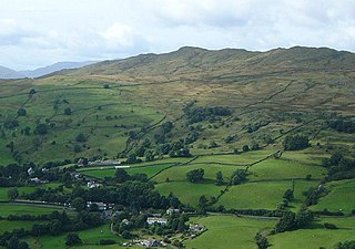
Troutbeck Tongue is a small fell located in the English Lake District, three miles ENE of Ambleside. It is one of 214 hills listed in Alfred Wainwright's Pictorial Guides to the Lakeland Fells, which makes it a popular attraction for walkers who are aiming to complete all the "Wainwrights". Because of its moderate height and proximity to a main road it is a pleasant half-day excursion that can be done when the higher fells are in cloud.

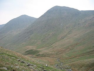
Stony Cove Pike is a fell in the Far Eastern part of the English Lake District. It stands on the other side of the Kirkstone Pass from Red Screes, and is on the end of a ridge coming down from High Street. It is separated from its neighbours by the deep col of Threshthwaite Mouth, so is a Marilyn – the sixteenth highest in the Lake District.

Harter Fell is a fell in the far eastern part of the English Lake District. The summit at lies the meeting point of three ridges, and Harter Fell forms the head of three valleys: Mardale, Longsleddale and the valley of the River Kent.
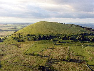
Great Mell Fell is an isolated hill or fell in the English Lake District, north of Ullswater and adjacent to the Eastern Fells. It rises from a level plain to a height of 537 m. Its top is an excellent viewpoint for many of the surrounding higher fells. The fell is now owned and managed by the National Trust and offers a place of quiet refuge.
Branstree is a fell in the Far Eastern part of the English Lake District. It overlooks the valley of Mardale and Haweswater Reservoir.

Yoke is a fell in the Lake District in Cumbria, England. It has a height of 706 m (2,316 ft) and is situated in the far eastern sector of the national park, 6½ kilometres ENE of the town of Ambleside. Yoke is the southern extremity of the long ridge that runs southwards from the fell of High Street. Yoke’s name is believed to be derived from the Old English language word geoc which is similar to the German word joch meaning mountain ridge.

Shipman Knotts is a fell in the English Lake District in Cumbria, England. It reaches a height of 587 metres (1,926 ft) and is situated in one of the quieter areas of the national park, 2 kilometres (1.2 mi) north-east of Kentmere village. Although not one of the best-known Lake District fells and strictly speaking it is just the southern shoulder of Kentmere Pike it earned a separate chapter in Alfred Wainwright’s Pictorial Guide to the Lakeland Fells due to “Its characteristic roughness…rocky outcrops are everywhere on its steep slopes”.
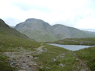
Green Gable is a fell in the English Lake District often traversed by walkers en route to its more famous neighbour Great Gable. It can be ascended from Honister Pass, Seathwaite in Borrowdale, or Ennerdale. There are good views of Gable Crag, Scafell Pike and the Buttermere valley from the summit.

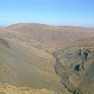
Wether Hill is a fell in the English Lake District, between Martindale and Haweswater. It lies on the main north-south ridge of the Far Eastern Fells between Loadpot Hill and High Raise. Lesser ridges also radiate out to the east and north-west.

Thornthwaite Crag is a fell in the English Lake District, standing to the west of Haweswater Reservoir. It is a focal point of the Far Eastern Fells, standing at the head of several valleys.
Wansfell is a fell in English Lake District situated 1½ miles east of the town of Ambleside. The fell is part of the long southern ridge of Caudale Moor and occupies the swath of territory between Ambleside and the Troutbeck valley.
Froswick is a fell in the English Lake District, standing on the fine narrow ridge between the valleys of Kentmere and Troutbeck.
Ill Bell is a fell in the English Lake District, in the county of Cumbria, standing on the narrow ridge between the valleys of Kentmere and Troutbeck.

Mardale Ill Bell is a fell in the English Lake District, rising to the south west of Haweswater Reservoir. It stands on the watershed between Mardale and Kentmere and is the highpoint of the south-eastern ridge of High Street, midway on its course to Harter Fell.

Kentmere Pike is a fell in the English Lake District, rising between the valleys of Kentmere and Longsleddale. It is the highpoint on the ridge between Harter Fell and Shipman Knotts.

Sallows is a fell in the English Lake District, rising between the valleys of Kentmere and Troutbeck. It is the highest point in the upland area to the south of Garburn Pass, variously termed Kentmere Park and Applethwaite Common on Ordnance Survey maps.

Birks is a fell in the English Lake District situated two kilometres south west of the village of Patterdale in the Eastern Fells. The fells summit sits on a shoulder of the north east ridge of the higher and better known fell of St Sunday Crag, by which it is dominated, walkers often pass over the top of Birks either climbing or descending from the larger fell. The fell's name means a place where Birch trees predominate.
Selside Pike is a fell in the English Lake District. It stands between the valleys of Mardale and Swindale in the Far Eastern Fells.
The Far Eastern Fells are a group of hills in the English Lake District. Reaching their highest point at High Street, they occupy a broad area to the east of Ullswater and Kirkstone Pass. Much quieter than the central areas of Lakeland they offer in general easier walking as the fells merge mainly into the surrounding moorlands.


