Kingston is a village and a census-designated place in the town of South Kingstown, Rhode Island, United States, and the site of the main campus of the University of Rhode Island. Much of the village center is listed on the National Register of Historic Places as Kingston Village Historic District.

Saunderstown is a small village and historic district in the towns of Narragansett and North Kingstown in Washington County, Rhode Island, United States.
Albion is a village and historic district in Lincoln, Rhode Island, in the United States.
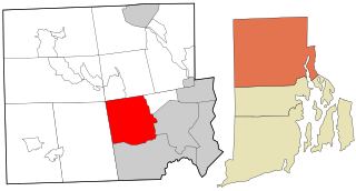
Lonsdale is a village and historic district in Lincoln and Cumberland, Providence County, Rhode Island, United States, near Rhode Island Route 146 and Route 95. The village was originally part of the town of Smithfield until Lincoln was created in the 1870s, and was originally centered on the Lincoln side of the river. William Blaxton settled in the area in 1635. In the nineteenth and early twentieth centuries, Lonsdale was home to several manufacturers including the Lonsdale Company's Bleachery, and the Ann & Hope mill was also located in the village in Cumberland.

The Smithfield Road Historic District is a rural historic district in North Smithfield, Rhode Island along Old Smithfield Road. It extends along Old Smithfield Road north from its junction with Sayles Hill Road, and is roughly bisected by Spring Brook. It includes eight historic houses or farmsteads, two 19th-century cemeteries, and a dam on Spring Brook just east of the road. The district encompasses a cross-section of the development of agricultural properties in North Smithfield over the 19th century, with properties dating from 1811 to 1932. The district covers 170 acres (69 ha), which includes lands currently and formerly in agricultural use.

The Windmill Hill Historic District is a historic district encompassing a large rural landscape in Jamestown, Rhode Island. It is bounded on the north by Eldred Avenue, on the east by East Shore Road, on the south by Great Creek, and on the west by Narragansett Bay. The area's historical resources included six farmsteads, as well as the Quaker Meetinghouse, the Jamestown Windmill, and its associated miller's house and barn. The area is predominantly rolling hills with open pastureland and forest. The district was listed on the National Register of Historic Places in 1978. The area is also rich in prehistoric evidence of Native American occupation, which is the subject of the Jamestown Archeological District listing on the National Register.
The Hazard Farmstead is a historic archaeological site in Jamestown, Rhode Island. It is the location of a major American Indian settlement whose artifacts have been dated from 2,500 BC to 1,000 AD. It appeared to be occupied seasonally from late summer to fall, and was intensively used during those times.

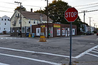
Arnold Mills Historic District is a historic district encompassing a modest 19th-century mill village in eastern Cumberland, Rhode Island. The district lies along the Nate Whipple Highway and Sneech Pond Road, south of the Arnold Mills Reservoir. Sneech Pond Road was formerly the major east-west highway through the area prior to the construction of the Nate Whipple Highway in the 1960s. The Arnold Mills village is in part bisected by Abbott Run, the stream which serves as the outlet of the reservoir; Sneech Pond Road crosses the run on an early 20th-century steel Pratt pony truss, now closed to vehicular traffic. The houses along this road generally date from the late 18th to mid-19th century, and mainly reflect Federal and Greek Revival styling. The most prominent structure in the district is the Arnold Mills United Methodist Church, located at the western end of the district on Nate Whipple Highway; it was built 1825-27 and remodeled in 1846.

The Dexter Arnold Farmstead is a historic farmstead on Chopmist Hill Road in Scituate, Rhode Island. The main house, a 2-1/2 story wood frame structure five bays wide, with a large central chimney, was built in 1813. The 3.6-acre (1.5 ha) property also has five outbuildings which appear to be near contemporaries to the house, a relative rarity in rural Rhode Island. The main barn survived into the 20th century, but was destroyed by the New England Hurricane of 1938. The property also includes a small family cemetery. The house, built by Dexter Arnold in land belonging to his father, remained in family hands until 1975.

The Ashton Historic District is a historic district in Cumberland, Rhode Island. The district consists of a mill and an adjacent mill village that was built for the workers of the mill. It lies between Mendon Road, Scott Road, Angell Road, Store Hill Road, Front Street and Middle Street. The district was added to the National Register of Historic Places on November 1, 1984.
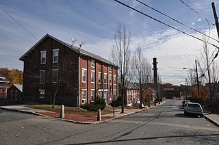
Berkeley Mill Village is a historic district encompassing the mill village of Berkeley in Cumberland, Rhode Island. The village is roughly bounded by Martin Street and Mendon Road on the north and east, railroad tracks to the west, and St. Joseph Cemetery to the south. The village, including a mill complex and mill employee housing, was built in 1872 by the Lonsdale Company. Most of the residential structures built are two-story brick duplexes, although Mendon Street is lined with a number of fine Queen Anne Victorian houses. A c. 1892 Stick-style church building, stands on Mendon Street at the northern end of the district.
Blackstone Park Historic District is roughly bounded by the Seekonk River, Laurell Avenue, Blackstone Boulevard, and South Angell Street in Providence, Rhode Island within the Blackstone region of the East Side.

The Wayland Historic District is a predominantly residential historic district on the east side of Providence, Rhode Island. It is a large area, covering about 122 acres (49 ha), bounded roughly on the north by Everett and Laurel Avenues, on the east by Blackstone Boulevard and Butler Avenue, on the west by Arlington Avenue, and on the south by Angell and South Angell Streets. This area, which was in the 19th century part of the Moses Brown farm, was platted for development in 1891, with most of the construction taking place in the early decades of the 20th century. Most of the residential properties in the district are single-family houses, typically built in revival styles popular at the time. They are set on similarly-sized lots with fairly uniform setbacks, and were typically built without garages. There are a number of two-family houses, and a small number of apartment buildings, most of which are found on the arterial roads of the area. There are several religious buildings, including several churches; the most architecturally distinctive religious building is the Jewish Temple Beth El, built 1951-54.
Black Farm, also known as the Isaac Collins Farm, is a historic farm in Hopkinton, Rhode Island bounded by Woodville Alton Road and Wood Road. The 264-acre (107 ha) was first developed by John Collins beginning in 1710, and saw agricultural use for over 200 years. The main house dates to the late 18th century, and is a 1-1/2 story gambrel-roofed post-and-beam structure. Other outbuildings include 19th century barns, a corn crib, and a guest cottage added in the 1930s. Set some distance off from this complex of buildings is the foundational remnant of what was probably an ice house: it consists of granite blocks and is eight feet in height.
The Fisherville Historic and Archeological District is a historic site in Exeter, Rhode Island. It is centered on Fisherville Brook in northeastern Exeter, around a mill complex that flourished in the mid-19th century. It includes the foundational remnants of a gristmill, sawmill, and included an abandoned early-19th century Cape style house at the time of its National Register nomination in 1980.

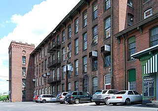
The South Street Historic District encompasses a small enclave of 19th-century houses on South Street between Meadow and Fruit Streets in Pawtucket, Rhode Island. Covering two blocks of South Street, it includes 21 buildings, of which 15 were built before 1850, and the rest before 1900. Most of the houses are 1-1/2 story wood frame structures, with many of the larger ones showing signs of having once been of a similar size. The most common architectural style is the Greek Revival, with notable examples at 19-21 and 37-39 South Street.

The Lime Kilns of Lincoln, Rhode Island, are the remnants of three colonial-era lime kilns, all that is left of one of the oldest lime processing operations in North America. They are located respectively off Louisquisset Pike, Sherman and Dexter Rock Roads in an area that has been known for its lime processing since the 17th century. When originally built, they were roughly cylindrical structures fashioned out of unmortared rubble stone. The first kiln, whose ruins are located near the Flanagan campus of the Community College of Rhode Island west of Louisquisset Pike, was the largest of the three, nearly 20 feet (6.1 m) in diameter. The second kiln remains are located to the south of Sherman Avenue, near its junction with Louisquisset Pike. In 1984 the standing walls were 8 feet (2.4 m) high, with three recognizable openings. The third kiln, of which only a partial wall remains standing, is located on the south side of Dexter Rock Road.

Foster Center is a village in the town of Foster, Rhode Island, United States. It was listed as a census-designated place (CDP) in 2010, with a population of 355. Historic elements of the village are included in the Foster Center Historic District, which is listed on the National Register of Historic Places. The district features various colonial and Greek Revival houses as well as the still functioning town building from the late 18th century. The district was added to the National Register of Historic Places on May 11, 1974.

Anthony is a village along Route 117 within the town of Coventry, Rhode Island near the villages of Washington and Quidnick on the southwestern banks of the Pawtuxet River. The village comprises "Anthony, Arnold, Boston, Mapledale, Meeting, Taft, Washington and Laurel Avenue."