Burley, Washington

Last updated

Burley, Washington
USA Washington location map.svg
Red pog.svg
Burley
Location in Washington and the United States
Usa edcp location map.svg
Red pog.svg
Burley
Burley (the United States)
Coordinates: 47°25′05″N122°37′46″W / 47.41806°N 122.62944°W / 47.41806; -122.62944
Country United States
State Washington
County Kitsap
Area
  Total4.92 sq mi (12.73 km2)
  Land4.76 sq mi (12.34 km2)
  Water0.15 sq mi (0.39 km2)
Elevation
33 ft (10 m)
Population
 (2020)
  Total2,081
  Density420/sq mi (160/km2)
Time zone UTC-8 (Pacific (PST))
  Summer (DST) UTC-7 (PDT)
ZIP code
98322
Area code 360
FIPS code 53-08885
GNIS feature ID1512051 [1]

Burley is an unincorporated community and census-designated place (CDP) in Kitsap County, Washington, United States. It is located just north of the boundary with Pierce County, about halfway between Gig Harbor to the south and Port Orchard to the north. It is located at the head of the Burley Lagoon in Henderson Bay. Burley is a residential area. The community's population stood at 2,081 at the 2020 census. [2]

Contents

Historical population
CensusPop.Note
2010 2,057
2020 2,0811.2%
Sources: [3] [2]

History

Burley was established in 1898 as a cooperative socialist colony [4] :129–167 by a group called the Co-operative Brotherhood, an offshoot of the Brotherhood of the Co-operative Commonwealth that had established Equality Colony elsewhere in Washington state in the previous year. Both communities were part of an attempt to plant socialist colonies in Washington in order to convert first the state, and then the entire nation, to socialism. [4] :55–113

Burley was originally named "Brotherhood". Circle City was an area of the colony with buildings laid out on the periphery of a circle. In its earliest years the community achieved a maximum population of approximately 150, [4] :145–146 but like some other planned towns of the era such as Equality Colony, its population endured a long decline through the ensuing years. The local economy was dominated by the lumber industry; other businesses never flourished, though a cigar-manufacturing effort did achieve some short-term success. [4] :150–151

Geography

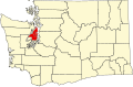
Burley is in southern Kitsap County. It is bordered to the south by the Pierce County communities of Wauna and Purdy. Washington State Route 16 passes through the eastern side of Burley, leading north 9 miles (14 km) to Port Orchard and south 7 miles (11 km) to Gig Harbor. According to the U.S. Census Bureau, the Burley CDP has a total area of 4.9 square miles (12.7 km2), of which 4.7 square miles (12.3 km2) are land and 0.2 square miles (0.4 km2), or 3.04%, are water. [3]

See also

Related Research Articles

<span class="mw-page-title-main">Kitsap County, Washington</span> County in Washington, United States

Kitsap County is located in the U.S. state of Washington. As of the 2020 census, its population was 275,611. Its county seat is Port Orchard; its largest city is Bremerton. The county, formed out of King County and Jefferson County on January 16, 1857, is named for Chief Kitsap of the Suquamish Tribe. Originally named Slaughter County, it was soon renamed.

<span class="mw-page-title-main">Freeland, Washington</span> Census-designated place in Washington, United States

Freeland is an unincorporated community and census-designated place (CDP) on Whidbey Island in Island County, Washington, United States. At the time of the 2010 census the population was 7,812. The town received its name based on its origins as a socialist commune in the early 1900s: in the eyes of its founders, the land of the town was literally to be free for all people. Some of the first settlers were veterans of a prior experiment in socialism, the nearby Equality Colony.

<span class="mw-page-title-main">East Port Orchard, Washington</span> CDP in Washington, United States

East Port Orchard is a census-designated place (CDP) in Kitsap County, Washington, United States. The population was 5,262 at the 2020 census.

<span class="mw-page-title-main">Erlands Point-Kitsap Lake, Washington</span> Former CDP in Washington, United States

Erlands Point-Kitsap Lake is an unincorporated area and former census-designated place (CDP) in Kitsap County, Washington, United States. The population was 2,935 at the 2010 census. For the 2020 census, the area was split into two CDPs, Erlands Point and Kitsap Lake.

<span class="mw-page-title-main">Kingston, Washington</span> Census-designated place in Washington, United States

Kingston is an unincorporated community and census-designated place (CDP) in Kitsap County, Washington, United States. The population was 2,515 at the 2020 census. Kingston is along the shores of Appletree Cove and Puget Sound, and is home to a major Washington State Ferry terminal linking it to Edmonds.

<span class="mw-page-title-main">Manchester, Washington</span> Census-designated place in Washington, United States

Manchester is an unincorporated community and census-designated place (CDP) in Kitsap County, Washington, United States. The population was 5,714 at the 2020 census. Manchester is located on the Puget Sound approximately 10 miles from downtown Seattle, and is adjacent to county seat Port Orchard to its east. Today, Manchester labels itself as a village. It is small in size but is home to a Kitsap Regional Library (KRL) branch, a post office, an elementary school, and a beachfront park to serve its residents.

<span class="mw-page-title-main">Navy Yard City, Washington</span> Census-designated place in Washington, United States

Navy Yard City is a census-designated place (CDP) in Kitsap County, Washington, United States. The population was 2,759 at the 2020 census.

<span class="mw-page-title-main">Port Orchard, Washington</span> City in Washington, United States

Port Orchard is a city in and the county seat of Kitsap County, Washington, United States. It is located 13 miles (21 km) due west of West Seattle and is connected to Seattle and Vashon Island via the Washington State Ferries run to Southworth. It is named after Port Orchard, the strait that separates Bainbridge Island from the Kitsap Peninsula.

<span class="mw-page-title-main">Poulsbo, Washington</span> City in Washington, United States

Poulsbo is a city on Liberty Bay in Kitsap County, Washington, United States. It is the smallest of the four cities in Kitsap County. The population was 11,970 at the 2020 census and an estimated 10,927 in 2018.

<span class="mw-page-title-main">Silverdale, Washington</span> Place in Washington, United States

Silverdale is an unincorporated community in Kitsap County, Washington, in the United States. Despite many failed attempts at incorporation, Silverdale has not become a city. The population was 20,733 at the 2020 census. For statistical purposes, the United States Census Bureau has defined Silverdale as a census-designated place (CDP).

<span class="mw-page-title-main">Suquamish, Washington</span> Census-designated place in Washington, United States

Suquamish is a census-designated place (CDP) in Kitsap County, Washington, United States. The population was 4,266 at the 2020 census. Comprising the Port Madison Indian Reservation, it is the burial site of Chief Seattle and was the site of the Suquamish tribe winter longhouse known as the Old Man House.

<span class="mw-page-title-main">Gig Harbor, Washington</span> City in Washington, United States

Gig Harbor is the name of both a bay on Puget Sound and a city on its shore in Pierce County, Washington. The population was 12,029 at the 2020 census.

<span class="mw-page-title-main">Edison, Washington</span> CDP in Washington, United States

Edison is a census-designated place (CDP) in Skagit County, Washington, United States. The population was 133 at the 2010 census. It is included in the Mount Vernon–Anacortes, Washington Metropolitan Statistical Area.

<span class="mw-page-title-main">Seabeck, Washington</span> Census-designated place in Washington, United States

Seabeck is an unincorporated community and census-designated place (CDP) in Kitsap County, Washington, United States. The population was 1,105 at the 2010 census. Seabeck is a former mill town on Hood Canal.

Southworth is an unincorporated community and census-designated place (CDP) on Puget Sound in Kitsap County, Washington, United States. It is best known for being the west end of the Fauntleroy-Vashon Island-Southworth Washington State Ferries run. Landmarks include Southworth Grocery, a US Post Office, ferry terminal, clay cliffs and a private beach on the point. Next to the ferry is a popular place to launch kayaks for trips to nearby Blake Island. The population of the Southworth CDP was 2,185 at the 2010 census.

<span class="mw-page-title-main">Key Peninsula</span>

The Key Peninsula lies along Puget Sound to the south of Kitsap Peninsula in the U.S. state of Washington. It is part of Pierce County and is bordered to the west by Case Inlet and to the east by Carr Inlet. The peninsula is approximately 16 miles (26 km) long and has two Washington State Parks.

Bethel is a census-designated place (CDP) in Kitsap County, Washington, United States. Located a few miles south of the city of Port Orchard, Bethel is a wooded residential area. Most residents commute to Port Orchard or nearby cities. It was first designated a place by the Census Bureau in the 2010 census, at which time its population was 3,713. By the 2020 census, the population increased to 4,073.

Chico is an unincorporated community and census-designated place (CDP) in Kitsap County, Washington, United States. Named in 1889 for a local Indian, Chico is located on the Dyes Inlet waterfront, south of Silverdale. At the 2020 census the community had a population of 2,723.

<span class="mw-page-title-main">Bangor Base, Washington</span> Census-designated place in Washington, United States

Bangor Base is a census-designated place (CDP) in Kitsap County, Washington, within U.S. Naval Base Kitsap on the Kitsap Peninsula. Its population was 5,482 at the 2020 census.

Port Gamble Tribal Community is a census-designated place (CDP) corresponding to the Port Gamble S'Klallam Reservation in Kitsap County, Washington, United States. The population was 916 at the 2010 census.

References

  1. "Burley". Geographic Names Information System . United States Geological Survey, United States Department of the Interior.
  2. 1 2 "Census Bureau profile: Burley, Washington". United States Census Bureau. May 2023. Retrieved May 8, 2024.
  3. 1 2 "Geographic Identifiers: 2010 Census Summary File 1 (G001), Burley CDP, Washington". American FactFinder. U.S. Census Bureau. Archived from the original on February 13, 2020. Retrieved June 26, 2019.
  4. 1 2 3 4 Charles Pierce LeWarne, Utopias in Puget Sound, 1885-1915. Seattle, University of Washington Press, 1975