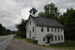
Fayston is a town in Washington County, Vermont, United States. The population was 1,364 at the 2020 census.

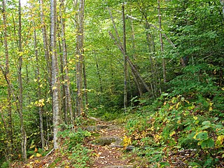
The Long Trail is a hiking trail located in Vermont, running the length of the state. It is the oldest long-distance trail in the United States, constructed between 1910 and 1930 by the Green Mountain Club. The club remains the primary organization responsible for the trail, and is recognized by the state legislature as "the founder, sponsor, defender, and protector" of the Long Trail System.

Mount Mansfield is the highest mountain in Vermont with a summit that peaks at 4,393 feet (1,339 m) above sea level. The summit is located within the town of Underhill in Chittenden County; the ridgeline, including some secondary peaks, extends into the town of Stowe in Lamoille County, and the mountain's flanks also reach into the town of Cambridge.

Mount Ellen is a mountain in the Green Mountains in the U.S. state of Vermont. Located at the northern edge of the Green Mountain National Forest in Washington County, the summit of Mount Ellen is in the northwest corner of Warren but the mountain extends into Fayston to the north and Lincoln to the west. Together with Lincoln Peak to the south, the slopes of Mount Ellen are home to the Sugarbush Resort.

Camel's Hump is a mountain in the Green Mountains in the U.S. state of Vermont. The north slope of the mountain borders the Winooski River, which has carved through the Green Mountains over eons. At 4,083 ft (1,244 m), it is tied for the third-highest mountain in Vermont. Surrounded by 10 acres (4 ha) of alpine tundra, the mountain is the most significant feature in Camel's Hump State Park. Because of its distinctive profile, it is perhaps the state's most recognized mountain, featured on the state quarter.

The National Wilderness Preservation System (NWPS) of the United States protects federally managed wilderness areas designated for preservation in their natural condition. Activity on formally designated wilderness areas is coordinated by the National Wilderness Preservation System. Wilderness areas are managed by four federal land management agencies: the National Park Service, the U.S. Forest Service, the U.S. Fish and Wildlife Service, and the Bureau of Land Management.

William Penn State Forest is a Pennsylvania State Forest in Pennsylvania Bureau of Forestry District #17. The main offices are located in Elverson in Chester County, Pennsylvania in the United States.

Joseph Battell was a publisher and philanthropist from Middlebury, Vermont. Battell is credited with preserving Vermont forest land including the land for Camel's Hump State Park. The Joseph Battell Wilderness in the Green Mountain National Forest bears his name.
St. Mary's River State Park is a public recreation area located in St. Mary's County, Maryland. The state park consists of two sites: one encompasses 250-acre (100 ha) St. Mary's Lake ; the second covers 2,200 acres (890 ha) and is largely undeveloped. The park is managed by the Maryland Department of Natural Resources.

New York State Forests are public lands administered by the Division of Lands and Forests of the New York State Department of Environmental Conservation (NYSDEC). New York State Forests are designated as reforestation, multiple use, and unique areas; and state nature and historic preserves, with approximately 600,000 acres (2,400 km2) classified as reforestation areas and approximately 9,000 acres (36 km2) classified as multiple use lands. Land within the Adirondack Park or the Catskill Park is not included as part of the State Forest system.

Camel's Hump State Park is a state park in the U.S. state of Vermont. The park straddles the northern Green Mountains in an area bounded by Vermont Route 17 on the south and the Winooski River on the north. As of 2017, the park covered a total of 21,224 acres (8,589 ha), making it the largest state park in Vermont.

Gifford Woods State Park is a state park located at the base of Pico Peak in Killington, Vermont. The wooded park provides camping, picnic, and fishing facilities, and has hiking trails, including a portion of the Appalachian Trail. It preserves an area of old-growth forest that has been designated a National Natural Landmark, and is accessible via an interpretive trail. The park was established in 1931. Part of it is listed on the National Register of Historic Places, for facilities developed by the Civilian Conservation Corps in the 1930s.
Mount Ascutney State Park is a state park in the U.S. state of Vermont. The park entrance is located along Vermont Route 44-A near the town of Windsor in Windsor County. Operated by the Vermont Department of Forests, Parks and Recreation, a significant portion of the park is listed on the National Register of Historic Places.
Camel's Hump State Forest covers a total of 2,323 acres (9.40 km2) in two blocks in the U.S. state of Vermont. Stevens Block comprises 1,680 acres (6.8 km2) in Buels Gore, Fayston, and Starksboro in Chittenden, Washington, and Addison counties, respectively. Howe Block covers 643 acres (2.60 km2) in Waitsfield and Fayston, both in Washington county. The forest is managed by the Vermont Department of Forests, Parks and Recreation.
Stark Mountain is a mountain in the Green Mountains in the U.S. state of Vermont. Located in the town of Fayston in Washington County, the mountain summit is 3,662 feet (1,116 m) in elevation. Stark Mountain is named after General John Stark, hero of the Battle of Bennington fought in 1777.
Camel's Hump Forest Reserve is a protected area in the U.S. state of Vermont. The area is bounded by Vermont Route 17 on the south, the Winooski River on the north, the Mad River on the east, and the Huntington River on the west. The Forest Reserve covers a total of 127.68 square miles (330.7 km2) or 81,715 acres (33,069 ha) of both public and privately-owned land, one of the largest blocks of core forest in the state.
Huntington Gap Wildlife Management Area is a wildlife management area in the U.S. state of Vermont. It consists of 1,602 acres (648 ha) in the towns of Huntington, Buels Gore, and Fayston. The area is owned by the State of Vermont and administered by the Vermont Fish & Wildlife Department.
