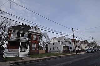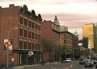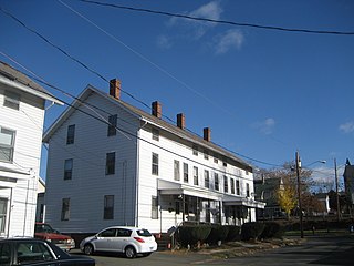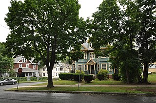
Enfield is a town in Hartford County, Connecticut, United States. The population was 44,654 at the 2010 census. It is bordered by Longmeadow, Massachusetts and East Longmeadow, Massachusetts, to the north, Somers to the east, East Windsor and Ellington to the south, and the Connecticut River to the west.

The Lummus Park Historic District or simply Lummus Park, is on the National Register of Historic Places and a locally historic designated district in Miami, Florida. It is roughly bound by Northwest Fifth Street to the north, Flagler Street to the south, Northwest Third Avenue to the east, and the Miami River to the west. On October 25, 2006, it was added to the U.S. National Register of Historic Places. Lummus Park has some of the oldest structures in Miami, and over the decades, has been able to retain a large part of its early pioneer character.

The Howard Avenue Historic District is a 32-acre (13 ha) historic district in The Hill neighborhood of the city of New Haven, Connecticut. Extending along Howard Avenue between Minor Street and Interstate 95, it contains an unusually high concentration of well-preserved late 19th-century middle class vernacular architecture, reflecting the area's growth at that time. It was listed on the National Register of Historic Places in 1985.

The Downtown North Historic District is a 19-acre (7.7 ha) historic district in Hartford, Connecticut. It is a predominantly residential area located around Main Street and High Street north of I-84 and south of the Amtrak railroad tracks. Its apartment blocks, houses, schools and churches, built up mainly in the late 19th and early 20th centuries as part of an expansion of the city's urban core. It includes the 130-foot (40 m) Keney Tower. The area was listed on the National Register of Historic Places in 2004.

The Dwight Street Historic District is an irregularly shaped 135-acre (55 ha) historic district in New Haven, Connecticut. The district is located immediately west of the center of Downtown New Haven and is generally bounded by Elm Street on the north, Park Street on the east, North Frontage Road on the south, and Sherman Avenue on the west. It contains one of the city's highest concentrations of well-preserved 19th and early 20th-century residential architecture, much of which was developed for the working classes in the city's factories. It was listed on the National Register of Historic Places in 1983. The historic district includes most of the Dwight neighborhood and several blocks of the northeast corner of the West River neighborhood.

The Main Street Historic District encompasses the historic civic, commercial, and residential center of Durham, Connecticut. The district is primarily linear and runs along Main Street from between Higganum Road and Town House Road in the south to Talcott Lane in the north, and along Maple Avenue, which parallels Main Street. The district includes most of its colonial architecture, as well as many of its civic buildings. It was listed on the National Register of Historic Places in 1986.

The Clay Hill Historic District in Hartford, Connecticut is a 60-acre (24 ha) historic district that was listed on the National Register of Historic Places in 1983, and expanded in 1984. Northwest of Downtown Hartford, the district is roughly bounded by Main, Mather, Garden, and Walnut Streets. The district contains examples of Queen Anne, Italianiate and Neoclassical Revival architecture.

The Canal Street–Clark Street Neighborhood Historic District encompasses a compact 19th-century working-class neighborhood of Brattleboro, Vermont. Most of its buildings are modest vernacular wood frame buildings, erected between 1830 and 1935; there are a few apartment blocks, and one church. The district was listed on the National Register of Historic Places in 1993.

The Allen Place–Lincoln Street Historic District encompasses a small neighborhood of late 19th-century housing built for white-collar service workers in southern Hartford, Connecticut. It is roughly bounded by Madison, Washington, and Vernon Streets, and Zion Hill Cemetery, and has well-preserved examples of vernacular Queen Anne and Colonial Revival architecture. It was listed on the National Register of Historic Places in 2003.

The Buckingham Square District of Hartford, Connecticut encompasses a mixed residential and commercial neighborhood area just south of the city's downtown. It is centered around Buckingham Square, laid out in 1830 on the site of an early colonial-era church. The district includes a concentration of well-preserved Victorian architecture from the 1860s to 1890s. It was listed on the National Register of Historic Places in 1977, and slightly enlarged in 1982.

The Bigelow-Hartford Carpet Mills Historic District encompasses a company-built factory and residential area in the Thompsonville area of Enfield, Connecticut. In addition to the former factory buildings of the Bigelow-Hartford Carpet Mills, it includes more than 150 housing units built by the company between about 1830 and 1920. It is roughly bounded on the north by Lafayette Street and Alden Avenue, the east by Hartford Avenue and Lincoln Street, the south by High Street, and the west by River Street. It was listed on the National Register of Historic Places in 1994.

Charter Oak Place is a street on the south side of downtown Hartford, Connecticut. Laid out in the 1860s, its residential character is in marked contrast to the commercial development that predominates around it. The street's buildings, constructed between the early 1860s and 1900, are a cross-section of Victorian architectural styles. The entire length of the street is listed on the National Register of Historic Places.

The Central Avenue-Center Cemetery Historic District encompasses part of the town center of East Hartford, Connecticut. Although it was founded in the mid-17th century, it is now dominated by architecture of the late 19th and early 20th centuries. The Center Cemetery is the town's oldest surviving property, and includes the grave of William Pitkin, a colonial governor. The district, including portions of Main Street and Central Avenue, was listed on the National Register of Historic Places in 1993.

The Manchester Historic District encompasses a historic planned industrial and residential area of Manchester, Connecticut. Located west of the town's Main Street area, the district includes most of the Cheney Brothers Historic District, a National Historic Landmark District covering the silk manufacturing mills, worker housing, and owner residences of the Cheney family, as well as other surrounding residential areas related to the growth and development of Manchester under the Cheney's influence. The district was listed on the National Register of Historic Places in 2000.

The West End North Historic District encompasses a neighborhood of late 19th and early 20th century residential architecture in western Hartford, Connecticut and eastern West Hartford, Connecticut. Roughly bounded by Prospect, Elizabeth, and Lorraine Streets and Farmington Avenue, the area includes a large number of Colonial Revival and Queen Anne houses, as well as numerous buildings in other period styles, with only a small number of losses. It was listed on the National Register of Historic Places in 1985.

The Signourney Square Historic District encompasses a neighborhood in the Asylum Hill area of Hartford, Connecticut, that was almost entirely built out in a single decade at the end of the 19th century as a middle-class residential area. It is roughly bounded by Garden, Ashley, and Woodland Streets on the east, south, and west, and by railroad tracks north of Sargeant Street to the north. The area retains much of its late 19th-century character, with relatively few modern intrusions. It was listed on the National Register of Historic Places in 1979, with small additions in 1983 and 2011.

The Sisson-South Whitney Historic District encompasses a neighborhood in the West End area of Hartford, Connecticut, that was built out between 1890 and 1930 as a streetcar suburb. It is roughly bounded by Farmington Avenue, South Whitney Street, West Boulevard, and Sisson Avenue, and includes a diversity of residential and commercial architecture, reflective of its initial development and subsequent growth. The district was listed on the National Register of Historic Places in 2013.

The Walnut Hill District is a historic district encompassing a predominantly residential area southwest of downtown New Britain, Connecticut. Roughly bounded by Walnut Hill Park and the New Britain General Hospital, as well as West Main, Main, Arch, and Hart Streets, the area mirrors in residential architecture the growth of the city as an industrial center between 1840 and 1930. The district was listed on the National Register of Historic Places in 1975.

The Vine Street Apartment Buildings, many now known as the Horace Bushnell Apartments, are a historic collection of residential apartment blocks at 4-48 Vine Street in Hartford, Connecticut. Built between 1922 and 1925, they consist of eleven brick buildings sharing massing, scale, and setting, with a cross-section of period building styles. They were listed on the National Register of Historic Places in 2012.


