Carterville, Illinois

Last updated

Carterville, Illinois
Carterville-Division-Street-il.jpg
Division St
Williamson County Illinois Incorporated and Unincorporated areas Carterville Highlighted.svg
Location of Carterville in Williamson County, Illinois.
Illinois in United States (US48).svg
Location of Illinois in the United States
Coordinates: 37°45′40.03″N89°4′46.52″W / 37.7611194°N 89.0795889°W / 37.7611194; -89.0795889
CountryUnited States
StateIllinois
County Williamson
Government
  MayorBradley Robinson
Area
[1]
  Total5.35 sq mi (13.86 km2)
  Land5.27 sq mi (13.64 km2)
  Water0.08 sq mi (0.22 km2)
Elevation
[2]
443 ft (135 m)
Population
 (2020)
  Total5,848
  Density1,110.52/sq mi (428.78/km2)
Time zone UTC-6 (CST)
  Summer (DST) UTC-5 (CDT)
ZIP Code
62918
Area code 618
FIPS code 17-11514
GNIS feature ID2393757 [2]
Wikimedia CommonsCarterville, Illinois
Website www.visitcarterville.com

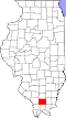
Carterville is a city in Williamson County, Illinois, United States. At the 2020 census, the city's population was 5,848. The city is part of the Carbondale-Marion-Herrin combined statistical area and has grown considerably as a residential community of Carbondale and Marion.

Contents

The city is located next to Crab Orchard National Wildlife Refuge. The Refuge's 44,000 acres (180 km2) of land and water contain a wide diversity of flora and fauna. [3]

History

Carterville was founded by George Monroe McNeill and Laban Carter. McNeill married Olive Herrin of Herrin's Prairie and in 1866 they settled on the farm now known as Carterville. Carter came to Williamson County in 1864, purchased 100 acres (0.40 km2) of land, and helped organize and secure a post office for Carterville in 1871. The town was named in his honor. [4] McNeill was one of the youngest members of the Union army during the American Civil War. He enlisted at 16 and was with General William T. Sherman during his March to the Sea. [4]

Geography

According to the 2010 census, the city has a total area of 5.28 square miles (13.7 km2), of which 5.19 square miles (13.4 km2) (or 98.30%) is land and 0.09 square miles (0.23 km2) (or 1.70%) is water. [5]

Demographics

Historical population
CensusPop.Note
1880 692
1890 96940.0%
1900 1,74980.5%
1910 2,97169.9%
1920 3,40414.6%
1930 2,866−15.8%
1940 2,8930.9%
1950 2,716−6.1%
1960 2,643−2.7%
1970 3,06115.8%
1980 3,44512.5%
1990 3,6305.4%
2000 4,61627.2%
2010 5,49619.1%
2020 5,8486.4%
U.S. Census [6]

As of the 2020 Census [7] , the city had a population of 5,848, with 2,656 housing units and 2,545 families. The population density was 2,339.2 inhabitants per square mile (903.2/km2). The racial makeup of the city was 87.4% White, 2.3% Black or African American, 3.1% Asian, 2.9% Hispanic or Latino, 0.3% American Indian and Alaska Native, and 0.1% Native Hawaiian and Other Pacific Islander.

In 2000, there were 1,933 households, out of which 32.1% had children under the age of 18 living with them, 54.4% were married couples living together, 10.0% had a female householder with no husband present, and 33.1% were non-families. 28.0% of all households were made up of individuals, and 10.8% had someone living alone who was 65 years of age or older. The average household size was 2.39 and the average family size was 2.95.

In the city the population was spread out, with 25.2% under the age of 18, 10.0% from 18 to 24, 28.1% from 25 to 44, 23.1% from 45 to 64, and 13.6% who were 65 years of age or older. The median age was 36 years. For every 100 females, there were 93.9 males. For every 100 females age 18 and over, there were 91.0 males.

The median income for a household in the city was $36,969, and the median income for a family was $44,722. Males had a median income of $34,231 versus $24,924 for females. The per capita income for the city was $18,884. About 9.9% of families and 14.6% of the population were below the poverty line, including 15.4% of those under age 18 and 7.1% of those age 65 or over.

Education

Carterville is home to John A. Logan College, named for the local American Civil War hero and politician John A. Logan. A college of approximately 3,500 students students, John A. Logan College was featured in Rolling Stone magazine as the nation's fifth best community college and in 2004 was recognized as one of the fastest growing community colleges in the nation. [8]

Carterville High School received a silver medal and ranked 94th in Illinois on U.S. News & World Report's 2016 list of the nation's best high schools. CHS was the only public high school in southern Illinois that performed above the state average of 21 on ACT testing. [9]

The Carterville Unit 5 Schools' athletic programs have been successful in the past, winning the IHSA State Conference Championship in Class 3A football in 1996 and in Class 2A softball in 2008 and 2016. The Carterville Varsity Cheer squad hold the record for the most wins in IHSA history. [10]

Notable people

Related Research Articles

<span class="mw-page-title-main">Williamson County, Illinois</span> County in Illinois, United States

Williamson County is a county in Southern Illinois. At the 2020 census, it had a population of 67,153. The largest city and county seat is Marion.

<span class="mw-page-title-main">Union County, Illinois</span> County in Illinois, United States

Union County is a county located in the U.S. state of Illinois. According to the 2020 United States Census, it had a population of 17,244. Its county seat is Jonesboro. It is located in the southern portion of Illinois known locally as "Little Egypt".

<span class="mw-page-title-main">Mason County, Illinois</span> County in Illinois, United States

Mason County is a county in the U.S. state of Illinois. According to the 2020 census, it had a population of 13,086. Its county seat is Havana. The county is named in honor of George Mason, a member of the Virginia legislature who campaigned for the adoption of the United States Bill of Rights.

<span class="mw-page-title-main">Johnson County, Illinois</span> County in Illinois, United States

Johnson County is a county in the U.S. state of Illinois. According to the 2020 census, it has a population of 13,308. Its county seat is Vienna. It is located in the southern portion of Illinois known locally as "Little Egypt".

<span class="mw-page-title-main">Jackson County, Illinois</span> County in Illinois, United States

Jackson County is a county located in the U.S. state of Illinois with a population of 52,974 at the 2020 census, the county is located 98 miles southeast of St. Louis. Its county seat is Murphysboro, and its most populous city is Carbondale, home to the main campus of Southern Illinois University. The county was incorporated on January 10, 1816, and named for Andrew Jackson. The community of Brownsville served as the fledgling county's first seat.

<span class="mw-page-title-main">Carbondale, Illinois</span> City in Illinois, United States

Carbondale is a city in Jackson County, Illinois, United States, within the Southern Illinois region informally known as "Little Egypt". As of the 2020 census, the city had a population of 25,083, making it the most populous city in Southern Illinois outside the Metro East region of Greater St. Louis.

<span class="mw-page-title-main">Cambria, Illinois</span> Village in Illinois, United States

Cambria is a village in northwestern Williamson County, Illinois, United States. The population was 1,228 at the 2010 census.

<span class="mw-page-title-main">Crainville, Illinois</span> Village in Illinois, United States

Crainville is a village in Williamson County, Illinois, United States. The population was 1,254 at the 2010 census.

<span class="mw-page-title-main">Creal Springs, Illinois</span> City in Illinois, United States

Creal Springs is a city in Williamson County, Illinois, United States. The population was 543 at the 2010 census.

<span class="mw-page-title-main">Herrin, Illinois</span> Place in Illinois, United States

Herrin is a city in Williamson County, Illinois. The population was 12,352 at the 2020 census. The city is part of the Marion-Herrin Micropolitan Area and is a part of the Carbondale-Marion-Herrin, Illinois Combined Statistical Area with 123,272 residents, the sixth most populous Combined statistical area in Illinois.

<span class="mw-page-title-main">Hurst, Illinois</span> City in Illinois, United States

Hurst is a city in Williamson County, Illinois, United States. The population was 795 at the 2010 census.

<span class="mw-page-title-main">Marion, Illinois</span> City in Illinois, United States

The city of Marion is the county seat of Williamson County, Illinois, United States. The population in Marion, IL was 16,855 according to the 2020 census.

<span class="mw-page-title-main">Spillertown, Illinois</span> Village in Illinois, United States

Spillertown is a village in Williamson County, Illinois, United States. The population was 203 at the 2010 census and as of 2018, the population has grown to an estimated 272.

<span class="mw-page-title-main">Crab Orchard, Kentucky</span> City in Kentucky, United States

Crab Orchard is a home rule-class city in Lincoln County, Kentucky, United States. The population was 841 at the 2010 census. It is part of the Danville Micropolitan Statistical Area.

<span class="mw-page-title-main">Crab Orchard, Tennessee</span> City in Tennessee, United States

Crab Orchard is a city in Cumberland County, Tennessee, United States. The population was 719 at the 2020 census.

<span class="mw-page-title-main">Crab Orchard Lake</span> Reservoir in Williamson County, Illinois

Crab Orchard Lake is a 6,965-acre (28.2 km²) reservoir in Williamson County, Illinois. It is the centerpiece of the Crab Orchard National Wildlife Refuge. It is fed by Devils Kitchen Lake and Little Grassy Lake, which are also within the National Wildlife Refuge.

<span class="mw-page-title-main">Metro Lakeland</span> Area of Southern Illinois, United States

Metro Lakeland is a name that was coined in the 1960s for an area of southern Illinois that is centered on the intersections of Interstate 57, Interstate 24, and Illinois Route 13 — a four-lane east-west highway connecting the communities of Murphysboro, Carbondale, Carterville, Herrin, Marion, and Harrisburg. Metro Lakeland was defined as Jackson, Williamson, Franklin, Saline, and Perry counties, with a combined population of approximately 210,000. Carbondale, Herrin, and Marion are the key urban areas, with a combined city-proper population of over 65,000 Carbondale, the site of Southern Illinois University, is the region's largest city. Metro Lakeland is about 88 miles (142 km) southeast of St. Louis, Missouri, or 120 miles (190 km) by Interstate highway.

<span class="mw-page-title-main">John E. Bradley</span> American politician

John Bradley is a former Democratic member of the Illinois House of Representatives, representing the 117th District from his appointment in June 2003 to his resignation in January 2017. He served as an Assistant Majority Leader from 2013 to 2017. The 117th district, located in Southern Illinois and parts of the Metro Lakeland area, includes all or parts of Benton, Buckner, Bush, Cambria, Carbondale, Carterville, Christopher, Colp, Crab Orchard, Creal Springs, Energy, Ewing, Freeman Spur, Granville, Hanaford, Herrin, Hurst, Johnston City, Macedonia, Marion, McLeansboro, Mulkeytown, North City, Orient, Pittsburg, Royalton, Sesser, Spillertown, Stonefort, Thompsonville, Valier, West City, West Frankfort, Whiteash, and Zeigler.

Dave Severin is a Republican member of the Illinois House of Representatives, representing the 117th district since January 2017. The 117th district, located in Southern Illinois and parts of the Metro Lakeland area, includes all or parts of Benton, Buckner, Bush, Cambria, Carbondale, Carterville, Christopher, Colp, Crab Orchard, Creal Springs, Energy, Ewing, Freeman Spur, Granville, Hanaford, Herrin, Hurst, Johnston City, Macedonia, Marion, McLeansboro, Mulkeytown, North City, Orient, Pittsburg, Royalton, Sesser, Spillertown, Stonefort, Thompsonville, Valier, West City, West Frankfort, Whiteash, and Zeigler.

Jim Kirkpatrick was a Democratic member of the Illinois House of Representatives, representing the 117th district for a brief period in January 2017. He was appointed to fill the vacancy left by John Bradley's early retirement after the latter's loss to Dave Severin. The 117th district, located in Southern Illinois and parts of the Metro Lakeland area, includes all or parts of Benton, Buckner, Bush, Cambria, Carbondale, Carterville, Christopher, Colp, Crab Orchard, Creal Springs, Energy, Ewing, Freeman Spur, Granville, Hanaford, Herrin, Hurst, Johnston City, Macedonia, Marion, McLeansboro, Mulkeytown, North City, Orient, Pittsburg, Royalton, Sesser, Spillertown, Stonefort, Thompsonville, Valier, West City, West Frankfort, Whiteash, and Zeigler.

References

  1. "2020 U.S. Gazetteer Files". United States Census Bureau. Retrieved March 15, 2022.
  2. 1 2 U.S. Geological Survey Geographic Names Information System: Carterville, Illinois
  3. Walker, T. "Crab Orchard National Wildlife Refuge". State Parks. Retrieved August 31, 2021.
  4. 1 2 "Cssbonline - Community". Archived from the original on February 6, 2007. Retrieved April 30, 2007.
  5. "Places: Illinois". 2010 Census Gazetteer Files. United States Census Bureau. Archived from the original on October 21, 2013. Retrieved May 3, 2012.
  6. Census of Population and Housing, U.S. Census Bureau
  7. "U.S. Census website". United States Census Bureau . Retrieved August 23, 2024.
  8. "HerrinFesta Italiana 2007 - Where the Food, Fun, & Entertainment are Primo!". Archived from the original on July 3, 2007. Retrieved December 16, 2007.
  9. Halstead, Marilyn (April 22, 2016). "Carterville School District sets high expectations". The Southern. Retrieved August 31, 2021.
  10. http://www.ihsa.org/activity/fb/records/team1-2.htm [ bare URL ]

Further reading