
Spindletop is a salt-dome oil field located in the southern portion of Beaumont, Texas, in the United States. The Spindletop dome was derived from the Louann Salt evaporite layer of the Jurassic geologic period. On January 10, 1901, a well at Spindletop struck oil. The Spindletop gusher blew for 9 days at a rate estimated at 100,000 barrels (16,000 m3) of oil per day. Gulf Oil and Texaco, now part of Chevron Corporation, were formed to develop production at Spindletop. According to Daniel Yergin, the Spindletop discovery led the United States into the oil age. Prior to Spindletop, oil was primarily used for lighting and as a lubricant. Because of the quantity of oil discovered, burning petroleum as a fuel for mass consumption suddenly became economically feasible.

Caddo County is a county located in the U.S. state of Oklahoma. As of the 2010 census, the population was 29,600. Its county seat is Anadarko. Created in 1901 as part of Oklahoma Territory, the county is named for the Caddo tribe who were settled here on a reservation in the 1870s. Caddo County is immediately west of the seven-county Greater Oklahoma City metro area, and although is not officially in the metro area, it has many economic ties in this region.

Richland County is a county in the U.S. state of Montana. As of the 2010 United States Census, the population was 9,746. Its county seat is Sidney.

Union County is a county located on the central southern border of the U.S. state of Arkansas. As of the 2010 census, the population was 41,639. The county seat is El Dorado. The county was formed on November 2, 1829, and named in recognition of the citizens' petition for a new county, which said that they were petitioning "in the spirit of Union and Unity." The county is directly adjacent to the south to Union Parish in the state of Louisiana.

Glendive is a city in and the county seat of Dawson County, Montana, United States, and home to Dawson Community College. Glendive was established by the Northern Pacific Railway when they built the transcontinental railroad across the northern tier of the western United States from Minnesota to the Pacific Coast. The town was the headquarters for the Yellowstone Division that encompassed 875 route miles (1,408 km); 546 (879) in main line and 328 (528) in branches with the main routes from Mandan, North Dakota, to Billings, Montana, and from Billings to Livingston, Montana. The town of Glendive is an agricultural and ranching hub of eastern Montana. The town is tucked between the Yellowstone River and the Badlands, named for the rugged terrain and jagged rock formations that are known to exist in the area. Makoshika State Park is located just east of Glendive.
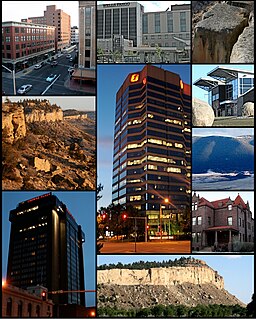
Billings is the largest city in the U.S. state of Montana, with a population estimated at 109,642 as of 2017. Located in the south-central portion of the state, it is the seat of Yellowstone County and the principal city of the Billings Metropolitan Area, which has a total a population of 170,498. It has a trade area of over 500,000.

Bristow is a city in Creek County, Oklahoma, United States. The population was 4,222 at the 2010 census, down 2.4 percent from 4,325 at the 2000 census.

Drumright is a city in Creek and Payne counties in the U.S. state of Oklahoma. It began as an oil boom town. However, the population has declined as oil production has waned in the area. The population was 2,907 at the 2010 census, almost unchanged from 2,905 at the 2000 census. Drumright and nearby Cushing were at the center of a large, productive oilfield in the 1910s and 1920s.

The Yellowstone River is a tributary of the Missouri River, approximately 692 miles (1,114 km) long, in the western United States. Considered the principal tributary of the upper Missouri, the river and its tributaries drain a wide area stretching from the Rocky Mountains in the vicinity of the Yellowstone National Park across the mountains and high plains of southern Montana and northern Wyoming.

The Clark Fork, or the Clark Fork of the Columbia River, is a river in the U.S. states of Montana and Idaho, approximately 310 miles (500 km) long. The largest river by volume in Montana, it drains an extensive region of the Rocky Mountains in western Montana and northern Idaho in the watershed of the Columbia River. The river flows northwest through a long valley at the base of the Cabinet Mountains and empties into Lake Pend Oreille in the Idaho Panhandle. The Pend Oreille River in Idaho, Washington, and British Columbia, Canada which drains the lake to the Columbia in Washington, is sometimes included as part of the Clark Fork, giving it a total length of 479 miles (771 km), with a drainage area of 25,820 square miles (66,900 km2). In its upper 20 miles (32 km) in Montana near Butte, it is known as Silver Bow Creek. Interstate 90 follows much of the upper course of the river from Butte to northwest of Missoula. The highest point within the river's watershed is Mount Evans at 10,641 feet (3,243 m) in Deer Lodge County, Montana along the Continental Divide.

Bannack is a ghost town in Beaverhead County, Montana, United States, located on Grasshopper Creek, approximately 11 miles (18 km) upstream from where Grasshopper Creek joins with the Beaverhead River south of Dillon. Founded in 1862, the town contemporarily operates as a National Historic Landmark and is managed by the state of Montana as Bannack State Park.

Traveler's Rest was a stopping point of the Lewis and Clark Expedition, located about one mile south of Lolo, Montana. The expedition stopped from September 9 to September 11, 1805, before crossing the Bitterroot Mountains, and again on the return trip from June 30 to July 3, 1806. Traveler's Rest is at the eastern end of the Lolo Trail. It was declared a National Historic Landmark in 1960 and added to the National Register of Historic Places in 1966. The boundaries were subsequently revised, and mostly lie within the 51-acre (21 ha) Traveler's Rest State Park, which is operated by the Montana Fish, Wildlife & Parks. Significant archeological findings made in 2002, including latrine sites with traces of mercury and fire hearths, make this the only site on the Lewis and Clark National Historic Trail that has yielded physical proof of the explorers' presence. Records made by Lewis and Clark often spell "Traveler's" as "Traveller's". This spot is largely unchanged from the days of Lewis and Clark. From this location, Lewis and Clark split up to explore Montana during their return trip, not reuniting until they reached Sanish, North Dakota.

The Williston Basin is a large intracratonic sedimentary basin in eastern Montana, western North Dakota, South Dakota, and southern Saskatchewan, that is known for its rich deposits of petroleum and potash. The basin is a geologic structural basin but not a topographic depression; it is transected by the Missouri River. The oval-shaped depression extends approximately 475 miles (764 km) north-south and 300 miles (480 km) east-west.

The Bakken Formation is a rock unit from the Late Devonian to Early Mississippian age occupying about 200,000 square miles (520,000 km2) of the subsurface of the Williston Basin, underlying parts of Montana, North Dakota, Saskatchewan and Manitoba. The formation was initially described by geologist J.W. Nordquist in 1953. The formation is entirely in the subsurface, and has no surface outcrop. It is named after Henry Bakken, a farmer in Tioga, North Dakota, who owned the land where the formation was initially discovered, during drilling for oil.

The history of Idaho in the American Civil War is atypical, as the territory was far from the battlefields.

Teapot Rock is a distinctive sedimentary rock formation in Natrona County, Wyoming that lent its name to a nearby oil field that became notorious as the focus of a bribery scandal during the Presidential administration of Warren G. Harding, the Teapot Dome scandal. The site was listed on the National Register of Historic Places in 1974.
Cat Creek is an unincorporated community in eastern Petroleum County, Montana, United States.


