Chengwatana, Minnesota

Last updated

Chengwatana
USA Minnesota location map.svg
Red pog.svg
Chengwatana
Usa edcp location map.svg
Red pog.svg
Chengwatana
Coordinates: 45°50′19″N92°56′15″W / 45.83861°N 92.93750°W / 45.83861; -92.93750
Country United States
State Minnesota
County Pine
Time zone UTC-6 (Central (CST))
  Summer (DST) UTC-5 (CDT)
Area code 320
GNIS feature ID649445 [1]

Chengwatana is an abandoned village site in Pine County, Minnesota, United States.

Contents

The former village was located immediately east of Pine City. The center of the village was generally considered near the present day intersection of Cross Lake Road (Pine County 9) and Government Road.

History

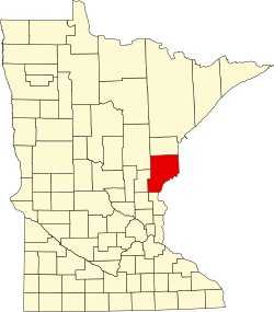
Chengwatana was an Ojibwa village, located along the lower course of the Snake River, Minnesota. Its name in Ojibwe was Zhingwaadena, a contraction of Zhingwaak-oodena or "White-Pine Town"; English uses the French transcription of the Ojibwe. After statehood of Wisconsin in 1848, the transient village became a permanent village located at the outlet of Cross Lake, on its south eastern shore, at the beginning of the lower course of the Snake River, named Snake River Dam. Elam Greeley, a lumberman, co-founder of Stillwater, and member of the Minnesota Territorial Legislature whom Greeley [2] is named after, owned the Chengwatana toll dam at the outlet of Cross Lake.

Elam Greeley ElamGreeley1852.jpg
Elam Greeley

On March 1, 1856, with very informal ceremony, the village was officially named as the County Seat of Pine County and the village was renamed Alhambra by Judd, Walker and Company and Daniel G. Robertson; however, this name was not very well accepted. In 1857, Alhambra was renamed as Chengwatana. When the Point Douglas to Superior Military Road, also known as "Douglas Highway," was constructed between the modern cities of Hastings, Minnesota and Superior, Wisconsin to replace the Kettle River Trail that connected the modern cities of Fridley, Minnesota with Moose Lake, Minnesota, the new road was designed to pass through Chengwatana. The village was garrisoned as a frontier military post, 1862-1863. A post office operated in the village until 1873.

When the railroad was constructed on the western shore of Cross Lake, a new village, Pine City, was platted — Pine City's name being a loose English translation of Chengwatana. In addition, Chengwatana and Pine City Townships were also named after the village of Chengwatana. With the railroad, Chengwatana declined into a ghost town. The county seat was transferred to Pine City in 1870.

A historical marker was placed at the former village site, simply stating its location, while a detailed historical marker noting Chengwatana and its relationship to the city of Pine City was placed along the railroad bridge crossing the Snake River in Pine City.

Related Research Articles

Chengwatana Township is a township in Pine County, Minnesota, United States. The population was 809 at the 2000 census. Chengwatana Township was organized in 1874. Its name is derived from the Ojibwe Zhingwaadena, applied originally to an Ojibwe village located at the confluence of the Snake River with the St. Croix River. Neighbouring Pine City Township and the City of Pine City get their names from the English translation of Chengwatana.

<span class="mw-page-title-main">Pine City, Minnesota</span> City in Minnesota, United States

Pine City is a city in and the county seat of Pine County, in east central Minnesota, United States. The population was 3,130 at the 2020 census. Part of the city is on the Mille Lacs Indian Reservation. Founded as a railway town, it soon became a logging community and the surrounding lakes made it a resort town. Today, it is in part as a commuter town for people working in the Minneapolis–Saint Paul metropolitan area.

<span class="mw-page-title-main">Willow River, Minnesota</span> City in Minnesota, United States

Willow River is a city in Pine County, Minnesota, United States, at the confluence of the Kettle and Willow Rivers. The population was 415 at the 2010 census.

<span class="mw-page-title-main">St. Croix River (Wisconsin–Minnesota)</span> River in Wisconsin and Minnesota, United States

The St. Croix River is a tributary of the Mississippi River, about 169 mi (272 km) long, in the U.S. states of Wisconsin and Minnesota. The lower 125 mi (201 km) of the river form the border between Wisconsin and Minnesota. The river is a National Scenic Riverway under the protection of the National Park Service. A hydroelectric plant at the Saint Croix Falls Dam supplies power to the Minneapolis–Saint Paul metropolitan area.

Nokomis is the name of Nanabozho's grandmother in the Ojibwe traditional stories and was the name of Hiawatha's grandmother in Henry Wadsworth Longfellow's poem, The Song of Hiawatha, which is a re-telling of the Nanabozho stories. Nokomis is an important character in the poem, mentioned in the familiar lines:

The St. Croix Chippewa Indians are a historical Band of Ojibwe located along the St. Croix River, which forms the boundary between the U.S. states of Wisconsin and Minnesota. The majority of the St. Croix Band are divided into two groups: the federally recognized St. Croix Chippewa Indians of Wisconsin, and the St. Croix Chippewa Indians of Minnesota, who are one of four constituent members forming the federally recognized Mille Lacs Band of Ojibwe. The latter is one of six bands in the federally recognized Minnesota Chippewa Tribe.

The Mille Lacs Indians, also known as the Mille Lacs and Snake River Band of Chippewa, are a Band of Indians formed from the unification of the Mille Lacs Band of Mississippi Chippewa (Ojibwe) with the Mille Lacs Band of Mdewakanton Sioux (Dakota). Today, their successor apparent Mille Lacs Band of Ojibwe consider themselves as being Ojibwe, but many on their main reservation have the ma'iingan (wolf) as their chief doodem (clan), which is an indicator of Dakota origins.

<span class="mw-page-title-main">Wild River State Park</span> State park in Minnesota, United States

Wild River State Park is a state park of Minnesota, United States, curving along 18 miles (29 km) of the St. Croix River. This long, narrow park is shaped somewhat like a sideways 'S', with development largely concentrated in the lower third. The remote upper sections flank the mouth of a tributary called the Sunrise River. The park is managed to provide quieter, more nature-oriented recreation as a counterpoint to the busier William O'Brien and Interstate State Parks downstream.

<span class="mw-page-title-main">Interstate Park</span> United States historic place

Interstate Park comprises two adjacent state parks on the Minnesota–Wisconsin border, both named Interstate State Park. They straddle the Dalles of the St. Croix River, a deep basalt gorge with glacial potholes and other rock formations. The Wisconsin park is 1,330 acres (538 ha) and the Minnesota park is 298 acres (121 ha). The towns of Taylors Falls, Minnesota and St. Croix Falls, Wisconsin are adjacent to the park. Interstate Park is within the Saint Croix National Scenic Riverway and the Ice Age National Scientific Reserve. The western terminus of the Ice Age National Scenic Trail is on the Wisconsin side. On the Minnesota side, two areas contain National Park Service rustic style buildings and structures that are listed on the National Register of Historic Places.

<span class="mw-page-title-main">Snake River (St. Croix River tributary)</span> River in Minnesota, United States

The Snake River is a 104-mile-long (167 km) tributary of the St. Croix River in east-central Minnesota in the United States. It is one of three streams in Minnesota with this name. Its name is a translation from the Ojibwa Ginebigo-ziibi, after the Dakota peoples who made their homes along this river. Kanabec County's name is derived from the Ojibwe word for this river.

<span class="mw-page-title-main">Namekagon River</span> River in Wisconsin, United States

The Namekagon River is a tributary of the St. Croix River. It is 101 miles (163 km) long and is located in northwestern Wisconsin in the United States. Its course is protected as part of the St. Croix National Scenic Riverway.

<span class="mw-page-title-main">Nemadji River</span> River in Minnesota and Wisconsin, United States

The Nemadji River is a river rising in Pine County, Minnesota, United States, which flows through Carlton County, Minnesota, and Douglas County, Wisconsin, to Lake Superior. The river is 70.8 miles (113.9 km) long measured from its source in Maheu Lake in Pine County, and 34.9 miles (56.2 km) from its confluence with the South Fork in Carlton County just east of the Minnesota-Wisconsin border. The Nemadji River empties into Lake Superior in an industrial neighborhood at Allouez Bay in the city of Superior's east-side neighborhood of Allouez and Wisconsin Point.

Lake Lena is an unincorporated community and Native American village in Ogema Township, Pine County, Minnesota, United States, located along the Lower Tamarack River. It currently is the administrative center for the Mille Lacs Indian Reservation, District III.

Pokegama is an unincorporated community in Pokegama Township, Pine County, Minnesota, United States; along the southern shores of Pokegama Lake. Its name in Ojibwe is Bakegamaang, meaning "at the side-lake", referring to Pokegama Lake's position to the Snake River.

French River is an unincorporated community in Duluth Township, Saint Louis County, Minnesota, United States; located on the North Shore of Lake Superior.

<span class="mw-page-title-main">Poplar River (Lake Superior)</span> River in Minnesota, United States

The Poplar River is a river in northeastern Minnesota that drains into Lake Superior.

The Chengwatana State Forest is a state forest located in Pine and Chisago counties in Minnesota. Its name is derived from the Ojibwe: Zhingwaadena, meaning white-pine town, after the nearby ghost town and township. Eastern White Pine was historically the dominant tree species in the surrounding forest prior to intensive logging at the end of the nineteenth century.

Point Douglas to Superior Military Road, also known as Point Douglas to St. Louis River Military Road was a road that ran between Point Douglas, located at the outlet of the Lower St. Croix Lake near Hastings, Minnesota, first to the falls of the St. Louis River near Thomson, Minnesota, and later extended to the mouth of the St. Louis River in Superior, Wisconsin. From Douglas Point immediately east of Hastings, Minnesota, the route connected Stillwater, Taylors Falls, Sunrise, Chengwatana, Fortuna, Scotts Corner, to Thomson and Superior. Several discontinuous sections of this road are still in use.

<span class="mw-page-title-main">Gooseberry River</span> River in Minnesota, United States

Gooseberry River is a 23-mile stream in Lake County, Minnesota, USA, draining into Lake Superior. It is known for its waterfalls, near its mouth in Gooseberry Falls State Park. The Gooseberry, like many of its neighboring streams, has an irregular discharge highly dependent on runoff from rain and snow melt. The region around the river was heavily forested and much logging took place during the early 20th century. The forest has since regrown and the falls and mouth of the river are now a thriving tourist destination.

Greeley is an unincorporated community in Royalton Township, Pine County, Minnesota, United States.

References

  1. "US Board on Geographic Names". United States Geological Survey. October 25, 2007. Retrieved January 31, 2008.
  2. Greeley, Elam, Minnesota Legislative Reference Library, Accessed December 5, 2010.

Further reading