The Jakarta metropolitan area or Greater Jakarta, known locally as Jabodetabekpunjur is the most populous megapolitan area in Indonesia. It includes the national capital as well as five satellite cities and three complete regencies. The original term "Jabotabek" dated from the late 1970s and was revised to "Jabodetabek" in 1999 when "De" was inserted into the name following its formation. The term "Jabodetabekjur" or "Jabodetabekpunjur" was legalised on the Presidential Regulation Number 54 of 2008, and then the name "Jabodetabekpunjur" is officially used.

Transjakarta or Jakarta BRT is a bus rapid transit (BRT) system in Jakarta, Indonesia. The first BRT system in Southeast Asia, it commenced operations on 15 January 2004 to provide a fast public transport system to help reduce rush hour traffic. The system is considered as the first revolutionary public transit mode in the capital city of Indonesia. The buses run in dedicated lanes (busways), and ticket prices are subsidised by the regional government. Transjakarta has the world's longest BRT system, which operates about 4,300 buses. Transjakarta aims to have 50 percent of its fleet be electric buses by 2027. By 2030, the aim is for the entire Transjakarta ecosystem to use electric buses. As of November 2023, it serves an average of 1.134 million passengers daily.
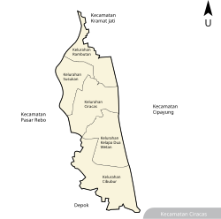
Pasar Rebo is a district (kecamatan) of East Jakarta, Indonesia. The boundaries of Pasar Rebo District are the Ciliwung to the west and north; and Bogor Raya Road and Cipinang River to the east. The city of Depok is located to the south of Pasar Rebo District.

Pondok Indah is an upscale residential area in Pondok Pinang, Kebayoran Lama, South Jakarta, Indonesia. It is one of the most prestigious suburb areas in Jakarta, and even in Indonesia. Pondok Indah is a much sought-after suburb by expatriates, conglomerates, celebrities, and government officials.

The Jakarta Mass Rapid Transit or Jakarta MRT is a rapid transit system in Jakarta, the largest metropolis of Indonesia.

Jatinegara Station (JNG) is a large type A-class railway station located on the border between Jatinegara and Matraman in Pisangan Baru Subdistrict, Matraman, East Jakarta. The station is the main entrance to Jakarta from cities east of Jakarta. Jatinegara station is operated by Kereta Api Indonesia and KAI Commuter.
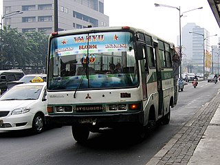
Koperasi Angkutan Jakarta or Kopaja was a cooperative established in 1971 to provide public transport services in Jakarta. There were reportedly over 1,400 minibuses in the Kopaja fleet in mid-2012, more than half of which were estimated to be over 20 years old.

Jalan M.H. Thamrin or Jalan Thamrin is a major thoroughfare in Jakarta, Indonesia. The road is located at the center of Jakarta, running from the north end of Jalan Jenderal Sudirman at West Flood Canal at the south end to the roundabout near Arjuna Wijaya Statue Jakarta at the north end. Developed in the 1950s, the road was a landmark of post-colonial Indonesia and continues to have a prominent importance in Jakarta.

The MetroMini minibus system was a major part of the public transport system of Jakarta. There were reportedly over 3,000 buses in the MetroMini fleet in mid-2012. The buses are similar to the parallel Kopaja system which also provides transport services, on different routes, across Jakarta. The distinctive MetroMini buses are orange and blue with a white stripe running along the length of the bus. Buses provide seating for around 20-30 people with, often, an equal number crammed into limited standing room so the buses are often overcrowded. But at 2015 Jakarta Governor Basuki Tjahaja Purnama stopped all of MetroMini's bus operations because of a MetroMini vs KRL Commuter Line crash. If MetroMini wants to operate again, it has to join Transjakarta like the Kopaja as a feeder bus. Many routes are/will replaced/replaced by Minitrans and Metrotrans buses.

The Jabodebek LRT or Greater Jakarta LRT is a light rapid transit system in Greater Jakarta, the capital city of Indonesia, as well as the adjacent areas of West Java, within the Jakarta Metropolitan area. It was implemented by the central government, and operated by Kereta Api Indonesia (KAI), the system connects the Jakarta city center with suburbs in Greater Jakarta such as Bogor, Depok and Bekasi, hence its acronym Jabodebek.

Jalan Jenderal Gatot Subroto(Gatot Subroto Avenue) is one of the major roads in Jakarta, Indonesia. The road starts from Dirgantara statue in South Jakarta, which crosses 10 administrative villages and ends at Slipi, Central Jakarta. The road is named after National Hero of Indonesia General Gatot Subroto. The road was constructed in 1960s. The road runs parallel with Jakarta Inner Ring Road. The location of the road is within the Golden Triangle CBD of Jakarta. Many important office buildings and skyscrapers are situated along the road.

BNI City station is a station for the Soekarno-Hatta Airport Rail Link and KAI Commuter service. Bank Negara Indonesia (BNI) holds the naming rights for the station, which was known as Sudirman Baru station during construction period. The station is located in Central Jakarta, on the north bank of West Flood Canal, about a hundred meters from Sudirman Commuter Rail station. The station is part of Dukuh Atas TOD.

As a metropolitan area of about 30 million people, Jakarta has a variety of transport systems. Jakarta was awarded 2021 global Sustainable Transport Award (STA) for integrated public transportation system.

The Jakarta Light Rapid Transit or Jakarta LRT is one of the light rapid transit systems in Jakarta, the capital city of Indonesia. It is conceived and built by the Jakarta provincial government. The first phase of the LRT, from Velodrome to Pegangsaan Dua, began commercial operations on 1 December 2019.

Jak Lingko is a public transport integration program designed to integrate payment and physical connection between transport modes in Jakarta. The integration includes BRT, Commuter rail, Light Metro, MRT, LRT, Airport rail link and local angkot (Mikrotrans).

Halim Station is a railway station complex located on Makasar, East Jakarta, Jakarta, Indonesia. The complex serves the Jakarta-Bandung high-speed railway of Kereta Cepat Indonesia China (KCIC) and the Jabodebek LRT Bekasi Line of Kereta Api Indonesia (KAI). The complex consists of two separate elevated stations connected via pedestrian bridge.

The TransJakarta Corridor 7 is a bus rapid transit corridor in East Jakarta, Jakarta, Indonesia, operated by TransJakarta. It connects the Kampung Rambutan Bus Terminal in Ciracas to the Kampung Melayu Bus Terminal in Jatinegara. The streets that passed by corridor 7 are Gedong Timur/Barat, Raya Bogor, Mayjen Sutoyo, MT Haryono, and Otto Iskandardinata streets. This corridor is the only TransJakarta corridor that is not integrated with the KRL Commuterline system, because the distance between the Kampung Melayu station and the nearest Commuterline station, Tebet, is quite far.

Dukuh Atas LRT Station is a light rail station located within the Dukuh Atas TOD in Jalan Setia Budi Tengah, Kuningan Timur, Setiabudi, South Jakarta, Jakarta, Indonesia. The station, which is located at an altitude of +27.9 meters, serves the Cibubur and Bekasi lines of the Jabodebek LRT system.