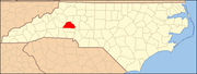
Catawba County is a county in the U.S. state of North Carolina. As of the 2020 census, the population was 160,610. Its county seat is Newton, and its largest community is Hickory.

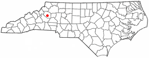
Bethlehem is a census-designated place (CDP) in Alexander County, North Carolina, United States. The population was 4,214 at the 2010 census. It is part of the Hickory–Lenoir–Morganton Metropolitan Statistical Area.

Connelly Springs is a town in Burke County, North Carolina, United States. The population was 1,669 at the 2010 census. It is part of the Hickory–Lenoir–Morganton Metropolitan Statistical Area.

Hildebran is a town in Burke County, North Carolina, United States. The population was 2,023 at the 2010 census. It is part of the Hickory-Lenoir-Morganton Metropolitan Statistical Area.

Valdese is a town in Burke County, North Carolina, United States. The population was 4,689 at the 2020 census. It is part of the Hickory-Lenoir-Morganton Metropolitan Statistical Area. One of the largest Waldensian congregations in the United States was founded in the town in the late nineteenth century, now known as the Waldensian Presbyterian Church. The town was settled by immigrants from the Cottian Alps in the Piedmont region of Italy.
Gamewell is a town in Caldwell County, North Carolina, United States. The population was 4,051 at the 2010 census. It is part of the Hickory–Lenoir–Morganton Metropolitan Statistical Area.

Granite Falls is a town in Caldwell County, North Carolina, United States. The population was 4,722 at the 2010 census. It is part of the Hickory–Lenoir–Morganton Metropolitan Statistical Area.
Northlakes is a census-designated place (CDP) in Caldwell County, North Carolina, United States. It is part of the Hickory–Lenoir–Morganton Metropolitan Statistical Area.

Brookford is a town in Catawba County, North Carolina, United States. The population was 442 at the 2020 census. It is part of the Hickory–Lenoir–Morganton Metropolitan Statistical Area. The Town of Brookford was incorporated March 1, 1907. Brookford began as a mill village, deriving its name from the combination of the two owner's names Holbrook and Shuford. The town has 4.56 miles of roadage.

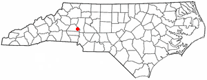
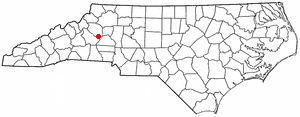
Catawba is a town in Catawba County, North Carolina, United States. The population was 603 at the 2010 census. It is part of the Hickory–Lenoir–Morganton Metropolitan Statistical Area. As with the county, the name recalls the Catawba people, the indigenous people who once inhabited the area.

Conover is a city in Catawba County, North Carolina, United States. The population was 8,421 as of the 2020 census. It is part of the Hickory–Lenoir–Morganton Metropolitan Statistical Area and Charlotte Metropolitan Area.
Lake Norman of Catawba is a census-designated place (CDP) in Catawba County, North Carolina, United States. The population was 8,658 at the 2020 census up from 7,411 at the 2010 census. It is part of the Hickory-Lenoir-Morganton Metropolitan Statistical Area.

Mountain View is a census-designated place (CDP) in Catawba County, North Carolina, United States. The population was 3,552 at the 2010 census. It is part of the Hickory–Lenoir–Morganton Metropolitan Statistical Area.

Newton is a city in Catawba County, North Carolina, United States. As of the 2010 census, the city had a population of 12,968. It is the county seat of Catawba County. Newton is part of the Hickory–Lenoir–Morganton Metropolitan Statistical Area.
Sherrills Ford is an unincorporated community and former census-designated place (CDP) in Catawba County, North Carolina, United States. Since the 2010 census, it has been included within the Lake Norman of Catawba CDP. It is part of the Hickory-Lenoir-Morganton Metropolitan Statistical Area.

St. Stephens is a census-designated place (CDP) in Catawba County, North Carolina, United States. The population was 8,759 at the 2010 census, down from 9,439 in 2000. It is part of the Hickory–Lenoir–Morganton Metropolitan Statistical Area.
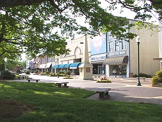
Hickory is a city in North Carolina primarily located in Catawba County and is the 25th most populous city in North Carolina. It is located approximately 60 miles (97 km) northwest of Charlotte. Hickory's population in the 2022 United States Census Bureau estimate was 44,084. Hickory is the main city of the Hickory–Lenoir–Morganton Metropolitan Statistical Area, which had a population of 368,347 in the 2022 census.

Long View is a town in Burke and Catawba counties in the U.S. state of North Carolina. The population was 4,871 at the 2010 census. It is part of the Hickory–Lenoir–Morganton Metropolitan Statistical Area.
Rhodhiss is a town in Caldwell and Burke counties in the U.S. state of North Carolina. The population was 1,070 at the 2010 census, up from 366 in 2000. It is part of the Hickory–Lenoir–Morganton Metropolitan Statistical Area.
Maiden is a town in Catawba and Lincoln counties in the U.S. state of North Carolina. The population was 3,310 at the 2010 census.