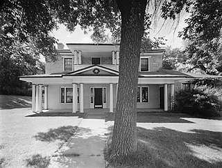
Colorado City is a town in Mohave County, Arizona, United States, and is located in a region known as the Arizona Strip. As of the 2020 census, the population of the town was 2,478, down from 4,821 in 2010. At least three Mormon fundamentalist sects are said to have been based there. A majority of residents and many local officials belong to the most prominent of these sects, the Fundamentalist Church of Jesus Christ of Latter-Day Saints, whose corporation also owned much of the land within and around the town until state intervention in the 2000s.

Sherman Township is a civil township of Huron County in the U.S. state of Michigan. The population was 1,083 at the 2010 census.

Allouez Township is a civil township of Keweenaw County in the U.S. state of Michigan. The population was 1,340 at the 2020 census.

Manitou Beach–Devils Lake is a census-designated place (CDP) in Lenawee County in the U.S. state of Michigan. The population of the CDP was 2,032 at the 2020 census. It is located within Rollin Township to the south and Woodstock Township to the north.
West Union is a town in Steuben County, New York, United States. The population was 343 as of the 2020 decennial census.

Highlands is a census-designated place (CDP) located along the Union Pacific Railroad, north of Interstate 10 and west of Farm to Market Road 2100, in an industrialized area of unincorporated Harris County, Texas, United States. The population was 8,612 at the 2020 census.

Arkansaw is an unincorporated census-designated place in the eastern portion of the town of Waterville, in Pepin County, Wisconsin, United States. Located approximately 3 miles (4.8 km) west of Durand, it has the ZIP code of 54721. As of the 2010 census, its population was 177. From 1881 to 1886, the community was the county seat of Pepin County.
Centennial Park is an unincorporated community and census-designated place (CDP) in Mohave County, Arizona, United States. The population was 1,578 at the 2020 census, up from 1,264 at the 2010 census. It is the central location for the Centennial Park group, a fundamentalist Mormon group.

Buford is an unincorporated community and census-designated place in central Clay Township, Highland County, Ohio, United States. The population was 306 at the 2020 census. It once had a post office, with the ZIP code 45110. The current ZIP code 45171 is for nearby Sardinia.
Hanna is an unincorporated community in western Duchesne County, Utah, United States, on the Uintah and Ouray Indian Reservation.
Freedom is an unincorporated community in both northeastern Caribou County, Idaho, and northwestern Lincoln County, Wyoming, in the United States; the Wyoming portion of the community is also a census-designated place (CDP). The population was 247 at the 2020 census.
Carlsbad is a census-designated place and unincorporated community in northwest Tom Green County, Texas, United States. It lies along U.S. Route 87 northwest of the city of San Angelo, the county seat of Tom Green County. Its elevation is 2,024 feet (617 m). Although Carlsbad is unincorporated, it has a post office, with the ZIP code of 76934; the ZCTA for ZIP Code 76934 had a population of 1,332 at the 2000 census.

Kearsarge is an unincorporated community in Calumet Township, Houghton County in the U.S. state of Michigan. It is approximately 2 miles (3.2 km) northeast of Calumet/Laurium on U.S. Route 41/M-26 at 47°16′30″N88°24′58″W.

Fairfield Township is a civil township of Lenawee County in the U.S. state of Michigan. As of the 2000 census, the township population was 1,756.
Abrams is an unincorporated community census-designated place located in the town of Abrams, Oconto County, Wisconsin, United States. Abrams is located near U.S. Route 41 and U.S. Route 141 8 miles (13 km) south-southeast of Oconto Falls. Abrams has a post office with ZIP code 54101. As of the 2020 census, its population was 358.

The Hampton's Ford Stage Stop and Barn is a historic district in northeastern Box Elder, Utah, United States, that is listed on the National Register of Historic Places.
Linwood is a hamlet and census-designated place (CDP) in the town of York, Livingston County, New York, United States. Its population was 74 as of the 2010 census. Linwood had a post office until February 6, 1993; it still has its own ZIP code, 14486.

Sparrow Bush is a hamlet in the town of Deerpark, in Orange County, New York, United States. The population as of the 2020 census is 981. The community is located along state routes 42 and 97, 2.3 miles (3.7 km) northwest of Port Jervis. Sparrow Bush has a post office with ZIP code 12780. The community is named after Henry L. Sparrow who owned a large piece of woodland near the D&H canal.The locals started to call this piece of land Sparrow's “Bosh” and Sparrow's “Bosk”. Over time the name of the town gradually evolved into Sparrow bush.

Upalco is an unincorporated community in eastern Duchesne County, Utah, United States.


