Comanche Springs (Texas)

Last updated

Comanche Springs
Fort Stockton Spring. (6756830455).jpg
Comanche Springs (Texas)
Name originAwache (Wide Water)
Location Fort Stockton, Pecos County, Texas
Coordinates 30°52′54″N102°52′44″W / 30.88167°N 102.87889°W / 30.88167; -102.87889 (Comanche Springs)
Spring source Edwards Aquifer
Elevation2,940 feet (896.1 m)
Type Artesian aquifer
Provides water for Rio Grande
USA Texas location map.svg
Red pog.svg
Usa edcp location map.svg
Red pog.svg

Comanche Springs was an aquifer of six artesian springs geographically located between the Edwards Plateau and the Trans-Pecos regions of West Texas. [1] [2] The military fortification Camp Stockton was built around the springs, eventually growing become the city of Fort Stockton.

Contents

The groundwater source originated from a Comanchean limestone fault combined within the bountiful Edwards Aquifer and the Glass Mountains. [3] [4] The natural spring has a physical geography routing north through Comanche Creek forming a confluence with Leon Creek and the Pecos River. [5] The alluvial river is a tributary to the Rio Grande.

History

Rio Grandé and Spanish expeditions

Comanche Springs served as an oasis with inhabitants dating to the Pre-Columbian era by the Jumano Indians. [6] Álvar Núñez Cabeza de Vaca scouted the Rio Grande region in 1536. [7] Fernando del Bosque explored the Rio Grandé area for Franciscans missionary districts in 1675 while Juan Domínguez de Mendoza lodged near the spring waters in the late 17th century. [8] [9] [10]

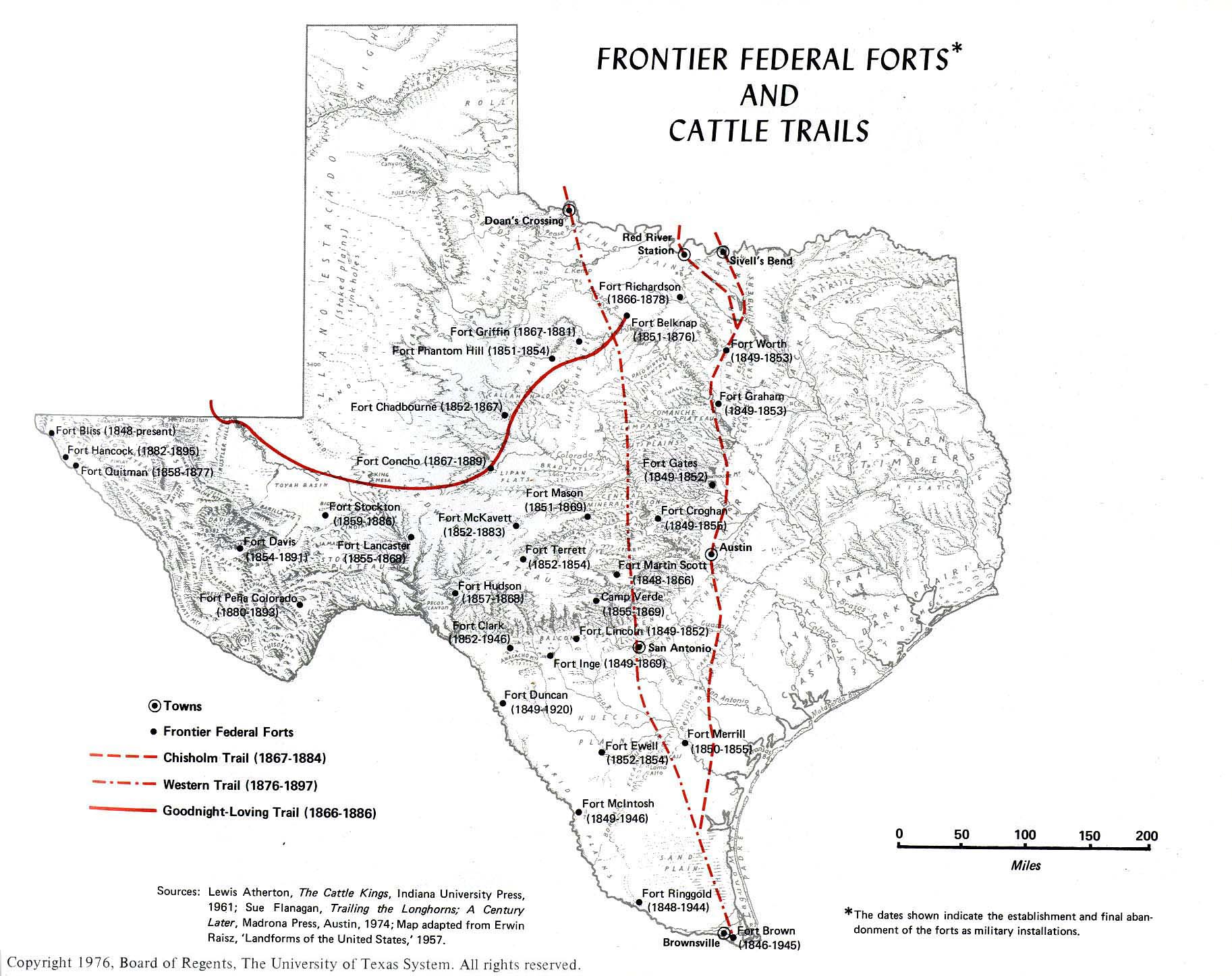
Forts and west frontier

On March 23, 1859, the Camp Stockton fortification was established in the Trans-Pecos region. [11] [12] The garrison served as cantonment for the United States Cavalry warding off Plains Indians seeking to disrupt and raid the American pioneer, Butterfield Overland Mail, Concord stagecoach, covered wagon, Old San Antonio Road, Old Spanish Trail, San Antonio-El Paso Road, San Antonio–San Diego Mail Line, and wagon trains. [13] [14] [15] [16] [17]

Nomadic culture of Plains Indians

Silhouette Sculpture on Trans-Pecos Plains Ft Stockton Sculpture on I-10 - panoramio.jpg
Silhouette Sculpture on Trans-Pecos Plains

The Apache, Comanche, and Kiowa visited the water basin frequently during bison and Colonial Spanish horse hunts, Comanche-Mexico War skirmishes, and Mexican Indian Wars in Northern Mexico. [18] The Comanche Trail permitted the nomadic migration of Native Americans to the West Texas desert climate during the Northern Hemisphere winter solstice. [19] The long-distance trail encompassed regional spring waters of Texas Big Bend Country given the horseback riding distance from the Staked Plains to Big Spring, Horsehead Crossing, Tunas Springs, Glenn Springs, San Vicente, Las Moras Springs, and Rio Grandé located within Big Bend National Park.

Irrigation of arid lands

Beginning in 1875, Comanche Springs was incorporated into an agricultural irrigation district resulting in the hydrological regression of the natural springs in the Chihuahuan Desert domain. [20] The Belding territory, located 11 miles (18 km) southwest of Comanche Springs, was a thriving agricultural development requiring voluminous water reserves. [21] The 6,000 acres (2,400 ha) to 7,000 acres (2,800 ha) irrigation demand lead to the overdrafting of the natural springs aquifer diminishing the Trans-Pecos water table. [22]

U.S. federal laws for arid lands irrigation

U.S. Congressional legislation for irrigation of the State of Texas arid lands.

Date of EnactmentPublic Law NumberU.S. Statute CitationU.S. Legislative BillU.S. Presidential Administration
June 12, 1906P.L. 59-22534  Stat.   259 H.R. 14184Theodore Roosevelt
August 11, 1916P.L. 64-19639  Stat.   506a H.R. 12365Woodrow Wilson
October 6, 1917Public Resolution 65-1440  Stat.   426 S.J.Res. 89Woodrow Wilson
June 18, 1926P.L. 69-40444  Stat.   753 H.R. 3862Calvin Coolidge
May 28, 1928P.L. 70-55645  Stat.   785 H.R. 11471Calvin Coolidge
February 20, 1958P.L. 85-33372  Stat.   17 S.J.Res. 39Dwight Eisenhower

Case law of Texas Rio Grandé and Trans-Pecos

Historical record

Comanche Springs received a Texas historic marker in 1968. [23]

Illustrations

See also

Balcones Fault Hydrology
Climate of Texas Newlands Reclamation Act
Coahuiltecan Rio Grande Project
Comanche Springs pupfish Riparian zone
Comancheria Salt Cedar
Desert climate Spanish colonization of the Americas
Embudo Stream Gauging Station Texas–Indian wars
Geography of Texas United States Bureau of Reclamation
Groundwater recharge Water cycle

References

  1. "Plateaus and Canyonlands". Texas Beyond History. University of Texas at Austin.
  2. "Trans Pecos Mountains & Basins". Texas Beyond History. University of Texas at Austin.
  3. "Edwards Aquifer Recharge Zone Geologic Map, South-Central Texas", U.S. Geological Survey, U.S. Department of the Interior
  4. "Glass Mountains". TSHA Handbook of Texas Online. Texas State Historical Association.
  5. U.S. Geological Survey Geographic Names Information System: Comanche Springs
  6. "Who were the Jumano?". Texas Beyond History. University of Texas at Austin.
  7. Chipman, Donald E. "Álvar Núñez Cabeza de Vaca". TSHA Handbook of Texas Online. Texas State Historical Association.
  8. Chipman, Donald E. "Fernando del Bosque". TSHA Handbook of Texas Online. Texas State Historical Association.
  9. Weddle, Robert S. "Juan Domínguez de Mendoza". TSHA Handbook of Texas Online. Texas State Historical Association.
  10. "The Gateway Missions". Texas Beyond History. University of Texas at Austin.
  11. "Frontier Federal Forts and Cattle Trails". Perry-Castañeda Library Map Collection. University of Texas at Austin. 1976.
  12. "U.S. Army on the Texas Frontier". Texas Beyond History. University of Texas at Austin.
  13. Richardson, Rupert N. (June 12, 2010). "Butterfield Overland Mail". Handbook of Texas Online. Texas State Historical Association.
  14. "Old San Antonio Road". Handbook of Texas Online. Texas State Historical Association. June 15, 2010.
  15. Fossey, Will (June 15, 2010). "Old Spanish Trail". Handbook of Texas Online. Texas State Historical Association.
  16. Austerman, Wayne R. (June 15, 2010). "San Antonio-El Paso Mail". Handbook of Texas Online. Texas State Historical Association.
  17. Stever, Rex H. (June 15, 2010). "Stagecoach Lines". Handbook of Texas Online. Texas State Historical Association.
  18. Wallace, Ernest; Hoebel, E. Adamson (1952). "The Horse and The Buffalo". The Comanches: Lords of the South Plains. The Civilization of the American Indian. Vol. 34. Norman, Oklahoma: University of Oklahoma Press. pp. 33–66. ISBN   978-0806102498. OCLC   1175397.{{cite book}}: ISBN / Date incompatibility (help)
  19. Dial, Steve. "The Passing of the Indian Era". Texas Beyond History. University of Texas at Austin.
  20. Kaiser, Ronald (July 2005). "Who Owns the Water?" [The State of Springs]. Texas Parks and Wildlife Magazine. Austin, Texas: Texas Parks and Wildlife Department.
  21. Justice, Glenn. "Belding, Texas". Handbook of Texas Online. Texas State Historical Association.
  22. Bloodworth, Morris E.; Gillett, Paul T. "Irrigation". Handbook of Texas Online. Texas State Historical Association.
  23. "Site of Comanche Springs — Pecos County - Marker Number: 4757". Texas Historic Sites Atlas. Texas Historical Commission. 1968.

Historical video archive