Related Research Articles

Wickliffe Mounds is a prehistoric, Mississippian culture archaeological site located in Ballard County, Kentucky, just outside the town of Wickliffe, about 3 miles (4.8 km) from the confluence of the Ohio and Mississippi rivers. Archaeological investigations have linked the site with others along the Ohio River in Illinois and Kentucky as part of the Angel phase of Mississippian culture. Wickliffe Mounds is controlled by the State Parks Service, which operates a museum at the site for interpretation of the ancient community. Listed on the National Register of Historic Places, it is also a Kentucky Archeological Landmark and State Historic Site.

The National Register of Historic Places in the United States is a register including buildings, sites, structures, districts, and objects. The Register automatically includes all National Historic Landmarks as well as all historic areas administered by the U.S. National Park Service. Since its introduction in 1966, more than 90,000 separate listings have been added to the register.

Buildings, sites, districts, and objects in California listed on the National Register of Historic Places:
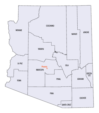
This is a directory of properties and districts listed on the National Register of Historic Places in Arizona. There are about fourteen hundred listed sites in the state, and each of its fifteen counties has at least ten listings on the National Register. Forty-seven of the state's sites are further designated as National Historic Landmarks.

This is a list of properties and districts in Illinois that are on the National Register of Historic Places. There are over 1,900 in total. Of these, 85 are National Historic Landmarks. There are listings in all of the state's 102 counties.
This National Park Service list is complete through NPS recent listings posted January 27, 2023.

This is a directory of properties and districts included among the National Register of Historic Places listings in Idaho. There are approximately 1,000 sites in Idaho listed on the National Register. Each of the state's 44 counties has at least one listing on the National Register.
These historic properties and districts in the state of Texas are listed in the National Register of Historic Places. Properties and/or districts are listed in most of Texas's 254 counties.

This is a list of properties and historic districts in Kentucky that are listed on the National Register of Historic Places. There are listings in all of Kentucky's 120 counties.

Fort Boonesborough was a frontier fort in Kentucky, founded by Daniel Boone and his men following their crossing of the Kentucky River on April 1, 1775. The settlement they founded, known as Boonesborough, Kentucky, is Kentucky's second oldest European-American settlement. It served as a major frontier outpost during the American Revolutionary War, and survived into the early 19th century before its eventual abandonment. A National Historic Landmark now administered as part of Fort Boonesborough State Park, the site is one of the best-preserved archaeological sites of early westward expansion by British colonists in that period. It is located in Madison County, Kentucky off Kentucky Route 627.
The Green River Shell Middens Archeological District is a historic district composed of archaeological sites in the U.S. state of Kentucky. All of the district's sites are shell middens along the banks of the Green River that date from the later portion of the Archaic period. Studies of this assemblage of sites were critical in the development of knowledge of the Archaic period in the eastern United States.

This is a list of the National Register of Historic Places listings in Hart County, Kentucky.

This is a list of the National Register of Historic Places listings in Edmonson County, Kentucky.

This is a list of the National Register of Historic Places listings in McCracken County, Kentucky.

The Portsmouth Earthworks are a large prehistoric mound complex constructed by the Native American Adena and Ohio Hopewell cultures of eastern North America. The site was one of the largest earthwork ceremonial centers constructed by the Hopewell and is located at the confluence of the Scioto and Ohio Rivers, in present-day Ohio.
Fort Mitchell Site may refer to:

The Mantle Rock Archeological District, near Smithland, Kentucky is a 215 acres (0.87 km2) historic district which was listed on the National Register of Historic Places in 2004.
Salts Cave Archeological Site, near Munfordville, Kentucky, is a cave and archeological site which was listed on the National Register of Historic Places in 1979. The cave is part of Mammoth Cave National Park.
This is a list of the National Register of Historic Places listings in Mammoth Cave National Park.
References
| Topics | |
|---|---|
| Lists by state |
|
| Lists by insular areas | |
| Lists by associated state | |
| Other areas | |
| Related | |