Countries of the Bay of Bengal

Last updated
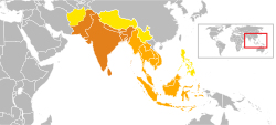
Map of the Bay of Bengal region Bay of Bengal map.png
Map of the Bay of Bengal region

The countries of the Bay of Bengal include littoral and landlocked countries in South Asia and Southeast Asia that depend on the bay for maritime usage. Historically, the Bay of Bengal has been a highway of transport, trade, and cultural exchange between diverse peoples encompassing the Indian subcontinent, Indochinese peninsula, and Malay Archipelago. Today, the Bay of Bengal region is the convergence of two major geopolitical blocs- the Association of Southeast Asian Nations (ASEAN) and the South Asian Association for Regional Cooperation (SAARC). The Bay of Bengal Initiative for Multisectoral Technical and Economic Cooperation (BIMSTEC) promotes regional engagement in the area.

Contents

The Bay of Bengal countries are often categorized into a maritime subregion. The bay hosts vital shipping routes linking its littoral and landlocked hinterland with the Indian Ocean. Its sea bed is being explored and exploited for hydrocarbon reserves.

Littoral countries

Landlocked countries and regions

Other dependent countries

Maritime history

Early history

Historic Indian cultural influence in South Asia and Southeast Asia: Indianized Hindu-Buddhist kingdoms within Greater India were spread across Indonesia and Malaysia (Srivijaya, Majapahit, Gangga Negara, Kalingga, Kutai, Singhasari, Tarumanagara and Pan Pan), Malaysia (Langkasuka, Thailand (Dvaravati), Indochina (Champa, Funan, and Chenla), and Myanmar (Pagan). Indian cultural zone.svg
Historic Indian cultural influence in South Asia and Southeast Asia: Indianized Hindu-Buddhist kingdoms within Greater India were spread across Indonesia and Malaysia (Srivijaya, Majapahit, Gangga Negara, Kalingga, Kutai, Singhasari, Tarumanagara and Pan Pan), Malaysia (Langkasuka, Thailand (Dvaravati), Indochina (Champa, Funan, and Chenla), and Myanmar (Pagan).

Prince Vijaya, the first recorded king of Sri Lanka, traveled from ancient Vanga (Bengal) through the Bay of Bengal to the island of Lanka and colonized it. Ancient Malay chronicles record the sailor Buddha Gupta traveling from Bengal to the Malay Archipelago through the Bay of Bengal.[ citation needed ] Ptolemy's map refers to the Bay of Bengal as the Gulf of the Ganges. [6]

Hindu-Buddhist kingdoms in Southeast Asia depended on the Bay of Bengal for trade and cultural exchange. The South Indian Chola dynasty dominated the region in the 11th century, with records describing the Bay of Bengal as Chola's Lake. [7]

Islam in Southeast Asia also spread through the Bay of Bengal, by serving as a bridge between the Malay Archipelago and Indo-Islamic states in the subcontinent. [8] [9]

In the 14th and 15th centuries, explorers like Ibn Battuta of Morocco, Niccolo De Conti of the Venetian Republic, and Admiral Zheng He of Imperial China ventured through the Bay of Bengal. The Maldives depended on the Bay of Bengal for its huge shell currency trade. [10]

In the 16th century, the Portuguese empire began traversing the sea routes of the Bay of Bengal. Portuguese maps referred to the bay as the "Gulf of Bengal". [11] The Burmese Empires and the Kingdom of Mrauk U were major powers in the Bay of Bengal. The Kingdom of Mrauk U engaged in a naval war with the Mughal Empire of India in 1666. In the 18th century, numerous European trading companies established settlements across the region.

In the 19th century, the British government established direct crown rule in the Indian subcontinent; while the Dutch government established supremacy in the Indonesian archipelago. Colonialism disrupted and ended the region's traditional maritime networks.

Modern era

In the early 20th century, shipping between British India and British Burma rapidly increased. Rangoon became one of the world's busiest ports for immigrant arrivals, ranking alongside New York City. [12] In Rangoon, thousands of Indian migrants arrived to settle in British Burma. The migration fostered strong economic links between India and Burma. British Burma's petroleum industry supplied much of India's petroleum demand. However, commercial links were disrupted during World War II, when Burma came under Japanese occupation. The Japanese took control of the Andaman Islands and used them as a penal colony. After the partition of India in 1947 and Burma's independence in 1948, there was a decline in Indo-Burmese commerce.

During the Indo-Pakistani War of 1971 over Bangladesh's independence, the Indian and Pakistani navies engaged in naval combat in the Bay of Bengal. A Pakistani submarine, the PNS Ghazi, sunk in the bay. In December 1971, the United States and Soviet Union mobilized naval strike groups around the Bay of Bengal. [13]

Bangladesh and Myanmar engaged in a naval standoff over disputed maritime territory in 2008. The two countries settled their maritime boundary dispute in 2012 at the International Tribunal for the Law of the Sea. [14] In 2014, India and Bangladesh resolved their maritime boundary disputes at a UN tribunal. [15]

The Rohingya refugee crisis, caused by persecution in Myanmar's Rakhine State, has been a major humanitarian and security challenge in the region.

Demographics

Population

According to Sunil S. Amrith, one in four people on earth live in the countries that border the Bay of Bengal. Its littoral areas — including coastal regions of eastern India, Bangladesh, Sri Lanka, Myanmar, Thailand, Malaysia, and Sumatra — are home to over half a billion people. [16]

Most populous urban areas among littoral Bay of Bengal countries

GulshanDhaka.jpg
Dhaka
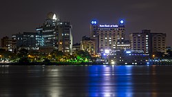
Kolkata skyline at night.jpg
Kolkata

Aerial view of Lumphini Park.jpg
Bangkok

RankCityCountryRegion/CountyPopulation (urban)

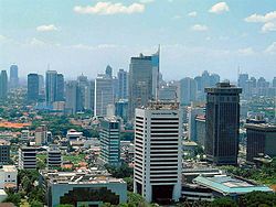
Jakarta.jpg
Jakarta
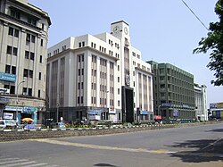
Parrys Corner, Chennai, India.jpg
Chennai
Central Business District 05.jpg
Yangon

1 Dhaka Bangladesh Dhaka Division 18,898,000 [17]
2 Kolkata India West Bengal 14,617,882 [18]
3 Bangkok Thailand Bangkok Province 14,565,547 [19]
4 Jakarta Indonesia Special Capital Region10,075,310 [20]
5 Chennai India Tamil Nadu 8,917,749 [21]
6 Yangon Myanmar Yangon Region 7,360,703 [22]
7 Chittagong Bangladesh Chittagong Division 4,009,423 [23]
8 Colombo Sri Lanka Western Province 2,323,826 [24]
9 Gazipur City Bangladesh Dhaka Division 1,820,374 [25]
10 Mandalay Myanmar Mandalay Region 1,726,889 [22]
11 Narayanganj Bangladesh Dhaka Division 1,636,441 [25]
12 Khulna Bangladesh Khulna Division 1,636,441 [25]
13 Guwahati India Assam 962,334 [26]
14 Chiang Mai Thailand Chiang Mai Province 960,906
Sources: Census reports of Bangladesh, Thailand, India and Myanmar

Economy

Statistical data (2021)

Country Nominal GDP Purchasing power parity Per capita Currency
Bangladesh $416.26 billion$1.11 trillion$2,520 Bangladeshi taka
Bhutan $2.547 billion$7.701 billion$3,117 Bhutanese ngultrum
China $19.912 trillion$30.18 trillion$14,096 Renminbi
India $3.535 trillion$11.745 trillion$2,543 Indian rupee
Indonesia $1.150 trillion$3.530 trillion$4,224 Indonesian rupiah
Myanmar $78 billion$258 billion$1,422 Myanmar kyat
Nepal $36.084 billion$122.62 billion$1,236 Nepalese rupee
Sri Lanka $84.532 billion$306.997 billion$3,830 Sri Lankan rupee
Thailand $536.841 billion$1,340 billion$7,674 Thai baht

Fishing

Fisheries is an important economic activity in countries with coasts along the Bay of Bengal, particularly in Sri Lanka, India, Bangladesh, Myanmar, Thailand, and Indonesia. The fishing industry in the Bay of Bengal area provides employment and sustenance to large numbers of people. Based on a recent estimate, the total number employed on a full-time basis in fisheries in the area covered by the Bay of Bengal is 1.85 million. In addition, a large number of people are engaged in fishing as a part-time activity. The total population in the households of those engaged in fishing, full-time or part-time, in this area, is estimated at ten million. [27]

In recent years, the fishing industry has developed into an important earner of foreign exchange through the export of marine and aquatic products. In Bangladesh, fish exports account for 15 percent of the total export earnings. Though the percentage contribution of the fisheries sector to the total export earnings of the country is yet marginal in the other countries in absolute terms, the export earnings have been increasing very fast. As export items, fish and fish products are very important, as the net earnings from these products are extremely high, a result of their being almost one hundred percent local resource-based. [27]

The increased production of marine fish has come primarily through the motorization of traditional craft, the introduction of new craft, and the introduction and popularization of new types of synthetic gear, which have replaced traditional gear. It is in Thailand alone, that the private/commercial sector has taken the initiative of introducing and extending craft and gear; there has been very little state support or intervention in these activities in this country. [27] The increasing emphasis accorded to the development of coastal aquaculture is another feature common to almost every country in the region. In countries such as Bangladesh, Sri Lanka, and India, a primary reason for the increased emphasis on coastal aquaculture is the increase in foreign exchange earnings generated from shrimp farming. [27]

Tourism

Thailand's Andaman Coast is the largest hub of tourism in the region. Sri Lanka's tourism industry has seen growth despite decades of civil war in the country's north. Bangladesh and India have significantly developed their domestic tourism industries, such as in Cox's Bazar. South India's renowned temple cities, such as Tanjore, are located near the Bay of Bengal. In Bangladesh, the notable mosque city of Bagerhat is located near the Bay of Bengal. Myanmar has prioritized tourism development, particularly in cultural heritage sites like Mrauk U and Bagan.

Transport

The Port of Colombo in Sri Lanka handles over 5 million twenty-foot equivalent units (TEU)s of container traffic. The Port of Chittagong in Bangladesh handles over 2 million TEUs of container traffic. The Port of Chennai in India handles around 1.7 million TEUs of container traffic. Ports that handle over 100,000 TEUs of container traffic include the Port of Kolkata, Tuticorin Port Trust, the Port of Yangon, the Port of Mongla, and the Port of Vizag. Colombo is the busiest seaport in BIMSTEC. Chittagong is the busiest seaport on the Bay of Bengal coastline, [28] followed by Chennai, Kolkata, Tuticorin, Yangon, Visakhapatnam, and Mongla. [29] [30] [31] [32] [33] Sittwe Port and Hambantota are other important ports in the region.

Thailand and India signed direct coastal shipping agreements with Bangladesh in 2016. [34] [35]

Busiest seaports (2015-16)

Top seaports in the Bay of Bengal littoral region

20160122 Sri Lanka 3614 Colombo sRGB (25470240960).jpg
Colombo
Chittagong Port Area 12.jpg
Chittagong

RankPort CityHarbourCountryContainer traffic (TEU)

Kolkata port 20170924 100222.jpg
Kolkata
Vizag Seaport aerial view.jpg
Vizag

1 Colombo Port of Colombo Sri Lanka 5 million [36]
2 Chittagong Port of Chittagong Bangladesh 2.2 million [37]
3 Chennai Port of Chennai India 1.5 million [29]
4 Kolkata Port of Kolkata India 630,000 [38]
5 Tuticorin Tuticorin Port Trust India 560,000 [39]
6 Visakhapatnam Visakhapatnam Port India 291,000 [40]
7 Yangon Port of Yangon Myanmar 244,888 [32]
8 Mongla Port of Mongla Bangladesh 100,000 [41]

Oil and gas

The Bay of Bengal has large untapped oil and natural gas reserves. [42] Geologists believe the region holds many of the largest reserves in the Asia-Pacific. [43] Currently, there are few offshore platforms operating in the Bay of Bengal. The Shwe offshore platform is operated by Daewoo International for supplies to China through Myanmar. [44] Bangladesh's Sangu platform, which opened in 1994, was shut down in 2013. [45] India's Reliance Industries began production in an offshore block near India's coast in 2009. [46]

Security and strategic importance

CARAT 2013 in the Bay of Bengal US Navy 110922-N-KK935-221 Ships from the U.S. and Bangladesh Navies transit as part of the sea phase of Cooperation Afloat Readiness and Training.jpg
CARAT 2013 in the Bay of Bengal
Malabar 2017 in the Bay of Bengal Ships from the Indian Navy, Japan Maritime Self-Defense Force (JMSDF) and the U.S. Navy sail in formation in the Bay of Bengal during exercise Malabar 2017.jpg
Malabar 2017 in the Bay of Bengal

Common security space

The BIMSTEC countries view the Bay of Bengal as a common security space. The first conference of national security chiefs in the region was held in 2017. [47]

Non-traditional security challenges

The Bay of Bengal has non-traditional security challenges of piracy, human trafficking, terrorist networks, and drug smuggling, which has led to greater cooperation between the navies of Bangladesh, India, the United States, and Thailand.

Sino-Indian rivalry

The Bay of Bengal is a prime zone of strategic competition between two of Asia's largest countries- China and India. An example is in the case of Myanmar, where the Sino-Myanmar pipelines and Chinese-funded Kyaukpyu port project were followed by the Kaladan Multi-Modal Transit Transport Project funded by India. China and India have jostled for strategic influence in Bangladesh, Sri Lanka and Nepal. The Sri Lankan port of Hambantota was built by the Chinese. [48] [49] [50]

Japanese initiatives

In 2014, Japanese Prime Minister Shinzo Abe announced an initiative to develop an industrial corridor in Bangladesh to strengthen Japan's economic footprint in the region. The initiative is termed the "Bay of Bengal Industrial Growth Belt" (BIG-B). [51] Japan is keen to establish a maritime surveillance center for the Indian Ocean region in Sri Lanka. [52]

Bangladesh, Thailand, and Myanmar depend on China as a source of military equipment. Some analysts have speculated that an arms race emerging between these countries. [53] [54]

Joint exercises

The United States, a major Indo-Pacific naval power, conducts the Cooperation Afloat Readiness and Training (CARAT) involving Bangladesh, Brunei, Cambodia, Indonesia, Malaysia, the Philippines, Singapore and Thailand. In 2011, CARAT was held off the coast of southeastern Bangladesh. The Malabar naval exercise is held by the navies of the United States, India, and Japan.

Natural disaster management

The Bay of Bengal region has seen some of modern history's worst natural disasters, such as the 1970 Bhola cyclone and the 2004 Indian Ocean tsunami. The international community often mobilizes naval forces to assist in relief operations in the aftermath of devastating natural disasters, most recently after Cyclone Sidr and Cyclone Nargis.

See also

Related Research Articles

<span class="mw-page-title-main">Bengal</span> Region in the eastern Indian subcontinent

Bengal is a historical geographical, ethnolinguistic and cultural term referring to a region in the eastern part of the Indian subcontinent at the apex of the Bay of Bengal. The region of Bengal proper is divided between the modern-day sovereign nation of Bangladesh and the Indian states of West Bengal, and some parts of Assam.

<span class="mw-page-title-main">Bay of Bengal</span> Northeastern part of the Indian Ocean

The Bay of Bengal is the northeastern part of the Indian Ocean. The world's largest bay, geographically it is positioned between the Indian subcontinent and the Indochinese peninsula, located below the Bengal region.

<span class="mw-page-title-main">BIMSTEC</span> International cooperation organisation

The Bay of Bengal Initiative for Multi-Sectoral Technical and Economic Cooperation (BIMSTEC) is an international organisation of seven South Asian and Southeast Asian nations, housing 1.73 billion people and having a combined gross domestic product of US$5.2 trillion (2023). The BIMSTEC member states – Bangladesh, Bhutan, India, Myanmar, Nepal, Sri Lanka, and Thailand – are among the countries dependent on the Bay of Bengal.

Ethnic groups in South Asia are ethnolinguistic groupings within the diverse populations of South Asia, including the countries of Bangladesh, Bhutan, India, Maldives, Nepal, Pakistan, and Sri Lanka. Afghanistan is variously considered to be a part of both Central Asia and South Asia, which means Afghans are not always included among South Asians, but when they are, South Asia has a total population of about 2.04 billion.

<span class="mw-page-title-main">Port of Chittagong</span> Major port in Bangladesh

The Port of Chittagong is the main seaport of Bangladesh. Located in Bangladesh's port city of Chittagong, and on the banks of the Karnaphuli River. The port handles over 70 percent of Bangladesh's export-import trade, and has been used by India, Nepal and Bhutan for transshipment. According to Lloyd's, it ranked as the 58th busiest container port in the world in 2019. The port has a recorded history dating back to ancient Roman accounts. It is the busiest container port on the Bay of Bengal.

<span class="mw-page-title-main">Outline of Bangladesh</span> Country in South Asia

The following outline is provided as an overview of and topical guide to Bangladesh:

<span class="mw-page-title-main">Military history of Bangladesh</span> Overview of the process of militarization in Bangladesh

Bangladesh's military history is intertwined with the history of a larger region, including present-day India, Pakistan, Nepal, Bhutan and Myanmar. The country was historically part of Bengal – a major power in South Asia and Southeast Asia.

<span class="mw-page-title-main">Andaman and Nicobar Command</span> Tri-services command of the Indian Armed Forces

The Andaman and Nicobar Command (ANC) is a integrated tri-services command of the Indian Armed Forces, based at Port Blair in the Andaman and Nicobar Islands, a Union Territory of India. It was created in 2001 to safeguard India's strategic interests in Southeast Asia and the Strait of Malacca by increasing rapid deployment of military assets in the region. It provides logistical and administrative support to naval ships which are sent on deployment to East Asia and the Pacific Ocean.

<span class="mw-page-title-main">Samatata</span> Ancient geopolitical division and kingdom of Bengal

Samataṭa was an ancient geopolitical division of Bengal in the eastern Indian subcontinent. The Greco-Roman account of Sounagoura is linked to the kingdom of Samatata. Its territory corresponded to much of present-day eastern Bangladesh and parts of the Rakhine State of Myanmar. The area covers the trans-Meghna part of the Bengal delta. It was a center of Buddhist civilisation before the resurgence of Hinduism, and Muslim conquest in the region.

<span class="mw-page-title-main">India–Thailand relations</span> Bilateral relations

India–Thailand relations, also known as the Indo–Thai relations, are the bilateral relations between India and Thailand. Relations were established in 1947, soon after India gained independence. Priests have provided a cultural link between the two countries since 1500 BCE. India shares a long sea border with Thailand as India's Andaman and Nicobar Islands share a maritime border with Thailand along the Andaman Sea. Since 2001, both countries have witnessed growing warmth, increasing economic and commercial links, exchange of high-level visits, and the signing of various agreements leading to a further intensification of relations. Thailand and India are cooperating in various multilateral fora like India's dialogue partnership with ASEAN, the ASEAN Regional Forum (ARF), and the East Asia Summit, the sub-regional grouping BIMSTEC involving Bangladesh, India, Sri Lanka, Thailand, Myanmar, Nepal and Bhutan, and trilateral transport linkages with Thailand, Myanmar and India. India is a member of the Asia Cooperation Dialogue (ACD) initiated by Thailand in 2002 and of the Mekong–Ganga Cooperation (MGC), a group of six countries.

The coastline of Tamil Nadu is located on the southeast coast of Indian Peninsula, and forms a part of Coromandel Coast of Bay of Bengal and Indian Ocean. It is 1076 km long and is the second longest coastline in the country after Gujarat. Chennai, the capital of the state and an important commercial and industrial center in the country is located in the northern part of the coast with Kanniyakumari, forming the southern tip where Indian Ocean, Bay of Bengal and Arabian Sea meet. It also shares maritime border with Sri Lanka across the Palk strait in Gulf of Mannar. The coastal corridor consists of 14 districts with 15 major ports and harbors, sandy beaches, lakes and river estuaries. Tamil Nadu is the only state in India with territory on both the eastern and western coastlines.

<span class="mw-page-title-main">2017 North Indian Ocean cyclone season</span>

The 2017 North Indian Ocean cyclone season was a below average yet deadly season in the annual cycle of tropical cyclone formation. This season produced only three named storms, of which one only intensified into a very severe cyclonic storm. The North Indian Ocean cyclone season has no official bounds but cyclones tend to form between April and December with the two peaks in May and November. These dates conventionally delimit the period of each year when most tropical cyclones form in the northern Indian Ocean. The season began with the formation Cyclone Maarutha on April 15 and ended with the dissipation of a deep depression on December 9.

<span class="mw-page-title-main">Cyclone Mora</span>

Severe Cyclonic Storm Mora was a moderate but deadly tropical cyclone that caused widespread devastation and severe flooding in Sri Lanka, Andaman and Nicobar Islands, Bangladesh, Myanmar and Northeast India in May 2017. The second named storm of the 2017 annual cyclone season, Mora developed from an area of low pressure over the southeastern Bay of Bengal on May 28. Mora reached peak strength with maximum sustained winds of 110 km/h (70 mph). The cyclone made landfall near Chittagong on the morning of May 30 and steadily weakened, dissipating early in the morning on May 31. Across its path, Mora dropped a large amount of rain, including 225mm of rainfall in Chittagong and northeast India. The storm is estimated to have caused damages nearing US$300 million.

<span class="mw-page-title-main">Eastern South Asia</span>

Eastern South Asia is a subregion of South Asia. It includes the countries of Bangladesh, Bhutan, India, and Nepal. Geographically, it lies between the Eastern Himalayas and the Bay of Bengal. Two of the world's largest rivers, the Ganges and the Brahmaputra, flow into the sea through Eastern South Asia. The region includes the world's highest mountainous terrain and the world's largest delta, and has a climate ranging from alpine and subalpine to subtropical and tropical. Since Nepal, Bhutan, and northeast India are landlocked, the coastlines of Bangladesh and East India serve as the principal gateways to the region.

The Port of Pangaon is an inland port and container terminal on the Buriganga River in Dhaka District, Bangladesh. It serves as a cargo port for Bangladesh's capital and largest city Dhaka. It was opened in 2013. It is the first river port of its kind in Bangladesh.

Illicit drug trafficking in the West Indian Ocean (WIO) has increasingly become a major security concern for many States in the region, and is gaining international attention. The Indian Ocean borders 24 states, and accounts for a third of the world’s ocean area. Until recently, other challenges, such as piracy off the coast of Somalia, has been at the forefront of international action. However, the utilisation of the Southern route by drug traffickers, and the consequent issues this has caused, has led to increased focus on how to tackle this issue.

<span class="mw-page-title-main">Exclusive economic zone of India</span> Economic zone exclusive to India

India has the 18th-largest exclusive economic zone (EEZ) with a total size of 2,305,143 km2 (890,021 sq mi). It includes the Lakshadweep island group in the Laccadive Sea off the southwestern coast of India and the Andaman and Nicobar Islands in the Bay of Bengal and the Andaman Sea. India's EEZ is bordered to the west by Pakistan, to the south by the Maldives and Sri Lanka and to the east by Bangladesh, Myanmar, Thailand, Malaysia and Indonesia. Based on new scientific data, India has petitioned United Nations to extend its EEZ from 200 Nautical miles to 500 miles.

References

  1. Hafez Ahmed (15 March 2012). "BD wins maritime suit against Myanmar". The Financial Express (Bangladesh) . Retrieved 2017-07-23.
  2. Ravi Prasad, Special to Hart Energy (2014-11-19). "Bangladesh Focuses On Bay Of Bengal | Exploration & Production". Epmag. Retrieved 2017-07-23.
  3. "With strong navy and army base, 'Andamans should be developed as commercial hub' : FYI, News - India Today". Indiatoday.intoday.in. 2017-05-16. Retrieved 2017-07-23.
  4. 1 2 3 Verlaan, Philomene A. (1959-08-21). "Bay of Bengal | bay, Indian Ocean". Britannica. Retrieved 2017-07-23.
  5. "China's Second Coast: Implications for Northeast India | Institute for Defence Studies and Analyses". Idsa.in. 2014-06-19. Retrieved 2017-07-23.
  6. Thomas Suárez (31 March 1992). Shedding the Veil: Mapping the European Discovery of America and the World. World Scientific. p. 35. ISBN   978-981-4505-79-6.
  7. Kulke, Hermann; Kesavapany, K.; Sakhuja, Vijay, eds. (2009). Nagapattinam to Suvarnadwipa: Reflections on the Chola Naval Expeditions to Southeast Asia. Singapore: Institute of Southeast Asian Studies. p. 80. ISBN   978-981-230-937-2.
  8. Sunil S. Amrith (7 October 2013). Crossing the Bay of Bengal. Harvard University Press. p. 37. ISBN   978-0-674-72846-2.
  9. Formichi, Chiara (2020). Islam and Asia: A History. Cambridge University Press. pp. 75–79. ISBN   978-1-107-10612-3.
  10. Boomgaard, P. (1 January 2008). "Linking Destinies: Trade, Towns and Kin in Asian History". BRILL – via Google Books.
  11. Sunil S. Amrith (7 October 2013). Crossing the Bay of Bengal. Harvard University Press. p. 18. ISBN   978-0-674-72846-2.
  12. "The Bay of Bengal: Rise and Decline of a South Asian Region". YouTube. 2014-06-16. Retrieved 2017-07-23.
  13. Rais, R.B (1987), The Indian Ocean and the Superpowers, Rowman & Littlefield, ISBN   0-389-20695-4.
  14. "INTERNATIONAL TRIBUNAL FOR THE LAW OF THE SEA" (PDF). Itlos.org. 2012. Archived from the original (PDF) on 2017-01-07. Retrieved 2017-07-25.
  15. Habib, Haroon (9 July 2014). "Bangladesh wins maritime dispute with India". The Hindu. Retrieved 2017-07-23.
  16. Sunil S. Amrith (2013-10-13). "The Bay of Bengal, in Peril From Climate Change". The New York Times . Retrieved 2017-07-25.
  17. "Dhaka Population 2017". World Population Review. 2016-11-19. Retrieved 2017-07-23.
  18. "Provisional Population Totals, Census of India 2011" (PDF). Censusindia.gov.in. Retrieved 2017-07-25.
  19. "Table 1 Population by sex, household type and household by type, average size of private household by region and area: 2010". Statistic tables, NSO website. National Statistics Office. Retrieved 18 September 2012.
  20. "Masuk". data.jakarta.go.id. 2015-03-30. Retrieved 2017-07-23.
  21. "Tamil Nādu (India): State, Major Agglomerations & Cities - Population Statistics in Maps and Charts". Citypopulation.de. Retrieved 2017-07-23.
  22. 1 2 "Census Main Report (UNION) - ENGLISH.pdf - Google Drive" . Retrieved 2017-07-23.
  23. "Population & Housing Census-2011: Union Statistics" (PDF). Bangladesh Bureau of Statistics. Archived from the original (PDF) on 2015-12-08. Retrieved 2017-07-23.
  24. Britannica Book of the Year 2014 - Encyclopaedia Britannica, Inc. - Google Books. Encyclopedia Britannica. March 2014. ISBN   9781625131713 . Retrieved 2017-07-23.
  25. 1 2 3 "Bangladesh: Divisions and Urban Areas - Population Statistics, Maps, Charts, Weather and Web Information".
  26. "Guwahati City Population Census 2011 | Assam". Census2011.co.in. Retrieved 2017-07-23.
  27. 1 2 3 4 "Fisheries in the Bay of Bengal" (PDF). FAO Fisheries and Aquaculture Department. Retrieved 1 August 2017.
  28. "Chittagong breaks record, tops 2 million TEU a year sooner than targeted - PORTS". SeaNews. Retrieved 2017-07-23.
  29. 1 2 "Chennai Port trust : performance during the year". Pib.nic.in. 2016-04-16. Retrieved 2017-07-23.
  30. "Highlights of Achievements for 2015-2016". Kolkata Port Trust. Archived from the original on 2017-06-16. Retrieved 2017-07-23.
  31. "Vizag port poised to emerge as transhipment hub". The Hindu . 2016-04-10. Retrieved 2017-07-25.
  32. 1 2 "Container port traffic (TEU: 20 foot equivalent units) | Data". Data.worldbank.org. Retrieved 2017-07-23.
  33. "Bangladesh port expands as shippers avoid Chittagong". Joc.com. 2012-06-05. Archived from the original on 2017-08-05. Retrieved 2017-07-25.
  34. "Bangladesh-Thailand in Multi-Billion Trade Boom? - Port Technology International". Porttechnology.org. 2016-02-10. Retrieved 2017-07-25.
  35. "India And Bangladesh Sign Standard Operating Procedure To Operationalize Agreement On Coastal Shipping". Marineinsight.com. 2016-12-29. Retrieved 2017-07-25.
  36. "Colombo Port creates history with 5 m TEU mark". Ft.lk. 2015-12-21. Retrieved 2017-07-23.
  37. "Chittagong Port ranks 76th in Lloyd's Register". Dhaka Tribune. Retrieved 2017-07-25.
  38. "India's major ports see 6.7 percent growth in container volumes". JOC.co. 7 April 2015. Retrieved 27 June 2015.
  39. "India's major ports see 6.7 percent growth in container volumes". Joc.com. 2012-06-05. Retrieved 2017-07-23.
  40. "Vizag port poised to emerge as transhipment hub". The Hindu. 2016-04-10. Retrieved 2017-07-23.
  41. "Bangladesh port expands as shippers avoid Chittagong". Joc.com. 2012-06-05. Archived from the original on 2017-08-05. Retrieved 2017-07-23.
  42. Sajeeb Wazed. "Investment in Bay of Bengal Will Unlock Potential for Billions". The Diplomat . Retrieved 2017-07-25.
  43. Jack Detsch. "Bangladesh: Asia's New Energy Superpower?". The Diplomat . Retrieved 2017-07-25.
  44. "SHWE platform installed off Myanmar". Offshore-mag.com. 15 February 2013. Retrieved 2017-07-25.
  45. "RPT-Santos closes down Bangladesh's only offshore gas field". Reuters . 2013-10-01. Retrieved 2017-07-25.
  46. "Reliance Fires Up Gas Production from India's KG-D6 Block | Rigzone". Rigzone.com. 2009-04-02. Retrieved 2017-07-25.
  47. "Bimstec countries see Bay of Bengal as common security space". The Independent (Bangladesh) . Dhaka. Archived from the original on 2019-09-02. Retrieved 2017-07-25.
  48. "The Rise of the Bengal Tigers: The Growing Strategic Importance of the Bay of Bengal | East-West Center". Eastwestcenter.org. 2015-06-04. Retrieved 2017-07-25.
  49. Constantino Xavier; David Brewster; Anthony Bergin; C. Raja Mohan. "The Bay of Bengal as a New Strategic Space - Carnegie India - Carnegie Endowment for International Peace". Carnegie India. Retrieved 2017-07-25.
  50. David Brewster (2014-12-02). "The Bay of Bengal: the Indo-Pacific's new zone of competition | The Strategist". Aspistrategist.org.au. Retrieved 2017-07-25.
  51. "The Initiative of BIG-B (The Bay of Bengal Industrial Growth Belt) | Bangladesh | Countries & Regions". Jica.gp.jp. 2014-06-16. Retrieved 2017-07-25.
  52. "Japan keen on making Sri Lanka a centre for strategic maritime surveillance". Bdnews24.com. 2017-04-20. Retrieved 2017-07-25.
  53. "ASEAN's new arms race: nations scramble to rearm as concerns over security grow". Aseantoday.com. Retrieved 2017-07-25.
  54. Saurav Jha (2014-04-23). "The Bay of Bengal Naval Arms Race". The Diplomat . Retrieved 2017-07-25.