Covent Garden tube station

Last updated

Covent Garden Underground no-text.svg
Covent Garden stn building.JPG
Station entrance
Open street map central london.svg
Red pog.svg
Covent Garden
Location of Covent Garden in Central London
Location Covent Garden
Local authority City of Westminster
Managed by London Underground
Number of platforms2
Fare zone 1
London Underground annual entry and exit
2018Decrease2.svg 16.89 million [1]
2019Decrease2.svg 16.55 million [2]
2020Decrease2.svg 1.62 million [3]
2021Increase2.svg 7.48 million [4]
2022Increase2.svg 12.99 million [5]
Railway companies
Original company Great Northern, Piccadilly and Brompton Railway
Key dates
15 December 1906Line opened
11 April 1907Station opened
Listed status
Listing gradeII
Entry number1401025 [6] [7]
Added to list20 July 2011
Other information
External links
Coordinates 51°30′47″N0°07′27″W / 51.5130°N 0.1243°W / 51.5130; -0.1243
Underground sign at Westminster.jpg London transportportal

Covent Garden is a London Underground station serving Covent Garden and the surrounding area in the West End of London. It is on the Piccadilly line between Leicester Square and Holborn stations and is in Travelcard Zone 1. [8] The station is at the corner of Long Acre and James Street and the street-level concourse is a Grade II listed building.

Contents

History

The station was planned by the Great Northern and Strand Railway (GN&SR), which had received parliamentary approval for a route from Wood Green station (now Alexandra Palace) to Strand in 1899. [9] After the GN&SR was taken over by the Brompton and Piccadilly Circus Railway (B&PCR) in September 1901, the two companies came under the control of Charles Yerkes' Metropolitan District Electric Traction Company before being transferred to his new holding company, the Underground Electric Railways Company of London (UERL) in June 1902. [10] To connect the two companies' planned routes, the UERL obtained permission for new tunnels between Piccadilly Circus and Holborn. The companies were formally merged as the Great Northern, Piccadilly and Brompton Railway following parliamentary approval in November 1902. [11] [12] [13] The station was opened by the Great Northern, Piccadilly and Brompton Railway on 11 April 1907, four months after services on the rest of the line began operating on 15 December 1906. [14]

In 1929, Covent Garden was suggested for closure in connection with the extension of the Piccadilly line: the elimination of less-busy stations in the central area would improve both reliability and journey times for long-distance commuters [15] [16] , though the closure did not proceed.

In 2011, English Heritage gave the station frontage Grade II listed status, [6] [7] on account of it being a good example of Leslie Green's architecture.

The station today

Design

Signage on the platforms Covent Garden stn tiling.JPG
Signage on the platforms

Like the rest of the original GNP&BR stations, the street level station building and platform tiling were designed by Leslie Green in the Modern Style (British Art Nouveau style). [17] [18] As is commonplace with other Central London stations Green designed, [19] the station building is a classic red 'Oxblood' building which has two elevations fronting onto the end of James Street and Long Acre. The platform wall was tiled with two shades of yellow and white tiling which formed geometric shapes along with three blank spaces to incorporate the station name. As part of Transport for London's investment programme, the ageing tiling dating back from the station's opening was replaced in 2010 in a like-for-like basis, retaining the look and feel of the platforms.

Platform level tiling

The distinctive platform level tilework. COVENT GARDEN-3 020909 CPS (3998137649).jpg
The distinctive platform level tilework.

The stations along the central part of the Piccadilly line, as well as some sections of the Northern line, were financed by Charles Yerkes, [20] and are famous for the Leslie Green designed red station buildings and distinctive platform tiling. Each station had its own unique tile pattern and colours.

Access

Covent Garden station is one of the few stations in Central London for which platform access is only by lift or an emergency spiral staircase with 193 steps. [21] There are four lifts that give access to street level, although a final flight of stairs from the lifts to the platforms means that the station is wheelchair-inaccessible. [22]

At the bottom of the staircase, numerous posters, warning users of the long climb ahead, suggest they make use of the station’s lifts instead. [23]

Proximity to Leicester Square

The journey between Leicester Square station and Covent Garden takes only about 20 seconds, and measures only 260 metres (280 yd), the shortest distance between two adjacent stations on the Underground network. [24] [25] The stations are so close that a pedestrian standing halfway between them on Long Acre can see both tube stations by turning around 180°.

As of 2022, the cash fare for the journey is £6.30, [26] or £36.21 per mile. In 2015, at £29.81/mi, the journey was more expensive per unit distance than the Venice-Simplon Orient Express. [27] [ original research? ] Posters at the station give details of the alternative methods of getting to and from Covent Garden using surrounding stations.

Services and connections

Train frequencies vary throughout the day, but generally operate every 3–7 minutes in both directions. [28] As a part of the Piccadilly line, the train is served by Night Tube on Friday and Saturday nights. [29]

Folklore

It is said that the ghost of actor William Terriss (murdered in 1897) haunts the station. It is claimed that he used to visit a bakery demolished when the station was built. [30] The last reported sighting of Terriss was in 1972. [31]

Notes and references

Notes

    Related Research Articles

    <span class="mw-page-title-main">Oval tube station</span> London Underground station

    Oval is a London Underground station in the London Borough of Lambeth. It is on the Northern line between Kennington and Stockwell stations and is in Travelcard Zone 2. It opened on 18 December 1890 as part of the City and South London Railway and is named after The Oval cricket ground, which it serves.

    <span class="mw-page-title-main">Charing Cross tube station</span> London Underground station

    Charing Cross is a London Underground station at Charing Cross in the City of Westminster. The station is served by the Bakerloo and Northern lines and provides an interchange with Charing Cross mainline station. On the Bakerloo line it is between Piccadilly Circus and Embankment stations, and on the Charing Cross branch of the Northern line it is between Leicester Square and Embankment stations. The station is in fare zone 1.

    <span class="mw-page-title-main">Aldwych tube station</span> London Underground station, 1907–1994

    Aldwych is a closed station on the London Underground, located in the City of Westminster in Central London. It was opened in 1907 with the name Strand, after the street on which it is located. It was the terminus of the short Piccadilly line branch from Holborn that was a relic of the merger of two railway schemes. The station building is close to the Strand's junction with Surrey Street, near Aldwych. During its lifetime, the branch was the subject of a number of unrealised extension proposals that would have seen the tunnels through the station extended southwards, usually to Waterloo.

    <span class="mw-page-title-main">Holborn tube station</span> London Underground station

    Holborn is a London Underground station in Holborn, Central London, located at the junction of High Holborn and Kingsway. It is served by the Central and Piccadilly lines. On the Central line the station is between Tottenham Court Road and Chancery Lane stations and on the Piccadilly line it is between Covent Garden and Russell Square stations. The station is in Travelcard Zone 1. Close by are the British Museum, Lincoln's Inn Fields, Red Lion Square, Bloomsbury Square, London School of Economics and Sir John Soane's Museum.

    <span class="mw-page-title-main">Leicester Square tube station</span> London Underground station

    Leicester Square is a London Underground station in the West End of London, within walking distance of Theatreland and Chinatown. It is located on Charing Cross Road, a short distance to the east of Leicester Square itself.

    <span class="mw-page-title-main">Oxford Circus tube station</span> London Underground station

    Oxford Circus is a London Underground station serving Oxford Circus at the junction of Regent Street and Oxford Street, with entrances on all four corners of the intersection. The station is an interchange between three lines: Bakerloo, Central and Victoria. As of 2022, it was the fourth-busiest station on the London Underground. On the Bakerloo line it is between Regent's Park and Piccadilly Circus stations, on the Central line it is between Bond Street and Tottenham Court Road stations, and on the Victoria line it is between Green Park and Warren Street stations. The station is in Travelcard Zone 1.

    <span class="mw-page-title-main">Green Park tube station</span> London Underground station

    Green Park is a London Underground station located on the edge of Green Park, with entrances on both sides of Piccadilly. The station is served by three lines: Jubilee, Piccadilly and Victoria. On the Jubilee line it is between Bond Street and Westminster stations, on the Piccadilly line it is between Hyde Park Corner and Piccadilly Circus stations, and on the Victoria line it is between Victoria and Oxford Circus stations. It is in fare zone 1.

    <span class="mw-page-title-main">South Kensington tube station</span> London Underground station

    South Kensington is a London Underground station in the district of South Kensington, south west London. It is served by the District, Circle and Piccadilly lines. On the District and Circle lines it is between Gloucester Road and Sloane Square, and on the Piccadilly line between Gloucester Road and Knightsbridge. It is in Travelcard Zone 1. The main station entrance is located at the junction of Old Brompton Road (A3218), Thurloe Place, Harrington Road, Onslow Place and Pelham Street. Subsidiary entrances are located in Exhibition Road giving access by pedestrian tunnel to the Natural History, Science and Victoria and Albert Museums. Also close by are the Royal Albert Hall, Imperial College London, the Royal College of Music, the London branch of the Goethe-Institut and the Ismaili Centre.

    <span class="mw-page-title-main">Kennington tube station</span> London Underground station

    Kennington is a London Underground station on Kennington Park Road in Kennington within the London Borough of Southwark. The station is served by the Northern line and is at the junction of the Charing Cross and Bank branches to the north and the Morden and Battersea Power Station branches to the south. Northbound, the next stations are Waterloo on the Charing Cross branch and Elephant & Castle on the Bank branch. Southbound, the next stations are Oval towards Morden and Nine Elms towards Battersea Power Station respectively. The station is in both Travelcard Zones 1 and 2.
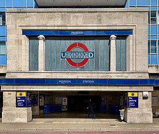
    <span class="mw-page-title-main">Morden tube station</span> London Underground station

    Morden is a London Underground station in Morden in the London Borough of Merton. The station is the southern terminus for the Northern line and is the most southerly station on the Underground network, despite being on the Northern Line. The next station towards north is South Wimbledon. The station is located on London Road (A24), and is in Travelcard Zone 4. Nearby are Morden Hall Park and Morden Park.
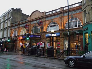
    <span class="mw-page-title-main">Earl's Court tube station</span> London Underground station

    Earl's Court tube station is a Grade II listed London Underground station in Earl's Court, London, on the District and Piccadilly lines. It is an important interchange for both lines and is situated in both Travelcard Zone 1 and Zone 2. The station has an eastern entrance on Earl's Court Road and a western entrance on Warwick Road. Another former entrance allowed passengers to enter the station from the other side of Warwick Road, via a ticket hall and subway leading to a concourse beneath the District line platforms. Earl's Court is a step-free tube station; the Earls Court Road entrance provides lift access between street and platform levels.
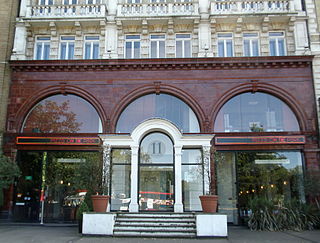
    <span class="mw-page-title-main">Hyde Park Corner tube station</span> London Underground station

    Hyde Park Corner is a London Underground station near Hyde Park Corner in Hyde Park. It is in Travelcard Zone 1, between Knightsbridge and Green Park on the Piccadilly line.
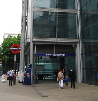
    <span class="mw-page-title-main">Euston Square tube station</span> London Underground station

    Euston Square is a London Underground station at the corner of Euston Road and Gower Street, just north of University College London – its main (south) entrance faces the tower of University College Hospital. The multi-interchange Euston station is beyond Euston Square Gardens, which is one street east. The station is between Great Portland Street and King's Cross St Pancras stations on the Circle, Hammersmith & City and Metropolitan lines in Travelcard Zone 1.

    <span class="mw-page-title-main">Gloucester Road tube station</span> London Underground station

    Gloucester Road is a London Underground station in Kensington, west London. The station entrance is located close to the junction of Gloucester Road and Cromwell Road. Close by are the Cromwell Hospital and Baden-Powell House.

    <span class="mw-page-title-main">Russell Square tube station</span> London Underground station

    Russell Square is a London Underground station opposite Russell Square on Bernard Street, Bloomsbury, in the London Borough of Camden. The station is on the Piccadilly line, between Holborn and King's Cross St Pancras and is in Travelcard Zone 1.

    <span class="mw-page-title-main">Down Street tube station</span> Closed London Underground station

    Down Street, also known as Down Street (Mayfair), is a disused station on the London Underground, located in Mayfair, west London. The Great Northern, Piccadilly and Brompton Railway opened it in 1907. It was latterly served by the Piccadilly line and was situated between Dover Street (now named Green Park) and Hyde Park Corner stations.

    <span class="mw-page-title-main">Boston Manor tube station</span> London Underground station

    Boston Manor is a London Underground station at the boundary of the boroughs of Hounslow and Ealing. The station is situated on the Heathrow branch of the Piccadilly line, between Osterley and Northfields stations, in Travelcard Zone 4.
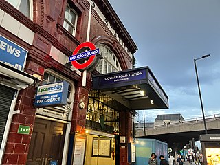
    <span class="mw-page-title-main">Edgware Road tube station (Bakerloo line)</span> London Underground station on the Bakerloo line

    Edgware Road is a London Underground station on the Bakerloo line, located in the City of Westminster. It is between Paddington and Marylebone stations on the line and falls within Travelcard zone 1. The station is located on the north-east corner of the junction of Edgware Road, Harrow Road and Marylebone Road. It is adjacent to the Marylebone flyover.

    <span class="mw-page-title-main">Great Northern, Piccadilly and Brompton Railway</span> Underground railway company in London

    The Great Northern, Piccadilly and Brompton Railway (GNP&BR), also known as the Piccadilly tube, was a railway company established in 1902 that constructed a deep-level underground "tube" railway in London, England. The GNP&BR was formed through a merger of two older companies, the Brompton and Piccadilly Circus Railway (B&PCR) and the Great Northern and Strand Railway (GN&SR). It also incorporated part of a tube route planned by a third company, the District Railway (DR). The combined company was a subsidiary of the Underground Electric Railways Company of London (UERL).

    The transport system now known as the London Underground began in 1863 with the Metropolitan Railway, the world's first underground railway. Over the next forty years, the early sub-surface lines reached out from the urban centre of the capital into the surrounding rural margins, leading to the development of new commuter suburbs. At the turn of the nineteenth century, new technology—including electric locomotives and improvements to the tunnelling shield—enabled new companies to construct a series of "tube" lines deeper underground. Initially rivals, the tube railway companies began to co-operate in advertising and through shared branding, eventually consolidating under the single ownership of the Underground Electric Railways Company of London (UERL), with lines stretching across London.

    References

    1. "Station Usage Data" (CSV). Usage Statistics for London Stations, 2018. Transport for London. 23 September 2020. Archived from the original on 14 January 2023. Retrieved 11 October 2023.
    2. "Station Usage Data" (XLSX). Usage Statistics for London Stations, 2019. Transport for London. 23 September 2020. Archived from the original on 9 November 2020. Retrieved 9 November 2020.
    3. "Station Usage Data" (XLSX). Usage Statistics for London Stations, 2020. Transport for London. 16 April 2021. Retrieved 1 January 2022.
    4. "Station Usage Data" (XLSX). Usage Statistics for London Stations, 2021. Transport for London. 12 July 2022. Retrieved 7 September 2022.
    5. "Station Usage Data" (XLSX). Usage Statistics for London Stations, 2022. Transport for London. 4 October 2023. Retrieved 10 October 2023.
    6. 1 2 Historic England. "Covent Garden Underground Station (1401025)". National Heritage List for England . Retrieved 12 November 2012.
    7. 1 2 "16 London Underground Stations Listed at Grade II". English Heritage. Archived from the original on 4 January 2015. Retrieved 28 July 2011.
    8. Standard Tube Map (PDF) (Map). Not to scale. Transport for London. April 2024. Archived (PDF) from the original on 28 May 2024. Retrieved 3 June 2024.
    9. "No. 27105". The London Gazette . 4 August 1899. pp. 4833–4834.
    10. Badsey-Ellis 2005, p. 118.
    11. Badsey-Ellis 2005, pp. 152–53.
    12. "No. 27464". The London Gazette . 12 August 1902. pp. 5247–5248.
    13. "No. 27497". The London Gazette . 21 November 1902. p. 7533.
    14. Rose 1999.
    15. 1 2 Connor 2006, p. 31.
    16. The other stations considered for closure were York Road (closed 1932), Brompton Road (closed 1934), Regent's Park, Mornington Crescent, Hyde Park Corner, Gillespie Road (now Arsenal), Gloucester Road and Down Street (closed 1934). [15]
    17. "London Underground by Design by Mark Ovenden – review". TheGuardian.com . 3 February 2013.
    18. "Covent Garden Underground Station, Non Civil Parish – 1401025 | Historic England". historicengland.org.uk. Retrieved 22 June 2020.
    19. Bull, John (1 January 2010). "The Man Who Painted London Red". London Reconnections. Retrieved 22 June 2020.
    20. "The Man Who Painted London Red". London Reconnections. January 2010. Retrieved 26 March 2015.
    21. WC2E 9JT, Covent Garden Underground Station Address 42 Long Acre London. "Covent Garden Underground Station". visitlondon.com. Retrieved 22 June 2020.{{cite web}}: CS1 maint: numeric names: authors list (link)
    22. "Wheelchair access & avoiding stairs". Transport for London. Retrieved 22 June 2020.
    23. Frost, Geoff Marshall and Matthew. "A short storey about steps | StationMasterApp" . Retrieved 15 June 2024.
    24. Key facts | Transport for London
    25. Geoff Marshall. "Tube Facts & Figures – Stations that are less than 60 seconds apart". geofftech.co.uk. Archived from the original on 3 April 2015. Retrieved 26 March 2015.
    26. "Single fare finder". Transport for London . Retrieved 15 August 2022.
    27. "Venice Simplon-Orient-Express – Luxury train journeys in Europe – London – Venice". belmond.com. Retrieved 26 March 2015.
    28. "Working Timetables (WTT)". Transport for London. Retrieved 22 June 2020.
    29. "The Night Tube". Transport for London. Retrieved 22 June 2020.
    30. The Murder of William Terriss – The Adelphi Theatre Calendar
    31. "City of the Dead". Time Out London. Archived from the original on 22 September 2008. Retrieved 26 March 2015.

    Bibliography

    • Badsey-Ellis, Antony (2005). London's Lost Tube Schemes. Capital Transport. ISBN   185414-293-3.
    • Connor, J.E. (2006) [1999]. London's Disused Underground Stations (2nd ed.). Capital Transport. ISBN   1-85414-250-X.
    • Rose, Douglas (1999). The London Underground, A Diagrammatic History. Douglas Rose/Capital Transport. ISBN   1-85414-219-4.
    Preceding station Underground no-text.svg London Underground Following station
    Leicester Square Piccadilly line Holborn