Leicester Square tube station

Last updated

Leicester Square Underground no-text.svg
LeicesterSquareTubeStation.jpg
Station entrance
Open street map central london.svg
Red pog.svg
Leicester Square
Location of Leicester Square in Central London
Location Theatreland and Chinatown
Local authority City of Westminster
Managed by London Underground
Number of platforms4
Fare zone 1
London Underground annual entry and exit
2019Decrease2.svg 34.56 million [1]
2020Decrease2.svg 3.95 million [2]
2021Increase2.svg 16.35 million [3]
2022Increase2.svg 29.39 million [4]
2023Decrease2.svg 27.38 million [5]
Railway companies
Original company Great Northern, Piccadilly and Brompton Railway
Charing Cross, Euston and Hampstead Railway
Key dates
15 December 1906GNP&B station opened
22 June 1907CCE&H station opened
Other information
External links
Coordinates 51°30′41″N0°07′41″W / 51.51139°N 0.12806°W / 51.51139; -0.12806
Underground sign at Westminster.jpg London transportportal

Leicester Square is a London Underground station in the West End of London, within walking distance of Theatreland and Chinatown, as well as the southern reaches of Soho. It is located on Charing Cross Road, a short distance to the east of Leicester Square itself.

Contents

The station is on the Charing Cross branch of the Northern line between Tottenham Court Road and Charing Cross stations, and on the Piccadilly line between Piccadilly Circus and Covent Garden stations. It is in Travelcard Zone 1.

History

On early Tube plans, the station was listed as Cranbourn Street, but the present name was used by the Great Northern, Piccadilly and Brompton Railway when the station opened on 15 December 1906. [6]

Like other stations on the original sections of the Piccadilly and Northern lines, the station was originally constructed with lifts providing access to the platforms. The increase in passenger numbers in the 1920s as the Northern line was extended north (to Edgware) and south (to Morden) and the expected further increase from the 1930s extensions of the Piccadilly line led to the reconstruction of the station below ground in the early 1930s. New station entrances were constructed to a new sub-surface ticket hall. As with the similar sub-surface ticket hall previously built at Piccadilly Circus, this was excavated partially under the roadway. From there banks of escalators were provided down to both sets of platforms. The redundant lifts were removed but the lift shaft remains in use as a ventilation shaft hidden behind a small door on the first landing of the Cranbourn Street entrance stairs. The redeveloped station opened in 1935. [7]

The escalators down to the Piccadilly line (the longest in the UK when opened in 1935) [8] were the longest on the entire Underground network, being 54 m (177 ft) in length, until the rebuilding and reopening of Angel in 1992, which overtook Leicester Square with its 60 m (197 ft) escalators. [9]

Offices above the red terracotta station building on the east side of Charing Cross Road were once occupied by the Northern line management staff but now have other functions in addition to the Northern line management, with Piccadilly line management and support functions on the first floor including a training centre. The building, known as Transad House, was occupied in its early years by the publishers of the Wisden Cricketers' Almanack and an image of cricket stumps appears above a doorway.

Film sprocket design on the Northern line platform. Leicester Square Film Sprockets.jpg
Film sprocket design on the Northern line platform.

On all four platforms, film sprockets are painted down the entire length and on the top and bottom of the display area (blue on the Piccadilly line platforms, and black on the Northern line platforms), in reference to the four premiere cinemas in Leicester Square.

Connections

London Buses routes 24, 29, 176 and night routes N5, N20, N29, N41 and N279 serve the station. [10] [11]

See also

Related Research Articles

<span class="mw-page-title-main">Waterloo tube station</span> London Underground station

Waterloo is a London Underground station located beneath Waterloo National Rail station. As of 2023, it is the 2nd busiest station on the London Underground, with 70.33 million users. It is served by four lines: Bakerloo, Jubilee, Northern and Waterloo & City.
<span class="mw-page-title-main">Tottenham Court Road station</span> National rail and London Underground station

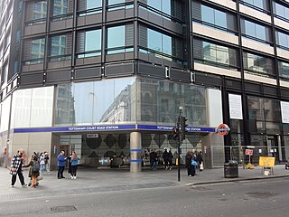
Tottenham Court Road is an interchange station in the West End of London for London Underground and Elizabeth line services.

<span class="mw-page-title-main">Notting Hill Gate tube station</span> London Underground station

Notting Hill Gate is a London Underground station near Notting Hill, London, located on the street called Notting Hill Gate. On the Central line, the station is between Holland Park and Queensway stations. On the Circle and District lines, it is between High Street Kensington and Bayswater stations. It is on the boundary of Travelcard Zone 1 and Zone 2.

<span class="mw-page-title-main">Bounds Green tube station</span> London Underground station

Bounds Green is a London Underground station, located at the junction of Bounds Green Road and Brownlow Road in Bounds Green in the London Borough of Haringey, North London. The station is on the Piccadilly line, between Wood Green and Arnos Grove stations, and is on the boundary between Zone 3 and Zone 4.

<span class="mw-page-title-main">Charing Cross tube station</span> London Underground station

Charing Cross is a London Underground station at Charing Cross in the City of Westminster. The station is served by the Bakerloo and Northern lines and provides an interchange with Charing Cross mainline station. On the Bakerloo line, the station is between Piccadilly Circus and Embankment stations, and on the Charing Cross branch of the Northern line, it is between Leicester Square and Embankment stations. The station is in fare zone 1.

<span class="mw-page-title-main">Piccadilly Circus tube station</span> London Underground station

Piccadilly Circus is a London Underground station located directly beneath Piccadilly Circus itself, with entrances at every corner. Located in Travel-card Zone 1, the station is on the Piccadilly line between Green Park and Leicester Square stations and on the Bakerloo line between Oxford Circus and Charing Cross stations.
<span class="mw-page-title-main">King's Cross St Pancras tube station</span> London Underground station

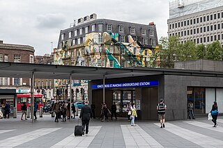
King's Cross St Pancras is a London Underground station on Euston Road in the Borough of Camden, Central London. It serves King's Cross and St Pancras main line stations in fare zone 1, and is an interchange between six Underground lines. The station was one of the first to open on the network. As of 2023, it is the most used station on the network for passenger entrances and exits combined.

<span class="mw-page-title-main">Green Park tube station</span> London Underground station

Green Park is a London Underground station located on the edge of Green Park, with entrances on both sides of the Piccadilly. The station is served by three lines: Jubilee, Piccadilly and Victoria. On the Jubilee line the station is between Bond Street and Westminster stations, on the Piccadilly line it is between Hyde Park Corner and Piccadilly Circus stations, and on the Victoria line it is between Victoria and Oxford Circus stations. It is in fare zone 1.

<span class="mw-page-title-main">South Kensington tube station</span> London Underground station

South Kensington is a London Underground station in the district of South Kensington, south west London. It is served by three lines: Circle, District and Piccadilly. On the Circle and District lines the station is between Gloucester Road and Sloane Sqaure stations, and on the Piccadilly line it is between Gloucester Road and Knightsbridge stations. The station is located in Travelcard Zone 1. The main station entrance is located at the junction of Old Brompton Road (A3218), Thurloe Place, Harrington Road, Onslow Place and Pelham Street. Subsidiary entrances are located in Exhibition Road giving access by pedestrian tunnel to the Natural History, Science and Victoria and Albert Museums. Also close by are the Royal Albert Hall, Imperial College London, the Royal College of Music, the London branch of the Goethe-Institut and the Ismaili Centre.

<span class="mw-page-title-main">Bond Street station</span> London Underground and Elizabeth line station

Bond Street is an interchange station in Mayfair, in the West End of London for London Underground and Elizabeth line services. Entrances are on Oxford Street, near its junction with New Bond Street, and on Hanover Square.

<span class="mw-page-title-main">Goodge Street tube station</span> London Underground station

Goodge Street is a London Underground station on Tottenham Court Road in Fitzrovia, in the London Borough of Camden. It is on the Charing Cross branch of the Northern line between Warren Street and Tottenham Court Road stations, and is in Travelcard Zone 1.

<span class="mw-page-title-main">Covent Garden tube station</span> London Underground station

Covent Garden is a London Underground station serving Covent Garden and the surrounding area in the West End of London. It is on the Piccadilly line between Leicester Square and Holborn stations and is in Travelcard Zone 1. The station is at the corner of Long Acre and James Street and the street-level concourse is a Grade II listed building.
<span class="mw-page-title-main">Hyde Park Corner tube station</span> London Underground station

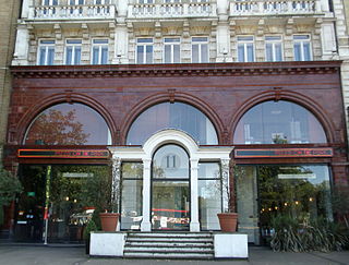
Hyde Park Corner is a London Underground station near Hyde Park Corner in Hyde Park, London. It is on the Piccadilly line between Knightsbridge and Green Park, and is located in Travelcard zone 1.

<span class="mw-page-title-main">Knightsbridge tube station</span> London Underground station

Knightsbridge is a London Underground station in Knightsbridge, London. It is on the Piccadilly line between South Kensington and Hyde Park Corner, and is in Travelcard Zone 1.

<span class="mw-page-title-main">Kentish Town station</span> London Underground and railway station

Kentish Town is an interchange station located in Kentish Town in the London Borough of Camden for London Underground and National Rail services.
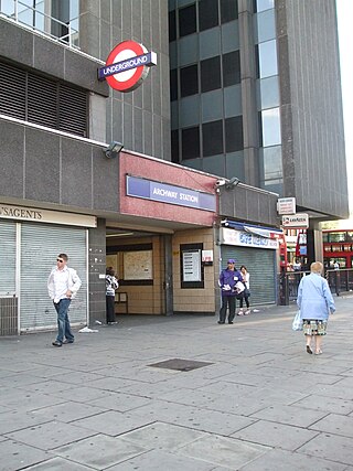
<span class="mw-page-title-main">Archway tube station</span> London Underground station

Archway is a London Underground station at the intersection of Holloway Road, Highgate Hill, Junction Road and Archway Road in Archway, north London, directly underneath the Vantage Point building. It is on the High Barnet branch of the Northern line, between Highgate and Tufnell Park stations, in Zones 2 and 3.
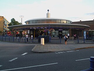
<span class="mw-page-title-main">Southgate tube station</span> London Underground station

Southgate is a London Underground station in Southgate. It is on the Piccadilly line between Arnos Grove and Oakwood stations and is in Travelcard Zone 4.

<span class="mw-page-title-main">Alperton tube station</span> London Underground station

Alperton is a London Underground station in Alperton, north-west London. It is on the Uxbridge branch of the Piccadilly line between Sudbury Town and Park Royal stations, in Travelcard Zone 4. It is located on Ealing Road (A4089), a short distance from the junction with Bridgewater Road (A4005), and is close to the Paddington branch of the Grand Union Canal.

<span class="mw-page-title-main">Holloway Road tube station</span> London Underground station

Holloway Road is a station on the London Underground. It is on the Piccadilly line between Caledonian Road and Arsenal stations, and in Travelcard Zone 2. The station opened on 15 December 1906.
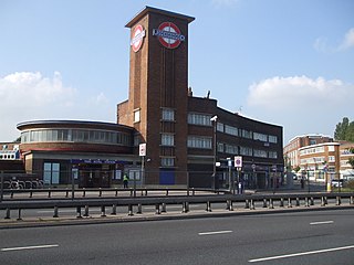
<span class="mw-page-title-main">Park Royal tube station</span> London Underground station

Park Royal is a London Underground station. It is on the Piccadilly line between North Ealing and Alperton stations and is in Travelcard Zone 3. It is situated on the south side of the east–west Western Avenue (A40), surrounded by residential Ealing and industrial Park Royal. There is a pedestrian subway under the A40 road near the station.

References

  1. "Station Usage Data" (XLSX). Usage Statistics for London Stations, 2019. Transport for London. 23 September 2020. Archived from the original on 9 November 2020. Retrieved 9 November 2020.
  2. "Station Usage Data" (XLSX). Usage Statistics for London Stations, 2020. Transport for London. 16 April 2021. Retrieved 1 January 2022.
  3. "Station Usage Data" (XLSX). Usage Statistics for London Stations, 2021. Transport for London. 12 July 2022. Retrieved 7 September 2022.
  4. "Station Usage Data" (XLSX). Usage Statistics for London Stations, 2022. Transport for London. 4 October 2023. Retrieved 10 October 2023.
  5. "Station Usage Data" (XLSX). Usage Statistics for London Stations, 2023. Transport for London. 8 August 2024. Retrieved 16 September 2024.
  6. Follenfant, H. G. (1975). Reconstructing London's underground. London Transport Executive. p. 45. ISBN   9780853290391.
  7. "Underground Journeys: Leicester Square". Royal Institute of British Architects. Archived from the original on 7 July 2011.
  8. Lee, Charles (1973). The Piccadilly Line. London: London Regional Transport. p. 23. ISBN   0853290423.
  9. "Underground Journeys: Escalators". Royal Institute of British Architects. Archived from the original on 7 July 2011.
  10. "Buses from Leicester Square" (PDF). TfL. June 2022. Retrieved 1 August 2022.
  11. "Night buses from Leicester Square" (PDF). TfL. June 2022. Retrieved 1 August 2022.
Preceding station Underground no-text.svg London Underground Following station
Piccadilly Circus Piccadilly line Covent Garden
Tottenham Court Road Northern line
Charing Cross Branch
Charing Cross