
Badakhshan is a historical region comprising the Wakhan Corridor in northeast Afghanistan, eastern Tajikistan, and Taxkorgan Tajik Autonomous County in China. Badakhshan Province is one of the 34 provinces of Afghanistan. Much of historic Badakhshan lies within Tajikistan's Gorno-Badakhshan Autonomous Region in the southeastern part of the country. The music of Badakhshan is an important part of the region's cultural heritage.

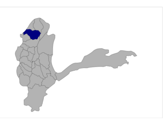
Badakhshan Province is one of the 34 provinces of Afghanistan, located in the northeastern part of the country. It is bordered by Tajikistan's Gorno-Badakhshan in the north and the Pakistani regions of Lower and Upper Chitral and Gilgit-Baltistan in the southeast. It also has a 91-kilometer (57-mile) border with China in the east.

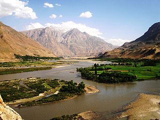
Darvaz, alternatively Darwaz, Darvoz, or Darwoz, or the Darvaz Khanate was an independent Tajik principality until 1878, ruled by a Mir and its capital was at Qal'ai Khumb. The principality controlled territory on the left and right banks of the Oxus River. The major settlements of Darvaz were Qal'ai Khumb and Kham.
Shighnan, also Shignan, Shugnan, Shughnan, and Khughnan, is an historic region whose name today may also refer to a town and a district in Badakhshan Province in the mountainous northeast of Afghanistan and also a district in Gorno-Badakhshan Autonomous Province in Tajikistan. The administrative center of the Shighnan District of Afghanistan is called Qaleh Barpanjeh. The administrative center of the Shughnon District of Tajikistan is called Khorogh.

Darayim is a district in Badakhshan province, Afghanistan. It was created in 2005 from part of Fayzabad district and is home to an estimated 68,419 residents.

Darwaz-e Bala, also known as Nusay, is a district in Badakhshan province, Afghanistan. It was created in 2005 from part of Darwaz District. It is home to approximately 11,000 residents.

Khash District is one of the 28 districts of Badakhshan province, northeastern Afghanistan. It was created in 2005 from part of Jurm district and is home to approximately 43,306 residents, making it the third most populous district of the province.
Kuf Ab is one of the 28 districts of Badakhshan province in eastern Afghanistan. It was created in 2005 from part of Khwahan and is home to approximately 21,400 residents. This district borders with the Districts Khwahan, Shekay, Nusay, Maimay, Raghistan, and with the Tajik district of Darvoz Gorno-Badakhshan Autonomous Province, Tajikistan.

Shekay or Shikai Persian: شهرستان شِکی is one of the 28 districts of Badakhshan province in northeastern Afghanistan. It was created in 2005 from part of Darwaz District and is home to approximately 26,000 residents. This district borders Nusay and Kuf Ab districts in Badakhshan and also Darvoz District in the Gorno-Badakhshan Autonomous Region of Tajikistan.

Tagab is one of the 29 districts of Badakhshan province in Afghanistan. It was created in 2005 from part of Fayzabad District and has a population of approximately 31,207 residents. The Karaste Canal is located in Tagab District.

Yaftal Sufla is one of the 29 districts of Badakhshan province in eastern Afghanistan. It was created in 2005 from part of the Fayzabad District and is home to approximately 58,626 residents.

Yamgan is one of the 29 districts of Badakhshan Province in eastern Afghanistan. It was created in 2005 from part of the Baharak District and is home to approximately 20,000 residents, mostly Ismailis.

Yawan is one of the 28 districts of Badakhshan province in eastern Afghanistan. It was created in 2005 from part of the Ragh District and is home to approximately 36,037 residents.

Darvoz District is a district in Tajikistan, located at the extreme north-west of the Gorno-Badakhshan Autonomous Region. It borders on Afghanistan to the south, along the Panj, and within Tajikistan on Khatlon Region to the west and on the Districts of Republican Subordination to the north. Its administrative capital is Qal'ai Khumb. The population of Darvoz district is 24,000. The district was historically part of the Darvaz principality, a semi-independent statelet ruled by a mir.

The Tajikistan–Afghanistan Friendship Bridge connects the two banks of Darvaz region across the Panj River separating Tajikistan and Afghanistan, at the town of Qal'ai Khumb. It was opened on 6 July 2004.

Khwahan is one of the 28 districts of Badakhshan province, located in northeastern Afghanistan. The district capital is Khwahan. The district borders Raghistan to the southwest, Kuf Ab to the northeast, the Panj river to the northwest, and Shamsiddin Shohin district, located in the Khatlon region of Tajikistan to the west.
Amurn is a village in Darwaz District, Badakhshan Province in north-eastern Afghanistan.
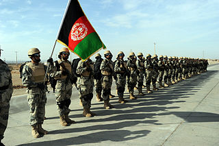
The Afghan Border Force (ABF) was a paramilitary police responsible for counterinsurgency and security of Afghanistan's border area with neighboring countries extending up to 30 miles (48 km) into the interior and formed part of the Afghan National Army. In December 2017, most of the Afghan Border Police (ABP) personnel of the Afghan National Police were transferred to the Afghan National Army to form the Afghan Border Force. The ABP retained 4,000 personnel for customs operations at border crossings and international airports such as checking documents of foreigners entering the country or deporting them.

Darwaz Airport is located next to the Panj River in Darwaz, which is the capital of Darwaz District in Badakhshan Province of Afghanistan. Situated at an elevation of 5,066 feet (1,544 m) above sea level, the airfield has a gravel runway measuring around 2,145 by 100 feet. The name Darwaz is Persian and refers to an entry or a gateway.

Maimay, also known as Darwaz-e Payeen, or simply Darwaz, is a district in Badakhshan Province of Afghanistan. It was created in 2005 from part of Darwaz District. It is home to approximately 29,893 residents. Maimay borders the Kuf Ab, Raghistan, Shighnnan, and Nusay districts, along with some districts in the Gorno-Badakhshan Autonomous Province, Tajikistan, including Vanj, Rushon, and Shughnon. The district was historically part of the Darwaz principality, a semi-independent statelet ruled by a mir.

