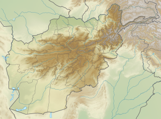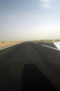
Hamid Karzai International Airport is located 5 kilometers (3.1 mi) from the city center of Kabul in Afghanistan. It serves as one of the nation's main international airports and as one of the largest military bases, capable of housing over one hundred aircraft. It was previously named Kabul International Airport and locally as Khwaja Rawash Airport, though it continues to be officially known by some airlines by the latter name. The airport was given its new name in 2014 in honor of former President Hamid Karzai. The decision was made by the National Assembly of Afghanistan and the Cabinet of President Ashraf Ghani.

Kunduz Airport is a public and military airport located 5 miles (8 km) south-southeast of Kunduz, a city in Kunduz Province in Afghanistan. It is also 9 miles (14 km) west of Khan Abad, 25 miles (40 km) south of the Oxus River, and 33 miles (53 km) south of the Tajikistan border.

Sheghnan Airport is located in the extreme northeast section of Afghanistan deep within Pamir mountain ranges in the Badakhshan Province of Afghanistan. The airport is close to the border with Tajikistan; to the east and parallel of the Shighnan airport is Khorog Airport in Tajikistan. These two airports are only 2,000 feet (0.6 km) apart and are separated by a river.

Mazar-e-Sharif International Airport, also known as Mawlānā Jalāl ad-Dīn Muhammad Balkhī International Airport, is located 9 km east of Mazar-i-Sharif in northern Afghanistan, a journey of 15 minutes by taxi from the center of the city. It comes with a dual-runway capable of handling large aircraft such as Boeing 747, Boeing C-17 Globemaster III and Antonov An-225. The airport has facilities for up to 1,000 passengers, making it one of the largest airports in Afghanistan.

Jalalabad Airport is located 3 miles (4.8 km) southeast of Jalalabad city in Afghanistan. This airport is currently being used only for military purposes and sometimes the United Nations' aircraft use this airport. It is occupied and maintained by the United States Armed Forces and civilian contractors. They operate out of Forward Operating Base Fenty, which is adjacent to Jalalabad Airport. The Afghan Air Force (AAF) and members of the International Security Assistance Force also use the airport.

Fayzabad Airport is an airport located 3.5 miles (5.6 km) northwest of Fayzabad, the provincial capital of Badakhshan Province, Afghanistan.

Bost Airport is an airport serving Lashkargah, a city in Helmand Province in Afghanistan. It is located on the east bank of the Helmand River, 5 miles (8 km) north of its junction with the Arghandab River. It is also 75 miles (121 km) west of Kandahar.

Khost Airport is located next to the city of Khost in eastern Afghanistan. It has been used historically for military purposes only but in recent years it was developed and expanded to be used also for commercial flights.

Chaghcharan Airport is an airport serving the city of Chaghcharan in Ghor Province, Afghanistan. It is located northeast of the Hari River, one mile east/northeast of Chaghcharan. It has a runway approximately 2,000 metres (6,600 ft) in length, taxi way and apron asphalted and capable of supporting small to medium (C130) sized aircraft. The airport is mostly used by the International Security Assistance Force (ISAF) and the Afghan National Security Forces (ANSF) but there are also regularly scheduled commercial flights as of May, 2014.

Farah Airport is a military airport located in Farah, Afghanistan. It is used by the United States Armed Forces the International Security Assistance Force (ISAF) and the Afghan Air Force (AAF). The United States Army Corps of Engineers is developing and expanding the airport, with new facilities being added for the Afghan National Security Forces (ANSF).

Khwahan Airport Persian: فرودگاه خواهان is a private use airport located near Khwahan, Badakhshan, Afghanistan.

Zaranj Airport is a domestic airport located by the city of Zaranj in far southwestern Afghanistan. It was built by the Afghan government to serve the population of Nimruz Province. The airport is used for civilian and military purposes. In addition to the Afghan Air Force and Afghan National Police, the U.S military and the International Security Assistance Force (ISAF) also have presence.

Taloqan Airport is an airport serving the city of Taloqan in Takhar Province, Afghanistan.

Tarinkot Airport is a domestic airport located in southeastern Afghanistan, one mile (2 km) south of Tarinkot, the capital city of the province of Urozgan. It is 60 miles (97 km) north of Kandahar, and 205 miles (330 km) south-southwest of the Afghan capital of Kabul. It was originally built to serve the population of Urozgan Province and neighboring Daykundi Province, which was partitioned in 2004.

Ghazni Airport is located in Ghazni, Afghanistan, next to the main Ghazni-Kandahar Highway. It serves the population of Ghazni and other nearby Afghan provinces. The airport is mainly used for civilian flights and is still being developed as of late 2013.

Maymana Airport is a public use airport located near Maymana, Faryab, Afghanistan.

Eshkashem Airport is a public use airport located near Eshkashem, Badakhshan, Afghanistan.

Darwaz Airport is a private use airport located near Darwaz, Badakhshan, Afghanistan.

Sharana Air Base is a public use airport located near Sharana, Paktika, Afghanistan.

Yawan Airport is a public use airport located in the Yawan District, Badakhshan, Afghanistan.


