Highway 97 is a major highway in the Canadian province of British Columbia. It is the longest continuously numbered route in the province, running 2,081 km (1,293 mi) and is the only route that runs the entire north–south length of British Columbia, connecting the Canada–United States border near Osoyoos in the south to the British Columbia–Yukon boundary in the north at Watson Lake, Yukon.
Highway 3A is the designation of two segments of highway in the southern part of British Columbia.
Highway 93 is a north–south route through the southeastern part of British Columbia, in the Regional District of East Kootenay and takes its number from U.S. Highway 93 that it connects with at the Canada–United States border. It follows the Crowsnest Highway (Highway 3) and Highway 95 through Radium Hot Springs and to where it crosses the Continental Divide into Alberta at Vermilion Pass, where it continues as Alberta Highway 93. The section between the Canada-U.S. border and the Crowsnest Highway is known as the Elko–Roosville Highway, the section between the Crowsnest Highway and Radium Hot Springs is known as the Kootenay–Columbia Highway, while the section east of Radium Hot Springs is known as the Banff–Windermere Parkway.
The Stewart–Cassiar Highway, also known as the Dease Lake Highway and the Stikine Highway as well as the Thornhill –Kitimat Highway from Kitimat to Thornhill, is the northwesternmost highway in the Canadian province of British Columbia. A scenic route through some of the province's most isolated areas, the highway first gained designation as British Columbia Highway 37 in the year 1975. At that time, its southern terminus was at the community of New Hazelton on the BC Highway 16. In 1975, with the completion of a new bridge over the Kitimat River, the highway's Yellowhead junction was relocated to a point on Highway 16 just south of the site of Kitwanga. Highway 37 was then extended south to Kitimat in 1986 superseding what was then designated Highway 25. At the north end, the highway briefly stretches into the Yukon, becoming Yukon Highway 37.

Burns Lake is a rural village in the North-western-Central Interior of British Columbia, Canada, incorporated in 1923. The village had a population of 1,659 as of the 2021 Census.

The Burrard Peninsula is a peninsula in the Lower Mainland region of British Columbia, Canada, bounded by the Burrard Inlet to the north, the Georgia Strait to the west, the North Arm of Fraser River to the south, and the Pitt River and Douglas Island to the east. The City of Vancouver occupies almost all of the western half of the peninsula, and the Cities of Burnaby and New Westminster occupy more than half of the eastern half. At its northeastern end, the peninsula is connected to the Eagle Mountain and Mount Burke of the Coast Mountains via a small isthmus at the center of the Tri-Cities.
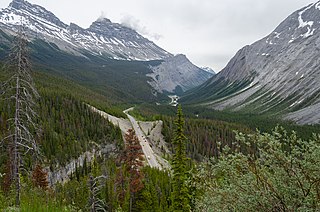
Highway 93 is a north–south highway in Alberta, Canada. It is also known as the Banff-Windermere Parkway south of the Trans-Canada Highway and the Icefields Parkway north of the Trans-Canada Highway. It travels through Banff National Park and Jasper National Park and is maintained by Parks Canada for its entire length. It runs from the British Columbia border at Vermilion Pass in the south, where it becomes British Columbia Highway 93, to its terminus at the junction with the Yellowhead Highway at Jasper. The route takes its number from U.S. Route 93, which runs uninterrupted south to central Arizona, and was initially designated as '93' in 1959.

Houston is a forestry, mining and tourism town in the Bulkley Valley of the Northern Interior of British Columbia, Canada. Its population as of 2021 was 3,052, with approximately 2,000 in the surrounding rural area. It is known as the "steelhead capital" and it has the world's largest fly fishing rod. Houston's tourism industry is largely based on ecotourism and Steelhead Park, situated along Highway 16. Houston is named in honour of the pioneer newspaperman John Houston.
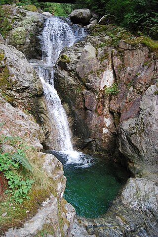
Davis Lake Provincial Park is a 185 acres (0.75 km2) park in British Columbia, Canada, established as a protected provincial park in October 1963. It is located east of the southern end of Stave Lake, northeast of Mission, British Columbia, approximately 18 km north on Sylvester Rd from BC Highway 7. There are campgrounds and beaches at the south end of the lake, access is walk-in only via a 1 km unmaintained gravel road.
Babine–Witsuwitʼen or Nadotʼen-Wetʼsuwetʼen is an Athabaskan language spoken in the Central Interior of British Columbia. Its closest relative is Carrier. Because of this linguistic relationship together with political and cultural ties, Babine–Witsuwitʼen is often referred to as Northern Carrier or Western Carrier. Specialist opinion is, however, that it should be considered a separate, though related, language.

Cultus Lake is a lake, associated community and provincial park in the Fraser Valley region of British Columbia, Canada. It is the source of the Sweltzer River. Cultus Lake is located 11 kilometres (6.8 mi) south of the Chilliwack River, near the city of Chilliwack and approximately 80 kilometres (50 mi) east of Vancouver. In 1950, Cultus Lake became a provincial park of British Columbia. Cultus Lake covers an area of 656 hectares, evenly on either side of the lake. At one time the lake had a sawmill and booming ground until it became a provincial park in the 1950s.
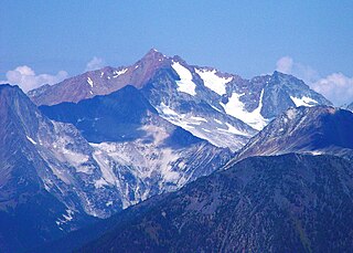
Skihist Mountain, also sometimes referred to as Skihist Peak, is the highest mountain in the Cantilever Range and in southwestern British Columbia, Canada. It is located on the southern boundary of Stein Valley Nlaka'pamux Heritage Park, about 20 km (12 mi) west of Lytton. It is the highest summit in the Lillooet Ranges, which lie between the Lillooet and Fraser Rivers, south of the Gates Valley and Seton and Anderson Lakes.
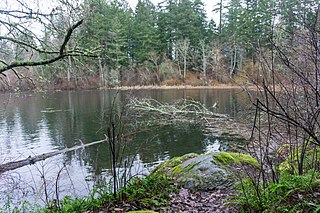
The Elk/Beaver Regional Park is a 1,072-acre (434 ha) park in Saanich, British Columbia, containing Elk Lake and Beaver Lake.

From 1886 to 1920, steamboats ran on the upper reaches of the Columbia and Kootenay in the Rocky Mountain Trench, in western North America. The circumstances of the rivers in the area, and the construction of transcontinental railways across the trench from east to west made steamboat navigation possible.
Clowhom Lake is a reservoir in the Sechelt Inlet basin, located on the Clowhom River at the upper end of Salmon Inlet, the southern side-inlet of Sechelt Inlet. Formed by Clowhom Dam, the reservoir was formerly two lakes, Upper Clowhom Lake and Lower Clowhom Lake, and had been referred to prior to their merger from inundation as the Clowhom Lakes.
The Banff–Windermere Highway, also known as the Banff-Windermere Parkway, is a 105 km (65 mi) highway which runs through the Canadian Rockies in British Columbia and Alberta in Canada. It runs from Radium Hot Springs, British Columbia to Castle Junction, Alberta, passing through Kootenay National Park and Banff National Park. It is designated as part of British Columbia Highway 93 and Alberta Highway 93.
There are four current and two former suffixed routes of Highway 97 in British Columbia, Canada. The majority of the routes serve the Okanagan area of the British Columbia Interior.
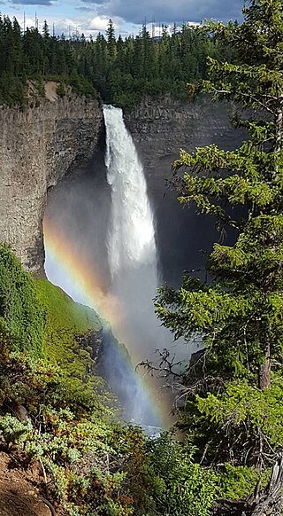
Wells Gray Provincial Park is a large wilderness park located in east-central British Columbia, Canada. The park protects most of the southern, and highest, regions of the Cariboo Mountains and covers 5,415 square kilometres. It is British Columbia's fifth largest provincial park, after Tweedsmuir, Tatshenshini, Spatsizi and Northern Rocky Mountains.

Cascade Falls Regional Park is a regional park under the administration of the Fraser Valley Regional District in the Hatzic Valley of the Lower Mainland region of British Columbia, Canada. The park was originally 9.5 hectares in area but was expanded to a current 22 hectares. It has picnic tables and pit toilets, with various hiking trails and a walkway leading to a viewing platform over a large waterfall, which is 15 minutes walk from the park's parking lot.
The Khtada River is a tributary of the Skeena River in the North Coast Regional District of the province of British Columbia, Canada. It originates in the Kitimat Ranges of the Coast Mountains, and flows south about 26 km (16 mi) to the lower tidal reach of the Skeena River, about 24 km (15 mi) upriver from Port Essington, 48 km (30 mi) southeast of Prince Rupert, and about 74 km (46 mi) southwest of Terrace.


