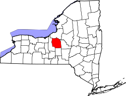
De Witt, New York | |
---|---|
Coordinates: 43°2′6″N76°4′4″W / 43.03500°N 76.06778°W Coordinates: 43°2′6″N76°4′4″W / 43.03500°N 76.06778°W | |
Country | United States |
State | New York |
County | Onondaga |
Town | DeWitt |
Area | |
• Total | 6.50 sq mi (16.85 km2) |
• Land | 6.49 sq mi (16.80 km2) |
• Water | 0.02 sq mi (0.05 km2) |
Elevation | 473 ft (144 m) |
Population (2020) | |
• Total | 11,247 |
• Density | 1,734.04/sq mi (669.54/km2) |
Time zone | UTC-5 (Eastern (EST)) |
• Summer (DST) | UTC-4 (EDT) |
ZIP Codes | |
Area code(s) | 315/680 |
FIPS code | 36-20467 |
GNIS feature ID | 2806956 [2] |
De Witt is a census-designated place (CDP) in the town of DeWitt, Onondaga County, New York, United States. It was first listed as a CDP prior to the 2020 census. [2]
The CDP is in eastern Onondaga County, in the southern part of the town of DeWitt. It is bordered to the northwest by the city of Syracuse, to the north by the village of East Syracuse, and to the east and south by Interstate 481, which separates it from the rest of the town of DeWitt. East Genesee Street is the main road through the CDP, leading west 4 miles (6 km) to downtown Syracuse and east 3 miles (5 km) to Fayetteville. New York State Route 92 follows East Genesee Street within the De Witt CDP, while State Route 5 follows it in the eastern part of the CDP, before turning north to take Erie Boulevard toward downtown.
Le Moyne College is in the northwest corner of the CDP.
Historical population | |||
---|---|---|---|
Census | Pop. | %± | |
2020 | 11,247 | — | |
U.S. Decennial Census [3] |
DeWitt is a town in Onondaga County, New York, United States. As of the 2020 census, the town's population was 26,074. The town is named after Major Moses DeWitt, a judge and soldier. An eastern suburb of Syracuse, DeWitt also is "the site of most of the campus and all of the academic buildings of Le Moyne College".
East Syracuse is an incorporated village and a suburb of the City of Syracuse in eastern Onondaga County, New York, United States. As of the 2010 U.S. census, the village had a population of 3,084. It is located immediately east of Syracuse, in the town of DeWitt.
Fairmount is a hamlet in Onondaga County, New York, United States. Fairmount is a western suburb of Syracuse, located in the far southeastern corner of the town of Camillus. Its zip code is 13219 (Syracuse). It is located within the West Genesee Central School District. The population was 10,224 at the 2010 census.
Manlius is a town in Onondaga County, east of the city of Syracuse, New York, United States. The population was 33,712 at the 2020 census, making it the third largest suburb in metropolitan Syracuse. In 2005, the town was ranked 98th on CNN's list of Best Places to Live.
New York State Route 5 (NY 5) is a state highway that extends for 370.80 miles (596.74 km) across the state of New York in the United States. It begins at the Pennsylvania state line in the Chautauqua County town of Ripley and passes through Buffalo, Syracuse, Utica, Schenectady, and several other smaller cities and communities on its way to downtown Albany in Albany County, where it terminates at U.S. Route 9 (US 9), here routed along the service roads for Interstate 787 (I-787). Prior to the construction of the New York State Thruway, it was one of two main east–west highways traversing upstate New York, the other being US 20. West of New York, NY 5 continues as Pennsylvania Route 5 (PA 5) to Erie.
Interstate 690 (I-690) is an auxiliary Interstate Highway that extends for 14.19 miles (22.84 km) through the vicinity of Syracuse, New York, in the United States. It is a spur of I-90 that travels southeast from Thruway exit 39 in Van Buren to I-481 in DeWitt. In between, I-690 passes through the western suburbs of Syracuse before heading east through the city itself, where it meets I-81 in downtown Syracuse. The expressway continues northwest of the Thruway as New York State Route 690 (NY 690).
New York State Route 48 (NY 48) is a 28.20-mile (45.38 km) north–south state highway in Central New York in the United States. The southern terminus of the route is located at Interstate 690 (I-690) exit 3 near the interchange between I-690 and the New York State Thruway (I-90) in Van Buren, northwest of Syracuse. The northern terminus is located at an intersection with NY 104 in Oswego. In between, NY 48 passes through the riverside communities of Baldwinsville and Fulton and runs alongside both the Seneca River and Oswego River. For most of its route, NY 48 serves as an alternate route of NY 481. The routes share similar alignments along the Oswego River from the Syracuse area to Oswego, with NY 481 following the eastern riverbank between the two locations.
New York State Route 173 (NY 173) is a state highway located in the Syracuse area of central New York in the United States. It takes a slightly bow-shaped route from NY 31 in the town of Van Buren to NY 5 in Chittenango, gently curving to the south of Downtown Syracuse in the center of its 30.59-mile (49.23 km) routing. Even so, NY 173 briefly enters the Syracuse city limits near where it intersects U.S. Route 11 (US 11). NY 173 passes through several suburbs of Syracuse, including Camillus, where it first meets NY 5, and Manlius, where it has a short overlap with NY 92.
New York State Route 290 (NY 290) is a state highway located entirely within Onondaga County, New York, extending from downtown Syracuse to the east side of the county. It provides access to Green Lakes State Park from the north.
New York State Route 92 (NY 92) is a state highway located in central New York in the United States. The western terminus of the route is at an intersection with U.S. Route 11 in downtown Syracuse. Its eastern terminus is at a junction with US 20 west of the village of Cazenovia. NY 92 is known as East Genesee Street through Syracuse and DeWitt; from DeWitt to Cazenovia, its name varies by location. It heads generally eastward through Syracuse to DeWitt, where it crosses Interstate 481 (I-481) while concurrent with NY 5. At the east end of the overlap, it splits off follows a more southeasterly routing through the village of Manlius to Cazenovia.
New York State Route 175 is an east–west state highway located entirely within Onondaga County, New York, in the United States. The 15.46-mile (24.88 km) route begins at an intersection with U.S. Route 20 (US 20) east of the village of Skaneateles and passes through the village of Marcellus before ending at a junction with US 11 in Syracuse. The highway was designated in the 1930 renumbering of state highways in New York.
New York State Route 370 (NY 370) is an east–west state highway in Central New York in the United States. It extends for about 35 miles (56.33 km) from an intersection with NY 104 and NY 104A south of the Wayne County village of Red Creek to a junction with U.S. Route 11 (US 11) in the Onondaga County city of Syracuse. The western and central portions of the route pass through mostly rural areas; however, the eastern section serves densely populated areas of Onondaga County, including the villages of Baldwinsville and Liverpool. NY 370 also passes through Cayuga County, where it connects to NY 34, a major north–south highway in Central New York.
New York State Route 598 (NY 598) is a north–south state highway located within Onondaga County, New York, in the United States. It extends for 2.31 miles (3.72 km) from an intersection with NY 5 in the city of Syracuse to a junction with NY 298 in the adjacent town of Salina. The route intersects Interstate 690 (I-690) near its southern terminus and passes through Syracuse's Eastwood neighborhood near its midpoint, where it meets NY 290.
New York State Route 20SY (NY 20SY) was a state highway in the vicinity of the city of Syracuse, New York, in the United States. It connected U.S. Route 20 (US 20) to downtown Syracuse via Skaneateles, Camillus, Manlius, and Cazenovia in Onondaga County and Madison County. The highway began at an intersection with US 20 and NY 321 in the village of Skaneateles and ended at a junction with US 20, NY 20N, and NY 92 near the village of Cazenovia. Most of NY 20SY overlapped another route; however, two sections of NY 20SY—one in the town of Camillus and another near the village of Fayetteville—were not concurrent with another highway.
Rushford is a census-designated place comprising the central settlement in the town of Rushford, Allegany County, New York, United States. As of the 2010 census it had a population of 363, out of a total population of 1,150 in the town.
Pavilion is a hamlet and census-designated place within the town of Pavilion in Genesee County, New York, United States. As of the 2010 census, the population of the CDP was 646, out of a total of 2,495 people in the town as a whole.
Greigsville is a hamlet and census-designated place (CDP) in the town of York, Livingston County, New York, United States. Its population was 209 as of the 2010 census. The community is located at the intersection of New York State Route 36 and New York State Route 63.
Groveland Station is a census-designated place (CDP) in Livingston County, New York, United States. The CDP consists of the hamlet of Groveland and nearby residential areas. The CDP population was 281 as of the 2010 census. New York State Route 63 passes through the community.
Linwood is a hamlet and census-designated place (CDP) in the town of York, Livingston County, New York, United States. Its population was 74 as of the 2010 census. Linwood had a post office until February 6, 1993; it still has its own ZIP code, 14486.
Radisson is a planned community and census-designated place (CDP) in the town of Lysander, Onondaga County, New York, United States. It was first listed as a CDP prior to the 2020 census.