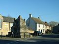
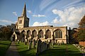
Deeping St James

Last updated

Deeping St James
UK Deeping St James.jpg
Signpost in Deeping St James
Lincolnshire UK location map.svg
Red pog.svg
Deeping St James
Location within Lincolnshire
Population6,923  [1]
OS grid reference TF150095
  London 80 mi (130 km)  S
Civil parish
  • Deeping St James
District
Shire county
Region
Country England
Sovereign state United Kingdom
Post town PETERBOROUGH
Postcode district PE6
Dialling code 01778
Police Lincolnshire
Fire Lincolnshire
Ambulance East Midlands
UK Parliament
List of places
UK
England
Lincolnshire
52°40′18″N0°17′58″W / 52.6717°N 0.29955°W / 52.6717; -0.29955

Deeping St James is a large village in the South Kesteven district of Lincolnshire, England. The population of the civil parish (including Frognall) was reported as 7,051 at the 2011 census. [2]

Contents

History

Based around a now lost 12th-century Benedictine Priory, destroyed during the Dissolution of the Monasteries, [3] the Grade I listed Anglican church of St James [4] is the largest church in The Deepings. It is a mixture of Norman, Early English and Perpendicular styles, [5] with a tower and spire added in 1717. [6] [7] The stones from the priory were used to build various 17th-century buildings in the area.[ citation needed ]

The village also has an 18th-century village lock-up, constructed on the site and with the materials from a 15th-century wayside cross. [8]

In the 17th century the manor was associated with the Wymondsold family of Welbeck Place, Putney, Surrey and East Lockinge, Berks. [9]

St James Deeping railway station, built by the Great Northern Railway Company in 1848, was closed in 1964. [10]

Although the separate cut for the Stamford Canal did not start until upstream of Market Deeping, Briggin's lock (or the Deeping High lock) was an important part of the Welland Navigation, and is still in place but is not navigable.

Geography

Deeping St James lies 1 mile (1.6 km) east from Market Deeping, to which it is conjoined, and on the River Welland, at the centre of rich sedimentary agricultural land on the B1166 and B1162 roads. With a population of 6,923 in 2,837 households, it is the largest of The Deepings parishes. [11] It falls within the drainage basin of the Welland and Deepings Internal Drainage Board. [12]

Community

The parish church of St James is part of the Elloe West Deanery of the Diocese of Lincoln. The 2013 incumbent is The Reverend Sonia Marshall. [13] [14] There is also the Catholic church of Our Lady and St Guthlac, and a Methodist and two Baptist chapels. With St Guthlac's church in Market Deeping, these comprise the Churches Together in Deeping group.

The Deepings School, the main secondary school for the Deepings area, is located on Park Road. The school is next to the former Deepings Leisure Centre which permanently closed down in 2021.

The village has three public houses, Chinese restaurants and takeaways, a pizza restaurant, garage, home care provider, bakery/tea room, a garden railway specialist, and three computer systems companies.

Resident at Deeping St James is three-time BDO World Champion and three-time World Masters darts champion Martin Adams. In 2015 he was granted the freedom of Deeping St James by the local parish council. [15] Composer Philip Spratley is also a resident.

Sport

A short lived greyhound racing track was opened at the rear of Bundle Farm on 13 June 1931. The racing was independent (not affiliated to the sports governing body the National Greyhound Racing Club) and was known as a flapping track, which was the nickname given to independent tracks. [16] Racing was every Tuesday and Saturday. [17]

Related Research Articles

<span class="mw-page-title-main">Crowland</span> Town in Lincolnshire, England

Crowland or Croyland is a town in the South Holland district of Lincolnshire, England. It is situated between Peterborough and Spalding. Crowland contains two sites of historical interest, Crowland Abbey and Trinity Bridge.

<span class="mw-page-title-main">River Welland</span> Lowland river in the east of England

The River Welland is a lowland river in the east of England, some 65 miles (105 km) long. It drains part of the Midlands eastwards to The Wash. The river rises in the Hothorpe Hills, at Sibbertoft in Northamptonshire, then flows generally northeast to Market Harborough, Stamford and Spalding, to reach The Wash near Fosdyke. It is a major waterway across the part of the Fens called South Holland, and is one of the Fenland rivers that were laid out with washlands. There are two channels between widely spaced embankments with the intention that flood waters would have space in which to spread while the tide in the estuary prevented free egress. However, after the floods of 1947, new works such as the Coronation Channel were constructed to control flooding in Spalding, and the washlands are no longer used solely as pasture, but may be used for arable farming.

<span class="mw-page-title-main">Spalding, Lincolnshire</span> Market town in Lincolnshire, England

Spalding is a market town on the River Welland in the South Holland district of Lincolnshire, England. The town had a population of 34,113 at the 2017 census. The town is the administrative centre of the South Holland District. The town is located between the cities of Peterborough and Lincoln, as well as the towns of Bourne, Market Deeping, March, Boston, Wisbech, Holbeach and Sleaford.

<span class="mw-page-title-main">Bourne, Lincolnshire</span> Market town in Lincolnshire, England

Bourne is a market town and civil parish in the South Kesteven district of Lincolnshire, England. It lies on the eastern slopes of the limestone Kesteven Uplands and the western edge of the Fens, 11 miles (18 km) north-east of Stamford, 12 miles (19 km) west of Spalding and 17 miles (27 km) north of Peterborough. The population at the 2011 census was 14,456. A 2019 estimate put it at 16,780.

<span class="mw-page-title-main">Stamford, Lincolnshire</span> Town in Lincolnshire, England

Stamford is a town and civil parish in the South Kesteven district of Lincolnshire, England. The population at the 2011 census was 19,701 and estimated at 20,645 in 2019. The town has 17th- and 18th-century stone buildings, older timber-framed buildings and five medieval parish churches. It is a frequent film location. In 2013 it was rated a top place to live in a survey by The Sunday Times. Its name has been passed on to Stamford, Connecticut, founded in 1641.

<span class="mw-page-title-main">Market Deeping</span> Town in Lincolnshire, England

Market Deeping is a market town and civil parish in the South Kesteven district of Lincolnshire, England, on the north bank of the River Welland and the A15 road. The population of the town at the 2011 census was 6,008.

<span class="mw-page-title-main">Burwell, Lincolnshire</span> Village and civil parish in England

Burwell is a small village and Civil parish in the East Lindsey district of Lincolnshire, England. It is situated on the A16 road, and north from Spilsby. The village covers approximately 2,200 acres (8.9 km2).

<span class="mw-page-title-main">Uffington, Lincolnshire</span> Village and civil parish in the South Kesteven district of Lincolnshire, England

Uffington is a village and civil parish in the South Kesteven district of Lincolnshire, England. The population of the civil parish at the 2011 census was 686. It is in the valley of the River Welland, between Stamford and The Deepings.

<span class="mw-page-title-main">The Deepings</span> Series of settlements in eastern England

The Deepings are a series of settlements close to the River Welland near the borders of southern Lincolnshire and north western Cambridgeshire in eastern England. Peterborough is about 8 miles to the south, Spalding about 10 miles to the north east and Stamford about 8 miles to the west.

<span class="mw-page-title-main">Swineshead, Lincolnshire</span> Village and civil parish in Lincolnshire, England

Swineshead is a village and civil parish in the Borough of Boston in Lincolnshire, England. It is 7 miles (11 km) west of the town of Boston. The population of the civil parish including Baythorpe was 2,810 at the 2011 census. The parish includes the areas of Swineshead Bridge and North End to the north, Fenhouses and Blackjack to the east, and Drayton to the south.

<span class="mw-page-title-main">Thurlby, South Kesteven</span> Village and civil parish in the South Kesteven district of Lincolnshire, England

Thurlby is a village and civil parish in the South Kesteven district of Lincolnshire, England. It is situated just west of the A15 road, 2 miles (3 km) south from the town of Bourne, and on the edge of the Lincolnshire Fens. It is sometimes referred to as Thurlby by Bourne to distinguish it from other villages in Lincolnshire with the same name. Thurlby and the hamlet of Northorpe to its north are conjoined. The parish had a population of 2,136 at the 2001 census and 2,153 at the 2011 census.

<span class="mw-page-title-main">Greatford</span> Village and civil parish in the South Kesteven district of Lincolnshire, England

Greatford is a village and civil parish in the South Kesteven district of Lincolnshire, England. It is situated 2 miles (3 km) west from the A15, 4.5 miles (7 km) north-east from Stamford, and 5 miles (8 km) south from Bourne. Greatford is noted for Greatford Hall, once the home of Francis Willis.

<span class="mw-page-title-main">Scawby</span> Village and civil parish in North Lincolnshire, England

Scawby is a village and civil parish in North Lincolnshire, England. It is situated 2 miles (3 km) south-west from Brigg, and just east from the A15 road, and south from the M180 motorway. According to the 2001 Census, Scawby population was 2,277, reducing slightly to 2,243 at the 2011 census.

<span class="mw-page-title-main">Stamford Canal</span> Canal in Lincolnshire, England

Stamford Canal, now disused, is one of the earliest post-Roman canals in England. It opened in 1670, around 100 years before the start of the Industrial Revolution which brought about the "golden age" for canals in Britain. Parts of the route can be traced on the ground, though only one lock survives intact. It was part of the Welland Navigation in Lincolnshire. First authorised in 1571, during the reign of Elizabeth I, construction did not start until 1664, under powers granted in 1620 and ratified by James I. It ran for 9.5 miles (15.3 km) from Stamford to Market Deeping and had 12 locks, two of which were on the river section at Deeping St James. No plans of its construction survive, although one of the locks was documented by a visiting water engineer in 1699. It contributed to the wealth of Stamford, allowing barley to be transported to the town for malting.

<span class="mw-page-title-main">Cowbit</span> Village and civil parish in Lincolnshire, England

Cowbit is a village and civil parish in the South Holland district of Lincolnshire, England. The population of the civil parish at the 2011 census was 1,220. It is situated 3 miles (5 km) south from Spalding and 5 miles (8 km) north from Crowland.

<span class="mw-page-title-main">Duddington</span> Human settlement in England

Duddington is a village and former civil parish, now in the parish of Duddington-with-Fineshade, in the North Northamptonshire district, in the ceremonial county of Northamptonshire, England. It is by the junction of the A47 and A43 roads, and is 9 kilometres (6 mi) southwest of the town of Stamford. The village is on the east bank of the River Welland which is the county boundary of Rutland. In 1961 the parish had a population of 184.

<span class="mw-page-title-main">Deeping St James Priory</span>

Deeping St James Priory was a priory in Deeping St James, Lincolnshire, England. It was a dependency of Thorney Abbey.

References

  1. "Area: Deeping St James CP". Office for National Statistics. 28 April 2004. Retrieved 26 October 2013.
  2. "Civil parish population 2011". Neighbourhood Statistics. Office for National Statistics. Archived from the original on 5 October 2016. Retrieved 26 April 2016.
  3. Historic England. "ST JAMES PRIORY CELL (350059)". Research records (formerly PastScape). Retrieved 26 October 2013.
  4. Historic England. "Church of St James (1062680)". National Heritage List for England . Retrieved 21 July 2011.
  5. Cox, John Charles (1916). Lincolnshire. London: Methuen & Co. Ltd. pp. 114, 155.
  6. Historic England. "ST JAMES CHURCH (350062)". Research records (formerly PastScape). Retrieved 27 October 2013.
  7. "Churches' own history description". Priory Church Deeping St. James. Archived from the original on 4 October 2010.
  8. Historic England. "Monument No. 350068". Research records (formerly PastScape). Retrieved 27 October 2013.
  9. Lysons, Daniel (1792). The Environs of London. Vol. 1. Surrey, Putney. pp. 404–435.
  10. Historic England. "ST JAMES DEEPING STATION (507065)". Research records (formerly PastScape). Retrieved 27 October 2013.
  11. "Parish Council details". Deeping St. James Parish Council. Archived from the original on 24 November 2010.
  12. "Welland and Deepings IDB". Welland & Deepings Internal Drainage Board. Retrieved 27 October 2013.
  13. "Deeping St James P C C". Diocese of Lincoln. Archived from the original on 29 October 2013. Retrieved 8 July 2013.
  14. "The Priory Church Deeping St. James" . Retrieved 27 October 2013.
  15. "Martin 'Wolfie' Adams to receive freedom of Deeping St James", Rutland and Stamford Mercury , 29 April 2015 . Retrieved 15 March 2019
  16. Barnes, Julia (1988). Daily Mirror Greyhound Fact File, page 413. Ringpress Books. ISBN   0-948955-15-5.
  17. "Deeping St James". Greyhound Racing Times. Retrieved 8 May 2019.