Stamford Canal

Last updated

Stamford Canal
High Locks Deeping St James geograph 705171.jpg
The remains of Deeping St James High Lock
Specifications
Locks12
Statusdefunct
History
Principal engineerDaniel Wigmore
Date of act1571
Date completed1670
Date closed1863
Geography
Start point Stamford
End point Market Deeping
Connects to River Welland

Stamford Canal, now disused, is one of the earliest post-Roman canals in England. [1] It opened in 1670, around 100 years before the start of the Industrial Revolution which brought about the "golden age" for canals in Britain. [2] Parts of the route can be traced on the ground, though only one lock survives intact. It was part of the Welland Navigation in Lincolnshire. First authorised in 1571, during the reign of Elizabeth I, construction did not start until 1664, under powers granted in 1620 and ratified by James I. It ran for 9.5 miles (15.3 km) from Stamford to Market Deeping and had 12 locks, two of which were on the river section at Deeping St James. No plans of its construction survive, although one of the locks was documented by a visiting water engineer in 1699. It contributed to the wealth of Stamford, allowing barley to be transported to the town for malting.

Contents

Plans to link it westwards to the Oakham Canal, northwards to the South Forty-Foot Drain and southwards to the River Nene in 1809 came to nothing, and it closed in 1863, soon after the arrival of the Midland Railway in the area. Although Stamford Corporation attempted to sell it after closure, its ownership was disputed, and they were unable to do so. Its course and some of its structures can still be traced in the landscape. These include warehouses at the terminus in Stamford, and a weir which regulated water levels on the River Gwash, which it crossed on the level.

History

The route of the canal is visible in Uffington Park Geograph-1546909-Welland-Canal-by-Glyn-Weekes.jpg
The route of the canal is visible in Uffington Park

The River Welland was one of the earlier on which improvements, in this case to allow navigation to Stamford, were authorised by an act of Parliament. The act was granted in the reign of Queen Elizabeth I in 1571, and the preamble explained how Stamford had prospered as a result of the river, but also stated that mills built between Stamford and Deeping had resulted in it no longer being navigable, as they had diverted the water. Powers were granted to restore the river using either the old channel or the new one, although it is not clear exactly what was meant by this. There is no evidence that any work was carried out under the terms of the act. [3]

However, the powers were revived in 1620, when Stamford Corporation was given permission by the Commission of Sewers to build a new artificial cut, which would run from the eastern edge of Stamford near Hudd's Mill, to Market Deeping, where it would rejoin the river. The corporation estimated that it would cost £2,000 to carry out the work, and the act enabled them to charge tolls for its use, set initially at three pence (1.25 p) per lock, which could be charged once the work was completed. The decision was ratified in 1623 by a grant of James I, and the corporation expected to have the work completed by 1627. However, they were unable to find a suitable contractor to carry out the work, and failed to reach agreement on terms with David Cecil in 1636, and two other potential contractors after that. Nothing happened until 1664, when an Alderman from Stamford called Daniel Wigmore took the job. He built the cut and 12 locks, which included the High Lock and the Low Lock on the river at Deeping St James, at a cost of £5,000. In return for his expenditure, he was given the lease of the tolls for the next 80 years, for which he paid a rent of one shilling (five pence). The cut was the longest canal with locks in the country, [4] when it was opened in 1670. [5] Its construction preceded the 'canal age' by around 100 years, making it one of England's earliest post-Roman canals. [6]

There are no known contemporary documents describing the design or methods of construction of the canal and nothing about its opening. [7] However, a report from 1632 on alterations to the river noted that 600 men were involved in the work, so presumably there was sufficient labour locally for such tasks. Wigmore probably used handbills at local inns to recruit his workers, since there were no newspapers to carry advertisements. The work would have been done using pickaxes, shovels and wheelbarrows. The excavated ditch was then lined with blue clay to make it watertight. Excavations for a sewer in 1974 and work on a rubbish tip in 1979 revealed the layers of blue clay, and there were clay pits near Stamford, which supported a pottery industry, although their precise location is unknown. [8]

The canal enabled goods to reach Stamford from The Wash, which was 34 miles (55 km) away, by way of Spalding and Crowland. The lower 24.4 miles (39.3 km) used the course of the Welland, [9] after which the two river locks and weirs at Deeping St James were encountered. Beyond Market Deeping, the course consisted of an artificial cut with 10 more locks, by which it reached the eastern edge of Stamford, after which it rejoined the river to reach the town wharf. The length of the cut was 6.5 miles (10.5 km), although the length of the canal is usually quoted as 9.5 miles (15.3 km), to include the improved river sections at both ends. [10] Just below Stamford, the canal crossed the River Gwash on the level. There was a weir on a bypass channel and a sluice on the main river channel, which enabled the river levels to be controlled, so that barges could cross. [10]

Operation

Trade thrived, for Richard Blome recorded the prosperous Stamford malt trade in 1673, which depended on barley being carried by boat. With the death of Daniel Wigmore, his son-in-law Charles Halford became the owner of the toll rights. In 1695, he was receiving between £400 and £500 per year, most of it derived from the carriage of sea coal. The trade amounted to 3,000 chaldrons that year, and he tried to get the tax on sea coal, which Parliament had approved, reversed. He did not succeed, and failed again in 1706, by which time he stated that the tax had decreased the amount of coal carried to just 500 chaldrons. Besides coal, the canal carried malt and agricultural produce, groceries, timber, slate and stone. Boats used on the canal were small lighters, 35 feet (11 m) long by around 7 feet (2.1 m) wide, capable of carrying from seven to fourteen tons, and normally worked in trains of four vessels. [11]

Although there are no known records from the time the canal was constructed, the lock at Hudd's Mill was documented by Thomas Surbey in 1699. Surbey was a water engineer, and made notes and drawings when he visited it, during a journey from London to York. The lock chamber was 86 feet (26.2 m) long and 11 feet (3.4 m) wide. The gates were hung on stone piers, but the banks between them were of earth. The gates were conventional 'V' gates, similar to modern ones, which included some sort of paddle, but did not include balance beams. Instead, a chain or rope was attached to the mid-stream edge of the gate and to the bank. While this would have made opening the gates possible, it is not obvious how they were shut. [12] The measurements match those of the surviving structures, with the exception of Briggin's lock, which appears to only be 56 feet (17 m) long. There is no visible evidence that it was shortened at some point, nor any obvious reason why it would have been built shorter than all the others. [13]

Expansion

When the Melton Mowbray Navigation was being planned in 1785, there were discussions of a link to Oakham, which eventually became the Oakham Canal, and onwards to Stamford. The idea of a canal from Stamford to Oakham, 11 miles (18 km) due west, was revived in 1809, with plans for a 7-mile (11 km) link from Stamford to the Nene at Peterborough, and a connection from near Market Deeping northwards to the South Forty-Foot Drain, from where Boston could be reached. A bill for this, together with one for a rival scheme to link Stamford to the Grand Junction Canal, which also included a connection to the South Forty-Foot Drain, were put before Parliament in 1811, but neither met with any success. The idea was raised again in 1815 and 1828, but no further action was taken. [14]

Decline

With the arrival of the railways, river trade declined. The Midland Railway reached Peterborough in 1846, and opened their line to Melton Mowbray, passing through Stamford, in 1848. Carriage of coal on the canal stopped, as the railways brought cheaper coal from the Midlands. The locks quickly deteriorated, and there were problems with leakage. By April 1863, all traffic had ceased, and Stamford Corporation tried to sell the line at auction, but failed because their ownership of it was disputed. [15]

Since its closure, the canal has largely disappeared but some parts are still viewable on maps and on the ground. The foundations of the two river locks are visible in the Deepings. [10] [16]

The River Welland is currently only navigable to Crowland but plans for the Fens Waterways Link include a new link from above Crowland to above the Dog in a Doublet sluice on the River Nene. There are currently no plans to restore navigation to Stamford. The Dog in a Doublet sluice near Peterborough was built in 1937; the Nene is tidal below it. [17]

Route

Stamford Canal
BSicon uCONTg.svg
River Welland to The Wash
BSicon uSTRbr.svg
BSicon uexSTRq.svg
Folly River
(limit of navigation)
BSicon uexSTR+l.svg
BSicon uexABZgr.svg
Old course of River Welland
BSicon CONTgq.svg
BSicon uxmKRZu.svg
BSicon uxmKRZu.svg
BSicon CONTfq.svg
Railway bridges
BSicon uexLock3.svg
BSicon uexSTR.svg
12
Deeping Low lock
BSicon uexSKRZ-Yu.svg
BSicon uexSTR.svg
B1162 Deeping Gate Bridge
BSicon uexLock3.svg
BSicon uexSTR.svg
11
Briggin's lock (Deeping High lock)
BSicon uexSKRZ-Yu.svg
BSicon uexSTR.svg
B1524 Market Deeping Bridge
BSicon gSTR+l.svg
BSicon gmABZgr exu+.svg
BSicon uexSTR.svg
Stamford Canal
BSicon ugLock3.svg
BSicon uexSTR.svg
BSicon uexSTR.svg
10
Thorpe's lock, Market Deeping
BSicon gSKRZ-Au.svg
BSicon uexSKRZ-Au.svg
A15 bridges
BSicon ugLock3.svg
BSicon uexSTR.svg
BSicon uexSTR.svg
9
Molecey's lock
BSicon gSTR.svg
BSicon uexSTR.svg
BSicon uexSTR.svg
BSicon ugLock3.svg
BSicon uexSTR.svg
BSicon uexSTR.svg
8
Eastfield lock
BSicon gSKRZ-Yu.svg
BSicon uexSKRZ-Yu.svg
King Street, West Deeping
BSicon ugLock3.svg
BSicon uexSTR.svg
BSicon uexSTR.svg
7
St Andrews lock
BSicon CONTgq.svg
BSicon gmKRZu.svg
BSicon uxmKRZu.svg
BSicon uxmKRZu.svg
BSicon CONTfq.svg
railway bridges
BSicon gSTR.svg
BSicon uexABZgl.svg
BSicon uexKRZo.svg
BSicon uexSTR+r.svg
Old course of Welland
BSicon ugLock3.svg
BSicon uexSTRl.svg
BSicon uxWEIRl.svg
BSicon uexSTR.svg
6
Tallington Horse Holmes lock
BSicon gSTR.svg
BSicon uexSTR.svg
BSicon ugLock3.svg
BSicon uexSTR+l.svg
BSicon uexSTRr.svg
5
Tallington Village lock
BSicon gSTR.svg
BSicon uexSTR.svg
BSicon ugLock3.svg
BSicon uexSTR.svg
4
Copthill Turnpike lock
BSicon gSTR.svg
BSicon uexSTR.svg
BSicon ugLock3.svg
BSicon uexSTR.svg
3
Copthill Farm East lock
BSicon gSTR.svg
BSicon uexSTR.svg
BSicon ugLock3.svg
BSicon uexSTR.svg
2
Copthill Farm West lock
BSicon gSKRZ-Yu.svg
BSicon uexSKRZ-Yu.svg
Uffington Stone Bridge
BSicon uexSTRq.svg
BSicon gSTR.svg
BSicon uexABZgr.svg
River Gwash
BSicon ugLock3.svg
BSicon uexSTR.svg
1
Hudd's Mill lock
BSicon gSTR.svg
BSicon uexABZgl.svg
BSicon uexSTR+r.svg
BSicon gSTR.svg
BSicon uMILL.svg
BSicon uexSKRZ-E.svg
Hudd's Mill and ford
BSicon gSTRl.svg
BSicon gmABZg+r exu+.svg
BSicon uexSTR.svg
Start of cut
BSicon uxWEIRr.svg
BSicon uexSTRr.svg
Stamford
BSicon uexWHRF.svg
Stamford wharf
BSicon uexCONTf.svg
To Source

Stamford Wharf was the upper limit of navigation, and was situated below Town Bridge, which carries the A43 road over the river at Stamford. There were buildings associated with the canal on both sides of the river, including a large warehouse next to the bridge, parts of which date from 1671, and which is Grade II listed. [18] Barges followed the river down past the ruins of St Leonard's Priory, established in 1090 [19] by the Benedictines, [20] to Hudds Mill, where the cut began, on the north side of the mill. Hudds Mill Lock was almost at the start of the cut. The canal flowed initially to the east, but turned to the north east to cross the River Gwash at right angles. [21] It then entered Uffington Park, where the remains of the weir that regulated river levels at the crossing can still be seen. The Gwash now has much less flow than it did when the canal was active, since the construction of the reservoir at Rutland Water further upstream. The earthworks of the canal continue through the park. [22]

The route of the canal is just to the north of the river, and a public footpath follows it through Uffington Park until it reaches the Uffington to Barnack road. The adjacent bridge over the River Welland has three arches and dates from the seventeenth century [23] but the canal bridge has been filled in to protect its structure. [24] There were three locks in open countryside on this section before the canal reached Tallington where Tallington Village Lock was located [21] just to the north of St Lawrence Church, parts of which date from the 12th to 15th centuries, with later additions. [25] Remains of bridge piers were uncovered during archaeological excavations carried out in 1998 when a water pipeline running from Tallington to West Deeping was installed. No details of the bridge have survived, but the levels suggest that it was probably a movable bridge. [26] The canal then passed close to Tallington Mill, a water mill dating from around 1700, [27] to reach Horse Holmes Lock. A railway line crossed the tail of the lock, but after the demise of the canal, the line was widened, and the lock is thought to be buried beneath the embankment. [10]

The canal then looped around the northern edge of Horse Marsh to reach West Deeping, where there was another lock. There are visible remains of this lock, indicating that it had stone piers at both ends to support the gates, with turf sides between them. [28] It then crossed King Street. An enclosure map dating from 1810 shows that the road crossed the canal by a ford, but that there was also a footbridge to allow pedestrians to cross the canal without getting wet. [29] From West Deeping to Market Deeping, the canal was close to the northern bank of the northern river channel. There were two more locks in open countryside, and another at the western edge of the town, after which the cut rejoined the river. The final two locks were built on the River Welland, Briggins Lock in Deeping St James, and Low Lock to the south-east of the village. [21]

Points of interest
Map all coordinates using: OpenStreetMap
Point Coordinates
(Links to map resources)
OS Grid Ref Notes
Deeping Low lock 52°39′59″N0°16′48″W / 52.6664°N 0.2800°W / 52.6664; -0.2800 (Deeping Low lock) TF164090
Deeping Gate pack bridge 52°40′15″N0°18′00″W / 52.6709°N 0.3000°W / 52.6709; -0.3000 (Deeping Gate pack bridge) TF150094
Deeping High lock 52°40′18″N0°18′11″W / 52.6717°N 0.3031°W / 52.6717; -0.3031 (Deeping High lock) TF148095
Thorpe's lock 52°40′30″N0°19′27″W / 52.6750°N 0.3242°W / 52.6750; -0.3242 (Thorpe's lock) TF134099
Molecey's lock 52°40′29″N0°20′18″W / 52.6747°N 0.3383°W / 52.6747; -0.3383 (Molecey's lock) TF124098
Eastfield lock 52°40′13″N0°20′50″W / 52.6703°N 0.3473°W / 52.6703; -0.3473 (Eastfield lock) TF118093
St Andrews lock 52°39′54″N0°21′39″W / 52.6651°N 0.3608°W / 52.6651; -0.3608 (St Andrews lock) TF109087
Tallington Horse Holmes lock 52°39′41″N0°22′36″W / 52.6615°N 0.3767°W / 52.6615; -0.3767 (Tallington Horse Holmes lock) TF098083
Tallington Village lock 52°39′29″N0°23′18″W / 52.6581°N 0.3882°W / 52.6581; -0.3882 (Tallington Village lock) TF091079
Copthill Turnpike lock 52°39′24″N0°23′59″W / 52.6567°N 0.3996°W / 52.6567; -0.3996 (Copthill Turnpike lock) TF083077
Copthill East Farm lock 52°39′12″N0°24′31″W / 52.6532°N 0.4086°W / 52.6532; -0.4086 (Copthill East Farm lock) TF077073
Copthill West Farm lock 52°39′05″N0°24′50″W / 52.6515°N 0.4140°W / 52.6515; -0.4140 (Copthill West Farm lock) TF073071
River Gwash 52°39′23″N0°27′07″W / 52.6563°N 0.4519°W / 52.6563; -0.4519 (River Gwash) TF048076 level crossing
Hudd's Mill lock 52°39′17″N0°27′37″W / 52.6548°N 0.4603°W / 52.6548; -0.4603 (Hudd's Mill lock) TF042074
Stamford Wharf 52°39′01″N0°28′38″W / 52.6503°N 0.4772°W / 52.6503; -0.4772 (Stamford Wharf) TF031069 Limit of navigation

Related Research Articles

<span class="mw-page-title-main">River Witham</span> River in eastern England

The River Witham is a river almost entirely in the county of Lincolnshire in the east of England. It rises south of Grantham close to South Witham at SK8818, passes through the centre of Grantham, passes Lincoln at SK9771 and at Boston, TF3244, flows into The Haven, a tidal arm of The Wash, near RSPB Frampton Marsh. The name "Witham" seems to be extremely old and of unknown origin. Archaeological and documentary evidence shows the importance of the Witham as a navigable river from the Iron Age onwards. From Roman times it was navigable to Lincoln, from where the Fossdyke was constructed to link it to the River Trent. The mouth of the river moved in 1014 following severe flooding, and Boston became important as a port.

<span class="mw-page-title-main">River Welland</span> Lowland river in the east of England

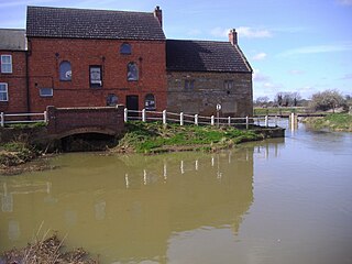
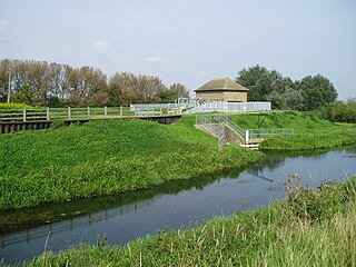
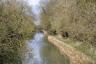
The River Welland is a lowland river in the east of England, some 65 miles (105 km) long. It drains part of the Midlands eastwards to The Wash. The river rises in the Hothorpe Hills, at Sibbertoft in Northamptonshire, then flows generally northeast to Market Harborough, Stamford and Spalding, to reach The Wash near Fosdyke. It is a major waterway across the part of the Fens called South Holland, and is one of the Fenland rivers which were laid out with washlands. There are two channels between widely spaced embankments with the intention that flood waters would have space in which to spread while the tide in the estuary prevented free egress. However, after the floods of 1947, new works such as the Coronation Channel were constructed to control flooding in Spalding and the washes are no longer used solely as pasture, but may be used for arable farming.

<span class="mw-page-title-main">River Nene</span> River in eastern England

The River Nene is a river in the east of England that rises from three sources in Northamptonshire. The river is about 105 miles (169 km) long, about 3.7 miles (6.0 km) of which forms the border between Cambridgeshire and Norfolk. It is the tenth-longest river in the United Kingdom, and is navigable for 88 miles (142 km), from Northampton to The Wash.

<span class="mw-page-title-main">River Great Ouse</span> River in England

The River Great Ouse is a river in England, the longest of several British rivers called "Ouse". From Syresham in Northamptonshire, the Great Ouse flows through Buckinghamshire, Bedfordshire, Cambridgeshire and Norfolk to drain into the Wash and the North Sea near Kings Lynn. Authorities disagree both on the river's source and its length with one quoting 160 mi (260 km) and another 143 mi (230 km). Mostly flowing north and east, it is the fifth longest river in the United Kingdom. The Great Ouse has been historically important for commercial navigation, and for draining the low-lying region through which it flows; its best-known tributary is the Cam, which runs through Cambridge. Its lower course passes through drained wetlands and fens and has been extensively modified, or channelised, to relieve flooding and provide a better route for barge traffic. The unmodified river would have changed course regularly after floods.

<span class="mw-page-title-main">River Weaver</span> River in Cheshire, England

The River Weaver is a river, navigable in its lower reaches, running in a curving route anti-clockwise across west Cheshire, northern England. Improvements to the river to make it navigable were authorised in 1720 and the work, which included eleven locks, was completed in 1732. An unusual clause in the enabling Act of Parliament stipulated that profits should be given to the County of Cheshire for the improvement of roads and bridges, but the navigation was not initially profitable, and it was 1775 before the first payments were made. Trade continued to rise, and by 1845, over £500,000 had been given to the county.

<span class="mw-page-title-main">Stamford, Lincolnshire</span> Town in Lincolnshire, England

Stamford is a town and civil parish in the South Kesteven District of Lincolnshire, England. The population at the 2011 census was 19,701 and estimated at 20,645 in 2019. The town has 17th- and 18th-century stone buildings, older timber-framed buildings and five medieval parish churches. It is a frequent film location. In 2013 it was rated a top place to live in a survey by The Sunday Times. Its name has been passed on to Stamford, Connecticut, founded in 1641.

<span class="mw-page-title-main">Bow Creek (London)</span> River in England

Bow Creek is a 2.25-mile (3.6 km) long tidal estuary of the English River Lea and is part of the Bow Back Rivers. Below Bow Locks the creek forms the boundary between the London Boroughs of Newham and Tower Hamlets, in East London.

<span class="mw-page-title-main">Louth Navigation</span> Canalised river in England

The Louth Navigation was a canalisation of the River Lud. It ran for 11 miles (18 km) from Louth in Lincolnshire, England, to Tetney Haven, at the mouth of the Humber. It was authorised by Act of Parliament in 1763 and completed in 1770, under the supervision of the engineer John Grundy Jr. and then by James Hoggard. Eight locks were required to overcome the difference in altitude, six of which were constructed with sides consisting of four bays.

<span class="mw-page-title-main">Uffington, Lincolnshire</span> Village and civil parish in the South Kesteven district of Lincolnshire, England

Uffington is a village and civil parish in the South Kesteven district of Lincolnshire, England. The population of the civil parish at the 2011 census was 686. It is in the valley of the River Welland, between Stamford and The Deepings.

<span class="mw-page-title-main">South Forty-Foot Drain</span> Drainage canal in eastern England

The South Forty-Foot Drain, also known as the Black Sluice Navigation, is the main channel for the land-drainage of the Black Sluice Level in the Lincolnshire Fens. It lies in eastern England between Guthram Gowt and the Black Sluice pumping station on The Haven, at Boston. The Drain has its origins in the 1630s, when the first scheme to make the Fen land available for agriculture was carried out by the Earl of Lindsey, and has been steadily improved since then. Water drained from the land entered The Haven by gravity at certain states of the tide until 1946, when the Black Sluice pumping station was commissioned.

<span class="mw-page-title-main">River Gwash</span> River in the East Midlands of England

The River Gwash, occasionally Guash, a tributary of the River Welland, flows through the English counties of Leicestershire, Rutland and Lincolnshire. It rises just outside the village of Knossington in Leicestershire, near the western edge of Rutland. It is about 39 kilometres (24 mi) long.

<span class="mw-page-title-main">Oakham Canal</span>

The Oakham Canal ran from Oakham, Rutland to Melton Mowbray, Leicestershire in the East Midlands of England. It opened in 1802, but it was never a financial success, and it suffered from the lack of an adequate water supply. It closed after 45 years, when it was bought by the Midland Railway to allow the Syston and Peterborough Railway to be built, partly along its course. Most of it is infilled, although much of its route can still be seen in the landscape, and there are short sections which still hold water.

<span class="mw-page-title-main">Melton Mowbray Navigation</span>

The Melton Mowbray Navigation was formed when the River Wreake in Leicestershire, England, was made navigable upstream from its junction with the River Soar and the Leicester Navigation near Syston to Melton Mowbray, opening in 1797. Largely river navigation, there were numerous lock cuts, to accommodate the 12 broad locks built along its length, many of which were built at sites where it was necessary to maintain the water levels for an adjacent mill.

<span class="mw-page-title-main">Middle Level Navigations</span> Waterway network in eastern England

<span class="mw-page-title-main">Itchen Navigation</span> Disused canal system in Hampshire, England

The Itchen Navigation is a 10.4-mile (16.7 km) disused canal system in Hampshire, England, that provided an important trading route from Winchester to the sea at Southampton for about 150 years. Improvements to the River Itchen were authorised by Act of Parliament in 1665, but progress was slow, and the navigation was not declared complete until 1710. It was known as a navigation because it was essentially an improved river, with the main river channel being used for some sections, and cuts with locks used to bypass the difficult sections. Its waters are fed from the River Itchen. It provided an important method of moving goods, particularly agricultural produce and coal, between the two cities and the intervening villages.

<span class="mw-page-title-main">Fens Waterways Link</span> Waterways project in eastern England

The Fens Waterways Link is a project to improve recreational boating opportunities in the counties of Cambridgeshire and Lincolnshire, England. By a combination of improvements to existing waterways and the construction of new links a circular route between Lincoln, Peterborough, Ely and Boston is planned. The project is being organised by the Environment Agency and financed from the Regional Development Agency and the European Union.

<span class="mw-page-title-main">Tallington</span> Village and civil parish in the South Kesteven district of Lincolnshire, England

Tallington is a village and civil parish in the South Kesteven district of Lincolnshire, England. The population of the civil parish at the 2011 census was 497. It is situated 4 miles (6 km) east from Stamford and 8 miles (13 km) north-east from the centre of Peterborough. The village has around 200 houses.

<span class="mw-page-title-main">River Don Navigation</span> Waterway navigation in South Yorkshire, England

The River Don Navigation was the result of early efforts to make the River Don in South Yorkshire, England, navigable between Fishlake and Sheffield. The Dutch engineer Cornelius Vermuyden had re-routed the mouth of the river in 1626, to improve drainage, and the new works included provision for navigation, but the scheme did not solve the problem of flooding, and the Dutch River was cut in 1635 to link the new channel to Goole. The first Act of Parliament to improve navigation on the river was obtained in 1726, by a group of Cutlers based in Sheffield; the Corporation of Doncaster obtained an Act in the following year for improvements to the lower river. Locks and lock cuts were built and by 1751 the river was navigable to Tinsley.

<span class="mw-page-title-main">Wisbech Canal</span> Broad beam canal near Wisbech Cambridgeshire

The Wisbech Canal was a broad canal from Wisbech, Isle of Ely in the Fenland area of Cambridgeshire, England. It ran from the River Nene at Wisbech to the Well Creek at Outwell now in Norfolk, which gave access to the River Great Ouse. It was abandoned in 1926 and filled in during the 1970s.

<span class="mw-page-title-main">A1175 road</span> Road in south-west Lincolnshire, England

References

  1. Labrum 1994, p. 75.
  2. "Engineering Timelines – Stamford Canal". engineering-timelines.com. Archived from the original on 4 March 2016. Retrieved 24 May 2013.
  3. Boyes & Russell 1977 , p. 236
  4. Boyes & Russell 1977 , pp. 239–240
  5. "River Welland History". Jim Shead. Archived from the original on 3 March 2016. Retrieved 2 July 2010.
  6. Simpson 2005, p. 1.
  7. Simpson 2005, p. 26.
  8. Simpson 2005, pp. 30–31.
  9. Cumberlidge 2009 , pp. 326–327
  10. 1 2 3 4 "The Stamford Canal". East Anglian Waterways Association. Archived from the original on 3 May 2019. Retrieved 2 July 2010.
  11. Boyes & Russell 1977 , pp. 240–241
  12. Simpson 2005 , pp. 39–40
  13. Simpson 2005 , p. 43
  14. Hadfield 1970 , p. 97
  15. Boyes & Russell 1977 , p. 241
  16. "Summary of Navigation on the River Welland". PastScape (1341736). Archived from the original on 3 March 2016. Retrieved 12 October 2009.
  17. "Vital work starts on river sluice near Peterborough". BBC. 3 June 2010. Archived from the original on 7 December 2020. Retrieved 17 December 2012.
  18. Historic England. "The Riverside Club, St Mary's Hill (1169487)". National Heritage List for England . Retrieved 16 December 2012.
  19. Historic England. "Remains of St Leonard's Priory (1062210)". National Heritage List for England . Retrieved 16 December 2012.
  20. Ordnance Survey, 1:25,000 map
  21. 1 2 3 Simpson 2005 , map inside back cover
  22. Simpson 2005 , pp. 35, 49
  23. Historic England. "Bridge over River Welland, Barnack Road Uffington (1317255)". National Heritage List for England . Retrieved 16 December 2012.
  24. Simpson 2005, p. 35.
  25. Historic England. "Church of St Lawrence, Tallington (1360195)". National Heritage List for England . Retrieved 16 December 2012.
  26. Simpson 2005, pp. 36–37.
  27. Historic England. "Tallington Mill (1062611)". National Heritage List for England . Retrieved 16 December 2012.
  28. Simpson 2005, p. 40.
  29. Simpson 2005, pp. 35–36.
Bibliography