Arbury Canals

Last updated

Arbury Canals
Lakes at Arbury Hall - geograph.org.uk - 227262.jpg
Arbury Hall, with the Hall Pool in the foreground
Specifications
Locks13
Statusdefunct
History
Principal engineerWilliam Bean
Date of first use1764
Date completed1795
Date closed1819 and 1962
Geography
Start pointSeeswood Pool
Connects to Coventry Canal
Arbury Canals
BSicon uKBHFa.svg
Seeswood Pool
BSicon uFGATEu.svg
Seeswood Lock
BSicon POINTERg@fq.svg
BSicon uSTR.svg
Seeswood Canal
BSicon uSTR+l.svg
BSicon uSTRq.svg
BSicon uABZg+r.svg
BSicon uSTR.svg
BSicon uFGATEu.svg
Triple lock (three way)
BSicon uDOCKSa.svg
BSicon uLock5.svg
Holly Kidd Double lock
BSicon uDOCKSe.svg
BSicon lBHF.svg
BSicon uSTR.svg
Hall Pool and Arbury Hall
BSicon uKBHFa.svg
BSicon uSTR.svg
Garden Pool
BSicon uFABZgl+l.svg
BSicon uSTRq.svg
BSicon uABZgr.svg
BSicon uFABZgl+l.svg
BSicon uSTRq.svg
BSicon uSTRr.svg
BSicon uWHRF.svg
Rough Wood wharf
BSicon uFGATEu.svg
BSicon uSTR.svg
Garden Lock
BSicon uFABZgl+l.svg
BSicon uSTRq.svg
BSicon uSTRq.svg
BSicon uSTRr.svg
Coton Lawn Canal
BSicon POINTERg@fq.svg
BSicon uSTR.svg
Arbury High Level Canal
BSicon uMILL.svg
BSicon uSTR.svg
Cornmill
BSicon uFGATEu.svg
Coventry Wood Lock
BSicon POINTERg@fq.svg
BSicon uSTR.svg
Coventry Wood Canal
BSicon uFGATEu.svg
Lock
BSicon uSKRZ-Eu.svg
BSicon uCONTg.svg
Griff Lane bridge
BSicon uSTR.svg
BSicon uSTR+l.svg
BSicon uFABZgr+r.svg
Coventry Canal
BSicon uSTR.svg
BSicon uSKRZ-Eu.svg
BSicon uCONTf.svg
Griff Hollows bridge
BSicon uSTR.svg
BSicon POINTERg@fq.svg
BSicon uSTR.svg
Griff Hollows Canal
BSicon uSTR.svg
BSicon uddHSTRf.svg
BSicon uSTRr.svg
Griff Hollows wharf
BSicon uKBHFa.svg
BSicon uSTR.svg
BSicon exSTR.svg
Kenilworth Pool
BSicon uSTRl.svg
BSicon uABZg+r.svg
BSicon POINTERg@fq.svg
BSicon exSTR.svg
Tramroad
BSicon POINTERg@fq.svg
BSicon uSTR.svg
BSicon exSTR.svg
Lower Arbury Canal
BSicon uSTR.svg
BSicon exSTRl.svg
BSicon uWHRF.svg
BSicon exKHSTeq.svg
New Wharf
BSicon uABZg+l.svg
BSicon uSTRq.svg
BSicon uSTRr.svg
New Cut
BSicon uddSTRr.svg
Bedworth basin and wharf
BSicon uSTR+l.svg
BSicon uxABZgr.svg
BSicon uLOCKSu.svg
BSicon uexSTR.svg
Collycroft Locks (5-6)
BSicon uexCONTgq.svg
BSicon uxABZql.svg
BSicon uxKRZo.svg
BSicon uLOCKSl.svg
BSicon uSTR+r.svg
Collycroft Locks (1-4)
BSicon uexCONTgq.svg
BSicon uexSTRq.svg
BSicon uexABZg+r.svg
BSicon uSTR.svg
Feeder
BSicon uMILL.svg
BSicon uexSTR.svg
BSicon uSTR.svg
Bedworth Mill
BSicon uexABZgl.svg
BSicon uexSTRq.svg
BSicon ueABZg+r.svg
Mill stream
BSicon uexSTR.svg
BSicon uddSTRr.svg
Old Wharf
BSicon uexSKRZ-Eu.svg
BSicon uSKRZ-Eu.svg
Coventry Turnpike Road
BSicon uexSTRl.svg
BSicon uexSTRq.svg
BSicon ueABZg+r.svg
Mill stream
BSicon POINTERg@fq.svg
BSicon uSTR.svg
Coventry Communication Canal
BSicon uFGATEu.svg
BSicon uCONTg.svg
Stop gates
BSicon uSTRl.svg
BSicon uFABZgr+r.svg
BSicon uSTR.svg
Coventry Canal
BSicon uCONTf.svg

The Arbury Canals were a system of private canals, in the Arbury Estate, between Nuneaton and Bedworth in Warwickshire, England. They connected with the Coventry Canal. They were built by Sir Roger Newdigate between 1764 and 1795, and ceased to be used soon after his death in 1806. The Griff Hollows Canal was separate to the main system, and carried coal until its closure in 1961.

Contents

Geography

The Arbury Canals consisted of seven sections of canal, which were individually named. The Griff Hollows Canal, which was not physically connected to the other six, linked the colliery at Griff to the Coventry Canal. [1]

About one mile to the south, the main system of canals connected the Coventry Canal to the Arbury Estate, and were used to transport coal and carry produce around the estate. [1] Both canals gained water from Seaswood Pool, just northeast of the village of Astley.

There were several branches from the main line including the Seeswood Canal which linked to Seeswood Pool, and a short branch to Hall Pool, one of the pools on the estate where water was stored.

The entire system was approximately 6 miles (9.7 km) long, and included thirteen locks, each 40 by 6 feet (12.2 by 1.8 metres). One unusual feature was the Triple Lock, which had a Y-shaped chamber, with two separate entrances from above, leading to different branches. [1]

History

Coal was found on the Arbury estate, owned by the Newdigate family, at the beginning of the eighteenth century. Sir Richard Newdigate, the 3rd Baronet, was keen to exploit these resources. He was responsible for the introduction of Newcomen atmospheric engines, which were used to drain the mines, the first being installed in 1716. [2] Its success was put down to luck by Desaguliers, writing in 1744, who stated that the use of condensation water had been discovered by accident, and that the valve gear, which made the machine self-acting, had been built from catches and strings by Humphrey Potter, a young lad whose job was to mind it. Whether this account was true is unknown, but it was self-acting in 1817, [3] when Henry Beighton studied it and published a detailed engraving of the engine. [4]

Sir Richard also constructed three "boatways" between 1700 and 1711, which were small canals used to convey coal from the outlying pits. His son, Sir Roger Newdigate, the 5th baronet, would incorporate these into a larger system. [2] Sir Roger, who was a Member of Parliament and became the owner of Arbury Hall on the early death of his brother, was a canal enthusiast. His interest may have stemmed from his involvement with the Bridgewater Canal, where he acted as Counsel for their bill to authorise an extension to the River Mersey. He started constructing canals on his estate in 1764, and by 1795 there were about 5.5 miles (8.9 km) of waterways. [5] William Bean from Derbyshire acted as engineer, assisted by the mason and bricklayer from the Arbury estate, John Morris. [6]

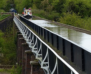
The Communication Canal was constructed to link a wharf near a worsted factory to the Coventry Canal. The channel and junction were excavated in 1771, although the canal was not finished until 1773. It was 1,078 yards (986 m) long, and included a stop lock close to the junction with the Coventry Canal. This was eventually connected to the Arbury Lower Canal or Griff Canal, most of which was in use by 1771. A new branch was built to connect the Griff Canal to the road running from Arbury to the main turnpike road in 1793. The wharf at its terminus was also served by a tramway connecting it to coal pits. The connection between the two canals was made in 1794, when a staircase of four locks and another of two were completed. The branch to the wharf crossed the locks on an aqueduct, to maintain a link to the worsted factory. The canal was 1,540 yards (1,410 m) long, and had a feeder running from Kenilworth Pool. [5]

The next section was called the Coventry Wood Canal, and was operational by 1771. Locks to connect it to the Griff Canal and the Arbury High Level Canal were completed in 1772, and it was 528 yards (483 m) long. The next section, the Arbury High Level Canal, was the earliest, as it was used for boating in 1764, and was surveyed in that year, to establish how it could be incorporated into a larger system. It was linked to the Garden Pool in 1773 by a lock, and boats could reach Hall Pool two years later, when a staircase of two locks and a single lock were built. This canal was 2,505 yards (2,291 m) long. [5]

Water for the canals was originally supplied by a feeder from Seeswood Lake, but in 1777, this was enlarged to make it navigable, and in 1784 another lock was built to give access from the canal into the lake. When completed, the Seeswood Canal was 1,980 yards (1,810 m) long. The final part of the estate canals was the Coton Lawn Canal, which ran for 2,112 yards (1,931 m) from the Arbury High Level Canal to a wharf on North Walk, passing through Spring Kidden Wood on its way. It was completed in 1795. [7]

Sir Roger also built tramways on his estate. The first connected some pits to the old wharf, but was largely redundant once the Collycroft locks were constructed. The second connected the new wharf on the main canal system to Griff Hollows wharf on the Griff Hollows Canal. It was opened on 29 July 1787, but was superseded by a double-track tramway on a slightly different route in 1793. Few other details have survived, and it is likely that they ceased operation at the same time as the canals did. [2]

Decline

After Newdigate's death in 1806, at the age of 88, the estate system continued to be used until 1812, but then it gradually became disused, and by 1819 the upper levels were no longer navigable. From that date the locks were replaced by weirs, and only the Communication Canal linking directly with the Coventry Canal remained navigable. [1] Despite the decline, the canals and reservoirs were inspected by the canal engineer Benjamin Bevan in 1815 and 1817, and informed his suggestion that the unfinished Grand Western Canal could be linked to Taunton by a narrow canal, which he made in 1818. The following year he assisted Newdigate's successor after claims were made that too much water was flowing from the canals into the Coventry Communication Canal. [8]

Today a few remains of the canal remain visible within the Arbury Estate. A number of original plans of the system are held by the Warwickshire County Record Office. [9] Arbury Mill, which had an undershot wheel and was fed from the canal, is a grade II listed building, and may have been the inspiration for George Eliot's The Mill on the Floss. [10]

Griff Hollows Canal

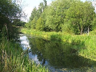
The Griff Hollows Canal was quite separate to the main system. Designed to carry coal to the Coventry Canal from the Griff Hollows wharf, which was connected to collieries by a tramroad, construction began in 1785, and it was opened on 29 July 1787. It was 1,320 yards (1,210 m) long, and was all on one level. It remained in commercial use until the colliery closed in 1961. [6] It continued to be navigable until 1973, when it was severed by the construction of the A444 road. The entrance can still be seen, and it still supplies water to the Coventry Canal.

Griff Hollows was the inspiration for George Eliot's "Red Deeps" in The Mill on the Floss , while the canal was probably the inspiration for her Brown Canal in the autobiographical sonnet Brother and Sister. [11]

The wide-arched bridge, the scented elder-flowers,
The wondrous watery rings that died too soon,
The echoes of the quarry, the still hours
With white robe sweeping-on the shadeless noon,
Were but my growing self, are part of me,
My present Past, my root of piety.

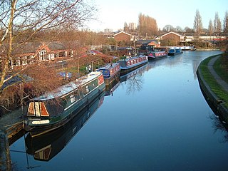
The route of the canal is owned by Nuneaton and Bedworth Borough Council. It has been infilled, and acts as a green corridor through an area of housing, industrial warehousing, and commercial buildings. The basin at the far end is still in water, and is known as Bermuda Lake. After a suggestion by a local boater called Alan Baxter in 2018, the council formed a Griff Arm Canal Review Working Group, to review the future of the canal, and whether it could be returned to use. Although it is crossed by the A444 road, there is sufficient room for the canal to pass beneath the road, so restoration is at least feasible. [12]

Points of interest

Map all coordinates using: OpenStreetMap

Related Research Articles

<span class="mw-page-title-main">Birmingham and Fazeley Canal</span> Canal in the United Kingdom

The Birmingham and Fazeley Canal is a canal of the Birmingham Canal Navigations in the West Midlands of England. Its purpose was to provide a link between the Coventry Canal and Birmingham and thereby connect Birmingham to London via the Oxford Canal.

<span class="mw-page-title-main">Manchester Bolton & Bury Canal</span> Canal in Greater Manchester, England

The Manchester Bolton & Bury Canal is a disused canal in Greater Manchester, England, built to link Bolton and Bury with Manchester. The canal, when fully opened, was 15 miles 1 furlong (24 km) long. It was accessed via a junction with the River Irwell in Salford. Seventeen locks were required to climb to the summit as it passed through Pendleton, heading northwest to Prestolee before it split northwest to Bolton and northeast to Bury. Between Bolton and Bury the canal was level and required no locks. Six aqueducts were built to allow the canal to cross the rivers Irwell and Tonge and several minor roads.

<span class="mw-page-title-main">Wyrley and Essington Canal</span> Narrow canal in the Midlands, England

The Wyrley and Essington Canal, known locally as "the Curly Wyrley", is a canal in the English Midlands. As built it ran from Wolverhampton to Huddlesford Junction near Lichfield, with a number of branches: some parts are currently derelict. Pending planned restoration to Huddlesford, the navigable mainline now terminates at Ogley Junction near Brownhills. In 2008 it was designated a Local Nature Reserve.

<span class="mw-page-title-main">Oxford Canal</span> Canal in England

The Oxford Canal is a 78-mile (126 km) narrowboat canal in southern central England linking the City of Oxford with the Coventry Canal at Hawkesbury via Banbury and Rugby. Completed in 1790, it connects to the River Thames at Oxford, and links with the Grand Union Canal, which it is combined with for 5 miles (8 km) between to the villages of Braunston and Napton-on-the-Hill.

<span class="mw-page-title-main">Nuneaton</span> Market town in Warwickshire, England

Nuneaton is a market town in the borough of Nuneaton and Bedworth in northern Warwickshire, England, located adjacent to the county border with Leicestershire to the north-east. Nuneaton's population at the 2021 census was 88,813, making it the largest town in Warwickshire. Nuneaton's larger urban area, which also includes the large adjoining villages of Bulkington and Hartshill had a population of 99,372 in the 2021 census.

<span class="mw-page-title-main">Bedworth</span> Human settlement in England

Bedworth is a market town in the borough of Nuneaton and Bedworth, Warwickshire, England. It is situated between Coventry, 6 miles to the south, and Nuneaton, 3 miles (5 km) to the north.

<span class="mw-page-title-main">Coventry Canal</span> Canal in Staffordshire, England

The Coventry Canal is a navigable narrow canal in the Midlands of England.

<span class="mw-page-title-main">Ashby Canal</span>

The Ashby-de-la-Zouch Canal is a 31-mile (50 km) long canal in England which connected the mining district around Moira, just outside the town of Ashby-de-la-Zouch in Leicestershire, with the Coventry Canal at Bedworth in Warwickshire. It was opened in 1804, and a number of tramways were constructed at its northern end, to service collieries. The canal was taken over by the Midland Railway in 1846, but remained profitable until the 1890s, after which it steadily declined. Around 9 miles (14 km) passed through the Leicestershire coal field, and was heavily affected by subsidence, with the result that this section from Moira, southwards to Snarestone, was progressively closed in 1944, 1957 and 1966, leaving 22 miles (35 km) of navigable canal.

<span class="mw-page-title-main">Leominster Canal</span> Canal in England, now defunct

The Leominster Canal was an English canal which ran for just over 18 miles from Mamble to Leominster through 16 locks and a number of tunnels, some of which suffered engineering problems even before the canal opened. Originally, the canal was part of a much more ambitious plan to run 46 miles from Stourport to Kington.

<span class="mw-page-title-main">Sheffield & Tinsley Canal</span>

The Sheffield & Tinsley Canal is a canal in the City of Sheffield, England. It runs 3.9 miles (6.3 km) from Tinsley, where it leaves the River Don, to the Sheffield Canal Basin in the city centre, passing through 11 locks. The maximum craft length that can navigate this lock system is 61 feet 6 inches (18.75 m) with a beam of 15 feet 6 inches (4.72 m).

<span class="mw-page-title-main">Swansea Canal</span>

The Swansea Canal was a canal constructed by the Swansea Canal Navigation Company between 1794 and 1798, running for 16.5 miles (26.6 km) from Swansea to Hen Neuadd, Abercraf in South Wales. It was steeply graded, and 36 locks were needed to enable it to rise 373 feet (114 m) over its length. The main cargos were coal, iron and steel, and the enterprise was profitable.

<span class="mw-page-title-main">Aike Beck</span> Former watercourse in the East Riding of Yorkshire, England

Aike Beck or the Lockington Navigation was a stream in the East Riding of Yorkshire, England, which was constructed as a navigation in the late 18th century, and ceased to function as such in the 1850s. The water supply came from Bryan Mills Beck and Scorborough Beck, but in 1988, these were diverted to feed into Arram Beck, and most of the channel was filled in with material from the flood banks.

<span class="mw-page-title-main">Ketley Canal</span>

The Ketley Canal was a tub boat canal that ran for about 1.5 miles (2.4 km) from Oakengates to Ketley works in Shropshire, England. The canal was built about 1788 and featured the first inclined plane in Britain. The main cargo of the canal was coal and ironstone. The inclined ceased to be used in 1816, when Ketley Works was closed, but the upper canal was not finally abandoned until the 1880s. A few traces of the canal are still visible in the landscape.

<span class="mw-page-title-main">Douglas Navigation</span>

The Douglas Navigation was a canalised section of the River Douglas or Asland, in Lancashire, England, running from its confluence with the River Ribble to Wigan. It was authorised in 1720, and some work was carried out, but the undertakers lost most of the share money speculating on the South Sea Bubble. Alexander Leigh attempted to revive it eleven years later, and opened it progressively between 1738 and 1742. Leigh began work on a parallel canal called Leigh's Cut to improve the passage from Newburgh to Gathurst, but progress was slow and it was unfinished in 1771.

<span class="mw-page-title-main">Greasbrough Canal</span>

The Greasbrough Canal was a private canal built by the Marquess of Rockingham to serve his coal mining interests in and around the village of Greasbrough, near Rotherham, South Yorkshire, England. It opened in 1780, and the Newbiggin branch was built some time later. The main line to Greasbrough closed in 1840 with the coming of the Sheffield and Rotherham Railway, and the canal ceased to carry commercial traffic during the First World War. Most of it has been filled in, but a small section near the River Don Navigation remains in water.

<span class="mw-page-title-main">Wey and Godalming Navigations</span> Waterways in Surrey, England

The River Wey Navigation and Godalming Navigation together provide a 20-mile (32 km) continuous navigable route from the River Thames near Weybridge via Guildford to Godalming. Both waterways are in Surrey and are owned by the National Trust. The River Wey Navigation connects to the Basingstoke Canal at West Byfleet, and the Godalming Navigation to the Wey and Arun Canal near Shalford. The Navigations consist of both man-made canal cuts and adapted parts of the River Wey.

<span class="mw-page-title-main">Shropshire Canal</span>

The Shropshire Canal was a tub boat canal built to supply coal, ore and limestone to the industrial region of east Shropshire, England, that adjoined the River Severn at Coalbrookdale. It ran from a junction with the Donnington Wood Canal ascending the 316 yard long Wrockwardine Wood inclined plane to its summit level, it made a junction with the older Ketley Canal and at Southall Bank the Coalbrookdale (Horsehay) branch went to Brierly Hill above Coalbrookdale; the main line descended via the 600 yard long Windmill Incline and the 350 yard long Hay Inclined Plane to Coalport on the River Severn. The short section of the Shropshire Canal from the base of the Hay Inclined Plane to its junction with the River Severn is sometimes referred to as the Coalport Canal.

<span class="mw-page-title-main">River Don Navigation</span> Waterway navigation in South Yorkshire, England

The River Don Navigation was the result of early efforts to make the River Don in South Yorkshire, England, navigable between Fishlake and Sheffield. The Dutch engineer Cornelius Vermuyden had re-routed the mouth of the river in 1626, to improve drainage, and the new works included provision for navigation, but the scheme did not solve the problem of flooding, and the Dutch River was cut in 1635 to link the new channel to Goole. The first Act of Parliament to improve navigation on the river was obtained in 1726, by a group of Cutlers based in Sheffield; the Corporation of Doncaster obtained an Act in the following year for improvements to the lower river. Locks and lock cuts were built and by 1751 the river was navigable to Tinsley.

<span class="mw-page-title-main">Huddlesford Junction</span> Canal junction in Staffordshire, England

Huddlesford Junction is a canal junction at the original north-eastern limit of the Wyrley and Essington Canal where it met the Coventry Canal, near Lichfield, in Staffordshire, England.

<span class="mw-page-title-main">Hawkesbury Junction</span>

Hawkesbury Junction or Sutton Stop is a canal junction in England, at the northern limit of the Oxford Canal where it meets the Coventry Canal, near Hawkesbury Village, Warwickshire, between Bedworth and Coventry. The alternative name, Sutton Stop, arises from the name of a family which provided several lock keepers there in the nineteenth century.

References

  1. 1 2 3 4 Hadfield 1970 , pp. 26–29
  2. 1 2 3 Lee 1973 , p. 1
  3. Skempton 2002, p. 477.
  4. Skempton 2002, p. 49.
  5. 1 2 3 Hadfield 1970, p. 27.
  6. 1 2 Hadfield 1970, p. 29.
  7. Hadfield 1970, pp. 27, 29.
  8. Skempton 2002, p. 57.
  9. "Arbury Canal, Bedworth mill CR 136/M/65-68". The National Archives. Retrieved 25 March 2011.
  10. Historic England. "Arbury Mill, Bedworth (1034971)". National Heritage List for England . Retrieved 25 March 2011.
  11. "George Eliot Country: A Guide". Nuneaton and Bedworth Borough Council. p. 15. Archived from the original on 27 April 2014. Retrieved 27 April 2014.
  12. "Plans to revive Griff Hollows Arm". Waterways World. August 2018. p. 26. ISSN   0309-1422.

Bibliography

  • Hadfield, Charles (1970). The Canals of the East Midlands. David and Charles. ISBN   978-0-7153-4871-0.
  • Lee, M. J. (April 1973). "Griff Collieries". 47. The Industrial Railway Record. Archived from the original on 3 March 2016.{{cite journal}}: Cite journal requires |journal= (help)
  • Russell, Ronald (1983). Lost Canals & Waterways of Britain. Sphere Books Ltd. ISBN   978-0-7221-7562-0.
  • Skempton, Sir Alec; et al. (2002). A Biographical Dictionary of Civil Engineers in Great Britain and Ireland: Vol 1: 1500 to 1830. Thomas Telford. ISBN   978-0-7277-2939-2.