
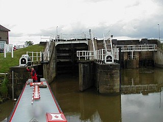
The Calder and Hebble Navigation is a broad inland waterway, with locks and bridge holes that are suitable for 14-foot-wide (4.3 m) boats, in West Yorkshire, England. Construction to improve the River Calder and the River Hebble began in 1759, and the initial scheme, which included 5.7 miles (9.2 km) of new cuts, was completed in 1770 and has remained navigable since it was opened. Significant improvements were made, including the Salterhebble branch to Halifax, opened in 1828, and ever-longer cuts to bypass river sections. Trade was assisted by the opening of the Rochdale Canal in 1804, which provided a through route from Sowerby Bridge to Manchester. There were plans to abandon the river sections completely in the 1830s, but these were modified as the needs of mill owners and other riparian landowners were recognised.

The River Brede is an English river in East Sussex. It flows into the Rock Channel and then onto the River Rother at Rye, Sussex. It takes its name from the village of Brede, which lies between Hastings and Tenterden.

Braunton is a large village, civil parish, ecclesiastical parish and former manor in Devon. The village is situated 5 miles (8 km) west of Barnstaple. It is one of the largest villages in Devon with a population at the 2021 census of 10,217 people. There are two electoral wards. Their joint population at the above census was 8,218. Within the parish is the fertile, low-lying Braunton Great Field, which adjoins the undulating Braunton Burrows, the Core Area in North Devon Biosphere Reserve, the largest psammosere in England. It confronts the Atlantic Ocean at the west of the parish at the large beach of Saunton Sands, one of the South West's international-standard surfing beaches.
The Grand Western Canal ran between Taunton in Somerset and Tiverton in Devon in the United Kingdom. The canal had its origins in various plans, going back to 1796, to link the Bristol Channel and the English Channel by a canal, bypassing Lands End. An additional purpose of the canal was the supply of limestone and coal to lime kilns along with the removal of the resulting quicklime, which was used as a fertiliser and for building houses. This intended canal-link was never completed as planned, as the coming of the railways removed the need for it.

The Grantham Canal ran 33 miles (53 km) from Grantham through 18 locks to West Bridgford, where it joined the River Trent. It was built primarily for the transportation of coal to Grantham. It opened in 1797 and its profitability steadily increased until 1841. It was then sold to a railway company, declined, and was finally closed in 1936. It was used as a water supply for agriculture, and so most of it remained in water after closure, although bridges were lowered. Since the 1970s, the Grantham Canal Society have been working to restore parts of it. Two stretches are now navigable to small vessels. A new route will be required where the canal joins the Trent, as road building has severed the original one.
The Chard Canal was a 13.5 miles (21.7 km) tub boat canal in Somerset, England, that ran from the Bridgwater and Taunton Canal at Creech St. Michael, over four aqueducts, through three tunnels and four inclined planes to Chard. It was completed in 1842, was never commercially viable, and closed in 1868. The major engineering features are still clearly visible in the landscape.

The Montgomery Canal, known colloquially as "The Monty", is a partially restored canal in eastern Powys and northwest Shropshire. The canal runs 33 miles (53 km) from the Llangollen Canal at Frankton Junction to Newtown via Llanymynech and Welshpool and crosses the England–Wales border.

The Droitwich Canal is a synthesis of two canals in Worcestershire, England; the Droitwich Barge Canal and the Droitwich Junction Canal. The Barge Canal is a broad canal which opened in 1771 linking Droitwich Spa to the River Severn at Hawford Bottom Lock, Claines. The Droitwich Junction Canal is a narrow canal, opened in 1854, which linked Droitwich to the Worcester and Birmingham Canal. Both were built to carry salt, and were abandoned in 1939. They have been the subject of a restoration plan since 1973, and the Barge Canal was officially reopened in 2010, while the Junction Canal reopened in July 2011. Following the opening of the canal, ownership transferred to the newly created Canal and River Trust

The Neath and Tennant Canals are two independent but linked canals in South Wales that are usually regarded as a single canal. The Neath Canal was opened from Glynneath to Melincryddan, to the south of Neath, in 1795 and extended to Giant's Grave in 1799, in order to provide better shipping facilities. With several small later extensions it reached its final destination at Briton Ferry. No traffic figures are available, but it was successful, as dividends of 16 per cent were paid on the shares. The canal was 13.5 miles (21.7 km) long and included 19 locks.
The Tarka Trail is a series of footpaths and cyclepaths around north Devon, England that follow the route taken by the fictional Tarka the Otter in the book of that name. It covers a total of 180 miles (290 km) in a figure-of-eight route, centred on Barnstaple.
The Market Weighton Canal ran 9.5 miles (15.3 km) from the Humber Estuary to its terminus near Market Weighton. It gained its act of Parliament in 1772 and opened in 1782. The 3.5 miles (5.6 km) closest to Market Weighton was abandoned in 1900 and the right of navigation through Weighton lock was lost in 1971. However, as of 2002 the lock was passable and the canal usable up to the junction with the River Foulness where silt has made it impassable. Also there is no right of navigation under the M62 motorway bridge to the north of Newport.
The Greasbrough Canal was a private canal built by the Marquess of Rockingham to serve his coal mining interests in and around the village of Greasbrough, near Rotherham, South Yorkshire, England. It opened in 1780, and the Newbiggin branch was built some time later. The main line to Greasbrough closed in 1840 with the coming of the Sheffield and Rotherham Railway, and the canal ceased to carry commercial traffic during the First World War. Most of it has been filled in, but a small section near the River Don Navigation remains in water.

The Stover Canal is a canal located in Devon, England. It was opened in 1792 and served the ball clay industry until it closed in the early 1940s. Today it is derelict, but the Stover Canal Society is aiming to restore it and reopen it to navigation.

Beverley Beck is a short canal in the East Riding of Yorkshire, England. The beck runs from Grovehill Lock on the River Hull at Beverley west for about 0.8 miles (1.3 km) into the town of Beverley. Until 1802, the beck was tidal, but the Beverley and Barmston Drain needed to pass under it, and the lock was constructed to maintain water levels over its tunnel. In 1898, a steam engine was installed, which could be used to top up the water levels in the beck by pumping water from the River Hull. A multimillion-pound refurbishment of the area concluded in 2007, with the refurbishment of the lock gates and pumping engine.

The Tavistock Canal is a canal in the county of Devon in England. It was constructed early in the 19th century to link the town of Tavistock to Morwellham Quay on the River Tamar, where cargo could be loaded into ships. The canal is still in use to supply water to a hydro-electric power plant at Morwellham Quay, and forms part of the Cornwall and West Devon Mining Landscape World Heritage Site. It is unusual for a canal, as it has a gentle slope over its length, resulting in a considerable flow of water.

The Cann Quarry canal was a canal in Devon, England which ran for just under 2 miles (3.2 km) from Cann Quarry to the River Plym at Marsh Mills. It opened in 1829, and a short tramway connected it to the Plymouth and Dartmoor Railway at Crabtree Junction. It had been replaced by a tramway within ten years, but continued to be used as a mill leat to supply Marsh Mills corn mill, and most of it is still visible.

Pidcock's Canal was a canal in Gloucestershire, England, which connected ironworks at Upper Forge and Lower Forge, and also ran to an inlet from the River Severn called Lydney Pill. It was constructed from 1778 onwards, and there were three locks below Middle Forge. Following the construction of the Lydney Canal in 1813, the canal connected to that, rather than Lydney Pill, and it was disused after 1840, by which time a horse-drawn tramway had been built up the valley of The Lyd. The tramway was eventually relaid as a steam railway and is now preserved as the Dean Forest Railway. Most of the canal, colloquially called The Cut, still exists below Middle Forge.

The Heywood Branch Canal was a branch of the Rochdale Canal from Castleton which led to Heywood. It opened in 1834 and carried traffic until 1937. It was abandoned in 1952, along with most of the Rochdale Canal, and although the Rochdale Canal has been reopened, the junction lies under the embankments of the M62 motorway.

The Ivelchester and Langport Navigation was a scheme to make the River Ivel navigable from Langport to Ilchester, in Somerset, England. Work started in 1795, but the scheme was effectively bankrupt by 1797, and construction of the locks was never completed.

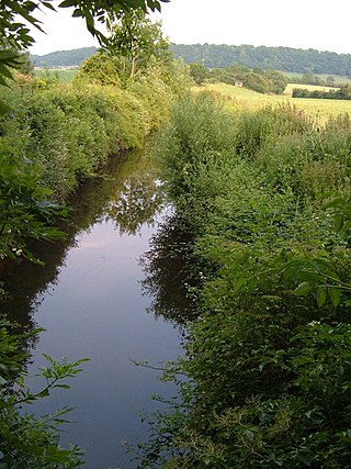
The River Dove is a river that extends through the Low Valley in Barnsley, England. It flows from Worsbrough Reservoir to its confluence with the River Dearne.

