Thorne and Hatfield Moors Peat Canals

Last updated

Thorne and Hatfield Moors Peat Canals
Boating Dike from Jaques Bank - geograph.org.uk - 2338146.jpg
Boating Dike near Jaques Bank, Dirtness. Its name derives from its use as a canal prior to the 1830s.
Specifications
Statusparts now act as drains
History
Date of actPrivately built
Date of first use1630s and 1890s
Date closed1830s and 1922
Geography
Start pointThorne Moors

Thorne and Hatfield Moors Peat Canals were a series of canals in South Yorkshire and Lincolnshire, England, which were used to carry cut peat from Thorne and Hatfield Moors to points where it could be processed or exported. There were two phases to the canals, the first of which lasted from the 1630s until the 1830s when coal imported on the Stainforth and Keadby Canal reduced the demand for peat as a fuel. The second started in the 1890s when peat found a new use as bedding for working horses and lasted until 1922 when Moorends Mill which processed the peat was destroyed by fire.

Contents

History

The canals were located in Hatfield Chase, an area of low-lying land which was regularly waterlogged prior to the 1630s. In 1626, the Dutch drainage engineer Cornelius Vermuyden was appointed by King Charles I to reclaim the Chase, and set about re-routing the River Don, so that it ran along the western edge of the Chase, and the River Idle, which he diverted along its southern edge. The River Torne was then left with no outlet, and a new channel was cut for it, which crossed the Chase to join the River Trent [1] There were some problems with the outlet of the Don and the new channel for the Torne, and considerable local dissent, which resulted in civil unrest and deliberate re-flooding of the land, which was not finally resolved until 1719. [2] Gradually, much of the Chase became suitable for agriculture. The drainage did not affect the two great raised mires or peat bogs, known as Thorne and Hatfield Moors.

Peat from the moors was used as a domestic fuel, but was also exported further afield. Precise dates for the first peat canals are uncertain, but soon after the construction of the diverted River Don, a canal was cut, which crossed the Chase to reach the Trent. A plan of the area, dated 1752, shows The Cutt by Thorne into Trent, and significantly, parts of it are still called Boating Dike on modern Ordnance Survey maps. A second canal on the western side of the moors, also called Boating Dike, ran past Thorne to join the River Don, and included a pound lock part way along it. Some 30 or 40 boats were using the canal in the 1790s, although the turves were transferred to larger vessels for onward passage along the Don. The canals were shown of a map of Yorkshire, produced by the cartographer Thomas Jefferys between 1767 and 1770. [3]

The hydrology of the region was altered in 1802 with the opening of the Stainforth and Keadby Canal, which cut across Hatfield Chase in an east-west direction, with Thorne Moors to the north and Hatfield Moors to the south. [4] Much of the Thorne boating dike was destroyed, and new drains were cut parallel to the canal. A new 2-mile (3.2 km) navigable drain was sanctioned by the Hatfield, Thorne and Fishlake Enclosure Commissioners, which ran along the southern section of Thorne Moors. There were then some 6 miles (9.7 km) of navigable drains, on which clinker-built boats operated. They were 28 by 6 feet (8.5 by 1.8 m), and were symmetrical in shape, allowing them to be worked in either direction without having to turn them. [5] Coal brought into the region by the Stainforth and Keadby Canal led to a fall in the demand for peat as a fuel. The number of boats operating on the peat canals had declined to 8 or 9 by the 1820s, and such traffic ceased altogether around 1830. Peat for export from the moors was taken to the Stainforth and Keadby Canal by cart. [6]

Second phase

The Peat Canals circa 1907, which supplied peat to Moorends Works. The access land boundary is recent. Blackwater Dike, Mill Drain and Cottage Dike still exist and are named on the 2006 1:25,000 Ordnance Survey map. Thorne Canals map.jpg
The Peat Canals circa 1907, which supplied peat to Moorends Works. The access land boundary is recent. Blackwater Dike, Mill Drain and Cottage Dike still exist and are named on the 2006 1:25,000 Ordnance Survey map.

Following the demise of the canals, the emphasis was on improving the moors for agriculture by warping, a process that involved spreading silt over the peat to produce a soil that could sustain agriculture. The Thorne Moor (Waste) Improvement Act was passed in 1848, which created the Thorne Moor Improvement Company, which was responsible for draining, warping or otherwise improving Thorne Waste, the southern section of the moors. The plans were tied into those for a railway link between Gainsborough, Thorne and Doncaster, authorised in the same year, but the Great Northern Railway Company failed to build the line, and little improvement was achieved. [7]

Two other schemes deserve mention. The first was for Swinefleet Warping Drain, to the east of the moors, the first part of which opened in 1821. It had been promoted by Ralph Creyke and T.H.S. Sotheron, who had obtained an Act of Parliament, and they succeeded in using the silt-rich water to flood the land and gradually improve it over the next forty years. Makin Durham built the Durham Warping Drain on the western edge of the moors, but although it opened in 1856, very little reclamation took place. He died in 1882, just as ideas for using the peat, rather than improving it for agriculture, were developing. The change occurred because there was an agricultural depression, and a need for an alternative to straw bedding for a large number of working horses in the country. [8]

Sections of both Hatfield Moors and Thorne Moors were leased to companies for peat cutting. The Hatfield Chase Moss Litter Company began cutting on Hatfield Moors in 1888. The Dutch Griendtsveen Moss Litter Company was formed in 1893 and started to acquire various peat businesses. They took over the works at Moorends, to the north of Thorne, and imported workers from the Netherlands. They brought their own tools and methods of working with them, and by 1899, there was a colony of around 300 Dutch people at Moorends, of which 120 were men working on the moors. They rebuilt the Moorends mill, and built around 14 miles (23 km) of canals to carry the peat from the moors to the mill. Ledgers in the offices were kept in Dutch and English, and there was some tension with the local population, who feared that such a large influx of foreigners might result in them losing their own jobs. [9]

The boats used on the system were about 40 feet (12 m) long, with a flat bottom and, like the earlier wooden boats, were pointed at both ends, so that they did not have to be turned. They were made of iron in the Netherlands, and then transported to Thorne. There were twelve boats on the system, which were manhandled on the side arms, where the peat was cut, and pulled by two horses on the longer sections back to the mill. Towpaths beside the canals were made from limestone. [10] From the cutting fields, the main canal headed north-west, and then turned to the west to reach Moorends Works. It crossed Durham's Warping Drain on an iron aqueduct, which required large amounts of brickwork to support it. It was completed at great cost in 1895, and also carried the 3 ft (914 mm) gauge tramway which served the northern part of the moors. [11]

In 1896, the British Peat Moss Litter Company was formed by the amalgamation of the Hatfield Chase Peat Moss Litter Company and most of the companies working on Thorne Moors. They paid £58,000 for Griendtsveen's Moorends Works. [12] The mill, which had been used for the production of paraffin since the late 1860s until its rebuilding in the 1880s, [13] was damaged by a fire in 1898. The wooden baling presses were destroyed, but were replaced with steel presses, which were powered by a 40-horsepower (30 kW) stationary steam engine which burned peat as its fuel. [14] Besides the canals and the aqueduct, the 1906 Ordnance Survey maps show two swing bridges, one on the northern section just beyond the junction where the line for the southern section turned off, and another where that line crossed the Cottage Dike. There was also a wind pump between the Cottage Dike and the southern canals, towards the eastern end of the canals. Marked towpaths ran along the northern edge of both sections of the canals and on the north-easterly side of the canal to the aqueduct and Mooorends Mill. [15]

There were intermittent problems with water supply for the canals, which also suffered from silting, and there were times when the only supply of peat for processing to the mill was from the tramways. They remained in use until 1922, when another fire destroyed the main mill building. The boats were cut up for scrap, and with no use, the canals reverted to bog. The works chimney was demolished in 1930, but the remaining buildings became a maintenance workshop. The tramway wagons were repaired there until 1956, after which the site was demolished. [14]

See also

Bibliography

Related Research Articles

<span class="mw-page-title-main">Deurne, Netherlands</span> Municipality in North Brabant, Netherlands

Deurne is a rural municipality and eponymous village in the province of North Brabant in the Netherlands. Including the villages of Liessel, Vlierden, Neerkant, and Helenaveen, Deurne had a population of 32,437 in 2021 and covers an area of 118.36 km2 (45.70 sq mi).

<span class="mw-page-title-main">Sheffield and South Yorkshire Navigation</span>

The Sheffield and South Yorkshire Navigation (S&SY) is a system of navigable inland waterways in South Yorkshire and Lincolnshire, England.

<span class="mw-page-title-main">Crowle, Lincolnshire</span> Town in North Lincolnshire, England

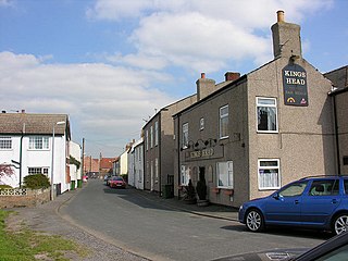
Crowle is a market town in the civil parish of Crowle and Ealand, on the Isle of Axholme in the North Lincolnshire unitary authority of Lincolnshire, England. The civil parish had a population at the 2011 census of 4,828. The town lies on the Stainforth and Keadby Canal.

<span class="mw-page-title-main">Thorne, South Yorkshire</span> Market town and civil parish in South Yorkshire, England

Thorne is a market town and civil parish in the City of Doncaster in South Yorkshire, England. It was historically part of the West Riding of Yorkshire until 1974. It has a population of 16,592, increasing to 17,295 at the 2011 Census.

<span class="mw-page-title-main">Axholme Joint Railway</span> Successor to the Goole and Marshland Railway and Axholme Light Railway

The Axholme Joint Railway was a committee created as a joint enterprise between the Lancashire and Yorkshire Railway (L&Y) and the North Eastern Railway (NER) and was established by the North Eastern Railway Act of 31 July 1902. It took over the Goole and Marshland Railway, running from Marshland Junction near Goole to Reedness Junction and Fockerby, and the Isle of Axholme Light Railway, running from Reedness Junction to Haxey Junction. Construction of the Goole and Marshland Railway had begun in 1898, and by the time of the takeover in early 1903, was virtually complete. The Isle of Axholme Light Railway was started in 1899, but only the section from Reedness Junction to Crowle was complete at the takeover. The northern section opened on 10 August 1903, and the line from Crowle to Haxey Junction opened for passengers on 2 January 1905.

<span class="mw-page-title-main">Fenn's, Whixall and Bettisfield Mosses National Nature Reserve</span> Nature reserve in England and Wales

Fenn's, Whixall and Bettisfield Mosses National Nature Reserve is a national nature reserve (NNR) which straddles the border between England and Wales, near Whixall and Ellesmere in Shropshire, England and Bettisfield in Wrexham County Borough, Wales. It comprises three peat bogs, Bettisfield Moss, Fenn's Moss and Whixall Moss. With Wem Moss and Cadney Moss, they are collectively a Site of Special Scientific Interest called The Fenn's, Whixall, Bettisfield, Wem & Cadney Moss Complex and form Britain's third-largest lowland raised bog, covering 2,388 acres (966 ha). The reserve is part of the Midland Meres and Mosses, an Important Plant Area which was declared a Wetland of International Importance under the Ramsar Convention in 1997. It is also a European Special Area of Conservation.

<span class="mw-page-title-main">New Junction Canal</span>

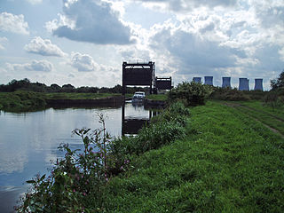
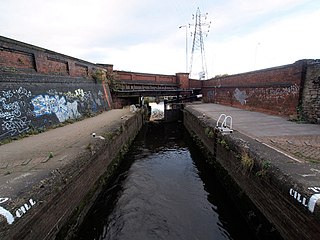
The New Junction Canal is a canal in South Yorkshire, England. It is part of the Sheffield and South Yorkshire Navigation (S&SYN), although it was jointly funded by the Aire and Calder Navigation, and was opened in 1905. It links the River Don Navigation and the Stainforth and Keadby Canal with the Aire and Calder Navigation. It is completely straight, and was the last canal built in England for commercial purposes.

<span class="mw-page-title-main">Hatfield Chase</span> Human settlement in England

Hatfield Chase is a low-lying area in South Yorkshire and North Lincolnshire, England, which was often flooded. It was a royal hunting ground until Charles I appointed the Dutch engineer Cornelius Vermuyden to drain it in 1626. The work involved the re-routing of the Rivers Don, Idle, and Torne, and the construction of drainage channels. It was not wholly successful, but changed the whole nature of a wide swathe of land including the Isle of Axholme, and caused legal disputes for the rest of the century. The civil engineer John Smeaton looked at the problem of wintertime flooding in the 1760s, and some remedial work was carried out.

<span class="mw-page-title-main">Stainforth and Keadby Canal</span> Canal in Yorkshire and Lincolnshire, England

The Stainforth and Keadby Canal is a navigable canal in South Yorkshire and Lincolnshire, England. It connects the River Don Navigation at Bramwith to the River Trent at Keadby, by way of Stainforth, Thorne and Ealand, near Crowle. It opened in 1802, passed into the control of the River Don Navigation in 1849, and within a year was controlled by the first of several railway companies. It became part of the Sheffield and South Yorkshire Navigation, an attempt to remove several canals from railway control, in 1895. There were plans to upgrade it to take larger barges and to improve the port facilities at Keadby, but the completion of the New Junction Canal in 1905 made this unnecessary, as Goole could easily be reached and was already a thriving port.

The South Yorkshire Railway was a railway company with lines in the West Riding of Yorkshire, England.

<span class="mw-page-title-main">Swinefleet</span> Village and civil parish in the East Riding of Yorkshire, England

Swinefleet is a village and civil parish in the East Riding of Yorkshire, England. It is situated approximately 2 miles (3.2 km) south-east of the town of Goole on the A161 road from Goole to Crowle. It lies on the south bank of the River Ouse. According to the 2011 UK census, Swinefleet parish had a population of 787, an increase on the 2001 UK census figure of 748. The main centre of population is at the extreme north of the parish, close to the River Ouse. The southern part of the parish is part of Swinefleet and Reedness Moors, and is characterised by drainage ditches and a few farm buildings.

<span class="mw-page-title-main">Goole Fields</span> Civil parish in the East Riding of Yorkshire, England

Goole Fields is a civil parish in the East Riding of Yorkshire, England. It is situated approximately 3 miles (4.8 km) south-west of Goole town centre and lies at both sides but mainly south of the A161 road, covering an area of 1,980.59 hectares. It is bordered to the east by the Swinefleet Warping Drain, to the south by the Blackwater Dike, and to the west by the railway line from Goole to Doncaster.

<span class="mw-page-title-main">River Don Navigation</span> Waterway navigation in South Yorkshire, England

The River Don Navigation was the result of early efforts to make the River Don in South Yorkshire, England, navigable between Fishlake and Sheffield. The Dutch engineer Cornelius Vermuyden had re-routed the mouth of the river in 1626, to improve drainage, and the new works included provision for navigation, but the scheme did not solve the problem of flooding, and the Dutch River was cut in 1635 to link the new channel to Goole. The first Act of Parliament to improve navigation on the river was obtained in 1726, by a group of Cutlers based in Sheffield; the Corporation of Doncaster obtained an Act in the following year for improvements to the lower river. Locks and lock cuts were built and by 1751 the river was navigable to Tinsley.

<span class="mw-page-title-main">River Torne (England)</span> River in the north of England

The River Torne is a river in the north of England, which flows through the counties of South Yorkshire and North Lincolnshire. It rises at the Upper Lake at Sandbeck Hall, in Maltby in South Yorkshire, and empties into the River Trent at Keadby pumping station. Much of the channel is engineered, as it plays a significant role in the drainage of Hatfield Chase, which it crosses.

<span class="mw-page-title-main">Thorne and Hatfield Moors</span> Lowland raised peat bog in England

Thorne and Hatfield Moors form the largest area of lowland raised peat bog in the United Kingdom. They are situated in South Yorkshire, to the north-east and east of Doncaster near the town of Thorne, and are part of Hatfield Chase. They had been used for small-scale extraction of peat for fuel from medieval times, and probably much earlier, but commercial extraction of the peat for animal bedding began in the 1880s. The peat was cut on the moors and, once it had dried, transported to several works on 3 ft narrow gauge tramways, always called trams locally. The wagons were pulled by horses to works at Creyke's Siding, Moorends, Medge Hall, Swinefleet and Hatfield. There was also a network of canals supplying the Moorends Works.

Warping was the former practice of letting turbid river water flood onto agricultural land, so that its suspended sediment could form a layer, before letting the water drain away. In this way poor soils were covered with fertile fine silt, and their rentable value was increased.

<span class="mw-page-title-main">South Humberside Main Line</span>

The South Humberside Main Line runs from Doncaster on the East Coast Main Line to Thorne where it diverges from the Sheffield to Hull Line. It then runs eastwards to Scunthorpe and the Humber ports of Immingham and Grimsby, with the coastal resort of Cleethorpes as terminus.

The Hull and Doncaster Branch is a secondary main railway line in England, connecting Kingston upon Hull to South Yorkshire and beyond via a branch from the Selby Line near Gilberdyke to a connection to the Doncaster–Barnetby line at a junction near Thorne 8 miles north-east of Doncaster.

<span class="mw-page-title-main">Crowle Peatland Railway</span>

Crowle Peatland Railway is a fledgling railway museum based on the peat moors at Crowle in North Lincolnshire, England.

<span class="mw-page-title-main">Swinefleet Warping Drain</span> Artificial waterway in the East Riding of Yorkshire, England

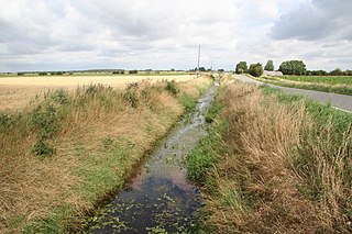
Swinefleet Warping Drain is an artificial waterway in the English county of the East Riding of Yorkshire, which was built to allow silt to be deposited on the peat moors, but now functions as a land drainage channel. It was constructed by Ralph Creyke, and the first section was completed in 1821.

References

  1. Van de Noort 2001 , p. 135
  2. Water Resources – Manuscripts & Special Collections. "Hatfield Chase Corporation, 1538–1973". The University of Nottingham. Archived from the original on 24 October 2020. Retrieved 29 April 2012.
  3. Hadfield 1972 , pp. 81–82
  4. Hadfield 1973 , p. 292
  5. Hadfield 1972 , p. 266
  6. Booth 1998 , p. 7
  7. Booth 1998 , pp. 7–8
  8. Booth 1998 , p. 8
  9. Booth 1998 , pp. 8–9
  10. Booth 1998 , p. 70
  11. Booth 1998 , p. 68
  12. Booth 1998 , p. 9
  13. Booth 1998 , p. 66
  14. 1 2 Booth 1998 , pp. 70–71
  15. Ordnance Survey, 1:2500 map, 1906