Dekorra, Wisconsin

Last updated

Dekorra, Wisconsin
Dekorra Town Hall.jpg
Town hall
Motto: 
"Beautifully Situated"
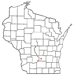
WIMap-doton-Dekorra.png
Location of Dekorra, Wisconsin
Coordinates: 43°25′5″N89°26′43″W / 43.41806°N 89.44528°W / 43.41806; -89.44528
Country Flag of the United States.svg  United States
State Flag of Wisconsin.svg  Wisconsin
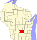
County Columbia
Area
  Total45 sq mi (116.5 km2)
  Land41.1 sq mi (106.6 km2)
  Water3.8 sq mi (10 km2)
Elevation
[1]
942 ft (287 m)
Population
 (2000)
  Total2,350
  Density57.1/sq mi (22.1/km2)
Time zone UTC-6 (Central (CST))
  Summer (DST) UTC-5 (CDT)
FIPS code 55-19375 [2]
GNIS feature ID1583065 [1]
Website Town of Dekorra, Columbia County, Wisconsin

Dekorra is a town in Columbia County, Wisconsin, United States. The population was 2,350 at the 2000 census.

Contents

History

Native American Indians originally lived in the area. [3] The town was laid out in 1836 when settlers from Kentucky came to the area. [4]

Geography

Dekorra pictured in July 2024 Dekorra.jpg
Dekorra pictured in July 2024

According to the United States Census Bureau, the town has a total area of 45 square miles (116.5 km2), of which, 41.1 square miles (106.6 km2) of it is land and 3.8 square miles (10 km2) of it (8.56%) is water.

Demographics

As of the census [2] of 2000, there were 2,350 people, 949 households, and 690 families residing in the town. The population density was 57.1 people per square mile (22.1/km2). There were 1,237 housing units at an average density of 30.1 per square mile (11.6/km2). The racial makeup of the town was 97.49% White, 0.04% African American, 0.85% Native American, 0.3% Asian, 0.3% from other races, and 1.02% from two or more races. Hispanic or Latino people of any race were 0.55% of the population.

There were 949 households, out of which 30% had children under the age of 18 living with them, 64.6% were married couples living together, 4.8% had a female householder with no husband present, and 27.2% were non-families. 21.9% of all households were made up of individuals, and 7.7% had someone living alone who was 65 years of age or older. The average household size was 2.48 and the average family size was 2.9.

In the town, the population was spread out, with 23.6% under the age of 18, 5.7% from 18 to 24, 29.9% from 25 to 44, 30.1% from 45 to 64, and 10.8% who were 65 years of age or older. The median age was 40 years. For every 100 females, there were 113.1 males. For every 100 females age 18 and over, there were 114.3 males.

The median income for a household in the town was $55,737, and the median income for a family was $63,583. Males had a median income of $38,782 versus $28,750 for females. The per capita income for the town was $25,319. About 1.6% of families and 2.1% of the population were below the poverty line, including 1.6% of those under age 18 and none of those age 65 or over.

Education

Dekorra is part of the Poynette School District. The district has two elementary schools, one middle school, and Poynette High School. [5]

Related Research Articles

<span class="mw-page-title-main">Columbia County, Wisconsin</span> County in Wisconsin, United States

Columbia County is a county located in the U.S. state of Wisconsin. As of the 2020 census, the population was 58,490. Its county seat and largest city is Portage. The county was created in 1846 as part of Wisconsin Territory.

<span class="mw-page-title-main">Conehatta, Mississippi</span> CDP in Mississippi, United States

Conehatta is a census-designated place (CDP) in Newton County, Mississippi. The population was 1376 at the 2020 census. It is one of the eight communities included in the Mississippi Band of Choctaw Indians Reservation and the population is 76% Choctaw.

<span class="mw-page-title-main">Dell Prairie, Wisconsin</span> Town in Wisconsin, United States

Dell Prairie is a town in Adams County in the U.S. state of Wisconsin. The population was 1,631 at the 2020 census, up from 1,590 at the 2010 census. The unincorporated community of Plainville is located in the town.

<span class="mw-page-title-main">Quincy, Wisconsin</span> Town in Wisconsin, United States

Quincy is a town in Adams County in the U.S. state of Wisconsin. The population was 1,159 at the 2020 census, slightly down from 1,163 at the 2010 census. The ghost town of Quincy was located in the town.

<span class="mw-page-title-main">Modena, Wisconsin</span> Town in Wisconsin, United States

Modena is a town in Buffalo County in the U.S. state of Wisconsin. The population was 354 at the 2010 census. The unincorporated community of Urne is also located partially in the town.

<span class="mw-page-title-main">Leeds, Wisconsin</span> Town in Wisconsin, United States

Leeds is a town in Columbia County, Wisconsin, United States. The population was 813 at the 2000 census. The unincorporated communities of Keyeser, Leeds, Leeds Center, and North Leeds are located in the town. The town took its name from the city of Leeds, England.

<span class="mw-page-title-main">Lewiston, Wisconsin</span> Town in Wisconsin, United States

Lewiston is a town in Columbia County, Wisconsin, United States. The population was 1,187 at the 2000 census.

<span class="mw-page-title-main">Lowville, Wisconsin</span> Town in Wisconsin, United States

Lowville is a town in Columbia County, Wisconsin, United States. The population was 987 at the 2000 census.

<span class="mw-page-title-main">Marcellon, Wisconsin</span> Town in Wisconsin, United States

Marcellon is a town in Columbia County, Wisconsin, United States. The population was 1,024 at the 2000 census. The unincorporated community of Belle Fountain is located in the town.

<span class="mw-page-title-main">Poynette, Wisconsin</span> Village in Wisconsin, United States

Poynette is a village in Columbia County, Wisconsin, United States. The population was 2,575 at the 2022 United States census. It is part of the Madison Metropolitan Statistical Area.

<span class="mw-page-title-main">Burns, Wisconsin</span> Town in Wisconsin, United States

Burns is a town in La Crosse County, Wisconsin, United States. The population was 949 at the 2010 census. It is part of the La Crosse, Wisconsin Metropolitan Statistical Area. The unincorporated communities of Burns and Burns Corners are located in the town.

<span class="mw-page-title-main">Lake Wisconsin, Wisconsin</span> CDP in Wisconsin, United States

Lake Wisconsin is a census-designated place (CDP) in Columbia and Sauk counties, in the towns of Lodi and Merrimac, in Wisconsin, United States. The population was 4,189 at the 2010 census.

Arlington is a town in Columbia County, Wisconsin, United States. The population was 848 at the 2000 census. The Village of Arlington is located within the town.

<span class="mw-page-title-main">Randolph, Wisconsin</span> Village in Wisconsin, United States

Randolph is a village in Columbia and Dodge Counties in the U.S. state of Wisconsin. The population was 1,811 at the 2010 census. Of this, 1,339 were in Dodge County, and 472 were in Columbia County. The village is located at the southeast corner of the Town of Randolph in Columbia County, although only a tiny portion of the village lies within the town. Most of the village lies within the Town of Westford in Dodge County. Small portions also lie within the Town of Fox Lake to the north and the Town of Courtland in Columbia County.

<span class="mw-page-title-main">Wyocena, Wisconsin</span> Village in Wisconsin, United States

Wyocena is a village in Columbia County, Wisconsin, United States. The population was 768 at the 2010 census. The village is located within the Town of Wyocena. It is part of the Madison Metropolitan Statistical Area.

<span class="mw-page-title-main">Wyocena (town), Wisconsin</span>

Wyocena is a town in Columbia County, Wisconsin, United States. The population was 619 at the 2000 Census. The Village of Wyocena is located within the town.

<span class="mw-page-title-main">Arena, Wisconsin</span> Village in Wisconsin, United States

Arena is a village in Iowa County, Wisconsin, United States. The population was 834 at the 2010 census. The village is located within the Town of Arena. It is part of the Madison Metropolitan Statistical Area.

The Town of Weston is located in Marathon County, Wisconsin, United States. It is part of the Wausau, Wisconsin Metropolitan Statistical Area. The population was 657 at the 2020 census.

<span class="mw-page-title-main">St. Croix Falls (town), Wisconsin</span> Town in Wisconsin, United States

St. Croix Falls is a town in Polk County, Wisconsin, United States. The population was 1,119 at the 2000 census. The City of St. Croix Falls is located within the town. The unincorporated community of Lamar is located in the town.

<span class="mw-page-title-main">Ironton, Wisconsin</span> Village in Wisconsin, United States

Ironton is a village in Sauk County, Wisconsin, United States, along the Little Baraboo River. The population was 253 at the 2010 census. The village is located within the Town of Ironton.

References

  1. 1 2 "US Board on Geographic Names". United States Geological Survey. October 25, 2007. Retrieved January 31, 2008.
  2. 1 2 "U.S. Census website". United States Census Bureau . Retrieved January 31, 2008.
  3. "A Brief History of Dekorra". Town of Dekorra, Columbia County, Wisconsin. Retrieved July 25, 2012.
  4. "Term: Dekorra, Columbia Co". Wisconsin Historical Society. Archived from the original on March 8, 2014. Retrieved July 25, 2012.
  5. "School District Of Poynette". School District Of Poynette. Retrieved July 28, 2012.

43°27′27″N89°28′03″W / 43.45750°N 89.46750°W / 43.45750; -89.46750