Districts of North Sulawesi

Last updated
Coat of Arms of Indonesia Garuda Pancasila.svg
This article is part of a series on the
politics and government of
Indonesia
Pancasila(national philosophy)
Constitution
Foreign relations

The province of North Sulawesi in Indonesia is divided into regencies, known as Kabupaten, which in turn are divided administratively into districts, known as Kecamatan.

Provinces of Indonesia Indonesian administrative division, first-level subdivision of the country

The Provinces of Indonesia are the 34 largest subdivisions of the country and the highest tier of the local government. Provinces are further divided into regencies and cities, which are in turn subdivided into subdistricts (kecamatan).

North Sulawesi Province in Indonesia

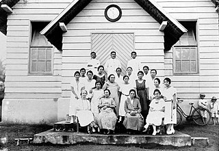
North Sulawesi is a province of Indonesia. It is located on the northern peninsula of the island of Sulawesi, on the Minahasa Peninsula, lies south of Philippines and southeast of Malaysia. It borders Philippines to the north, the Maluku Sea to the east, Gorontalo to the west and the Gulf of Tomini to the south. The province's capital and largest city is Manado, and its population was 4,135,526 according to the 2010 census; the latest official estimate is 4,353,540. Manado is also the main gateway and the economic center of the province. Other major towns includes Tomohon and Bitung. There are 41 mountains with an altitude ranging from 1,112–1,995 metres (3,648–6,545 ft). Most geologic conditions are the young volcanic region, a large number of eruptions and the active cone shape of the active volcanoes that adorn the central Minahasa, Bolaang Mongondow and Sangihe Islands.

Indonesia Republic in Southeast Asia

Indonesia, officially the Republic of Indonesia, is a country in Southeast Asia, between the Indian and Pacific oceans. It is the world's largest island country, with more than seventeen thousand islands, and at 1,904,569 square kilometres, the 14th largest by land area and the 7th largest in combined sea and land area. With over 261 million people, it is the world's 4th most populous country as well as the most populous Muslim-majority country. Java, the world's most populous island, contains more than half of the country's population.

The districts of North Sulawesi with the regency it falls into are as follows:

  1. Bunaken
  2. Bunaken Kepulauan
  3. Malalayang
  4. Mapanget
  5. Paal Dua
  6. Sario
  7. Singkil
  8. Tikala
  9. Tuminting
  10. Wanea
  11. Wenang
  1. Aertembaga
  2. Girian
  3. Lembeh Selatan
  4. Lembeh Utara
  5. Madidir
  6. Maesa
  7. Matuari
  8. Ranowulu
  1. Kotamobagu Barat
  2. Kotamobagu Selatan
  3. Kotamobagu Timur
  4. Kotamobagu Utara
  1. Tomohon Barat
  2. Tomohon Selatan
  3. Tomohon Tengah
  4. Tomohon Timur
  5. Tomohon Utara
  1. Eris
  2. Kakas
  3. Kakas Barat
  4. Kawangkoan
  5. Kawangkoan Barat
  6. Kawangkoan Utara
  7. Kombi
  8. Langowan Barat
  9. Langowan Selatan
  10. Langowan Timur
  11. Langowan Utara
  12. Lembean Timur
  13. Mandolang
  14. Pineleng
  15. Remboken
  16. Sonder
  17. Tombariri
  18. Tombariri Timur
  19. Tombulu
  20. Tompaso
  21. Tompaso Barat
  22. Tondano Barat
  23. Tondano Selatan
  24. Tondano Timur
  25. Tondano Utara
  1. Amurang
  2. Amurang Barat
  3. Amurang Timur
  4. Kumelembuai
  5. Maesaan
  6. Modoinding
  7. Motoling
  8. Motoling Barat
  9. Motoling Timur
  10. Ranoyapo
  11. Sinonsayang
  12. Suluun Tareran
  13. Tareran
  14. Tatapaan
  15. Tenga
  16. Tompasobaru
  17. Tumpaan
  1. Airmadidi
  2. Dimembe
  3. Kalawat
  4. Kauditan
  5. Kema
  6. Likupang Barat
  7. Likupang Selatan
  8. Likupang Timur
  9. Talawaan
  10. Wori
  1. Belang
  2. Pasan
  3. Pusomaen
  4. Ratahan
  5. Ratahan Timur
  6. Ratatotok
  7. Silian Raya
  8. Tombatu
  9. Tombatu Timur
  10. Tombatu Utara
  11. Touluaan
  12. Touluaan Selatan
  1. Bilalang
  2. Bolaang
  3. Bolaang Timur
  4. Dumoga
  5. Dumoga Barat
  6. Dumoga Tengah
  7. Dumoga Tenggara
  8. Dumoga Timur
  9. Dumoga Utara
  10. Lolak
  11. Lolayan
  12. Passi Barat
  13. Passi Timur
  14. Poigar
  15. Sangtombolang
  1. Bintauna
  2. Bolangitang Barat
  3. Bolangitang Timur
  4. Kaidipang
  5. Pinogaluman
  6. Sangkub
  1. Bolaang Uki
  2. Helumo
  3. Pinolosian
  4. Pinolosian Tengah
  5. Pinolosian Timur
  6. Posigadan
  7. Tomini
  1. Kotabunan
  2. Modayag
  3. Modayag Barat
  4. Mooat
  5. Motongkad
  6. Nuangan
  7. Tutuyan
  1. Beo
  2. Beo Selatan
  3. Beo Utara
  4. Damau
  5. Essang
  6. Essang Selatan
  7. Gemeh
  8. Kabaruan
  9. Kalongan
  10. Lirung
  11. Melonguane
  12. Melonguane Timur
  13. Miangas
  14. Moronge
  15. Nanusa
  16. Pulutan
  17. Rainis
  18. Salibabu
  19. Tampan’amma
  1. Kendahe
  2. Kepulauan Marore
  3. Manganitu
  4. Manganitu Selatan
  5. Nusa Tabukan
  6. Tabukan Selatan
  7. Tabukan Selatan Tengah
  8. Tabukan Selatan Tenggara
  9. Tabukan Tengah
  10. Tabukan Utara
  11. Tahuna
  12. Tahuna Barat
  13. Tahuna Timur
  14. Tamako
  15. Tatoareng
  1. Biaro
  2. Siau Barat
  3. Siau Barat Selatan
  4. Siau Barat Utara
  5. Siau Tengah
  6. Siau Timur
  7. Siau Timur Selatan
  8. Tagulandang
  9. Tagulandang Selatan
  10. Tagulandang Utara

Related Research Articles

Sangihe Islands Sangihe Islands

The Sangihe Islands – Indonesian: Kepulauan Sangihe – are a group of islands which constitute two regencies within the province of North Sulawesi, in northern Indonesia, the Sangihe Islands Regency and the Sitaro Islands Regency. They are located north-east of Sulawesi between the Celebes Sea and the Molucca Sea, roughly halfway between Sulawesi and Mindanao, in the Philippines; the Sangihes form the eastern limit of the Celebes Sea. The islands combine to total 813 square kilometres, with many of the islands being actively volcanic with fertile soil and mountains.

Districts of Central Sulawesi

The province of Central Sulawesi in Indonesia is divided into regencies which is turn are divided administratively into districts, known as Kecamantan.

Subdistricts of Lampung

The province of Lampung in Indonesia is divided into regencies which in turn are divided administratively into subdistricts or kecamatan.

Districts of Maluku

The province of Maluku in Indonesia is divided into nine regencies (kabupaten) and two independent cities (kota); these in turn are divided administratively into 118 districts known as Kecamatan. The 118 districts of Maluku, with the regency or city each falls into, are as follows:

Districts of North Maluku

The province of North Maluku in Indonesia is divided into regencies which is turn are divided administratively into districts, known as Kecamantan.

Sub-districts of North Sumatra

The province of North Sumatra in Indonesia is divided into regencies which is turn are divided administratively into sub-districts.

Districts of South Kalimantan

The province of the South Kalimantan in Indonesia is divided into regencies which is turn are divided administratively into districts, known as Kecamatan.

Subdistricts of West Sumatra

The province of the West Sumatra in Indonesia is divided into kabupaten or regencies which in turn are divided administratively into subdistricts or kecamatan.

Sitaro Islands Regency Regency in North Sulawesi, Indonesia

Sitaro Islands Regency is a regency located off the northern extremity of Sulawesi Island in the southern Sangihe Islands, North Sulawesi Province, Indonesia. The Regency was formed under Law Number 15 Year 2007 from 2 January 2007, by separation from the Sangihe Islands Regency of which it had previously formed the southern part.

Minahasa Regency Regency in North Sulawesi, Indonesia

Minahasa Regency is a regency in North Sulawesi, Indonesia. Its capital is Tondano.

Southeast Maluku Regency Regency in Maluku, Indonesia

Southeast Maluku Regency is a regency of Maluku, Indonesia. It is coincident with the Kei Islands, except that the city of Tual, although within the Kei Islands geographically and the seat of the Regency's administration, is technically independent of the Regency. The land area of the Regency is 1,031.81 km², and it had a population of 96,442 at the 2010 Census; the latest official estimate was 107,428. The capital is located in Langgur.

Miss Indonesia 2009 is the 5th edition of Miss Indonesia. The final night of Miss Indonesia 2009 was held in Cendrawasih Room, Jakarta Convention Center, on June 5, 2009. The event was hosted by Tantowi Yahya and first runner-up of Miss Indonesia 2008, Kartika Indah Pelapory

Districts of West Kalimantan

The province of the West Kalimantan in Indonesia is divided into regencies which is turn are divided administratively into districts, known as Kecamatan.

Districts of North Kalimantan

The province of North Kalimantan in Indonesia is divided into kabupaten or regencies which is turn are divided administratively into districts, known as kecamatan.

Mongondow people The Mongondowis are an ethnic group native to the northeastern part of the Sulawesi island, Indonesia

The Mongondow or Bolaang Mongondow people are an ethnic group native to the north-eastern part of the Indonesian island of Sulawesi. The Mongondows are predominantly Muslim. They have traditionally been concentrated in the provinces of North Sulawesi and Gorontalo. This ethnic group used to be united by a single entity, the Kingdom of Bolaang Mongondow, which became the western regencies of North Sulawesi after the Indonesian independence.

The Kingdom of Bolaang Mongondow, previously known as Kingdom of Bola'ang, was a state that ruled over majority of area of the present-day Bola'ang-Mongondow regencies in the North Celebes province of Indonesia, excluding Bola'ang Mongondow Utara regency, which was a territory that was ruled by smaller kingdoms of Bintauna and Kaidipang.

Bernard Wilhelm Lapian Indonesian journalist and politician

Bernard Wilhelm "B. W." Lapian was a nationalist involved in the struggle for Indonesian independence. He published several newspapers that gave voice to the welfare of the Indonesian people and promoted Indonesian nationalism. He was also part a group who established a separate Christian denomination from the official Dutch East-Indies church institution. After Indonesia gained its independence, Lapian served as head of the district of Manado and acting governor of Sulawesi. In 2015, he was given the title of "National Hero of Indonesia" by President Joko Widodo.

References

  1. "Mengenal Wilayah Manado Saat Sebelas Kecamatan" (in Indonesian). Pemerintah Kota Manado. Retrieved 22 February 2018.
  2. "Pemerintah Kota Bitung" (in Indonesian). BPK RI Perwakilan Provinsi Sulawesi Utara. Retrieved 22 February 2018.
  3. "Profil & Sejarah Kotamobagu" (in Indonesian). Kota Kotamobagu. Retrieved 22 February 2018.
  4. "Ini Kelurahan Dengan Jumlah Pemilih Terbanyak di Kota Tomohon" (in Indonesian). PT BMCOM. Retrieved 22 February 2018.
  5. "Desa/Kelurahan" (in Indonesian). Pemerintah Kabupaten Minahasa. Retrieved 22 February 2018.
  6. "Kondisi Wilayah" (in Indonesian). Pemerintah Kabupaten Minahasa Selatan. Retrieved 22 February 2018.
  7. "Profil Kabupaten Minahasa Utara" (in Indonesian). Disnaker Minut. Retrieved 22 February 2018.
  8. "Kondisi Geografi Minahasa Tenggara" (in Indonesian). Pemerintah Kabupaten Minahasa Tenggara. Retrieved 22 February 2018.
  9. "KPU Bolmong Tetapkan Daftar Pemilih Tetap" (in Indonesian). KPU Kabupaten Bolaang Mongondow. Retrieved 22 February 2018.
  10. "KTP Warga Tomini dan Helumo Masih Data Lama" (in Indonesian). DutaDemokrasi.com. Retrieved 22 February 2018.
  11. "Penduduk Boltim Tercatat 72.460 Jiwa" (in Indonesian). TRIBUNnews.com Network. Retrieved 22 February 2018.
  12. "Daftar Desa, Kelurahan Perkecamatan di Kabupaten Kepulauan Sangihe" (in Indonesian). Pemerintah Kabupaten Kepulauan Sangihe. Retrieved 22 February 2018.
  13. "Ini rincian data pemilih Sitaro tiap kecamatan" (in Indonesian). Antara . Retrieved 22 February 2018.