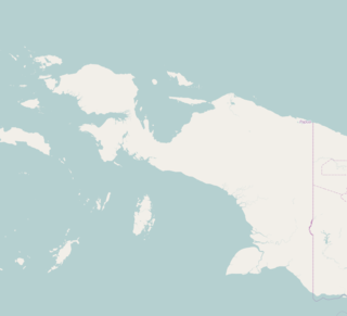
Papua is the largest and easternmost province of Indonesia, comprising most of Western New Guinea. It is bordered by the state of Papua New Guinea to the east, the province of West Papua to the west, the Pacific Ocean to the north, and the Arafura Sea to the south. According to the 2010 census by Statistics Indonesia, Papua had a population of 2,833,381, the majority of whom are Christians. The province is divided into twenty-eight regencies and one city. Its capital and largest city is Jayapura.
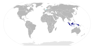
The Provinces of Indonesia are the 34 largest subdivisions of the country and the highest tier of the local government. Provinces are further divided into regencies and cities, which are in turn subdivided into districts (kecamatan).

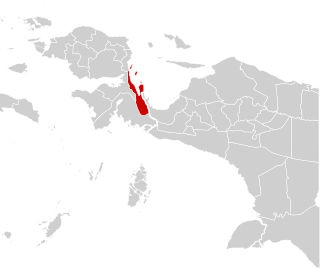
West Papua is a province of Indonesia. It covers the two western peninsulas of the island of New Guinea, Bird's Head Peninsula and Bomberai Peninsula, along with nearby islands. The province is bordered to the north by the Pacific Ocean, to the west by the Halmahera Sea and the Ceram Sea, to the south by the Banda Sea, and to the east by the province of Papua and the Cenderawasih Bay. Manokwari is the province's capital, while Sorong is its largest city. West Papua is the least populous province in Indonesia, with a population of 760,422 according to the 2010 census by Statistics Indonesia.
A daïra or daerah is an administrative division in Algeria and Western Sahara in West Africa, as well as Brunei, Indonesia and Malaysia in Southeast Asia. It is commonly translated in English as "district".
Merauke is a regency in Papua Province, Indonesia. It covers an area of 44,071 km2, and had a population of 195,716 at the 2010 Census; the latest official estimate is 240,826.
Jayapura is a city in the Indonesian province of Papua.
Sorong is a chartered coastal city of West Papua province of Indonesia.

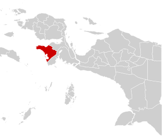
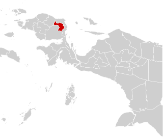
Sorong Regency is a regency of West Papua Province of Indonesia. It covers an area of 7,415.29 km2, and had a population of 70,619 at the 2010 Census; the latest official estimate is 81,486. Its administrative centre is the town of Aimas. The regency surrounds Sorong City (Kota), which is independent of the Regency; Sorong City has an airport, Sorong Airport, which also serves the Regency.
Jayapura Regency is one of the regencies (kabupaten) in Papua Province of Indonesia. It is situated to the west of, but does not include, the City of Jayapura. Previously covering most of the north-east portion of Papua Province, it was reduced substantially in extent from 12 November 2002, when the eastern districts were split off to form a new Keerom Regency and the western districts were split off to form a new Sarmi Regency. It now covers an area of 11,157.15 km2, and had a population of 111,943 at the 2010 Census; the latest official estimate is 137,744. The administrative centre is the municipality of Sentani, with 44,779 inhabitants in 2010.
Fakfak Regency - formerly spelt "Fak-Fak" - is a regency of West Papua province of Indonesia. It covers an area of 11,036.48 km2, and had a population of 66,828 at the 2010 Census; the latest official estimate is 77,112. The administrative centre is the town of Fakfak.

Maybrat Regency is a regency of West Papua Province of Indonesia. It has an area of 5,461.69 km2 (2,108.77 sq mi), and had a population of 33,081 at the 2010 Census; the latest official estimate is 38,067. The administrative centre is the town of Kumurkek.

South Sorong Regency is a regency of West Papua Province of Indonesia. It has an area of 3,946.94 km2, and had a population of 37,900 at the 2010 Census; the latest official estimate is 43,898. The administrative centre is the town of Teminabuan.

Teluk Bintuni Regency is a regency of West Papua Province of Indonesia. It covers an area of 20,840.83, comprising administrative districts on both sides of Bintuni Bay, a gulf which separates the Bird's Head Peninsula and Bomberai Peninsula which form the main constituents of the province; it had a population of 52,422 at the 2010 Census; the latest official estimate is 60,489. The administrative centre is the town of Bintuni.
Teluk Wondama Regency or Wondama Bay Regency is a regency of West Papua province of Indonesia. It covers an area of 3,959.53 km2, and had a population of 26,321 at the 2010 Census; the latest official estimate is 30,371. The administrative centre lies in the village of Rasiei.

South Manokwari Regency is a regency of West Papua Province of Indonesia. It was formed in 2013 from the southern districts of Manokwari Regency. The population of the area now comprised in the new regency was 18,564 at the 2010 Census. The administrative centre is the town of Ransiki.
Arfak Mountains Regency is a regency of the West Papua Province of Indonesia. It was formed in 2013 from the western districts of Manokwari Regency. The areas now comprised in the new regency had a population of 23,877 at the 2010 Census. The administrative centre is the town of Anggi.