Dorinish

Last updated

Dorinish
Native name:
Deoirinis
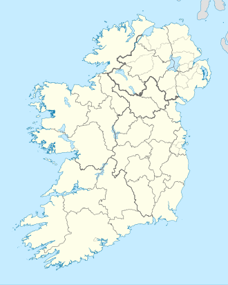
Island of Ireland location map.svg
Red pog.svg
Dorinish
Geography
Location Atlantic Ocean (Clew Bay)
Coordinates 53°48′44.68″N9°40′17.65″W / 53.8124111°N 9.6715694°W / 53.8124111; -9.6715694
Area19.74 acres (7.99 ha) [1]
Administration
Province Connacht
County Mayo
Demographics
Population0

Dorinish (Irish: Deoirinis) is an uninhabited island in Clew Bay in County Mayo, Ireland. During the 1970s it was briefly inhabited by Hippies who established a commune there under the patronage of the island's then owner John Lennon.

Contents

History

Artists on Dorinish island, summer 2011 Aerialblue9.jpg
Artists on Dorinish island, summer 2011
Map of Dorinish Island Map of Dorinish Island.jpg
Map of Dorinish Island

John Lennon purchase and Hippie Commune

The island was previously owned by John Lennon, who purchased the island in 1967 for £1,700. Previously used by sailing ships for its stones, the island became a place of peace for Lennon and his family. After his divorce from wife Cynthia, the island went unused until Lennon invited "King of the Hippies" Sid Rawle and Timi Walsh to establish a commune on the island in 1970. [2] For the next two years, a group of roughly 25 hippies called Dorinish home, growing their own vegetables and raising children. [3] [4] They called themselves 'the Diggers' and Rawle would later say "Dorinish was heaven and it was hell". [5]

In 1972 a fire burned down the island's supply tent and the commune disbanded. After Lennon's death, Yoko Ono sold the island for nearly £30,000 and donated the proceeds to an Irish orphanage. Dorinish is now used as a grazing site for livestock and is sometimes visited by enthusiastic Beatles fans. An artists' summer school "Aerial Blue" was held on the island in July 2011. [6]
Demographics

Historical population
YearPop.±%
184113    
18510−100.0%
186100.00%
187115    
188114−6.7%
18916−57.1%
19010−100.0%
191100.00%
192600.00%
YearPop.±%
193600.00%
194600.00%
195100.00%
195600.00%
196100.00%
196600.00%
19711    
19795+400.0%
19810−100.0%
YearPop.±%
198600.00%
199100.00%
199600.00%
200200.00%
200600.00%
201100.00%
201600.00%
Source: Central Statistics Office. "CNA17: Population by Off Shore Island, Sex and Year". CSO.ie. Retrieved 12 October 2016.

See also

Related Research Articles

<span class="mw-page-title-main">County Mayo</span> County in Ireland

County Mayo is a county in Ireland. In the West of Ireland, in the province of Connacht, it is named after the village of Mayo, now generally known as Mayo Abbey. Mayo County Council is the local authority. The population was 137,231 at the 2022 census. The boundaries of the county, which was formed in 1585, reflect the Mac William Íochtar lordship at that time.

Hyde Park may refer to:

<span class="mw-page-title-main">Westport, County Mayo</span> Town in County Mayo, Ireland

Westport is a town in County Mayo in Ireland. It is at the south-east corner of Clew Bay, an inlet of the Atlantic Ocean on the west coast of Ireland. Westport is a tourist destination and scores highly for quality of life. It won the Irish Tidy Towns Competition three times in 2001, 2006 and 2008. In 2012 it won the Best Place to Live in Ireland competition run by The Irish Times.

<span class="mw-page-title-main">Castlebar</span> Town in County Mayo, Ireland

Castlebar is the county town of County Mayo, Ireland. Developing around a 13th-century castle of the de Barry family, from which the town got its name, the town now acts as a social and economic focal point for the surrounding hinterland. With a population of 13,054 in the 2022 census, Castlebar was one of the fastest growing towns in Ireland in the early 21st century.

<span class="mw-page-title-main">Ballyhaunis</span> Town in County Mayo in Ireland

Ballyhaunis is a town in County Mayo, Ireland. It is at the crossroads of the N60 and N83 National secondary roads and on the railway line linking Dublin to Westport and Ballina.

<span class="mw-page-title-main">Claremorris</span> Town in County Mayo in Ireland

Claremorris is a town in County Mayo in the west of Ireland, at the junction of the N17 and the N60 national routes. As of the 2017, it was the fastest growing town in the county, having seen a 31% increase in population between 2006 and 2011 and a 23% increase between 2002 and 2006. Between the 2016 census and the 2022 census, the population of Claremorris grew further, from 3,687 to 3,857 inhabitants.

<span class="mw-page-title-main">Killala</span> Village in County Mayo, Ireland

Killala is a village in County Mayo in Ireland, north of Ballina. The railway line from Dublin to Ballina once extended to Killala. To the west of Killala is the townland of Townsplots West, which contains a number of ancient forts. Historically associated with Saint Patrick, and the seat of an episcopal see for several centuries, evidence of Killala's ecclesiastical past include a 12th-century round tower and the 17th century Cathedral Church of St Patrick. As of the 2016 census of Ireland, the village had a population of 562. The village is in a civil parish of the same name.

<span class="mw-page-title-main">Clew Bay</span> Ocean bay in County Mayo, Ireland

Clew Bay is a large ocean bay on the Atlantic coast of County Mayo, Ireland. It is roughly rectangular and has more than a hundred small islands on its landward side; Ireland's best example of sunken drumlins. The larger Clare Island guards the entrance of the bay.

<span class="mw-page-title-main">Clare Island</span> Island in County Mayo, Ireland

Clare Island, also historically Inishcleer, is a mountainous island guarding the entrance to Clew Bay in County Mayo, Ireland. Historically part of the kingdom of Umhaill, it is famous as the home of the 16th century pirate queen Gráinne O'Malley. The population of the island is 138 according to the 2022 census. To the south-west lies Inishturk (inhabited) and Caher Island (uninhabited), and to the north is Achill Island.

London Street Commune was a hippy movement formed during the 1960s. It aimed to highlight concerns about rising levels of homelessness and to house the hundreds of hippies sleeping in parks and derelict buildings in central London.

<span class="mw-page-title-main">County colours (Gaelic games)</span> Kit worn in Irish inter-county GAA competitions

The county colours of an Irish county are the colours of the kit worn by that county's representative team in the inter-county competitions of the Gaelic Athletic Association (GAA), the most important of which are the All-Ireland Senior Football Championship and the All-Ireland Senior Hurling Championship. Fans attending matches often wear replica jerseys, and wave flags and banners in the county colours. In the build-up to a major match, flags and bunting are flown or hung from cars, buildings, telegraph poles, and other fixtures across the county, especially in those regions where GAA support is strong.

<span class="mw-page-title-main">Kilcummin, County Mayo</span> Civil parish in County Mayo Ireland

Kilcummin is a beachhead and civil parish on the northern coast of County Mayo in Ireland. Traditionally a fishing community, the Kilcummin area is sparsely populated. The "Tír Sáile - North Mayo Sculpture Trail" and "Tour d'Humbert" tourist route lead through the area. Kilcummin overlooks Killala Bay, the blue flag beach "An Trá nRoss", "Bartra Island" and lies on the opposite shore to Enniscrone and its beach in County Sligo.

<span class="mw-page-title-main">National Museum of Ireland – Country Life</span> Social history museum in County Mayo, Ireland

The National Museum of Ireland – Country Life is located in Turlough village, 8 km (5.0 mi) northeast of Castlebar, County Mayo, Ireland. Established in 2001, the museum is part of the National Museum of Ireland and is the only national museum outside Dublin. The museum exhibits the way of life of rural Irish people between 1850 and 1950, and is in the grounds of Turlough Park House. There are displays about the home, the natural environment, trades and crafts, communities, and working on the land and on water.

<span class="mw-page-title-main">Corraun Peninsula</span> Peninsula on the west coast of Ireland

The Corraun Peninsula, also spelt Currane, is a peninsula in County Mayo, on the west coast of Ireland. It extends out from the mainland towards Achill Island.

<span class="mw-page-title-main">Ubi Dwyer</span> Irish anarchist activist (1933–2001)

Bill 'Ubi' Dwyer or William Ubique Dwyer was an anarchist activist in New Zealand, Australia, England and his native Ireland and is best known as the originator and principal organiser of the Windsor Free Festival.

<span class="mw-page-title-main">Sid Rawle</span> British activist (1945–2010)

Sidney William Rawle was a British campaigner for peace and land rights, free festival organiser, and a former leader of the London squatters movement. Rawle was known to British tabloid journalists as 'The King of the Hippies', not a title he ever claimed for himself, but one that he did eventually co-opt for his unpublished autobiography.

<span class="mw-page-title-main">Ballina, County Mayo</span> Town in County Mayo, Ireland

Ballina is a town in north County Mayo, Ireland. It lies at the mouth of the River Moy near Killala Bay, in the Moy valley and Parish of Kilmoremoy, with the Ox Mountains to the east and the Nephin Beg mountains to the west. The town occupies two baronies; Tirawley on the west bank of the Moy River, and Tireragh, a barony within County Sligo, on its east banks. At the 2022 census, the population of Ballina was 10,556.

<span class="mw-page-title-main">Atlantic Technological University</span> Technological university based in Ireland

Atlantic Technological University is a technological university in the west and north-west of Ireland. It was formally established on 1 April 2022 as a merger of three existing institutes of technology (ITs) – Galway-Mayo IT, IT Sligo, and Letterkenny IT – into a single university, the fourth such TU in Ireland.

References

  1. "Dorinish". Residency Unlimited. Townlands.ie. Retrieved 21 November 2021.
  2. Abrams, Philip; McCulloch, Andrew (August 1976). Communes, Sociology and Society . Cambridge University Press. p.  38.
  3. "Working in the cabbage garden on Dorinish Island, August 1971". library.mayo.ie. 1 August 1971. Retrieved 9 October 2022.
  4. "Home life on Dorinish Island, August 1971". library.mayo.ie. 1 August 1971. Retrieved 9 October 2022.
  5. Ferriter, Diarmuid (2018). On the Edge Ireland’s Off-shore Islands: a Modern History.
  6. "Aerial Blue Island Residency, Ireland (Deadline: June 2, 2011)". Residency Unlimited. Retrieved 9 January 2016.