Kilmovee

Last updated • 4 min readFrom Wikipedia, The Free Encyclopedia

Kilmovee
Cill Mobhí
Village
Cashel, Kilmovee - geograph.org.uk - 674155.jpg
Cashel ring fort at Kilmovee
Ireland adm location map.svg
Red pog.svg
Kilmovee
Location in Ireland
Coordinates: 53°53′13″N8°41′16″W / 53.88704°N 8.68784°W / 53.88704; -8.68784
Country Ireland
Province Connacht
County County Mayo
Elevation
56 m (184 ft)
Population
 (2002)
  Total
613
 Urlaur: 523
Kilkelly: 839
Time zone UTC+0 (WET)
  Summer (DST) UTC-1 (IST (WEST))
Irish Grid Reference M545936
Website kilmovee.info

Kilmovee (Irish : Cill Mobhí, meaning 'Church of Mobhí') is a village and civil parish in County Mayo, Ireland. It is a mainly rural parish on the R325 road, midway between Kilkelly and Ballaghaderreen.

Contents

In March 2004, the Cois Tine Heritage Centre was opened and since then it has become a cultural centre for the people of the area. [1] [2] In 2011, the Annual Seosamh Mac Gabhann Summer School was established in Kilmovee to honour the Irish language playwright and music teacher Seosamh Mac Gabhann, who lived and worked in Kilmovee for much of his life. [3] [4]

History

In pre-Norman Ireland, the lands of Kilmovee formed part of the Kingdom of Sliabh Lugha, a territory ruled by the O'Gadhra Dynasty. Sliabh Lugha was a subdivision of the larger Gailenga kingdom, from which derives the modern name Gallen.

After the Norman Invasion, the parish of Kilmovee became part of the Barony of Costello. The Nangle or de Angelo invaders came southwest from the De Lacy territory in Carrick-on-Shannon and forced the O'Gadhras from their stronghold in Airtech Mór, building their own castle there in 1225. It became known as Castlemore and the region was sometimes called Castlemore-MacCostello.

Coolavin - The sept of O'Gara were given as Lord of Cuil Obh-Finn (Prince of Coolavin) and of Sliabh Lugha which was part of the Barony of Costello in Co. Mayo, where they had spread in the 13th century. O'Gara was seated at Moygara castle. By the 13th century the MacDermots became lords of Coolavin.

The Annals of Connacht mention a skirmish which took place in Clooncara, Kilmovee in 1464:

1464.51

An attack was made by Muirgius son of Cormac Mac Diarmata Gall, at Cluain Carthaig in Sliab Luga, on Edmund of the Plain Mac Goisdelb, wherein Tomaltach Oc O Gadra was killed with one cast of a javelin.

Samuel Lewis's Topographical Dictionary of Ireland, published in 1837, gives the following account of Kilmovee:

KILMOVEE, a parish, in the Barony of Costello, County Mayo, and province of Connacht, 5 miles (W. by N.) from Ballaghadereen, on the road to Castlebar; containing 4240 inhabitants. It comprises 19,668 statute acres, as applotted under the tithe act, including 8500 acres of bog, and the remainder is very barren and mountainous.
It is a vicarage, in the diocese of Achonry, forming part of the union of Castlemore; the rectory is impropriate in Viscount Dillon. The tithes amount to £200. 8. 10., which is equally divided between the impropriator and the vicar. The R. C. parish is co-extensive with that of the Established Church, and has chapels at Kilmovee and Glen. About 330 children are educated in four private schools. There are some remains of the old church in a burial-ground.

Archaeological sites

An ogham stone found in a wall in Kilmovee is now mounted beside "The Three Wells." "The Three Wells" are reputed to have sprung up when St. Mobhi struck the ground with his staff when he had no water to baptise the local people.

According to the Celtic Inscribed Stones Project the inscription is somewhat damaged but the legible part reads: "ALATTOS MAQI BR"[--. [5]

The parish of Kilmovee has several Iron Age stone forts in various states, including Kilcashel Stone Fort. [6]

Built heritage

The Glebe

The residence of the Protestant Rector for Ballaghaderreen. When the French army was marching east from Killala to Longford, the battalion came through Kilmovee to cross the River Lung. Local farmers joined the battalion to fight off the enemy. When the battalion was defeated, the local farmers’ lands were confiscated and given to the Protestant Church.[ citation needed ]

Church of Mobhí

Kilmovee is known in Irish as Cill Mobhí (Church of Mobhí). Mobhí (Irish pronunciation: [mˠəˈvʲiː] ) was known as "Mobhí the Teacher" and is believed to have died in 544 AD. The name Mobhí is a pet form of the name Berchán. [7] A pestilence which devastated Ireland in 544 caused the dispersion of Mobhi's disciples, and Columba returned to Ulster. [8]

Old RIC Barrack

According to the 1901 Census of the United Kingdom there were three Royal Irish Constabulary barracks in the parish of Kilmovee; one in Kilkelly, one at Rathnagussaun and one at Sraheens. The Barracks at Sraheens is still standing though now derelict. During the War of Independence, in June 1921, the RIC barracks at Sraheens was subjected to sniper fire from the Kilkelly Company of the East Mayo IRA under the command of Mick Moffett. One Black and Tans soldier was wounded during the operation and as a result the barracks was abandoned. [9]

20th century

In 1975, Kilmovee teacher Seosamh Mac Gabhann set up a Senior Céilí Band in Kilmovee, named Ceoltóirí Mobhí. The band gained recognition with two of their jigs, known as "The Kilmovee Jigs". [10] In 1977 one of the first rural swimming pools in Ireland was opened in Kilmovee. [11]

Sport

An annual charity running event, the Kilmovee 10K began in April 2010. It has been called "the flattest 10k in Ireland" and has attracted runners from all over the country. [12] [13]

Kilmovee Shamrocks is the local GAA club. The Shamrocks have competed in county and regional competitions. Some of these club's Ladies' Gaelic football players have won All-Ireland titles with the Mayo senior and minor teams and at other levels.[ citation needed ] Kilmovee GAA won the under-21 Mayo final in September 2007 for the first time. The Shamrocks also won the Under 18 title for the third time in a row in October 2007.[ citation needed ]

Townlands

Townlands in the area include:[ citation needed ]

Name in EnglishName in IrishTranslation
AughadeffinAchadh DoiffinDivin's field
BallinrumpaBaile an Rumpatown of the rupture or rump
BallyglassBaile Glasgreen village
BarculBarr Cuilltop of the hazel
CarrowbegCeathrú Bheagthe little quarter
CarrownalackaCeathrú an Leacaquarter of the hillside
CashellahennyCaiseal LaithinneLahinny's stone fort
ClooncaraCluain Cárthalawn or meadow of the rock
CloonfaulisCluain Falasbright meadow
CloonfeaghraCluain FiachraFiachra's lawn or meadow
CloonironCluain Iarrainnmeadow of the iron
CloonnamnaCluain na Mnáthe woman's lawn or meadow
CulgarriffCor Garbhcoarse round hill (Cor also denotes a pit)
CulcastleCoill an Chaisilwood of the fort
CulclareCoill a' Chláirwood of the plain
CuliaghCoilleadhwoodland
DerraghDoire Eachthe oakwood of the horses
DerrynaleckDoire na Leiceoakwood of the flat stone
GlantavraunGleann TabhráinTavran's Glen
GowlaunGabhlána small fork
KilkellyCill CheallaighCeallach's church
KilmoreCoill Mhórgreat wood
KilmoveeCill MobhiSt Mobhi's church
KnockbrackCnoc Breacspeckled hill
LeveelickLeath-Mhíliucthe marshy half
MagheraboyMachaire Buíyellow plain
RaherolishRath ar EolaisEolus' Fort
RathnagussaunRath na nGiosánfort of the pikes
Rusheens EastRuisínísmall point of land, or small woods
Rusheens WestRuisínísmall point of land, or small woods
ShammerbawnSeamair Bánwhite sorrel, or shamrock
ShammerdooSeamair Dubhblack sorrel, or shamrock
SkeheenSceithína small bush or lone thorn
SinolaneSonnach-mhulláinmound or rampart of the hill
SraheensSraithínísmall holms
TavraneTeamhrána little hill commanding fine prospect
TullygannyTulach Gainimhhill of the sand
EgoolAccomhalOld Irish, meaning a junction or connecting piece of Land
UrlaurUrlára floor

Related Research Articles

<span class="mw-page-title-main">County Mayo</span> County in Ireland

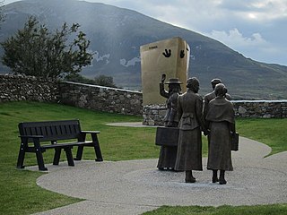
County Mayo is a county in Ireland. In the West of Ireland, in the province of Connacht, it is named after the village of Mayo, now generally known as Mayo Abbey. Mayo County Council is the local authority. The population was 137,231 at the 2022 census. The boundaries of the county, which was formed in 1585, reflect the Mac William Íochtar lordship at that time.

<span class="mw-page-title-main">Connacht</span> Province in the west of Ireland

Connacht or Connaught, is one of the four provinces of Ireland, in the west of Ireland. Until the ninth century it consisted of several independent major Gaelic kingdoms.

<span class="mw-page-title-main">Castlebar</span> Town in County Mayo, Ireland

Castlebar is the county town of County Mayo, Ireland. Developing around a 13th-century castle of the de Barry family, from which the town got its name, the town now acts as a social and economic focal point for the surrounding hinterland. With a population of 13,054 in the 2022 census, Castlebar was one of the fastest growing towns in Ireland in the early 21st century.

<span class="mw-page-title-main">Ballaghaderreen</span> Town in County Roscommon, Ireland

Ballaghaderreen is a town in County Roscommon, Ireland. It was part of County Mayo prior to 1898. It is in the north-west of the county, near the borders with counties Mayo and Sligo, just off the N5 road. The population was 1,808 in the 2016 census.

<span class="mw-page-title-main">Aidhne</span>

Aidhne, also known as Uí Fhiachrach Aidhni, Mag nAidni, later Maigh Aidhne, was the territory of the Uí Fhiachrach Aidhni, a túath located in the south of what is now County Galway in the south of Connacht, Ireland.. Aidhne is coextensive with the present diocese of Kilmacduagh.

<span class="mw-page-title-main">Lahardane</span> Village in County Mayo, Ireland

Lahardane, also sometimes spelled Lahardaun, is a village in the parish of Addergoole, County Mayo, Ireland, adjacent to Lough Conn and to Nephin, and close to the towns of Crossmolina, Castlebar and Ballina. The 2016 census recorded a population of 178.

<span class="mw-page-title-main">MacHale Park</span> Gaelic football stadium

MacHale Park is a GAA stadium in Castlebar, County Mayo, Ireland. It is the home of the Castlebar Mitchels GAA and Mayo GAA Gaelic football teams. Built in 1931, the ground currently has a capacity of 25,369 and is named after John MacHale, Catholic Archbishop of Tuam from 1831 to 1881. It is the twelfth-biggest sports stadium in the Republic of Ireland by capacity and the second-biggest in the province of Connacht after Pearse Stadium in Galway.

The Mayo Senior Football Championship, known for sponsorship reasons as the Connacht Gold Mayo Senior Football Championship, is an annual Gaelic football competition contested by the top Mayo GAA clubs.

<span class="mw-page-title-main">Costello (barony)</span> Ancient barony of Ireland

Costello is one of the ancient baronies of Ireland. Unusually for an Irish barony, it straddles two counties: County Mayo and County Roscommon. It comprises the modern day districts of Kilkelly, Kilmovee, Killeagh, Kilcolman, and Castlemore.

<span class="mw-page-title-main">Mac Siúrtáin</span> Norman-Irish Clan

Mac Siúrtáin, aka Mac Jordan and Jordan, is the name of a Connacht family of Norman-Irish origins.

Miles de Angulo Anglo-Irish knight and baron, fl. 1245–1259.

<span class="mw-page-title-main">Joyce Country</span> Cultural region in the west of Ireland

Joyce Country is a cultural region in counties Galway and Mayo in Ireland. It is sometimes called Partry, after the former tribal territory of the Partraige, which it largely matches. Part of it falls within the Connacht Gaeltacht. Joyce Country lies on the shores of Lough Mask and Lough Corrib, and includes the Partry Mountains. It is a rural area that includes small settlements such as Clonbur, Cong, Cornamona and Toormakeady. It borders Connemara, to its south and west.

<span class="mw-page-title-main">Islandeady</span> Village in Connacht, Ireland

Islandeady is a village in County Mayo, Ireland, about halfway between the towns of Castlebar and Westport.

<span class="mw-page-title-main">Gailenga</span> Two related peoples and kingdoms in medieval Ireland

Gailenga was the name of two related peoples and kingdoms found in medieval Ireland in Brega and Connacht.

The Kings of Luighne Connacht were rulers of the people and kingdom of Luighne Connacht, located in what is now County Mayo and County Sligo, Ireland.

The Kings of Sliabh Lugha were rulers of the district of Sliabh Lugha located in what is now the barony of Costello, County Mayo, Ireland.

Ruaidrí Ó Gadhra was an Irish king of Sliabh Lugha and Chief of the Name.

The Ó Gadhra Chiefs of the Name were the heads of the Clan O'Gara, who were originally located in Sliabh Lugha, the southern part of the territory ruled by the Kings of Luighne Connacht. In the 13th century they were expelled from the area and moved to Cul Ui Fionn, later known as the barony of Coolavin, County Sligo.

Ó Gadhra or O'Gara is an Irish surname which originated in the kingdom of Luighne Connacht. Variants include Garry, Geary, Gerry, and Guiry.

Kilcurl comprises the two townland areas of Kilcurl Anglesey and Kilcurl Feronsby. The townlands are situated one mile (1.6 km) from its nearest village, Knocktopher, and located on a road to Carrickshock monument one mile (1.6 km) away and two miles (3.2 km) to Ballyhale. The village of Knocktopher is situated in the parish of Ballyhale, south County Kilkenny, in Ireland.

References

  1. "Castlebar - County Mayo - From the Connaught Telegraph - 24 March 2004". www.castlebar.ie.
  2. "Cois Tine Archives | Kilmovee Info". Archived from the original on 26 September 2013.
  3. "Seosamh MacGabhann Summer School - Kilmovee Info". Archived from the original on 17 January 2013. Retrieved 26 January 2013.
  4. "RTÉ ENTERTAINMENT: Out and about with Ar mo thaisteal dom | RTÉ Presspack". RTÉ.ie .
  5. "CISP - Site: Rusheens East". www.ucl.ac.uk.
  6. "Mayo" (PDF). National Monuments in State Care: Ownership & Guardianship. National Monuments Service. 4 March 2009.
  7. "[celt-saints] 12 October #4".
  8. St. Columba Catholic Encyclopedia.
  9. Bureau of Military History Archived 19 February 2015 at the Wayback Machine WS Ref #: 1733, Witness: Sean Walsh, Officer, IRA Mayo, 1921
  10. "Seosamh Mac Gabhann - 1929 - 2008 - Kilmovee Info - Kilmovee Info". Archived from the original on 18 February 2013. Retrieved 26 January 2013.
  11. "Kilmovee, Co. Mayo in the West of Ireland | mayo-ireland.ie".
  12. "Kilmovee 10K - Homepage - Kilmovee 10K".
  13. "Kilmovee 10km - The Flattest 10k in Ireland? | Athenry AC". www.athenryac.com.