List of islands of County Mayo

Last updated

Map of County Mayo's western seaboard Islands of County Mayo.svg
Map of County Mayo's western seaboard
Achill is Ireland's largest island Keem Bay, Achill Island Co. Mayo, Ireland - geograph.org.uk - 683771.jpg
Achill is Ireland's largest island
Clew Bay contains 141 named islands, along with numerous tidal islets Clew Bay, June 2015.jpg
Clew Bay contains 141 named islands, along with numerous tidal islets

This articles lists the islands of County Mayo, the mainland of which is part of the island of Ireland. Included in this list are named offshore and freshwater islands as recorded by Ordnance Survey Ireland or the Placenames Database of Ireland. Additionally, areas of ecological significance related to both offshore and freshwater islands, designated by the National Parks and Wildlife Service, are also listed.

Contents

Although County Mayo has hundreds of offshore and freshwater islands, only a handful of islands and island groups are large enough to be distinguishable on a typical map of the county, namely Achill Island, Clare Island and Inishturk, along with the island clusters of Duvillaun, Inishkea, Clew Bay and the major loughs. There are over 100 islands which are greater than 10 acres (4.0 ha) in area. The largest island is Achill, which extends to 148 km2 (37,000 acres), making it Ireland's largest offshore island. [2]

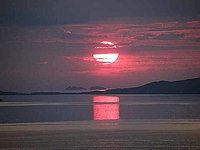
Due to its abundance of bays, inlets and offshore islands, Mayo is reputed to have the longest coastline of any county in Ireland, at 1,168 km (726 mi) or approximately 21% of the total coastline of the State. [3] [4]

The geology and geomorphology of the county and its islands is among the most varied and complex in Ireland. Islands such as those at Clew Bay are low-lying, formed when rising sea levels drowned a vast field of drumlins, while others like Clare Island and Achill are characterised by mountains and towering sea-cliffs, of which Croaghaun are the third-highest in Europe, at 688 m (2,257 ft) [5]

The bedrock geology of the islands is broadly divided into two groups. Those north of Clew Bay such as Achill and the islands off the Mullet Peninsula are generally of ancient Dalradian age, similar to County Donegal and the Grampian Highlands. Inishglora contains some of the oldest rocks in Ireland, at 1.75 billion years old. Further south, the islands are much more diverse. Clare island alone is composed of Cambrian, Ordovician, Silurian and Carboniferous terranes sutured together. Geologically, the Clew Bay islands themselves are the youngest in the county, formed during the Lower Carboniferous about 350 million years ago. [6]

The county's offshore islands - and islands off the west coast of Ireland generally - developed their own distinct culture and traditions stretching back centuries. Records from the 1841 Census show that 47 of County Mayo's offshore islands were inhabited, with a combined population of approximately 10,000. [n 1] [7] The Great Famine resulted in widespread or total depopulation of the islands. Towards the end of the 19th century the population of the larger islands began to recover somewhat, only to be set back by emigration following independence as the Irish government initially encouraged the evacuation of the islands due to the cost of providing services to them, further hastening the decline. [8]

Today, the islands are recognised by the State as an integral part of Ireland's national heritage, preserving the remnants of a unique aspect of Irish culture. The remaining inhabited islands receive support and funding through the Department of Culture, Heritage and the Gaeltacht. [9] As of the 2016 Census, there are 2,700 people living on 14 of the county's offshore islands (of which 2,440 live on Achill), accounting for 1.87% of the county's population. [10]

Islands of Mayo by population

Demographics

The 2016 census records 14 offshore islands as having a usually resident population. Achill has been connected to the mainland via bridge since 1887, making Clare Island the county's most populous unconnected island, with 159 inhabitants as of 2016. This makes Clare Island the fifth-most populous unconnected island in Ireland, after the three Aran Islands off Galway and Arranmore off County Donegal. [11]

Deserted village on Achill County Mayo - Achill Island - Deserted Village - Grazing Sheep & Derelict Cottage (geograph 4002127).jpg
Deserted village on Achill

Mayo County Council is responsible for the governance of the islands, and islanders are entitled to certain benefits and exemptions, such as lower motor tax rates. [12] The islands also receive funding from the Department of Culture, Heritage and the Gaeltacht, as several offshore islands along with much of northwest Mayo are recognised Gaeltacht areas.

As many as 47 offshore islands had permanent populations prior to the Great Famine. Communities had resided on these islands for generations, and their remains can still be seen to this day through the villages, stone walls and lazybeds which they left behind. By the end of the 19th century most of the county's islands had been deserted. In contrast, Achill benefitted from a bridge to the mainland which allowed the population to temporarily rebound, reaching its all-time peak in 1911.

Fish curing on Clare Island, c. 1900 Fish Curing on Clare Island (7108837815).jpg
Fish curing on Clare Island, c. 1900

Emigration from the islands continued into the 20th-century as traditional industries such as fishing and textiles were unable to provide an attractive, or in many cases adequate, income to young islanders. In recent times, the islands have become a popular tourist destination and depend heavily on the tourism and hospitality sector. Their population swells during the summer months, particularly on Achill and Clare. Popular activities include surfing, sailing, island-hopping in Clew Bay, spiritual retreats and eco-tourism. [13]

The following table shows population trends for the fourteen currently inhabited islands as of the last census. The overall trend is a continuing decline in the population of Mayo's offshore islands, which is currently at a historic low. The county as a whole was one of just three in Ireland to record a population decrease between 2011 and 2016. The population of Mayo during this time decreased by 0.2%, whereas the population of the islands fell by 5.3%. Although the overall population fell during this time, four previously uninhabited islands received new residents, including Achillbeg, which had been uninhabited since 1965. [14]

Currently inhabited islands

RankIslandBaronyPopulation
2016 2011 1841 Peak Population
(if not 1841)
1 Achill Burrishoole 2,4402,5694,9015,260 (1911)
2 Clare Murrisk 1591681,615
3 Inishturk Murrisk 5153577
4 Inis Bigil Erris 182567162 (1926)
5 Collanmore Burrishoole 74213215 (1851)
6Inishnakillew Burrishoole 67126
7 Inishlyre Burrishoole 44113122 (1851)
8 Clynish Burrishoole 4487
9 Inish Turk Beg Burrishoole 41057
10 Duvillaun More Erris 2231
11Collanbeg Burrishoole 2049 (1861)
12 Achillbeg Burrishoole 10178
13 Inishkea North Burrishoole 10155
14Rosbarnagh Burrishoole 1042
Total2,7002,8468,166
Change-5.3%-65.2%-

Formerly inhabited islands

IslandBaronyPopulation
1841Peak Population
(if not 1841)
Year Abandoned
Rosmore Island Burrishoole 133
Moynish More Burrishoole 991881-1891
Island More Burrishoole 88
Rosturk Island Burrishoole 64
Inishkea South Erris 621934
Inishdaff Burrishoole 57
Inishgowla South Burrishoole 52
Inishtubbrid Burrishoole 42
Knockycahillaun Burrishoole 41
Inishcottle Burrishoole 4045 (1911)2011-2016
Derrinish Burrishoole 40
Inishquirk Burrishoole 37
Inisheeny Burrishoole 36
Annagh Islands Erris 331851
Illanataggart Burrishoole 33
Inishgort Burrishoole 3235 (1871)2006-2011
Crovinish Burrishoole 32
Inishoo Burrishoole 29
Bartragh Island Tirawley 281951
Inisherkin Burrishoole 28
Inishgowla Burrishoole 28
Inishnacross Burrishoole 27
Inishraher Burrishoole 25
Inishturlin Burrishoole 25
Inishkeel Burrishoole 23
Inishbee Burrishoole 20
Inishglora Erris 16
Eagle Island Erris 1522 (1861)1988
Dorinish Burrishoole 1315 (1871)1901
Inishbobunnan Burrishoole 13
Inishilra Burrishoole 12
Inishcooa Burrishoole 6
Barranagh Island Erris 01 (1874)late 1800s
Blackrock Island Erris 015 (1881)1974
Roman Island Burrishoole 036 (1911)1966-1971
Total1,229

Islands of Mayo by area

Larger islands

With the exception of Achill, County Mayo's islands are generally small in size, with only 13 larger than 100 acres (40 ha) and 3 larger than 1,000 acres (400 ha). There are numerous offshore islands in the 10 to 100 acre range, along with at least 15 freshwater islands larger than 10 acres, the largest of which is Illannaglashy on Lough Conn at 82 acres (33 ha). [15]

The one hundred largest islands in the county are listed below. "F" designates a freshwater island.

Achill IRL Jan99 26 (9277948677).jpg
Achill
Clare Island Clareisland2.jpg
Clare Island
Inishturk Inishturk1.jpg
Inishturk
Bartragh Island Bartragh Island from Bartragh Head - geograph.org.uk - 486784.jpg
Bartragh Island
Inishkea South Inishkea South Island. - geograph.org.uk - 291277.jpg
Inishkea South
Caher Island Inishturk Beach - geograph.org.uk - 288665.jpg
Caher Island
Inish Turk Beg Inishturkbeg aerial.jpg
Inish Turk Beg
Inishnakillew Inishnakillew, Co. Mayo - geograph.org.uk - 1245209.jpg
Inishnakillew
Inishglora Inishglora, Erris, Co. Mayo..jpg
Inishglora
Rosturk Rosturk Clew Bay geograph-3180700-by-Ben-Brooksbank.jpg
Rosturk
Kid Island Kid Island, Kilcommon, Erris, North Mayo..jpg
Kid Island
Eagle Island Eagle Island Lighthouse.jpg
Eagle Island
Inishraher Inishrasher - geograph.org.uk - 1402114.jpg
Inishraher
Dorinish Aerialblue9.jpg
Dorinish
IslandIrish name [n 2] Archipelago / LocationArea
(Acres) [n 3]
Highest Point [n 4]
Achill AcaillAchill Islands36,572688 m (2,257 ft)
Clare Oileán ChliaraClew Bay4,053462 m (1,516 ft)
Inishturk Inis ToircAtlantic Islands1,620191 m (627 ft)
Inishbiggle Inis BigilAchill Islands63734 m (112 ft)
Annagh IslandOileán an EanaighAchill Islands62723 m (75 ft)
Inishkea North Inis Gé ThuaidhInishkea Islands57424 m (79 ft)
Bartragh Island An Bheartrach Killala Bay 47726 m (85 ft)
Inishkea South Inis Gé TheasInishkea Islands38972 m (236 ft)
Achillbeg Acaill BheagAchill Islands331110 m (360 ft)
Collanmore Island Collainn MhórClew Bay19953 m (174 ft)
Duvillaun More Dubhoileán MórDuvillaun Islands17763 m (207 ft)
Caher Island Cathair na NaomhAtlantic Islands13061 m (200 ft)
Rosmore IslandAn Ros MórNewport Bay11628 m (92 ft)
Illannaglashy (F)Oileán na Glaise Lough Conn 8227 m (89 ft)
Clynish ClaínisClew Bay8142 m (138 ft)
Island MoreAn tOileán MórClew Bay7842 m (138 ft)
Barranagh IslandOileán BearanachBlacksod Bay747 m (23 ft)
Inish Turk Beg Inis Toirc BheagClew Bay6453 m (174 ft)
InishnakillewInis na CoilleadhNewport Bay6427 m (89 ft)
Moynish MoreMaínis MórClew Bay6237 m (121 ft)
Inishglora Inis GluaireAtlantic Islands6022 m (72 ft)
InishbeeInis BíNewport Bay5629 m (95 ft)
Duvillaun Beg Dubhoileán BeagDuvillaun Islands5314 m (46 ft)
Rosbarnagh IslandOileán Ros BairneachNewport Bay5337 m (121 ft)
Inishlyre Inis LadhairDorinish Harbour5226 m (85 ft)
Annagh Island EastAn tEanach ThoirWesport Bay489 m (30 ft)
Annagh Island (F)Oileán an EanaighLough Conn4523 m (75 ft)
InishtubbridInis TiobradNewport Bay4128 m (92 ft)
InishdaffInis DamhNewport Bay4031 m (102 ft)
Inishower (F)Inis Odhar Furnace Lough 3616 m (52 ft)
KnockycahillaunCnoc Uí ChathaláinClew Bay3536 m (118 ft)
Carrigeenamore (F)An Carraigín Mór Lough Mask 3522 m (72 ft)
Bleanmore IslandAn Bhléan MhórCorraun Peninsula3414 m (46 ft)
Rosturk IslandRos ToircNewport Bay3424 m (79 ft)
InishgowlaInis GabhlaNewport Bay3328 m (92 ft)
Inishdegil MoreInis Téigil MórAtlantic Islands3212 m (39 ft)
InishkeeraghInis CaorachAtlantic Islands3217 m (56 ft)
Kid IslandOileán Mionnán Broadhaven Bay 3286 m (282 ft)
IllanataggartOileán an tSagairtClew Bay3228 m (92 ft)
CarrickmoylenacurhogaCarraig Bhéal na gCarógInishkea Islands3214 m (46 ft)
InishquirkInis CoirceNewport Bay3244 m (144 ft)
InishgortInis GoirtClew Bay3129 m (95 ft)
InishsherkinInis EarcáinNewport Bay3130 m (98 ft)
InishkeelInis CaolNewport Bay3027 m (89 ft)
CrovinishCroibhinisDorinish Harbour2923 m (75 ft)
DerrinishDairinisNewport Bay2921 m (69 ft)
InishraherInis RaithirWestport Bay2933 m (108 ft)
InishlaughilInis LeamhchoilleNewport Bay2845 m (148 ft)
Bartraw IslandAn BheartrachWestport Bay2813 m (43 ft)
Inishgowla SouthInis Gabhla TheasWestport Bay2820 m (66 ft)
InishnacrossInis na CroiseNewport Bay2736 m (118 ft)
InisheenyInis AonaighWestport Bay2722 m (72 ft)
MuckinishMuicinisNewport Bay2637 m (121 ft)
Annaghroe Island (F)An tEanach RuaLough Conn2518 m (59 ft)
GlassillanAn GlasoileánAchill Island2523 m (75 ft)
Inishcottle Inis CotailNewport Bay2526 m (85 ft)
Inishgleasty (F)Inis GléastaLough Mask2437 m (121 ft)
InishbobunnanInis Bó BonnánNewport Bay2431 m (102 ft)
Eagle Island Oileán sa TuaidhAtlantic Islands2360 m (200 ft)
RoeillaunRua-oileánClew Bay2333 m (108 ft)
InishloyInis LáíNewport Bay2310 m (33 ft)
InishcooaInis CuaNewport Bay2327 m (89 ft)
Long Island (F)An tOileán FadaLough Mask2225 m (82 ft)
Rabbit IslandOileán BhrídeClew Bay2122 m (72 ft)
Inishrobe (F)Inis RóbaLough Mask2130 m (98 ft)
InishturlinInis TuirlingeNewport Bay2127 m (89 ft)
InishcuillInis CoillNewport Bay2128 m (92 ft)
Derreens Island (F)An Doirín Carrowmore Lake 208 m (26 ft)
Dorinish DeoirinisClew Bay2030 m (98 ft)
RoslynaghRos LaighneachClew Bay1833 m (108 ft)
Illannambraher EastOileán na mBráthar ThoirClew Bay1828 m (92 ft)
CarrickawiltCarraig an MhoiltInishkea Islands189 m (30 ft)
Inishoght (F)Inis UichtLough Mask1825 m (82 ft)
Collanbeg IslandCollainn BheagClew Bay1725 m (82 ft)
InishooInis UamhaClew Bay1732 m (105 ft)
Annagh Island WestAn tEanach ThiarWestport Bay1711 m (36 ft)
InishdaweelInis Dá MhaolClew Bay1638 m (125 ft)
CarrigeeCarraig AodhaInishkea Islands1615 m (49 ft)
River Island (F)Oileán na hAbhannLough Mask1613 m (43 ft)
Saints Island (F)Inis Na NaomhLough Mask1630 m (98 ft)
Inishdurra (F)Inis DuraLough Mask1632 m (105 ft)
InishleagueInis LiagWesport Bay1624 m (79 ft)
Baunros MoreBánros MórKillala Bay1513 m (43 ft)
Inishdalla Inis DealaAtlantic Islands1527 m (89 ft)
InishdaskyInis TeascthaClew Bay1530 m (98 ft)
Annaghteige Island (F) Eanach ThaidhgLough Conn1527 m (89 ft)
Rabbit IslandOileán BhrídeNewport Bay1528 m (92 ft)
IllandavuckOileán DhabhaicAtlantic Islands1456 m (184 ft)
Conors Island (F)Oileán Chonchúir Lough Carra 1420 m (66 ft)
InishfeshInis FeiseClew Bay1310 m (33 ft)
InishaghooInis AchadhAchill Islands1320 m (66 ft)
Carrigeenagur Island (F)Carraigín na gCorrLough Mask1323 m (75 ft)
Pig Island (F)Oileán na MuiceLough Mask1328 m (92 ft)
Illannambraher WestOileán na mBráthar ThiarClew Bay1225 m (82 ft)
InishkeeInis CaoichClew Bay1214 m (46 ft)
InishdoonverInis DúnmharClew Bay1225 m (82 ft)
Lambs Island (F)Oileán na nUanLough Mask1211 m (36 ft)
Devenish Island (F)DaimhinisLough Mask1230 m (98 ft)
Annagh Island MiddleAn tEanach LárWestport Bay127 m (23 ft)
Goose IslandInis na nGéKillala Bay1212 m (39 ft)

Smaller offshore islands

County Mayo has hundreds of smaller islands and islets. Most of the county's offshore islands are located in Clew Bay, with smaller clusters located around the Achill archipelago, the west and south coasts of the Mullet Peninsula, and Blacksod Bay. The list below is not exhaustive, and includes named offshore islands that are either extensive (typically greater than 2 acres in area) or in someway locally significant or identifiable.

Unlike the above list, this list is in alphabetical order and does not include freshwater islands.

Map of Clew Bay (1890) Clew bay-old map.jpg
Map of Clew Bay (1890)
Small islands in Clew Bay Achill, Corraun, Clew Bay (3585764882).jpg
Small islands in Clew Bay
The Stags The Stags, Co Mayo - geograph.org.uk - 243341.jpg
The Stags
Mweelaun Sunset over Mwellaun - geograph.org.uk - 1397615.jpg
Mweelaun
Inishdaugh Inishdaugh - geograph.org.uk - 1402108.jpg
Inishdaugh
Inishdalla Inishdalla.jpg
Inishdalla
Islet off Killadoon Beach nr. Killadoon, Co.Mayo - geograph.org.uk - 556555.jpg
Islet off Killadoon
Bills Rocks Sunset over Bills Rocks - geograph.org.uk - 1394320.jpg
Bills Rocks
Dun Briste Downpatrick Head - geograph.org.uk - 297658.jpg
Dún Briste
Blackrock Island Black Rock Island - County Mayo - Ireland.jpg
Blackrock Island
IslandIrish nameArchipelago / Location
Annagh IslandOileán an EanaighMullet Peninsula
ArdillaunArdoileánKillala Bay
AttimonbegÁth Tíomáin BeagKillala Bay
Baunros BegBánros BeagKillala Bay
Baunros MoreBánros MórKillala Bay
Beetle Island NorthOileán an tSindile ThuaidhClew Bay
Beetle Island SouthOileán an tSindile TheasClew Bay
Bills RocksCarraig BillAtlantic Islands
Blackrock Island An TorAtlantic Islands
BuddaghAn Chailleach Benwee Head
Calf IslandOileán an GhamhnaClew Bay
Calf IslandOileán an GhamhnaKillala Bay
Camel IslandOileán CamallNewport Bay
CarrickduffAn Charraig DhubhMullet Peninsula
CarrickduffAn Charraig DhubhNorth Mayo Coast
CarrickheskCarraig SheiscMullet Peninsula
CarricknarontyCarraig na RóntaAtlantic Islands
Carricknaronty NorthCarraig na Rónta ThuaidhMullet Peninsula
CarricknaweelogeCarraig na bhFaoileogMullet Peninsula
Carrigeenglass NorthAn Carraigín Glas ThuaidhClew Bay
Cone IslandOileán an ChuainMullet Peninsula
CorillanCorroileánWestport Bay
CarrigeenaveaghCarraigín na bhFiachClew Bay
CregnarullahSceir na RoilleachMullet Peninsula
Cross RockAn Charraig DhubhMullet Peninsula
DoonvinallaAn DúnaBenwee Head
Doonbristy IslandDún BristeNorth Mayo Coast
Dooneen IslandAn Dúnín Uggool Beach
Finnaun IslandFionnánWestport Bay
ForillanForoileánWestport Bay
FreaghillanFraochoileánKillala Bay
Freaghillan EastFraochoileán ThoirNewport Bay
FreaghillanluggaghFraochoileán LogachNewport Bay
GlassillaunGlasoileánNorth Mayo Coast
Green IslandAn tOileán GlasWestport Bay
Green IslandAn tOileán GlasKillala Bay
Heath IslandOileán FraoighCorraun Peninsula
Horse IslandOileán na gCapallNorth Mayo Coast
IllancroaghOileán CruaicheCorraun Peninsula
IllanleamnaheltyOileán Léim na hEilteAtlantic Islands
Illanmaster Oileán MáistirNorth Mayo Coast
IllanmawMá-oileánClew Bay
IllannaconneyOileán an ChonnaidhClew Bay
IllannakanogeOileán na gCánógNorth Mayo Coast
IllannamonaOileán na MónaAchill Islands
IllaunateeOileán an TíClew Bay
IllaunroeAn tOileán RuaClew Bay
InishacrickInis an ChnoicClew Bay
InishbollogInis BolgClew Bay
InishcannonInis CeannannNewport Bay
InishcoraghInis CórachNewport Bay
InishcorkyInis CorcaíClew Bay
InishdaughInis DeáchClew Bay
Inishdeash BegInis Déise BeagClew Bay
Inishdeash MoreInis Déise MórClew Bay
InishderryInis DoireMullet Peninsula
InishilraInis IolraClew Bay
InishimmelInis ImillWestport Bay
InishlaghanInis LachanClew Bay
InishlimInis LoimClew Bay
InishmoltInis MoltNewport Bay
Kid Island EastOileán na MeannánNewport Bay
MauherillanMáthairoileánNewport Bay
Money BegAn Muine BheagClew Bay
Moynish BegMaínis BeagClew Bay
MweelaunMhaoilinneAtlantic Islands
Pig IslandOileán na MuiceNorth Mayo Coast
Quinsheen IslandCuinsínClew Bay
RoeillanRua-oileánAchill Islands
RosnambraherRos na mBrátharNewport Bay
Sloe IslandOileán na nAirníWestport Bay
The StagsNa Stacaí Benwee Head
ToghercloheenBarr na SpinceNorth Mayo Coast
TorduffAn Tor DubhNorth Mayo Coast

Freshwater islands

There are numerous large loughs within the county, containing hundreds of small freshwater islands. Lough Mask in southern Mayo is the largest lough in the county. At 83 km2 (21,000 acres) it is the 6th-largest lough in Ireland (as well as the 6th-largest in Britain and Ireland). Further south, Lough Corrib is the 2nd-largest lough in Ireland; however, only a small portion of this lough is located within the county. [16]

Illannaglashy, on Lough Conn, is the largest freshwater island in the county, at 82 acres (33 ha) in area. Freshwater islands have played an important role in the county's history and host an abundance of castles, monasteries, church ruins and unspoiled woodlands.

Lough Mask

Loughs of northern Mayo Ordnance Survey Ireland Half-Inch Sheet 6 North Mayo, Published 1956.jpg
Loughs of northern Mayo
Loughs of southern Mayo Ordnance Survey Ireland Half-Inch Sheet 11 South Mayo, Published 1965.jpg
Loughs of southern Mayo
Lough Corrib Lough Corrib.jpg
Lough Corrib
Lough Mask Small bay on Lough Mask - geograph.org.uk - 1405152.jpg
Lough Mask
Lough Conn Lough Conn and Nephin - geograph.org.uk - 1538691.jpg
Lough Conn
Lough Carra Castleburke Castle on Lough Carra Co Mayo.jpg
Lough Carra
Lough Beltra Beltra Lough - geograph.org.uk - 1393044.jpg
Lough Beltra
Carrowmore Lake Connaught (1912) (14765914451).jpg
Carrowmore Lake
Lough Cullin Lough Cullin - geograph.org.uk - 806947.jpg
Lough Cullin
Islandeady Lough Islandeady Lough - geograph.org.uk - 969225.jpg
Islandeady Lough
  • Aghinish
  • Bed Island
  • Bilberry Island
  • Black Island
  • Black Island
  • Board Island
  • Carrigeen Island
  • Carrigeen Middle
  • Carrigeenabreana
  • Carrigeenagur Island
  • Carrigeenamore
  • Carrigeenavilla
  • Carrigeenaweelaun
  • Carrigeenbaun
  • Carrigeenbunnahown
  • Carrigeendany Islands
  • Carrigeenduree
  • Carrigeenfair Island
  • Carrigeenkeelagh
  • Carrigeenmauntrasna
  • Carrigeennagool
  • Carrigeennalogh
  • Carrigeennasassonagh
  • Carrigeenowen
  • Carrigeenshangorman
  • Castle Hag
  • Cow Island
  • Dash Island
  • Devenish Island
  • Doran Islands
  • Goat Island
  • Green Island
  • Gull Island
  • Flag Island
  • Heath Island
  • Illan Columbkille
  • Illanboe Beg
  • Illanboe More
  • Illandawaur
  • Ingon Island
  • Inishangan
  • Inishdurra
  • Inishgleasty
  • Inishoght
  • Inishowenlackboy
  • Inishrobe
  • Kid Island
  • Lackboy
  • Lamb Island
  • Long Island
  • Long Islands
  • Lusteen Beg
  • Lusteen More
  • Nut Island
  • Oak Island
  • Pig Island
  • Rams Island
  • Rialisk
  • Ringolden
  • River Island
  • Saints Island
  • Seerillaun
  • Shangorman
  • Shrub Island
  • Thick Island
  • Whiteland Island

Lough Carra

  • Ballycally Island
  • Bird Island
  • Bonnianillish Island
  • Bush Island
  • Carrigeennagat Island
  • Castle Island
  • Castlehag Island
  • Church Island
  • Conors Island
  • Cow Islands
  • Crane Island
  • Creevagh Island
  • Deer Island
  • Derrinrush Island
  • Derrynafresha Island
  • Doonbeg Island North
  • Doonbeg Island South
  • Gleneary Island
  • Hog Island
  • Horse Island
  • Illanatrim
  • Kiln Island
  • Lady's Island
  • Lakeview Island
  • Leamnahye Island
  • Long Island
  • Mearing Island
  • Otter Island
  • Otter Island
  • Otter Islands
  • Pleasure Island
  • Priest Island
  • Rat Island
  • Stare Island
  • Stony Island

Lough Corrib

  • Abbots Rock
  • Ballycurrin Island
  • Bartragh Island
  • Bertragh Islands
  • Blackderry Island
  • Blackderry Rock
  • Bushy Island
  • Camillaun
  • Carrigeen
  • Castletown Rock
  • Cornelian Islands
  • Crow Islands
  • Dog Islands
  • Easter Island
  • Flower Island
  • Gibbs Islands
  • Grass Island
  • Green Island
  • Green Island East
  • Holy Island
  • Inishkeeragh Island
  • Island Morris
  • Kilmore
  • Kilmorebeg
  • Matthew Island
  • Mine Island
  • Mucky Island
  • Oak Island
  • Prison Islands
  • Rabbit Island
  • Red Island
  • Salmon Island
  • Salmon Point Island
  • Sloe Island
  • Whiskey Island

Lough Conn

  • Annagh Island
  • Annaghroe Island
  • Annaghteige Island
  • Bears Island
  • Burnt Island
  • Carnaweelan Island
  • Castle Island
  • Chain Island
  • Cliff Island
  • Coarse Island
  • Cragh Islands
  • Creeve Island
  • Freaghillan
  • Illanaghty
  • Illanaloughaun
  • Illanbeg
  • Illannaglashy
  • Inishlee Island
  • Longford Island
  • Loosky Island
  • Rinard Island
  • Rocky Island
  • Roe Island
  • Sandy Island

Smaller lakes

Lough Cullin

  • Griffins Island
  • Illanboy
  • Illaner
  • Illangub
  • Illanneill
  • Illanulque

Lough Beltra

  • Bush Island
  • Coarse Island
  • Islandmore
  • Low Island
  • Tree Island

Carrowmore Lake

  • Atlavally Island
  • Derreens Island
  • Gortmore Island
  • Muingerroon Island

Furnace Lough

  • Illanroe
  • Inishower
  • Saints Island

Islandeady Lough

  • Note: Despite being a small lough, Islandeady had three sizeable islands, at 38, 21 and 20 acres respectively. However, due to the lowering of waterlevels in the 20th century the three islands are now peninsulas.
  • Illanlteige East
  • Illanteige West
  • Islandeady

Monastic islands

Clare Island Abbey Abbey at Clare Island - geograph.org.uk - 238140.jpg
Clare Island Abbey

Six islands within County Mayo have had a dedicated monastery or abbey established on them. Four of these are offshore, and two of these are freshwater islands. They are listed below:

In addition to the above sites, many more islands within the county have been used for religious purposes. The ruins of old churches and cemeteries can be found scattered across such islands.

Biodiversity

Many of the county's offshore and freshwater islands are designated as areas of ecological significance and are protected both at national and European level. Mayo's offshore islands are a haven for wildlife and biodiversity, supporting hundreds of species of bird, fish and marine mammal, as well as unique vegetation. Five of the county's major inland lakes (along with their islands) are also protected, those being Lough Mask, Lough Conn, Lough Cullin, Lough Carra and Carrowmore Lake. [17]

The biodiversity of the islands is protected under the following designations. There is overlap across designations, as different designations apply to different species, e.g. the Duvillaun Islands are an SAC, SPA and proposed NHA.

The following areas of ecological significance are located either on or adjacent to County Mayo's offshore islands. The five major inland lakes listed as SPAs are also included, and are shown in italics in the list below.

Atlantic puffin (Fratercula arctica) Puffin Latrabjarg Iceland.jpg
Atlantic puffin (Fratercula arctica)
Grey seal (Halichoerus grypus) Grey seal (48475759077).jpg
Grey seal (Halichoerus grypus)
Atlantic bottlenose dolphin (Tursiops truncatus) Tursiops truncatus 01.jpg
Atlantic bottlenose dolphin (Tursiops truncatus)
Bog cotton (Eriophorum angustifolium) Eriophorum angustifolium (5858098416).jpg
Bog cotton (Eriophorum angustifolium)
Razorbill (Alca torda) Razorbill (Alca torda) (13668086884).jpg
Razorbill (Alca torda)
Basking shark (Cetorhinus maximus) Basking Shark.jpg
Basking shark (Cetorhinus maximus)
Great cormorant (Phalacrocorax carbo) Great Cormorant PT 2.jpg
Great cormorant (Phalacrocorax carbo)
Black crowberry (Empetrum nigrum) Empetrum nigrum by Maseltov 2.jpg
Black crowberry (Empetrum nigrum)

Special areas of conservation

Special protection areas

Italics indicates that the SPA is an inland lake

Natural heritage areas

Proposed natural heritage areas

Island index

Notes

  1. This refers solely to the islands contained within the present-day boundary of County Mayo. In 1841 several other islands in the area, including Inishbofin and Inishshark, were under the jurisdiction of County Mayo. These were legally transferred to County Galway in 1873 and are not included in this list.
  2. Taken from the Placenames Database of Ireland
  3. Where available, area is from Ordnance Survey Ireland's Cassini 6" maps. Otherwise area is from 19th-century 6" maps (both viewable via the Historic 6" layer of the link in the OS-map column)
  4. Unless stated otherwise, height is from Ordnance Survey Ireland's 1:50,000 series maps (viewable for Republic of Ireland islands via the Wind Report layer of the link in the OS-map column )

Related Research Articles

<span class="mw-page-title-main">Achill Island</span> Island off the western coast of Ireland, in County Mayo

Achill Island is the largest of the Irish isles and lies off the west coast of Ireland in County Mayo. It has a population of 2,345. Its area is 148 km2 (57 sq mi). Achill is attached to the mainland by Michael Davitt Bridge, between the villages of Achill Sound and Polranny. A bridge was first completed here in 1887. Other centres of population include the villages of Keel, Dooagh, Dooega, Dooniver, and Dugort. The parish's main Gaelic football pitch and secondary school are on the mainland at Polranny. Early human settlements are believed to have been established on Achill around 3000 BC. The island is 87% peat bog. The parish of Achill consists of Achill Island, Achillbeg, Inishbiggle and the Corraun Peninsula.

<span class="mw-page-title-main">County Mayo</span> County in Ireland

County Mayo is a county in Ireland. In the West of Ireland, in the province of Connacht, it is named after the village of Mayo, now generally known as Mayo Abbey. Mayo County Council is the local authority. The population was 137,231 at the 2022 census. The boundaries of the county, which was formed in 1585, reflect the Mac William Íochtar lordship at that time.

<span class="mw-page-title-main">Geography of Ireland</span> Geography of the island of Ireland, northwestern Europe

Ireland is an island in Northern Europe in the north Atlantic Ocean. The island lies on the European continental shelf, part of the Eurasian Plate. The island's main geographical features include low central plains surrounded by coastal mountains. The highest peak is Carrauntoohil, which is 1,039 metres (3,409 ft) above sea level. The western coastline is rugged, with many islands, peninsulas, headlands and bays. The island is bisected by the River Shannon, which at 360.5 km (224 mi) with a 102.1 km (63 mi) estuary is the longest river in Ireland and flows south from County Cavan in Ulster to meet the Atlantic just south of Limerick. There are a number of sizeable lakes along Ireland's rivers, of which Lough Neagh is the largest.

<span class="mw-page-title-main">Clare Island</span> Island in County Mayo, Ireland

Clare Island, also historically Inishcleer, is a mountainous island guarding the entrance to Clew Bay in County Mayo, Ireland. Historically part of the kingdom of Umhaill, it is famous as the home of the 16th century pirate queen Gráinne O'Malley. The population of the island is 138 according to the 2022 census. To the south-west lies Inishturk (inhabited) and Caher Island (uninhabited), and to the north is Achill Island.

<span class="mw-page-title-main">Caher Island</span>

Caher Island, an uninhabited island off the coast of County Mayo in Ireland, is situated between the larger Clare Island and Inishturk.

<span class="mw-page-title-main">Erris</span> Barony in County Mayo, Ireland

Erris is a barony in northwestern County Mayo in Ireland consisting of over 230,452 acres (932.61 km2), much of which is mountainous blanket bog. It has extensive sea coasts along its west and north boundaries. The main towns are Belmullet and Bangor Erris. The name Erris derives from the Irish 'Iar Ros' meaning 'western promontory'. The full name is the Iorrais Domnann, after the Fir Bolg tribe, the Fir Domnann. To its north is the wild Atlantic Ocean and the bays of Broadhaven and Sruth Fada Conn and to its west is Blacksod Bay. Its main promontories are the Doohoma Peninsula, Mullet Peninsula, Erris Head, the Dún Chiortáin and Dún Chaocháin peninsulas and Benwee Head.

<span class="mw-page-title-main">Mullet Peninsula</span> Peninsula in County Mayo, Ireland

The Mullet Peninsula —also known as the Mullet and sometimes as the Erris Peninsula—is a peninsula in the barony of Erris in County Mayo, Ireland. As of 2016 it has a population of 3963. It consists of a large promontory connected to the mainland at Belmullet, a town of about 1,000 inhabitants, by a narrow isthmus. There are several villages on the Mullet peninsula including Aughleam, Elly, Corclough and Binghamstown. The Peninsula is about 33 km (21 mi) long and ranges from 200 metres (660 ft) to 12 km (7.5 mi) wide. Its northernmost point is Erris Head. The peninsula's doglegged shape forms two bays, Blacksod Bay and Broadhaven Bay.

<span class="mw-page-title-main">Glenamoy</span> Village in County Mayo, Ireland

Glenamoy is a village on the R314 road in the parish of Kilcommon, Erris in the northern part of County Mayo in Ireland.

<span class="mw-page-title-main">Doohoma</span> Townland in Connacht, Ireland

Doohoma or Doohooma is a townland, peninsula and a census town in the County Mayo Gaeltacht, Ireland. It is located on Ireland's Atlantic coastline overlooking Achill Island and the Mullet Peninsula.

<span class="mw-page-title-main">Corraun Peninsula</span> Peninsula on the west coast of Ireland

The Corraun Peninsula, also spelt Currane, is a peninsula in County Mayo, on the west coast of Ireland. It extends out from the mainland towards Achill Island.

<span class="mw-page-title-main">Blacksod Bay</span> Bay of the Atlantic Ocean in Erris, Ireland

Blacksod Bay is a bay of the Atlantic Ocean in Erris, north County Mayo, Ireland. The 16 km (9.9 mi) long and 8 km (5.0 mi) wide bay is bounded on its western side by the Mullet Peninsula. Its eastern side includes Kiltane Parish, which extends southwards from Belmullet towards Gweesalia and Doohoma.

Tóin an tSeanbhaile is a small village located on the north east point of Achill Island, Ireland. It lies within the Mayo Gaeltacht.

<span class="mw-page-title-main">Broadhaven Bay</span> Bay in County Mayo, Ireland

Broadhaven Bay is a natural bay of the Atlantic Ocean on the northwestern coast of County Mayo, Ireland. The opening of the bay faces northward, stretching 8.6 km between Erris Head in the west and Kid Island/Oileán Mionnán in the east.

<span class="mw-page-title-main">Carrowmore Lake</span> Lake in County Mayo, Ireland

Carrowmore Lake is situated in the parishes of Belmullet, Kiltane and Kilcommon Erris, County Mayo between the villages of Bangor Erris and Barnatra at the southern end of Broadhaven Bay. The freshwater lake is over 4 miles (6 km) long and almost 3 miles (5 km) wide at its widest point. Glencullen's two townlands line its eastern shore and Rathmorgan and the Knocknascollop mountains rise up along its western shores. Carrowmore is not a deep lake and it provides the drinking water for the whole of the Erris area. It is fed by the Carrowmore River and drains into the Owenmore River on its way to Blacksod Bay. The lake is designated as a S.P.A. in E.U. law and also as 000476 Complex S.A.C..

Duvillaun is the name of a cluster of islands lying south to the Inishkea Islands and Inishglora in the Atlantic Ocean off the coast of North Mayo. The main island is known as Duvillaun More. The other islands are known as Duvillaun Beg, Turduvillaun, Shiraghy, Keely, Gaghta, and Leamareha.

The civil parish of Kilcommon in Erris, northern County Mayo, Ireland has a total of 37 townlands: small geographic divisions of land in Ireland and Scotland's Outer Hebrides. Townlands originated in Gaelic Ireland, and predate the late-12th-century Anglo-Norman invasion. However, some townland names are derived from British plantations and Norman manors.

<span class="mw-page-title-main">Wild Atlantic Way</span> Irish coastal 2,500 km road route

The Wild Atlantic Way is a tourism trail on the west coast, and on parts of the north and south coasts, of Ireland. The 2,500 km driving route passes through nine counties and three provinces, stretching from County Donegal's Inishowen Peninsula in Ulster to Kinsale, County Cork, in Munster, on the Celtic Sea coast.

<span class="mw-page-title-main">Carrickkildavnet Castle</span> Ruined tower house, County Mayo, Ireland

Carrickkildavnet Castle or Kildavnet Castle is a tower house and National Monument located in Achill Island, Ireland.

References

  1. "The Story of Clew Bay from Granuaile to John Lennon". irishtimes.com. The Irish Times . Retrieved 11 May 2020.
  2. "Ireland's Island Day-Trips". osi.ie. Ordnance Survey of Ireland. Retrieved 11 April 2020.
  3. "Irish Coastal Habitats: A Study of Impacts on Designated Conservation Areas" (PDF). heritagecouncil.ie. Heritage Council. Retrieved 6 May 2020.
  4. "Mayo County Council Climate Adaptation Strategy" (PDF). mayococo.ie. Mayo County Council. Retrieved 9 May 2020.
  5. "Croaghaun Mountain, Achill, 688m". mountainviews.ie. mountainviews. Retrieved 18 April 2020.
  6. "Geology of County Mayo" (PDF). geoschol.com. geoschol.ie. Retrieved 14 April 2020.
  7. "Population of Offshore Islands since 1841 by Sex, Islands by Electoral Division and CensusYear". CSO.ie. CSO. Retrieved 10 May 2020.
  8. "The pub goes, the priest goes, the people go': New radio documentary explores evacuation of Ireland's islands". TheJournal.ie . The Journal. Retrieved 30 April 2020.
  9. "Gaeltacht - Islands". chg.gov.ie. The Department of Culture, Heritage and the Gaeltacht. Retrieved 27 April 2020.
  10. "Population of Inhabited Islands Off the Coast 2011 to 2016 by Sex, Islands and CensusYear". Central Statistics Office. Retrieved 29 April 2020.
  11. "Population Distribution and Movements". CSO.ie. CSO. Retrieved 10 May 2020.
  12. "Island Vehicles". mayococo.ie. May County Council. Retrieved 26 April 2020.
  13. "Offshore Islands in County Mayo". mayoireland.ie. Mayo Ireland. Retrieved 25 April 2020.
  14. "Latest Census Shows Further Decline in Island Population". thereek.ie. The Reek. Retrieved 25 April 2020.
  15. "OSI Maps, 6" Cassini Maps". osi.ie. Ordnance Survey Ireland. Retrieved 15 April 2020.
  16. Ordnance Survey Ireland: Mountains, Rivers and Lakes
  17. National Parks and Wildlife Service - Protected Sites

See also