This article needs additional citations for verification .(November 2021) |
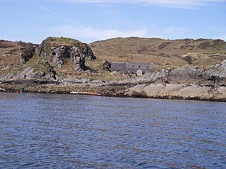
Inishcottle ( Gaeilge: Inis Coitil [1] ) is an inhabited island in Clew Bay, County Mayo, Ireland.
This article needs additional citations for verification .(November 2021) |
Inishcottle ( Gaeilge: Inis Coitil [1] ) is an inhabited island in Clew Bay, County Mayo, Ireland.
|
|
| |||||||||||||||||||||||||||||||||||||||||||||||||||||||||||||||||||||||||||||||||||||||
| Source: Central Statistics Office. "CNA17: Population by Off Shore Island, Sex and Year". CSO.ie. Retrieved 12 October 2016. [2] | |||||||||||||||||||||||||||||||||||||||||||||||||||||||||||||||||||||||||||||||||||||||||

Point Judith is a village and a small cape, on the coast of Narragansett, Rhode Island, on the western side of Narragansett Bay where it opens out onto Rhode Island Sound. It is the location for the year-round ferry service that connects Block Island to the mainland and contains the fishing hamlet of Galilee, Rhode Island.
Sandray is one of the Barra Isles in the Outer Hebrides of Scotland. It never had a large population, and has been uninhabited since 1934. It is now known for its large seabird colony.

German submarine U-853 was a Type IXC/40 U-boat of Nazi Germany's Kriegsmarine during World War II. Her keel was laid down on 21 August 1942 by DeSchiMAG AG Weser of Bremen. She was commissioned on 25 June 1943 with Kapitänleutnant Helmut Sommer in command. U-853 saw action during the Battle of the Atlantic in World War II. She conducted three patrols, sinking two ships totalling 5,353 GRT and 430 tons.
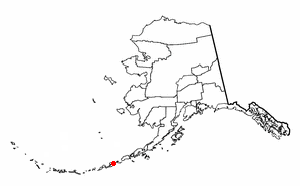
The Fox Islands are a group of islands in the eastern Aleutian Islands of the U.S. state of Alaska. The Fox Islands are the closest to mainland North America in the Aleutian chain, and just east of Samalga Pass and the Islands of Four Mountains group.
This article lists extreme locations on Earth that hold geographical records or are otherwise known for their geophysical or meteorological superlatives. All of these locations are Earth-wide extremes; extremes of individual continents or countries are not listed.

Abaeté is a municipality in the north of the Brazilian state of Minas Gerais. In 2020, the population was 23,250 in a total area of 1,816 square kilometers. It became a municipality in 1870.
Garbh Eileach is an uninhabited island in the Inner Hebrides of the west coast of Scotland. It is the largest of the Garvellachs and lies in the Firth of Lorne between Mull and Argyll.

Ingrow is a suburb of Keighley, West Yorkshire, England that lies on the River Worth. The name Ingrow comes from Old Scandinavian which means 'corner of land in the meadow.' The suburb is located on the A629 road and is 0.93 miles (1.5 km) south west of Keighley town centre.

The Isla Iguana Wildlife Refuge is a 58-hectare wildlife reserve located 5 kilometers off the Los Santos Province on the Azuero Peninsula in Panama.
Ynys Dulas is a small island located off the north-east coast of Anglesey, Wales. It marks the most eastern part of the parish of Llaneilian.

The Colony of the Queen Charlotte Islands was a British colony constituting the archipelago of the same name from 1853 to 1858, when it was amalgamated into the Colony of British Columbia. In 2010 the archipelago was renamed Haida Gwaii.

Longay is a small uninhabited Scottish island in the Inner Sound just off the coast of the Isle of Skye, north of Pabay and east of Scalpay.
Fuaigh Mòr is an island in the Outer Hebrides of Scotland. It is off the west coast of Lewis near Great Bernera in Loch Roag. It is 84 hectares and 67 metres at its highest point.

Flodday is an uninhabited island, south west of Barra in the Western Islands of Scotland.
Igloolik Island is a small island in the Qikiqtaaluk Region of Nunavut, Canada. It is located in the Foxe Basin, very close to the Melville Peninsula, and it is often thought to be a part of the peninsula. It forms part of the Arctic Archipelago.

Grandyle Village is a hamlet and census-designated place (CDP) in the town of Grand Island in Erie County, New York, United States. As of the 2010 census, it had a population of 4,629.
German submarine U-629 was a Type VIIC U-boat built for Nazi Germany's Kriegsmarine for service during World War II. She was laid down on 23 August 1941 by Blohm & Voss, Hamburg as yard number 605, launched on 12 May 1942 and commissioned on 2 July 1942 under Oberleutnant zur See Hans-Helmuth Bugs.

The Szczecin Voivodeship was a voivodeship (province) of the Polish People's Republic from 1975 to 1989, and the Third Republic of Poland from 1989 to 1998. Its capital was Szczecin, and it was centered on the western Farther Pomerania. It was established on 1 June 1975, from the part of the Szczecin Voivodeship, and existed until 31 December 1998, when it was incorporated into then-established West Pomeranian Voivodeship.
53°51′11″N9°37′44″W / 53.853°N 9.629°W
| | This article related to the geography of County Mayo, Ireland is a stub. You can help Wikipedia by expanding it. |
