County Mayo is a county in Ireland. In the West of Ireland, in the province of Connacht, it is named after the village of Mayo, now generally known as Mayo Abbey. Mayo County Council is the local authority. The population was 137,231 at the 2022 census. The boundaries of the county, which was formed in 1585, reflect the Mac William Íochtar lordship at that time.

Castlebar is the county town of County Mayo, Ireland. Developing around a 13th-century castle of the de Barry family, from which the town got its name, the town now acts as a social and economic focal point for the surrounding hinterland. With a population of 13,054 in the 2022 census, Castlebar was one of the fastest growing towns in Ireland in the early 21st century.

Templeogue is a southwestern suburb of Dublin in Ireland. It lies between the River Poddle and River Dodder, and is about halfway from Dublin's centre to the mountains to the south.

Julianstown is a village in County Meath, Ireland. It is located near Drogheda on the R132 regional road. In 1641, the Battle of Julianstown was fought here during the Irish Rebellion of 1641.

Michael Davitt was an Irish republican activist for a variety of causes, especially Home Rule and land reform. Following an eviction when he was four years old, Davitt's family migrated to England. He began his career as an organiser of the Irish Republican Brotherhood, which resisted British rule in Ireland with violence. Convicted of treason felony for arms trafficking in 1870, he served seven years in prison. Upon his release, Davitt pioneered the New Departure strategy of cooperation between the physical-force and constitutional wings of Irish nationalism on the issue of land reform. With Charles Stewart Parnell, he co-founded the Irish National Land League in 1879, in which capacity he enjoyed the peak of his influence before being jailed again in 1881.

Gob an Choire or Gob a' Choire, formerly anglicised as Gubacurra, is a Gaeltacht village in County Mayo, Ireland. It lies on the east coast of Achill Island and is the first settlement one reaches after crossing the Michael Davitt Bridge, a swing bridge that joins Achill Island to Corraun Peninsula on the mainland. In ancient times the southern entrance was guarded by Carrickkildavnet Castle.

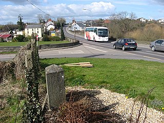
Ballindine is a village in County Mayo, Ireland. It is located along the Western Railway Corridor, 6.5 km (4 miles) south of Claremorris. The N17 road passes through the village, carrying over 10,000 vehicles daily, and it connects to the R328 road on the south side of town.

Leighlinbridge is a small town on the River Barrow in County Carlow, Ireland. It is 11 km south of Carlow town, on the R705 road. The N9 national primary route once passed through the village, but was by-passed in the 1980s.

Ardrahan is a village in County Galway, Ireland.

Two-Mile Borris is a village in County Tipperary, Ireland. The village is located on the L4202 road at the junction with the Ballyduff Road, close to the N75 and 4.7 mi (7.6 km) from Thurles town centre. It is also situated 1 mile from junction 5 of the M8 motorway. Its population was 572 as of the 2016 census, up from 502 in 2006. It is situated in the townland of Borris which is part of the civil parish of Twomileborris in the ancient barony of Eliogarty.

Kilmore or Killmore is a small village, townland and civil parish in County Armagh, Northern Ireland. It lies 2.5 miles (4 km) north of Richhill and within the Armagh City, Banbridge and Craigavon Borough Council area. It had a population of 190 people in the 2011 Census.

Ballyhale is a village in the south east of Ireland. Located in the south of County Kilkenny, south of the city of Kilkenny and roughly halfway to Waterford city.

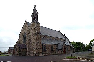
Bohola is a village in County Mayo, Ireland located along the N5 national primary road. It is in the barony of Gallen and gives its name to the civil parish of Bohola. The village's amenities include two pubs, a post office, a cafe and a Catholic church.
The term New Departure has been used to describe several initiatives in the late 19th century by which Irish republicans, who were committed to independence from Britain by physical force, attempted to find a common ground for co-operation with groups committed to Irish Home Rule by constitutional means. In the wake of the Fenian Rising of 1867 and the unpopular executions which followed it, Fenianism was popularised and became more moderate, while the Home Rule movement was edging toward radicalism at the same time, laying the framework for the alliance. The term was coined by John Devoy in an anonymous article in the New York Herald on 27 October 1878 in which he laid out a framework for a new policy.

The National Museum of Ireland – Country Life is located in Turlough village, 8 km (5.0 mi) northeast of Castlebar, County Mayo, Ireland. Established in 2001, the museum is part of the National Museum of Ireland and is the only national museum outside Dublin. The museum exhibits the way of life of rural Irish people between 1850 and 1950, and is in the grounds of Turlough Park House. There are displays about the home, the natural environment, trades and crafts, communities, and working on the land and on water.

Moore Street is a street in central Dublin, Ireland, off Henry Street, one of Ireland's main shopping streets. The famous Moore Street open-air fruit and vegetable market is Dublin's oldest food market. The market there is a famous landmark on the northside of the city.
Bohola-Moy Davitts is a Gaelic Athletic Association club based in Foxford, County Mayo, Ireland. The club fields Gaelic football teams in competitions organized by the Mayo GAA county board. The team's nickname is the "Moy Boys"

Irishtown is a village in County Mayo, Ireland, located on the southern county border with County Galway about halfway between Claremorris and Tuam on the R328 regional road. Irishtown is in the Civil Parish of Crossboyne, Barony of Clanmorris and the Catholic Diocese of Tuam. It is sometimes referred to as 'The Cradle of the Land League' due to its connections with the founding of the Irish National Land League.
Davitts GAA is a Gaelic Athletic Association club based in the parish of Kilvine in south County Mayo, Ireland.

Strade Abbey is a former Franciscan/Dominican monastery and National Monument located in County Mayo, Ireland.


