
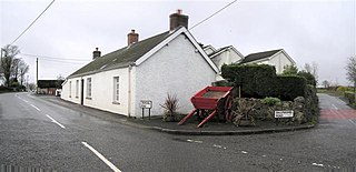
Tullyhogue, also called Tullaghoge or Tullahoge, is a small village and townland in County Tyrone, Northern Ireland. It is within the civil parish of Desertcreat and is about three kilometres south of Cookstown.

Palmerstown is a civil parish and suburb in South Dublin, Ireland. It is located about 8 km west of Dublin city centre. The area is bordered to the north by the River Liffey, to the west by Lucan, to the south by Ballyfermot and to the east by the village of Chapelizod. Palmerstown village is situated near the Liffey Valley Shopping Centre. The area is situated near the major junction of the M50 motorway and the N4. It is 8.8 km from Dublin city centre. The Old Lucan Road, once the main route from the city to the west, passes through the centre of Palmerstown village.

Monamolin or Monamoling is a small rural village in County Wexford, Ireland, about 11 km (6.8 mi) south of the town of Gorey.
Craughwell is a village and townland in County Galway, Ireland. The name is also used as a surname, properly Ó Creachmhaoil, though often anglicised as Craughwell and Crockwell. The surname was largely unknown outside of the southeast of County Galway until the end of the 19th century when émigrés established families which still thrive in Newfoundland, Bermuda, Cornwall, Ohio and Berkshire County, Massachusetts, among other places.
Bonniconlon, officially Bunnyconnellan, is a village in the barony of Gallen in east County Mayo, Ireland. The village is on the R294 regional road to the east of Ballina, County Mayo, and close to the Ox Mountains.
Clondulane is a village in north County Cork, Ireland, 3.5m east of Fermoy, just off the Main Fermoy-Dungarvan Road. Originally built as a camp for the workers of a Cork Milling Company grain mill, it now has a population of over 200. However, with 60 new houses being built in the immediate area, this is soon to rise dramatically. . Unusually, there are three large houses of note in the village: Clondulane, Glandulane, and Careysville Houses, the latter being owned by the Duke of Devonshire(England)and used as a lodging house during the salmon season. Along with 4 housing estates and many stand alone dwellings, there is a school, community centre, public house, playing fields, park, disused railway station, factory, a Protestant school, Protestant church and graveyard.

Clonaslee is a village in north County Laois, Ireland, situated in the foothills of the Slieve Bloom Mountains on the R422 Mountmellick to Birr road. Clonaslee is approximately 100 km west of Dublin, and is close to the towns of Portlaoise and Tullamore.
Ballyeaston, formerly spelt Ballyistin, is a small village and townland in County Antrim, Northern Ireland. It is 2–3 km north of Ballyclare, on the road to Larne. It lies on the southern hill slopes overlooking Six Mile Water. In the 2001 Census it had a population of 90 people. It is within the Antrim & Newtownabbey Borough Council area.

Killester is a small, largely residential, suburb of Dublin, Ireland on the Northside of the city.
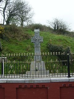
Béal na Bláth, alternatively Béal na mBláth, Béal na Blá, Bealnablath or Bealnabla, is a small village on the R585 road in County Cork, Ireland. The area is best known as the site of the ambush and assassination of Michael Collins.
Loup or the Loup is a small village in County Londonderry, Northern Ireland. It lies near the western shore of Lough Neagh between Moneymore, Magherafelt, Ballyronan and Coagh. It is situated within Mid-Ulster District.

Kilcummin is a beachhead on the northern coast of County Mayo, Ireland. The Kilcummin area is sparsely populated. Although fishing is still the main source of income of people in Kilcummin, tourism is becoming more important, with the "Tír Sáile - North Mayo Sculpture Trail" and the "Tour d'Humbert" leading through the area. Kilcummin overlooks Killala Bay, the blue flag beach "An Trá nRoss", "Bartra Island" and lies on the opposite shore to Enniscrone and its beach in County Sligo.

Castlelyons is a small village in the east of County Cork, Ireland. It is also a civil parish in the barony of Barrymore. The name is derived from a stronghold of the Uí Liatháin - an early medieval kingdom. It is situated 6 km (3.7 mi) south of Fermoy. In the 2002 census it recorded a population of 211.
Colehill is a village and townland in south-east County Longford, Ireland. Its Irish name was historically anglicised as Knocknagoal and Knocknagole.

Castleblakeney or Castleblakeny, historically Gallagh, is a village in County Galway, Ireland. It is at the crossroads of the R359 and R339 regional roads, 5km south of the town of Mountbellew.
Moylough is a small rural village located in County Galway in Ireland. It is located on the N63 national secondary road, and is served also by the R328 and R364 regional roads. It is 50 km from Galway, 30 km from Roscommon, and 5 km northwest of Mountbellew. It is twinned with Elliant in Brittany.

Muckanaghederdauhaulia is a 470-acre townland in the civil parish of Kilcummin in County Galway, Ireland. It is in the poor law union of Oughterard in the barony of Moycullen.
Arbour Hill is an inner city area of Dublin, on the Northside of the River Liffey, in the Dublin 7 postal district. Arbour Hill, the road of the same name, runs west from Blackhall Place in Stoneybatter, and separates Collins Barracks, now part of the National Museum of Ireland, to the south from Arbour Hill Prison to the north, whose graveyard includes the burial plot of the signatories of the Easter Proclamation that began the 1916 Rising.

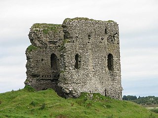
Crusheen, formerly called Inchicronan, is a Catholic parish in County Clare, Ireland. Inchicronan is also a civil parish, covering the same area. The parish lies to the southwest of Ennis. It contains the village of Crusheen and the ruin of Inchicronan Priory, built in 1190.
Legan is a village in County Longford, Ireland. The village population as of 2016 is 215.


