Dotswood Queensland | |||||||||||||||
---|---|---|---|---|---|---|---|---|---|---|---|---|---|---|---|
Coordinates | 19°33′37″S146°13′13″E / 19.5602°S 146.2202°E | ||||||||||||||
Population | 83 (2021 census) [1] | ||||||||||||||
• Density | 0.02462/km2 (0.0638/sq mi) | ||||||||||||||
Postcode(s) | 4820 | ||||||||||||||
Area | 3,370.6 km2 (1,301.4 sq mi) | ||||||||||||||
Time zone | AEST (UTC+10:00) | ||||||||||||||
Location |
| ||||||||||||||
LGA(s) | Charters Towers Region | ||||||||||||||
State electorate(s) | Traeger | ||||||||||||||
Federal division(s) | Kennedy | ||||||||||||||
|
Dotswood is a rural locality in the Charters Towers Region, Queensland, Australia. [2] In the 2021 census, Dotswood had a population of 83 people. [1]
The neighbourhood of Macrossan is located in the west of the locality beside the bridge over the Burdekin River.
The Great Northern Railway passes through the locality. There are a number of abandoned railway stations on that line within the locality:
Another abandoned station is Keelbottom railway station ( 19°26′34″S146°19′00″E / 19.4427°S 146.3168°E ) on the now-closed Greenvale railway line. [3]
The Hervey Range Developmental Road runs through from east to west. [4]
In 1863 Phillip Somer and Matthew Hervey were granted the license to occupy the 42 square miles (110 square kilometres) and 25 square miles (65 km2) of the Keelbottom and Watershed Pastoral Runs respectively, by the Crown Lands Office in Brisbane. [5] [6] By late 1865 these men had transferred their holdings of the Emysland, Dotswood, Nursiedob, Keelbottom, Watershed, and Tala (or Tula).runs to the Bank of New South Wales. These properties lay on one or both sides of Keelbottom Creek. [7] Eventually Dotswood Station comprised the runs of Arthurs Peak, Back Plains, Hardwick, Pall Mall, Poon Boon, Redyke (or Red Dyke), Smiths Brook and Yallock Vale, as well as those already mentioned. [8] [9] [10]
The neighbourhood of Macrossan takes its name from the Macrossan railway station, which in turn is named after the politician John Murtagh Macrossan. [11] [12]
This locality was within the Star River Mineral Field, which was discovered in 1865. [13] The following year John Macrossan passed through the area. [14] The Ravenswood Gold Field, discovered in 1868, eventually extended north into the Star River Mineral Field. [15] [8] From 1881 silver-lead deposits in the Ravenswood mining district, the most promising at Argentine, were being mined in what was called a silver mania. [16] [17] However this ended suddenly in 1883, after the failure of a locally capitalized smelting works and low returns. [18] [19]
In late 1872 1,100 acres (450 hectares ) on Keelbottom Creek, Kennedy district were reserved for the town reserve of Boolangalla. [20]
In the town of Argentine, 67 town lots, at £16 per acre, and 3 mineral selections, were offered for sale by the Crown Lands Office in October 1882. By the next year the town consisted of several public houses, one butcher's shop, a baker's shop, three stores and two gardens. [21] [22] [23] In December 1888 the name of the Star River Post Office was changed to Argentine Post Office. [24]
In the 2016 census Dotswood had a population of 101 people. [25]
In the 2021 census, Dotswood had a population of 83 people. [1]
Dotswood has a number of heritage-listed sites, including:
Most of this locality is within of the Department of Defence's Townsville Field Training Area. [28]
There are no schools in Dotswood. For students living in southern Dotswood, the nearest government primary school is Richmond Hill State School in Richmond Hill, Charters Towers, and the nearest government secondary school is Charters Towers State High School in the Charters Towers CBD. For students living in eastern Dotswood, the nearest government primary school is The Willows State School in Kirwan, Townsville, and the nearest government secondary school is Thuringowa State High School in Condon, Townsville. For students living in other parts of Dotswood, there are no nearby schools; the options are distance education and boarding school. [29]
There are non-government schools in Charters Towers and Townsville. [29]
Macrossan Park is a free campground overlooking the Burdekin River, situated between the rail and road bridges ( 20°00′12″S146°26′20″E / 20.0034°S 146.4389°E ) [30]
Surgeons Lookout is a tourist attraction ( 19°41′11″S146°32′19″E / 19.6864°S 146.5387°E ). [31]
Ayr is a rural town and locality in the Shire of Burdekin, Queensland, Australia. It is the centre of a sugarcane-growing region and the administrative centre for the Burdekin Shire Council. In the 2021 census, the locality of Ayr had a population of 8,603 people.
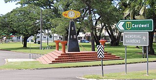
Ingham is a rural town and locality in the Shire of Hinchinbrook, Queensland, Australia. It is named after William Bairstow Ingham and is the administrative centre for the Shire of Hinchinbrook.
Richmond is a rural town and locality in the Shire of Richmond, Queensland, Australia. In the 2021 census, the locality of Richmond had a population of 578 people.
Home Hill is a rural town and locality in the Shire of Burdekin, Queensland, Australia. In the 2021 census, the locality of Home Hill had a population of 2,876 people.
North Queensland or the Northern Region is the northern part of the Australian state of Queensland that lies just south of Far North Queensland. Queensland is a massive state, larger than many countries, and its tropical northern part has been historically remote and undeveloped, resulting in a distinctive regional character and identity.
Pentland is a rural town and locality in the Charters Towers Region, Queensland, Australia. In the 2021 census, the locality of Pentland had a population of 248 people.
Paluma is a town in the City of Townsville and a locality split between the City of Townsville and the Charters Towers Region in Queensland, Australia. In the 2021 census, the locality of Paluma had a population of 87 people.
Ravenswood is a rural town and locality in the Charters Towers Region, Queensland, Australia. In the 2021 census, the locality of Ravenswood had a population of 297 people.
Rollingstone is a rural town and coastal locality in the City of Townsville, Queensland, Australia. In the 2021 census, the locality of Rollingstone had a population of 133 people.
Hervey Range is a rural locality split between the City of Townsville and the Charters Towers Region, Queensland, Australia. In the 2021 census, Hervey Range had a population of 295 people.
Queenton is an eastern suburb of Charters Towers in the Charters Towers Region, Queensland, Australia. In the 2021 census, Queenton had a population of 1,236 people.
Breddan is a rural locality in the Charters Towers Region, Queensland, Australia. In the 2021 census, Breddan had a population of 478 people.
Feluga is a rural locality in the Cassowary Coast Region, Queensland, Australia. In the 2021 census, Feluga had a population of 306 people.
Broughton is a rural locality in the Charters Towers Region, Queensland, Australia. In the 2021 census, Broughton had a population of 714 people.
McDesme is a rural locality in the Shire of Burdekin, Queensland, Australia. In the 2021 census, McDesme had a population of 254 people.
Mingela is a rural town and locality in the Charters Towers Region, Queensland, Australia. In the 2021 census, the locality of Mingela had a population of 14 people.
Sellheim is a town in the locality of Breddan in the Charters Towers Region, Queensland, Australia.
Toonpan is a rural locality in the City of Townsville, Queensland, Australia. In the 2021 census, Toonpan had a population of 62 people.
Groper Creek is a coastal town and rural locality in the Shire of Burdekin, Queensland, Australia. In the 2021 census, the locality of Groper Creek had a population of 66 people.
Drummondslope is a former rural locality in the Barcaldine Region, Queensland, Australia. In the 2016 census, Drummondslope had a population of 43 people. On 22 November 2019 the Queensland Government decided to amalgamate the localities in the Barcaldine Region, resulting in five expanded localities based on the larger towns: Alpha, Aramac, Barcaldine, Jericho and Muttaburra. Drummondslope was incorporated into Alpha.