
Edinburgh North and Leith is a constituency of the House of Commons of the Parliament of the United Kingdom, first used in the 1997 general election. It elects one Member of Parliament (MP) by the first past the post system of election.

Edinburgh West was a constituency of the Scottish Parliament (Holyrood) from 1999 until 2011. It elected one Member of the Scottish Parliament (MSP) by the plurality method of election. It was also one of nine constituencies in the Lothians electoral region, which elected seven additional members, in addition to nine constituency MSPs, to produce a form of proportional representation for the region as a whole.
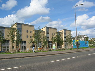
Silverknowes is a district of Edinburgh, Scotland. Silverknowes lies to the northwest of the city. The district contains over 2000 homes, ranging in size from bungalow to semi-detached housing, much of it built during the mid-twentieth century.

Davidson's Mains is a former village and now a district in the north-west of Edinburgh, Scotland. It is adjacent to the districts of Barnton, Cramond, Silverknowes, Blackhall and Corbiehill/House O'Hill. It was absorbed into Edinburgh as part of the boundary changes in 1920 and is part of the EH4 postcode area.

Balgreen is a suburb of Edinburgh, located approximately two miles west of the city centre, most commonly known for its primary school, Balgreen Primary. It is located to the west of Murrayfield and Saughtonhall, to the east of Corstorphine, and to the north of Gorgie. It is bound to the north by Corstorphine Hill, to the west by Carrick Knowe Golf Course, and roughly to the east by Water of Leith.

Ferry Road is one of the major roads of Edinburgh, Scotland, deriving its name from being the road from Queensferry to Leith. It runs from the eastern end of Davidson's Mains village in the west, to Leith in the east, passing through Drylaw, Crewe Toll and Goldenacre on the way. It is classified as the A902 from Leith to Crewe Toll where the A902 continues as Telford Road.

East Craigs is a residential district of Edinburgh located in the north-west of the city, on the western flanks of Corstorphine Hill. It lies next to the green belt, and prior to development was a working farm.

Craigcrook is a suburb of Edinburgh, Scotland, best known for Craigcrook Castle. It is fairly affluent, and lies on the north east slopes of Corstorphine Hill. It is near Clerwood, and Blackhall. Davidson's Mains lies to the north, separated from the district by the A90 - Queensferry Road.
Niddrie is a residential suburb in Eastern Edinburgh in Scotland.

Crewe Toll is an area in Edinburgh, the Scottish capital.
Pilton is a residential area of north Edinburgh, Scotland. It is to the north of Ferry Road, west of Granton and immediately east of Muirhouse. Pilton consists of two, mostly council, housing schemes - West Pilton and East Pilton. These schemes are regarded as two of the most deprived schemes in Edinburgh and suffer from high crime rates and anti-social behaviour especially young joyriders stealing powerful motorbikes and cars, driving them recklessly round the scheme. Pilton is generally considered to be part of the larger neighbouring area of Granton.
Muirhouse is a residential estate in the north of Edinburgh, the capital of Scotland.
Parkgrove is a suburb of Edinburgh, the capital of Scotland. Approximately 4 miles north-west of Edinburgh city centre. The suburb is located between the neighbouring areas of Clermiston, Barnton and Davidson's Mains.

Stenhouse is a suburb of Edinburgh, the capital of Scotland. It lies to the west of the City Centre, adjacent to Whitson and Saughton Mains and close to Broomhouse and Chesser. It is a mainly residential area.
West Pilton is a residential area of Edinburgh north of Ferry Road, east of Muirhouse, and immediately west of East Pilton and then Granton.

The King's Buildings is a campus of the University of Edinburgh in Scotland, and contains most of the schools within the College of Science and Engineering, excepting only part of the School of Informatics and the School of Geosciences, which are located at the central George Square campus. The campus lies south of West Mains Road, west of Mayfield Road and east of Blackford Hill, about 2 miles (3.2 km) south of George Square. Scotland's Rural College (SRUC) and Biomathematics and Statistics Scotland (BioSS) also have facilities there.
Westfield is an area of the town of Cumbernauld in Scotland. Westfield is a popular residential area originally built by Cumbernauld Development Corporation in the late 1970s and early 1980s. It comprises a residential area and a large industrial estate. Historically there was a farm at Westfield as shown on Roy's map of the Lowlands and the 1st 25 inch Ordnance Survey Map of Scotland. It is located near Condorrat and Broadwood Stadium, home of Clyde FC. Historically, there were two local primary schools, St Francis of Assisi Primary School and Westfield Primary School. St. Francis of Assisi Primary School closed in 2009. The site has been re-developed by North Lanarkshire Council with new, high quality social housing available to rent. The new street is named Netherinch Way. Westfield also has other modern, private developments for example a new Bellway Housing development sits near Broadwood stadium along with a neighboring housing development. Westfield has a selection of frequent bus services to Airdrie, Cumbernauld Town Centre, Glasgow, Kilsyth and Kirkintilloch with buses operated by David Allan Coaches, First Group & McGills. In 2017 plans for a new retail park near Broadwood Studium were approved.
Niddrie Mains is an area of east Edinburgh, north of Niddrie Mains Road. The Mains refers to the farm of Niddrie which occupied the land on which the social housing estate for southeast Edinburgh was built in the 1920s.
Ebenezer James MacRae was a Scottish architect serving as City Architect for Edinburgh for most of his active life.
Duncan Menzies (1837-1910) was a Scottish architect and civil engineer. His best known work is the Turnberry Hotel in Ayrshire. His grandest scheme is Murrayfield Avenue in west Edinburgh.
