The Aztec Ruins National Monument preserves Ancestral Puebloan structures in the northwestern part of the U.S. state of New Mexico. This national monument is close to both the town of Aztec and the Animas River, and it is about 12 miles (19 km) northeast of Farmington, New Mexico. The Salmon Ruins and Heritage Park, which also has Puebloan structures, is about 9.5 miles (15.3 km) south of the monument. The Aztec ruins date from the 11th to the 13th centuries. American settlers in the 19th century named them the "Aztec ruins" based on their erroneous belief that the Aztec civilization built them.

Bandelier National Monument is a 33,677-acre (13,629 ha) United States National Monument near Los Alamos in Sandoval and Los Alamos counties, New Mexico. The monument preserves the homes and territory of the Ancestral Puebloans of a later era in the Southwest. Most of the pueblo structures date to two eras, dating between 1150 and 1600 AD.

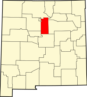
El Morro National Monument is a U.S. national monument in Cibola County, New Mexico, United States. Located on an ancient east–west trail in the western part of the state, the monument preserves the remains of a large prehistoric pueblo atop a great sandstone promontory with a pool of water at its base, which subsequently became a landmark where many centuries of explorers and travelers left historic inscriptions that survive today.

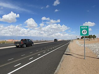
Fort Union National Monument is a unit of the National Park Service of the United States, and is located north of Watrous in Mora County, New Mexico. The national monument was founded on June 28, 1954.
Chamizal National Memorial, located in El Paso, Texas, along the United States–Mexico international border, is a National Park Service site commemorating the peaceful settlement of the Chamizal boundary dispute.

The National Register of Historic Places in the United States is a register including buildings, sites, structures, districts, and objects. The Register automatically includes all National Historic Landmarks as well as all historic areas administered by the U.S. National Park Service. Since its introduction in 1966, more than 90,000 separate listings have been added to the register.

El Presidio Real de Santa Bárbara, also known as the Royal Presidio of Santa Barbara, is a former military installation in Santa Barbara, California, USA. The presidio was built by Spain in 1782, with the mission of defending the Second Military District in California. In modern times, the Presidio serves as a significant tourist attraction, museum and an active archaeological site as part of El Presidio de Santa Barbara State Historic Park.

This is a directory of properties and districts listed on the National Register of Historic Places in Arizona. There are about fourteen hundred listed sites in the state, and each of its fifteen counties has at least ten listings on the National Register. Forty-five of the state's sites are further designated as National Historic Landmarks.

This is a list of properties and districts listed on the National Register of Historic Places in New Jersey. There are more than 1,700 listed sites in New Jersey. All 21 counties in New Jersey have listings on the National Register.

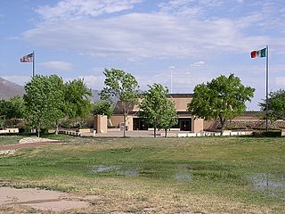
El Presidio Reál de San Diego is a historic fort in San Diego, California. It was established on May 14, 1769, by Gaspar de Portolá, leader of the first European land exploration of Alta California - at that time an unexplored northwestern frontier area of New Spain. The presidio was the first permanent European settlement on the Pacific Coast of the present-day United States. As the first of the presidios and Spanish missions in California, it was the base of operations for the Spanish colonization of California. The associated Mission San Diego de Alcalá later moved a few miles away.
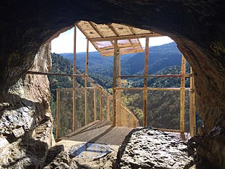
Sandia Cave, also called the Sandia Man Cave, is an archaeological site near Bernalillo, New Mexico, within Cibola National Forest. First discovered and excavated in the 1930s, the site exhibits evidence of human use from 9,000 to 11,000 years ago. It was declared a National Historic Landmark in 1961. The site is open to the public, up a difficult half-mile trail off New Mexico State Road 165.
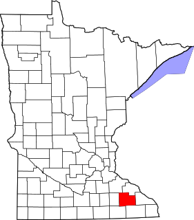
This is a list of the National Register of Historic Places listings in Olmsted County, Minnesota. It is intended to be a complete list of the properties and districts on the National Register of Historic Places in Olmsted County, Minnesota, United States. The locations of National Register properties and districts for which the latitude and longitude coordinates are included below, may be seen in an online map.

This is a list of the National Register of Historic Places listings in Cerro Gordo County, Iowa.
This is a list of the National Register of Historic Places listings in Santa Fe County, New Mexico.

This is a list of the National Register of Historic Places listings in El Paso County, Texas.

Northern Rio Grande National Heritage Area is a federally designated National Heritage Area in the U.S. state of New Mexico. The national heritage area includes a section of the upper Rio Grande Valley that has been inhabited by the Puebloan peoples since the early Pre-Columbian era.
Tomé Domínguez de Mendoza was a Spanish soldier who served as acting Governor of New Mexico in 1664.

The Valmora Sanatorium Historic District, near Watrous, New Mexico, includes building(s) dating from 1910. It was listed as a historic district on the National Register of Historic Places in 1995. The listing included nine contributing buildings and a contributing site, on 5 acres (2.0 ha).