Ell Pond (Rhode Island)

Last updated

Ell Pond
Ell Pond-Rhode Island kettle hole.jpeg
Ell Pond in Rhode Island.
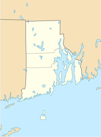
USA Rhode Island location map.svg
Red pog.svg
Map of Rhode Island
Location Hopkinton, Rhode Island
Coordinates 41°30′19″N71°46′58″W / 41.50533°N 71.78291°W / 41.50533; -71.78291
Area50 acres (20 ha)
Established1972
Designated1974

Ell Pond is a kettle hole in Hopkinton, Washington County, Rhode Island. It is surrounded by a swamp of red maple and Atlantic white cypress, and by steep granitic monadnocks. The small area contains communities of both hydrophytic and xeric plants, which makes it ideal for ecological research and education. It was designated a National Natural Landmark in May 1974. [1] In 1972, The Nature Conservancy purchased 50 acres (20 ha) including the pond to extend 218 acres (88 ha) of protected land owned by the Audubon Society of Rhode Island and the 1,002 acres (405 ha) of Rockville Wildlife Management Area owned by the state. [2] The preserve is jointly managed by all three entities. There are hiking trails in the preserve, but Ell pond is specifically not reachable due to its fragile environment.

As of 2025, Ell Pond is the only listed National Natural Landmark in Rhode Island.

Related Research Articles

<span class="mw-page-title-main">Tallgrass Prairie National Preserve</span> In the Flint Hills region of Kansas, US

Tallgrass Prairie National Preserve is a United States National Preserve located in the Flint Hills region of Kansas, north of Strong City. The preserve protects a nationally significant example of the once vast tallgrass prairie ecosystem. Of the 400,000 square miles (1,000,000 km2) of tallgrass prairie that once covered the North American continent, less than 5% remains, primarily in the Flint Hills. Since 2009, the preserve has been home to the Tallgrass Prairie bison herd.

<span class="mw-page-title-main">Columbus and Franklin County Metro Parks</span> Park district in Central Ohio

The Columbus and Franklin County Metro Parks are a group of 20 metropolitan parks in and around Columbus, Ohio. They are officially organized into the Columbus and Franklin County Metropolitan Park District. The Metro Parks system was organized in 1945 under Ohio Revised Code Section 1545 as a separate political division of the state of Ohio. The Metro Parks are overseen by a Board of Park Commissioners consisting of three citizens appointed to three-year terms without compensation by the Judge of the Probate Court of Franklin County, Ohio. The Board in turn appoints an Executive Director responsible for operations and management of the parks.

<span class="mw-page-title-main">Sandy Island Beach State Park</span> New York State park

Sandy Island Beach State Park is a New York State park on the eastern shore of Lake Ontario. Its highlight is a 1,500-foot (460 m) natural sandy beach. The park is near the southern end of a notable 17-mile (27 km) length of sandy shoreline, coastal dunes, and wetlands ; a 1959 study noted that "The eastern end of Lake Ontario contains not only the finest beaches on the entire lake but also the finest wildlife habitat."

<span class="mw-page-title-main">Volo Bog State Natural Area</span> State park in Illinois, USA

Volo Bog State Natural Area is a nature reserve in Illinois, United States, preserving Volo Bog. The bog was designated a National Natural Landmark in 1973 as the only remaining open-water quaking bog in Illinois. The site also contains woodlands, savanna, marshes, prairie restoration areas, shrubland and old fields. Maintained by the Illinois Department of Natural Resources, the site is located about a mile west of U.S. Route 12 between the towns of Volo and Fox Lake, Illinois.

Beechwood Farms Nature Reserve is a 134-acre (0.5 km2) protected area for flora, fauna, and wildlife in Fox Chapel, Pennsylvania, a Pittsburgh suburb. The site has served as the headquarters of the Audubon Society of Western Pennsylvania (ASWP) since 1977.

<span class="mw-page-title-main">Boston Post Road Historic District (Rye, New York)</span> Historic district in New York, United States

The Boston Post Road Historic District is a 286-acre (116 ha) National Historic Landmark District in Rye, New York, and is composed of five distinct and adjacent properties. Within this landmarked area are three architecturally significant, pre-Civil War mansions and their grounds; a 10,000-year-old Indigenous peoples site and viewshed; a private cemetery, and a nature preserve. It is one of only 11 National Historic Landmark Districts in New York State and the only National Historic Landmark District in Westchester County. It touches on the south side of the nation's oldest road, the Boston Post Road, which extends through Rye. A sandstone Westchester Turnpike marker "24", inspired by Benjamin Franklin's original mile marker system, is set into a wall that denotes the perimeter of three of the contributing properties. The district reaches to Milton Harbor of Long Island Sound. Two of the properties included in the National Park Service designation are anchored by Greek Revival buildings; the third property is dominated by a Gothic Revival structure that was designed by Alexander Jackson Davis.

<span class="mw-page-title-main">Mill Grove</span> Historic house in Pennsylvania, United States

Mill Grove is a historic house and estate on Pawlings Road in Audubon, Pennsylvania. Built in the 1760s, it is notable as the first home in America of painter and naturalist John James Audubon (1785-1851), for whom the community is named. The 130-acre (53 ha) estate is now maintained as a museum and wildlife sanctuary by Montgomery County, and was designated a National Historic Landmark in 1989. The house serves as the educational center of the Pennsylvania chapter of the National Audubon Society, and is known as John James Audubon Center at Mill Grove.

Mark's and Jack's Island Natural Area Preserve is a 2,305-acre (9.33 km2) Natural Area Preserve located in Accomack County, Virginia. The preserve supports Chesapeake Bay beach habitat, as well as various types of marsh, shrub, and forest vegetation. Many species of birds can be found in the preserve's wetlands, and numerous plant species live in the marsh, including marsh-elder. Loblolly pine and black cherry may be seen along the tops of some old dunes. The beaches provide a home for the northeastern beach tiger beetle.

<span class="mw-page-title-main">Black Pond Wildlife Management Area</span> New York state wildlife management area

Black Pond Wildlife Management Area is a 526-acre (213 ha) New York State Wildlife Management Area (WMA) that lies on the eastern shore of Lake Ontario, and at the northern limit of an unusual region of sandy barrier beaches and lagoons. Much of the barrier beach in Black Pond WMA has forested sand dunes that are about 60 feet (18 m) high; these are the highest sand dunes in the northeast United States excepting Cape Cod. Immediately north of the WMA is the 360-acre (150 ha) El Dorado Beach Preserve, which is a bird refuge owned by The Nature Conservancy. North of the outlet from Black Pond to Lake Ontario, the shoreline is a weathered, flat bedrock shelf that is "calcareous" instead of sandy.

<span class="mw-page-title-main">Thompson Pond</span> Lake in New York, United States

Thompson Pond in Pine Plains, New York is a 75-acre (30 ha) 15,000-year-old glacial kettle pond at the foot of 1,403-foot (428 m) Stissing Mountain. It is the source of Wappinger Creek, a tributary of the Hudson River that drains much of Dutchess County.

<span class="mw-page-title-main">McLean Game Refuge</span> Nature preserve in Connecticut, US

The McLean Game Refuge is a 4,400 acres (1,800 ha) nature preserve with the overwhelming majority of the land being in the town of Granby, with smaller tracts of land on the Granby border in Simsbury and Canton, Connecticut. Senator and Governor of Connecticut, George P. McLean had purchased the land throughout his life. It was left to the McLean Fund upon his death in 1932 and remains open to the public today. In November 1973, 1,800 acres (730 ha) of the Refuge were designated a National Natural Landmark.

<span class="mw-page-title-main">Burlingame State Park</span>

Burlingame State Park is a public recreation area located in the town of Charlestown, Rhode Island. The state park's 3,100 acres (1,300 ha) offer camping, hiking, and water activities on Watchaug Pond. The park's campground abuts the Burlingame Management Area and Kimball Wildlife Sanctuary.

The John H. Chafee National Wildlife Refuge is a national wildlife refuge of the United States, located along the Narrow River on the southern coast of Rhode Island.

<span class="mw-page-title-main">Thousand Springs State Park</span>

Thousand Springs State Park is a public recreation and nature preservation area consisting of multiple units — Billingsley Creek, Earl M. Hardy Box Canyon Springs Nature Preserve, Malad Gorge, Niagara Springs, and Ritter Island — in Gooding County, Idaho.

<span class="mw-page-title-main">Kern River Preserve</span> Nature reserve in California, United States

The Audubon Kern River Preserve is a riparian nature reserve owned by the National Audubon Society in the US state of California, near Weldon in Kern County.

<span class="mw-page-title-main">Connecticut Audubon Society</span> American non-profit organization

The Connecticut Audubon Society, founded in 1898 and headquartered in Fairfield, Connecticut, is a nonprofit organization dedicated to "conserving Connecticut’s environment through science-based education and advocacy focused on the state’s bird populations and habitats." Connecticut Audubon Society is independent of the National Audubon Society (NAS), just as in the neighboring state of Massachusetts, where Massachusetts Audubon Society is independent of the NAS.

<span class="mw-page-title-main">Quicksand Pond</span>

Quicksand Pond is a pond in Little Compton, Rhode Island.

<span class="mw-page-title-main">Sharon Audubon Center</span> Wildlife sanctuary in Sharon, Connecticut

The Sharon Audubon Center is a wildlife sanctuary of the National Audubon Society in Sharon, Connecticut. The 1,147 acres (464 ha) of the Sharon Audubon Center property is primarily forest land with two ponds with 11 miles (18 km) of trails for visitors to use. Its facilities include a raptor aviary, a herb garden, a garden to attract birds and butterflies, a sugar house, a memorial room to Hal Borland, a small museum and store. Sharon Audubon Center is located at 325 Cornwall Bridge Road.

<span class="mw-page-title-main">Arroyo Conejo Open Space</span> Park in Ventura County, California, United States

Arroyo Conejo Open Space is a 302-acre (122 ha) open space reserve in the western Simi Hills in northern Newbury Park, Ventura County, California. Most of it is part of the 250-acre (100 ha) Arroyo Conejo Nature Preserve.

<span class="mw-page-title-main">Marshlands Conservancy</span> United States historic place

Marshlands Conservancy is a 147-acre nature preserve in the city of Rye, New York, fully owned and operated by Westchester County Parks. It has numerous wildlife habitats, ranging from ponds to creeks to a large meadow area, succession forest, freshwater wetlands, and the only extensive salt marsh in Westchester. It borders Long Island Sound and can be entered via an easement on the historic Boston Post Road. It is one of 5 properties that together constitute the Boston Post Road Historic District, the only National Historic Landmark District in Westchester County. It has high archaeological sensitivity. The conservancy has also been designated an Important Bird Area.

References

  1. NPS NNL Summary
  2. "Rockville Management Area". Archived from the original on March 10, 2009. Retrieved December 14, 2008.